|
Duradanda
Introduction Duradanda , दुराडाँडा is one of the mid-hills in Lamjung District, one of the districts in Gandaki in central Nepal. Duradanda is a historic place formerly comprising six village development committees (VDCs) namely Chandreshwor, Duradanda (sensu stricto), Dhuseni, Ishaneshwor, Neta, and Purankot. After the restructuring of the local government bodies established by the Constitution of Nepal 2015, the former VDCs now represent different wards of Sundarbazar (Chandreshwor, Duradanda, Dhuseni and Sindure), Madhyanepal (Neta and Ishaneshwor) or Besishahar (Purankot) municipalities. The main entry point or the starting point of 'Duradanda' hill is 'Satrasaya Phant' (Satrasaya Fedi). This is also the base of Duradanda hill. The north and east sides of Duradanda hill are bordered by the Kirinche river, the south side by the Paundi river, and the west side by the Neta and Sindure. Naming of Duradanda The name 'Duradanda' 'दुराडाँड ... [...More Info...] [...Related Items...] OR: [Wikipedia] [Google] [Baidu] |
Village Development Committee (Nepal)
A village development committee ( ne, गाउँ विकास समिति; ''gāum̐ vikās samiti'') in Nepal was the lower administrative part of its Ministry of Federal Affairs and Local Development. Each district had several VDCs, similar to municipalities but with greater public-government interaction and administration. There were 3,157 village development committees in Nepal. Each village development committee was further divided into several wards ( ne, वडा) depending on the population of the district, the average being nine wards. Purpose The purpose of village development committees is to organise village people structurally at a local level and creating a partnership between the community and the public sector for improved service delivery system. A village development committee has status as an autonomous institution and authority for interacting with the more centralised institutions of governance in Nepal. In doing so, the village development co ... [...More Info...] [...Related Items...] OR: [Wikipedia] [Google] [Baidu] |
Madhyanepal
Madhyanepal ( ne, मध्यनेपाल) is a municipality located in Lamjung District in Gandaki Province of Nepal. It is one of four municipalities located in Lamjung. Madhyanepal reestablished on 10 March 2017 renaming the former Karaputar Karaputar was a municipality of Lamjung District in Gandaki Province of central Nepal. The municipality was established on 19 September 2015 by merging the existing Bangre, Bhorletar, Isaneshwor and Karapu village development committees (VDC ... municipality merging with Neta VDC. The former Karaputar municipality was established in 2015, declaring Karapu Bazar the admin center. Total area of the municipality is and the population according to the 2011 Nepal census is 23,385. The municipality is divided into 10 wards. References External links Municipalities in Gandaki Province Populated places in Lamjung District Nepal municipalities established in 2015 {{Lamjung-geo-stub ... [...More Info...] [...Related Items...] OR: [Wikipedia] [Google] [Baidu] |
1991 Nepal Census
The 1991 Nepal census was a widespread national census conducted by the Nepal Central Bureau of Statistics. Working with Nepal's Village Development Committees at a district level, they recorded data from all the main towns and villages of each district of the country. The data included statistics on population size, households, sex and age distribution, place of birth, residence characteristics, literacy, marital status, religion, language spoken, caste/ethnic group, economically active population, education, number of children, employment status, and occupation. This census was followed by the 2001 Nepal census. References See also * List of village development committees of Nepal (Former) * 2001 Nepal census * 2011 Nepal census Censuses in Nepal Nepal Nepal (; ne, :ne:नेपाल, नेपाल ), formerly the Federal Democratic Republic of Nepal ( ne, सङ्घीय लोकतान्त्रिक गणतन्त्र नेपाल ), ... [...More Info...] [...Related Items...] OR: [Wikipedia] [Google] [Baidu] |
Bharatpur, Nepal
Bharatpur (, ne, भरतपुर, ) is a city in southern central Nepal. It is the third most populous city of Nepal after Kathmandu and Pokhara with 369,377 inhabitants in 2021. It is also the second largest metropolitan city in Nepal by area. It is the district headquarter of the Chitwan District. Bharatpur is one of the fastest-growing cities in Nepal. It lies on the western bank of the Narayani River and serves as a commercial center of the Chitwan district and the central region of Nepal. Most of the shopping area lies in the area of Narayangadh, while government offices, hospitals and colleges are situated in other parts of the city, including Nepal's premier cancer hospital, B.P Koirala Memorial Cancer Hospital. In March 2017, Bharatpur was declared a metropolitan city after Narayani Municipality, Chitrawan Municipality and Kabilas Village were merged into it. Economy The economy of Bharatpur is traditionally based on agriculture. The city also holds a small-s ... [...More Info...] [...Related Items...] OR: [Wikipedia] [Google] [Baidu] |
Pokhara
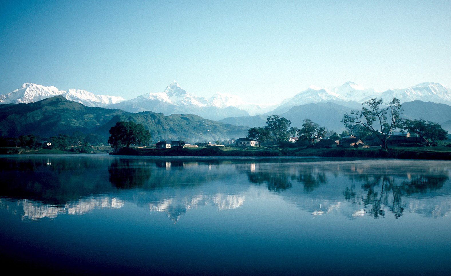
Pokhara ( ne, पोखरा, ) is a metropolis, metropolitan city in Nepal, which serves as the capital of Gandaki Province. It is the List of cities in Nepal, second most populous city of Nepal after Kathmandu, with 518,452 inhabitants living in 101,669 households in 2021 Nepal census, 2021. It is the country's largest metropolitan city in terms of area. The city also serves as the headquarters of Kaski District. Pokhara is located west of the capital, Kathmandu. The city is on the shore of Phewa Lake, and sits at an elevation of approximately 822m. The Annapurna Range, with three out of the ten highest peaks in the world—Dhaulagiri, Annapurna, Annapurna I and Manaslu—is within of the valley. Pokhara is considered the tourism capital of Nepal, being a base for trekkers undertaking the Annapurna Circuit through the Annapurna Conservation Area region of the Annapurna ranges in the Himalayas. The city is also home to many of the elite Gurkha soldiers, soldiers native to So ... [...More Info...] [...Related Items...] OR: [Wikipedia] [Google] [Baidu] |
Kathmandu
, pushpin_map = Nepal Bagmati Province#Nepal#Asia , coordinates = , subdivision_type = Country , subdivision_name = , subdivision_type1 = Province , subdivision_name1 = Bagmati Province , subdivision_type2 = District , subdivision_name2 = Kathmandu , established_title = , founder = Manjushri , parts_type = No. of Wards , parts = 32 , seat_type = , seat = , government_footnotes = , government_type = Mayor–council government , governing_body = Kathmandu Metropolitan Government, , leader_title = Mayor , leader_name = Balendra Shah ( Ind.) , leader_title1 = Deputy mayor , leader_name1 = Sunita Dangol (UML) , leader_title2 = Executive Officer , leader_name2 = Basanta Adhikari , unit_pref ... [...More Info...] [...Related Items...] OR: [Wikipedia] [Google] [Baidu] |
Pokhara International Airport
Pokhara International Airport ( ne, पोखरा अन्तर्राष्ट्रिय विमानस्थल) is an international airport in Pokhara, Gandaki Province, Nepal. It is located east of the old domestic airport, which it will gradually replace. The airport is Nepal's third international airport and officially began operations on 1 January 2023, with STOL-operations to Jomsom still being operated from the old airport. The airport is expected to handle one million passengers per year. History The concept of constructing an international airport in Pokhara was first developed in 1971. In 1976, the Government of Nepal acquired land for that purpose. In 1989, the Japan International Cooperation Agency conducted a study regarding the construction of the airport. The project stalled, however, and was reinitiated in 2009, when a new agreement on air travel between India and Nepal was signed. In 2013, the Civil Aviation Authority of Nepal signed an a ... [...More Info...] [...Related Items...] OR: [Wikipedia] [Google] [Baidu] |
Besisahar
Besishahar ( ne, बेसीशहर नगरपालिका) is a municipality and the district headquarters of Lamjung District in Gandaki Province, Nepal. The Besishahar Municipality was formed by merging the existing Village Development Committees i.e. Besishahar, Gaunshahar, Udipur, Chandisthan, Baglungpani (wards no. 3,4,7,8 & 9), Bajhakhet, Hiletaksar (wards no. 9) and Chiti and have 11 wards. This municipality has a sub-tropical climate with deciduous forests. Annapurna II, Machhapuchhre, Lamjung Himal can be viewed from north of Besishahar Municipality. Population At the time of the 2011 Nepal census it had a population of 39,356 including Besishahar, Gaunshahar, Udipur, Chiti, Baglungpani, Bajhakhet and Chandisthan. Transportation and communications Dumre–Besishahar–Chame Highway connects the city to various parts of Nepal. The proximity of this city from Kathmandu (178.8 km), Pokhara (108.9 km), Bharatpur (104 km), Birganj (234& ... [...More Info...] [...Related Items...] OR: [Wikipedia] [Google] [Baidu] |
Sundarbazar
Sundarbazar is a Municipality in Lamjung District in the Gandaki Province of northern-central Nepal Nepal (; ne, नेपाल ), formerly the Federal Democratic Republic of Nepal ( ne, सङ्घीय लोकतान्त्रिक गणतन्त्र नेपाल ), is a landlocked country in South Asia. It is mai .... The Sundarbazar Municipality was formed by merging the existing Village Development Committees i.e. Bhoteodar, Sundarbazar, Parewadanda, Tarku and Kuncha as one of the 61-municipalities category on 2071. As of 2011 Nepal census, it had 11,230 male population and 15,445 female population living in 7,512 households.. Sundarbazar is the education center of the Lamjung district. There are two campuses affiliated by Tribhuvan University Nepal, namely Matribhumi Campus and Lamjung Agriculture and Animal Science Campus. Sundarbazar is one of the major center of the lamjung district. There are many schools running such as Adarsha High Schoo ... [...More Info...] [...Related Items...] OR: [Wikipedia] [Google] [Baidu] |
Zones Of Nepal
Until the establishment of seven new provinces in 2015, Nepal was divided into 14 administrative zones ( Nepali: अञ्चल; ''anchal'') and 77 districts ( Nepali: जिल्ला; ''jillā''). The 14 administrative zones were grouped into five development regions ( Nepali: विकास क्षेत्र; ''vikās kṣetra''). Each district was headed by a Chief District Officer (CDO), who was responsible for maintaining law and order and coordinating the work of field agencies of the various government ministries. From east to west: * Eastern Development Region: **Mechi Zone, named after the Mechi River **Kosi Zone, named after the Kosi River ** Sagarmatha Zone, named after Sagarmatha (Mount Everest) * Central Development Region: **Janakpur Zone, named after its capital city **Bagmati Zone, named after the Bagmati River **Narayani Zone, named after the Narayani (lower Gandaki) River * Western Development Region: **Gandaki Zone, named after the Gandaki River ... [...More Info...] [...Related Items...] OR: [Wikipedia] [Google] [Baidu] |
Nepal
Nepal (; ne, नेपाल ), formerly the Federal Democratic Republic of Nepal ( ne, सङ्घीय लोकतान्त्रिक गणतन्त्र नेपाल ), is a landlocked country in South Asia. It is mainly situated in the Himalayas, but also includes parts of the Indo-Gangetic Plain, bordering the Tibet Autonomous Region of China to the north, and India in the south, east, and west, while it is narrowly separated from Bangladesh by the Siliguri Corridor, and from Bhutan by the Indian state of Sikkim. Nepal has a diverse geography, including fertile plains, subalpine forested hills, and eight of the world's ten tallest mountains, including Mount Everest, the highest point on Earth. Nepal is a multi-ethnic, multi-lingual, multi-religious and multi-cultural state, with Nepali as the official language. Kathmandu is the nation's capital and the largest city. The name "Nepal" is first recorded in texts from the Vedic period of the India ... [...More Info...] [...Related Items...] OR: [Wikipedia] [Google] [Baidu] |
Gandaki Province
Gandaki Province ( ne, गण्डकी प्रदेश ) ), is one of the seven federal provinces established by the current constitution of Nepal which was promulgated on 20 September 2015. Pokhara is the province's capital city. It borders the Tibet Autonomous Region of China to the north, Bagmati Province to the east, Karnali Province to the west, and Lumbini Province and Bihar of India to the south. The total area of the province is 21,504 km2 - about 14.57% of the country's total area. According to the latest census, the population of the province was 2,403,757. The newly elected Provincial Assembly adopted Gandaki Province as the permanent name by replacing its initial name Province no. 4 in July 2018. Krishna Chandra Nepali is the present chief minister of Gandaki Province Etymology Gandaki Province was named after the river Gandaki. Gandaki is a major river in the province. This river has Important links with historical Hindu civilization. The Gandaki river ... [...More Info...] [...Related Items...] OR: [Wikipedia] [Google] [Baidu] |


