|
Donnelly Drive (Ottawa)
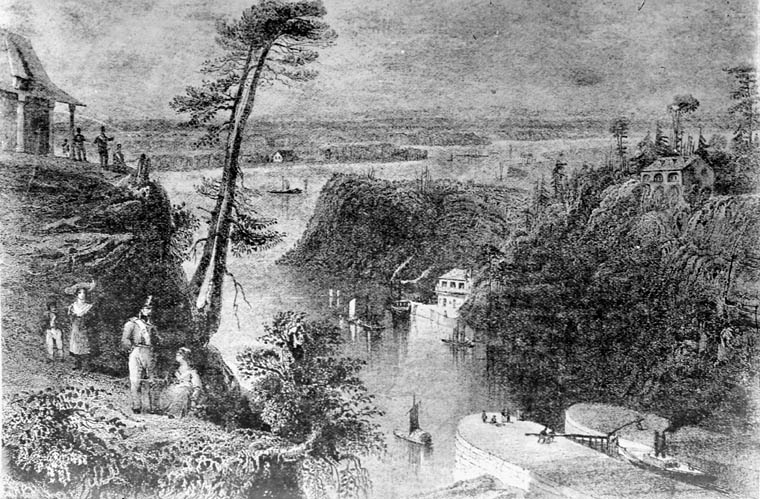
Donnelly Drive ( Ottawa Road #2) is a rural road in Ottawa, Ontario, Canada. The road runs along the western bank of the Rideau River from Burritts Rapids to Reevecraig Road South. Between these two points, Donnelly Drive passes through Becketts Landing and passes by Rideau River Provincial Park. The eastern portion of Donnelly Drive was originally part of Ontario Highway 16. It runs along the Rideau Canal waterway, which was a major trade route in the early 1800s. It also runs close to the border of the city of Ottawa and the United Counties of Leeds And Grenville The United Counties of Leeds and Grenville, commonly known as Leeds and Grenville, is a county in Ontario, Canada, in the Eastern Ontario subregion of Southern Ontario. It fronts on the Saint Lawrence River and the international boundary between ..., which is the Rideau River. Donnelly Drive turns into Heritage Road once it reaches Burritts Rapids. References Roads in Ottawa {{Ontario-road-stub ... [...More Info...] [...Related Items...] OR: [Wikipedia] [Google] [Baidu] |
List Of Numbered Routes In Ottawa
The city of Ottawa, Ontario, Canada maintains many regional roads, like most counties and regional municipalities in Southern and Eastern Ontario. The regional road system was created by the Regional Municipality of Ottawa-Carleton (RMOC) and managed by the RMOC until 2001. In 2001, when all six cities, four townships, and one village within the former RMOC amalgamated to form the new city of Ottawa, responsibility of the regional road system was transferred to the new city of Ottawa, and they became today's “Ottawa roads”. In general, even-numbered routes run east-west and odd-numbered routes run north-south. Also, the lowest-numbered routes are generally found in the southern part of the city for even (east-west) numbered routes, and in the western part for odd (north-south) numbered routes. This pattern, however, has many exceptions. As more roads were added to the numbered-road system, the availability of numbers decreased and consequently, the numbering pattern had to ... [...More Info...] [...Related Items...] OR: [Wikipedia] [Google] [Baidu] |
Ottawa
Ottawa (, ; Canadian French: ) is the capital city of Canada. It is located at the confluence of the Ottawa River and the Rideau River in the southern Ontario, southern portion of the province of Ontario. Ottawa borders Gatineau, Quebec, and forms the core of the Ottawa–Gatineau census metropolitan area (CMA) and the National Capital Region (Canada), National Capital Region (NCR). Ottawa had a city population of 1,017,449 and a metropolitan population of 1,488,307, making it the list of the largest municipalities in Canada by population, fourth-largest city and list of census metropolitan areas and agglomerations in Canada, fourth-largest metropolitan area in Canada. Ottawa is the political centre of Canada and headquarters to the federal government. The city houses numerous List of diplomatic missions in Ottawa, foreign embassies, key buildings, organizations, and institutions of Government of Canada, Canada's government, including the Parliament of Canada, the Supreme Cour ... [...More Info...] [...Related Items...] OR: [Wikipedia] [Google] [Baidu] |
Ontario
Ontario ( ; ) is one of the thirteen provinces and territories of Canada.Ontario is located in the geographic eastern half of Canada, but it has historically and politically been considered to be part of Central Canada. Located in Central Canada, it is Canada's most populous province, with 38.3 percent of the country's population, and is the second-largest province by total area (after Quebec). Ontario is Canada's fourth-largest jurisdiction in total area when the territories of the Northwest Territories and Nunavut are included. It is home to the nation's capital city, Ottawa, and the nation's most populous city, Toronto, which is Ontario's provincial capital. Ontario is bordered by the province of Manitoba to the west, Hudson Bay and James Bay to the north, and Quebec to the east and northeast, and to the south by the U.S. states of (from west to east) Minnesota, Michigan, Ohio, Pennsylvania, and New York. Almost all of Ontario's border with the United St ... [...More Info...] [...Related Items...] OR: [Wikipedia] [Google] [Baidu] |
Burritts Rapids, Ontario
Burritts Rapids is a small village located on the Rideau River in eastern Ontario. The hamlet was named after Stephen Burritt, whose family was the first to settle in this area. At one time, the hamlet prospered due to its location on the Rideau Canal. The community straddles the river, so part is located in Rideau Township, now Rideau-Jock Ward in Ottawa, and part in North Grenville Township. There is a lock on the canal to bypass rapids here, the Burritts Rapids Bridge which crosses the canal and a stationary bridge which crosses the river. History In 1793, Stephen and Daniel Burritt, from Arlington, Vermont, settled in the vicinity of the area now known as Burritt's Rapids. A plaque was erected by the Ontario Archaeological and Historic Sites Board commemorating the founding of Burritt's Rapids. By 1812, Burritts Rapids had become a bustling hamlet. At the peak of its prosperity, it had telegraphic and daily mail, 2 general stores, a bakery, a millinery shop, 2 shoe shops, a ... [...More Info...] [...Related Items...] OR: [Wikipedia] [Google] [Baidu] |
Ontario Highway 16
King's Highway 16, commonly referred to as Highway 16 and historically as the Prescott Highway, is a provincially maintained highway in the Canadian province of Ontario. The highway once travelled from near Prescott to Ottawa, traversing the distance between the St. Lawrence River and the Ottawa River. However, its length was truncated significantly when most of the route was twinned with a second roadway, and renumbered as Highway 416. A short stub remains through Johnstown, crossing the St. Lawrence on the Ogdensburg–Prescott International Bridge to Ogdensburg, New York, where it becomes New York State Route 812. The Ottawa–Prescott Road was one of the first highways designated in Ontario; it was one of three designated by 1918. The highway was numbered in August 1925. By then, it was mostly paved, except for portions south of Kemptville, which were paved by 1930. It immediately became the primary route between Toronto and Ottawa, via Highway 2, and as such ... [...More Info...] [...Related Items...] OR: [Wikipedia] [Google] [Baidu] |
Rideau Canal
The Rideau Canal, also known unofficially as the Rideau Waterway, connects Canada's capital city of Ottawa, Ontario, to Lake Ontario and the Saint Lawrence River at Kingston. It is 202 kilometres long. The name ''Rideau'', French for "curtain", is derived from the curtain-like appearance of the Rideau River's twin waterfalls where they join the Ottawa River. The canal system uses sections of two rivers, the Rideau and the Cataraqui, as well as several lakes. Parks Canada operates the Rideau Canal. The canal was opened in 1832 as a precaution in case of war with the United States. It remains in use today primarily for pleasure boating, with most of its original structures intact. The locks on the system open for navigation in mid-May and close in mid-October. It is the oldest continuously operated canal system in North America. In 2007 it was registered as a UNESCO World Heritage Site. History Plan After the War of 1812, information was received about the United States ... [...More Info...] [...Related Items...] OR: [Wikipedia] [Google] [Baidu] |
United Counties Of Leeds And Grenville
The United Counties of Leeds and Grenville, commonly known as Leeds and Grenville, is a county in Ontario, Canada, in the Eastern Ontario subregion of Southern Ontario. It fronts on the Saint Lawrence River and the international boundary between Canada and the United States, opposite of the State of New York. The county seat is Brockville. The county was formed by the union of the historical counties of Leeds and Grenville in 1850. Subdivisions There are 10 municipalities in Leeds and Grenville (in order of population): * Municipality of North Grenville (part of Grenville sub-region) * Township of Rideau Lakes (part of Leeds sub-region) * Township of Elizabethtown-Kitley (part of Leeds sub-region) * Township of Leeds and the Thousand Islands (part of Leeds sub-region) * Township of Augusta (part of Grenville sub-region) * Township of Edwardsburgh/Cardinal (part of Grenville sub-region) * Village of Merrickville–Wolford (part of Grenville sub-region) * Township of Athens (p ... [...More Info...] [...Related Items...] OR: [Wikipedia] [Google] [Baidu] |


