|
Daymer Bay
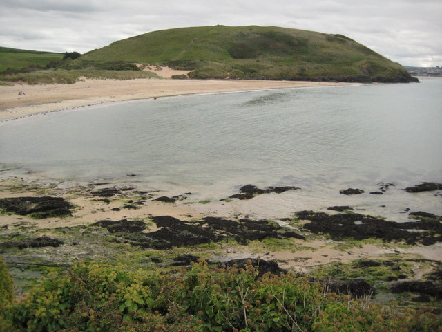
Daymer Bay is a bay and a beach on the east side of the River Camel estuary in north Cornwall, England, United Kingdom. It is situated approximately six miles (10 km) north of Wadebridge.Ordnance Survey: Landranger map sheet 200 ''Newquay & Bodmin'' Daymer Bay lies west of Trebetherick village at . The bay is bounded to the north by Trebetherick Point and to the south by Brea Hill. Daymer Bay beach is backed by dunes and behind them is St Enodoc's Church where the poet John Betjeman is buried. The beach is very popular for windsurfing and kitesurfing Kiteboarding or kitesurfing is a sport that involves using wind power with a large power kite to pull a rider across a water, land, or snow surface. It combines aspects of paragliding, surfing, windsurfing, skateboarding, snowboarding, and wak .... References External links Daymer Bay tide times Beaches of Cornwall Bays of Cornwall Populated coastal places in Cornwall {{NorthCornwall-geo-stub ... [...More Info...] [...Related Items...] OR: [Wikipedia] [Google] [Baidu] |
River Camel
The River Camel ( kw, Dowr Kammel, meaning ''crooked river'') is a river in Cornwall, England. It rises on the edge of Bodmin Moor and with its tributaries its catchment area covers much of North Cornwall. The river flows into the eastern Celtic Sea between Stepper Point and Pentire Point having covered about 30 miles, making it the second longest river wholly in Cornwall. The river is tidal upstream to Egloshayle and is popular for sailing, birdwatching and fishing. The name ''Camel'' comes from the Cornish language for 'the crooked one', a reference to its winding course. Historically the river was divided into three named stretches. Heyl ( kw, Heyl, meaning ''estuary'') was the name for the estuary up to Egloshayle, the River Allen ( kw, Dowr Alen, meaning ''shining river'') was the stretch between Egloshayle and Trecarne, whilst the Camel was reserved for the stretch of river between its source and Trecarne. Geology and hydrology The River Camel rises on Hendraburnick Do ... [...More Info...] [...Related Items...] OR: [Wikipedia] [Google] [Baidu] |
Cornwall
Cornwall (; kw, Kernow ) is a historic county and ceremonial county in South West England. It is recognised as one of the Celtic nations, and is the homeland of the Cornish people. Cornwall is bordered to the north and west by the Atlantic Ocean, to the south by the English Channel, and to the east by the county of Devon, with the River Tamar forming the border between them. Cornwall forms the westernmost part of the South West Peninsula of the island of Great Britain. The southwesternmost point is Land's End and the southernmost Lizard Point. Cornwall has a population of and an area of . The county has been administered since 2009 by the unitary authority, Cornwall Council. The ceremonial county of Cornwall also includes the Isles of Scilly, which are administered separately. The administrative centre of Cornwall is Truro, its only city. Cornwall was formerly a Brythonic kingdom and subsequently a royal duchy. It is the cultural and ethnic origin of the Cornish dias ... [...More Info...] [...Related Items...] OR: [Wikipedia] [Google] [Baidu] |
United Kingdom
The United Kingdom of Great Britain and Northern Ireland, commonly known as the United Kingdom (UK) or Britain, is a country in Europe, off the north-western coast of the continental mainland. It comprises England, Scotland, Wales and Northern Ireland. The United Kingdom includes the island of Great Britain, the north-eastern part of the island of Ireland, and many smaller islands within the British Isles. Northern Ireland shares a land border with the Republic of Ireland; otherwise, the United Kingdom is surrounded by the Atlantic Ocean, the North Sea, the English Channel, the Celtic Sea and the Irish Sea. The total area of the United Kingdom is , with an estimated 2020 population of more than 67 million people. The United Kingdom has evolved from a series of annexations, unions and separations of constituent countries over several hundred years. The Treaty of Union between the Kingdom of England (which included Wales, annexed in 1542) and the Kingdom of Scotland in 170 ... [...More Info...] [...Related Items...] OR: [Wikipedia] [Google] [Baidu] |
Wadebridge
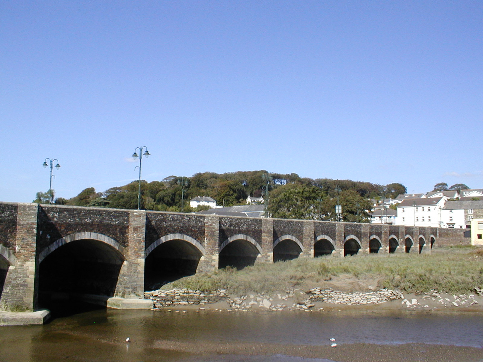
Wadebridge (; kw, Ponswad) is a town and civil parish in north Cornwall, England, United Kingdom. The town straddles the River Camel upstream from Padstow.Ordnance Survey: Landranger map sheet 200 ''Newquay & Bodmin'' The permanent population was 6,222 in the census of 2001, increasing to 7,900 in the 2011 census. There are two electoral wards in the town (East and West). Their total population is 8,272. Originally known as ''Wade'', it was a dangerous fording point across the river until a bridge was built here in the 15th century, after which the name changed to its present form. The bridge was strategically important during the English Civil War, and Oliver Cromwell went there to take it. Since then, it has been widened twice and refurbished in 1991. Wadebridge was served by a railway station between 1834 and 1967; part of the line now forms the Camel Trail, a recreational route for walkers, cyclists and horse riders. The town used to be a road traffic bottleneck on the ... [...More Info...] [...Related Items...] OR: [Wikipedia] [Google] [Baidu] |
Trebetherick
Trebetherick ( kw, Trebedrek) is a village on the north coast of Cornwall. It is situated on the east side of the River Camel estuary approximately six miles (10 km) north of Wadebridge and half a mile (800 metres) south of Polzeath.Ordnance Survey: Landranger map sheet 200 ''Newquay & Bodmin'' Trebetherick straddles the Polzeath to Wadebridge road and extends west to Daymer Bay and northwest to Trebetherick Point, a rocky headland in the estuary, where the remains of shipwrecks can be seen on the foreshore. The National Trust owns land adjacent to Trebetherick Point. Geography South of Trebetherick Point is Daymer Bay with a sandy beach sheltered from the Atlantic. The beach provides safe bathing for holidaying families and is also popular with windsurfers. At the south end of Daymer Bay Brea Hill rises to 62 metres (203 feet) with several tumuli at the summit. Behind Daymer Bay's sand dunes and south of Trebetherick is the St Enodoc Golf Club's golf course. Between i ... [...More Info...] [...Related Items...] OR: [Wikipedia] [Google] [Baidu] |
Brea Hill, Trebetherick
Brea Hill ( kw, Bre, meaning ''hill''), pronounced "Bray Hill" is a round hill beside the River Camel estuary in north Cornwall, England, United KingdomOrdnance Survey: Landranger map sheet 200 ''Newquay & Bodmin'' The hill is highOrdnance Survey: Explorer map (scale 1:25000); Sheet 106 ''Newquay & Padstow'' and there are Bronze Age tumuli (burial mounds) at the summit. The underlying geology in this area of Cornwall is Devonian slates. Brea Hill is situated at the south end of Daymer Bay between the settlements of Trebetherick and Rock in the civil parish of St Minver Lowlands. Cornwall Council online mapping. Retrieved June 2010 approximately five miles northwest of Wadebridge On the west side, Brea Hill rises straight from the foreshore; on the north and south it rises from low sand dunes. To the east, the dunes give way to a golf course and grassland with St Enodoc's Church (where the poet Sir John Betjeman is buried) just below the hill. The South West Coast Path ... [...More Info...] [...Related Items...] OR: [Wikipedia] [Google] [Baidu] |
St Enodoc's Church
St. Enodoc Church, Trebetherick (Old kw, Gwenedek, ''St. Guenedoc'') is a chapel in the parish of St Minver. It is located to the south of the village of Trebetherick, Cornwall, England, United Kingdom (). It is a Grade I listed building. Background The church is situated in sand dunes east of Daymer Bay and Brea Hill on the River Camel estuary. Wind-driven sand has formed banks that are almost level with the roof on two sides. From the sixteenth century to the middle of the nineteenth century, the church was virtually buried by the dunes and was known locally as "Sinking Neddy" or "Sinkininny Church". To maintain the tithes required by the church, it had to host services at least once a year, so the vicar and parishioners descended into the sanctuary through a hole in the roof (see Talk). By 1864 it was unearthed and the dunes were stabilized. The church is surrounded by the Church course of the St Enodoc Golf Club. History The church is said to lie on the site of a cave where ... [...More Info...] [...Related Items...] OR: [Wikipedia] [Google] [Baidu] |
John Betjeman
Sir John Betjeman (; 28 August 190619 May 1984) was an English poet, writer, and broadcaster. He was Poet Laureate from 1972 until his death. He was a founding member of The Victorian Society and a passionate defender of Victorian architecture, helping to save St Pancras railway station from demolition. He began his career as a journalist and ended it as one of the most popular British Poets Laureate and a much-loved figure on British television. Life Early life and education Betjeman was born John Betjemann. He was the son of a prosperous silverware maker of Dutch descent. His parents, Mabel (''née'' Dawson) and Ernest Betjemann, had a family firm at 34–42 Pentonville Road which manufactured the kind of ornamental household furniture and gadgets distinctive to Victorians. During the First World War the family name was changed to the less German-looking Betjeman. His father's forebears had actually come from the present day Netherlands more than a century earlier, setting ... [...More Info...] [...Related Items...] OR: [Wikipedia] [Google] [Baidu] |
Windsurfing
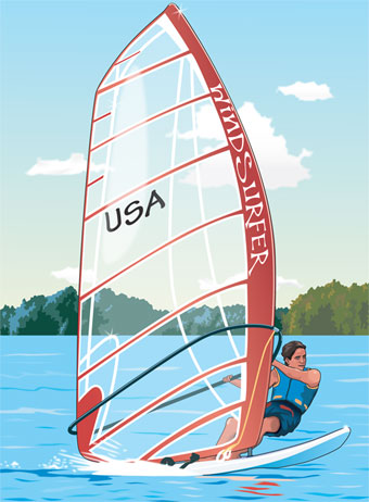
Windsurfing is a wind propelled water sport that is a combination of sailing and surfing. It is also referred to as "sailboarding" and "boardsailing", and emerged in the late 1960s from the aerospace and surf culture of California. Windsurfing gained a popular following across Europe and North America by the late 1970s and had achieved significant global popularity by the 1980s. Windsurfing became an olympic sport in 1984. Newer variants include windfoiling, kiteboarding and wingfoiling. Hydrofoil fins under the board allow the boards to safely lift out of the water and fly silently and smoothly above the surface even in lighter winds. Windsurfing is a recreational, family friendly sport, most popular at flat water locations around the world that offer safety and accessibility for beginner and intermediate participants. Technique and equipment have evolved over the years Major competitive disciplines include slalom, wave and freestyle. Increasingly, "foiling" is replacing trad ... [...More Info...] [...Related Items...] OR: [Wikipedia] [Google] [Baidu] |
Kitesurfing
Kiteboarding or kitesurfing is a sport that involves using wind power with a large power kite to pull a rider across a water, land, or snow surface. It combines aspects of paragliding, surfing, windsurfing, skateboarding, snowboarding, and wakeboarding. Kiteboarding is among the less expensive and the more convenient sailing sports. After some concepts emerged in the late 1970s and early 1980s and some designs were successfully tested, the sport received a wider audience in the late 1990s and became mainstream at the turn of the century. It has freestyle, wave-riding, and racing competitions. The sport held the speed sailing record, reaching before being eclipsed by the Vestas Sailrocket. Worldwide, there are 1.5 million kitesurfers, while the industry sells around 100,000 to 150,000 kites per year. Most power kites are leading edge inflatable kites or foil kites attached by about of flying lines to a control bar and a harness. The kitesurfer rides on either a bidir ... [...More Info...] [...Related Items...] OR: [Wikipedia] [Google] [Baidu] |


