|
Dark Canyon Ruins
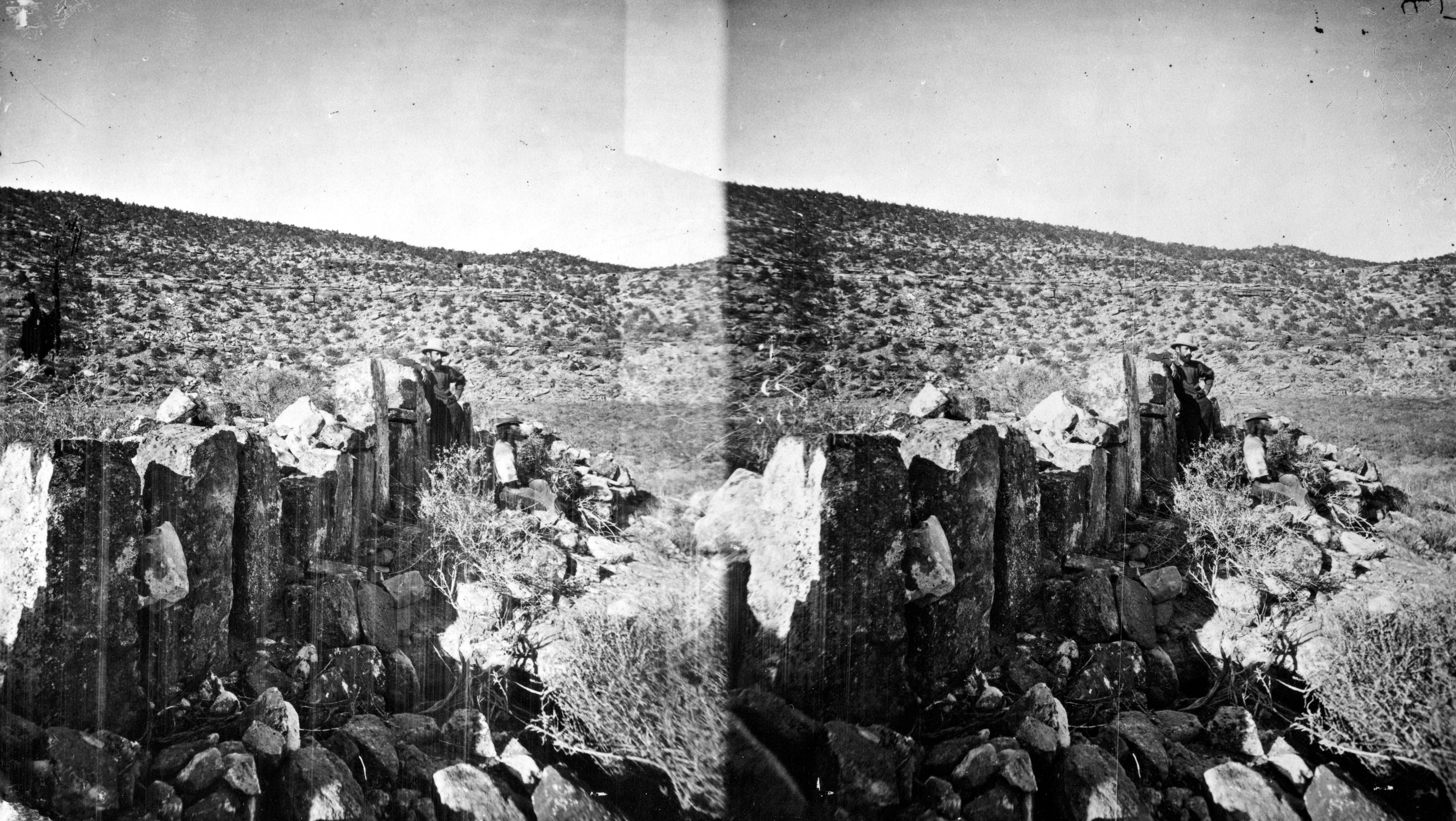
The Dark Canyon Ruins are a collection of ancient Puebloan ruins in southeastern Utah found in Dark Canyon Wilderness, part of Bears Ears National Monument Bears Ears National Monument is a United States national monument located in San Juan County in southeastern Utah, established by President Barack Obama by presidential proclamation on December 28, 2016. The monument protects of public land su .... At least 72 archaeological sites have been identified in the Beef Basin-Dark Canyon Plateau area. The ruins mostly consist of cliff dwellings, ceramics, and petroglyph art. Ceramic collections in the area indicate that the structures may have been occupied during the Pueblo II and Pueblo III periods. However, there is evidence of earlier human habitation in the canyons by the Pueblo/Anasazi, starting in 600 CE. Most of the ruins are cliff houses or storerooms, with the region abandoned around 1300 CE. Later, other native groups like the Ute and Navajo moved into the region, ... [...More Info...] [...Related Items...] OR: [Wikipedia] [Google] [Baidu] |
San Juan County, Utah
San Juan County ( ) is a County (United States), county in the southeastern portion of the U.S. state of Utah. As of the 2010 United States Census, the population was 14,746. Its county seat is Monticello, Utah, Monticello, while its most populous city is Blanding, Utah, Blanding. The Utah State Legislature named the county for the San Juan River (Colorado River), San Juan River, itself named by Spain, Spanish List of explorers, explorers (in honor of John the Apostle, Saint John). San Juan County borders Arizona, Colorado, and New Mexico at the Four Corners. History The Utah Territory authorized creation of San Juan County on February 17, 1880, with territories annexed from Iron County, Utah, Iron, Kane County, Utah, Kane, and Piute County, Piute counties. There has been no change in its boundaries since its creation. Monticello was founded in 1887, and by 1895 it was large enough to be designated the seat of San Juan County. Geography San Juan County lies in the southeaster ... [...More Info...] [...Related Items...] OR: [Wikipedia] [Google] [Baidu] |
Utah
Utah ( , ) is a state in the Mountain West subregion of the Western United States. Utah is a landlocked U.S. state bordered to its east by Colorado, to its northeast by Wyoming, to its north by Idaho, to its south by Arizona, and to its west by Nevada. Utah also touches a corner of New Mexico in the southeast. Of the fifty U.S. states, Utah is the 13th-largest by area; with a population over three million, it is the 30th-most-populous and 11th-least-densely populated. Urban development is mostly concentrated in two areas: the Wasatch Front in the north-central part of the state, which is home to roughly two-thirds of the population and includes the capital city, Salt Lake City; and Washington County in the southwest, with more than 180,000 residents. Most of the western half of Utah lies in the Great Basin. Utah has been inhabited for thousands of years by various indigenous groups such as the ancient Puebloans, Navajo and Ute. The Spanish were the first Europe ... [...More Info...] [...Related Items...] OR: [Wikipedia] [Google] [Baidu] |
United States
The United States of America (U.S.A. or USA), commonly known as the United States (U.S. or US) or America, is a country primarily located in North America. It consists of 50 states, a federal district, five major unincorporated territories, nine Minor Outlying Islands, and 326 Indian reservations. The United States is also in free association with three Pacific Island sovereign states: the Federated States of Micronesia, the Marshall Islands, and the Republic of Palau. It is the world's third-largest country by both land and total area. It shares land borders with Canada to its north and with Mexico to its south and has maritime borders with the Bahamas, Cuba, Russia, and other nations. With a population of over 333 million, it is the most populous country in the Americas and the third most populous in the world. The national capital of the United States is Washington, D.C. and its most populous city and principal financial center is New York City. Paleo-Americ ... [...More Info...] [...Related Items...] OR: [Wikipedia] [Google] [Baidu] |
Blanding, Utah
Blanding () is a city in San Juan County, Utah, United States. The population was 3,375 at the 2010 census, making it the most populated city in San Juan County. It was settled in the late 19th century by Mormon settlers, predominantly from the famed Hole-In-The-Rock expedition. Economic contributors include mineral processing, mining, agriculture, local commerce, tourism, and transportation. Blanding is located near both the Navajo and White Mesa Ute Native American reservations and a significant percentage of Blanding's population has family ties to these nearby cultures. Blanding is a gateway to an abundance of nearby natural and archaeological resources, including The Dinosaur Museum, Natural Bridges National Monument, Monument Valley, and the Four Corners area, Glen Canyon National Recreation Area (Lake Powell), Cedar Mesa archaeological and wilderness area, the San Juan River including Goosenecks State Park, and the Needles district of Canyonlands National Park. It i ... [...More Info...] [...Related Items...] OR: [Wikipedia] [Google] [Baidu] |
United States Forest Service
The United States Forest Service (USFS) is an agency of the U.S. Department of Agriculture that administers the nation's 154 national forests and 20 national grasslands. The Forest Service manages of land. Major divisions of the agency include the Chief's Office, National Forest System, State and Private Forestry, Business Operations, and Research and Development. The agency manages about 25% of federal lands and is the only major national land management agency not part of the U.S. Department of the Interior, which manages the National Park Service, the U.S. Fish and Wildlife Service, and the Bureau of Land Management. History The concept of national forests was born from Theodore Roosevelt's conservation group, Boone and Crockett Club, due to concerns regarding Yellowstone National Park beginning as early as 1875. In 1876, Congress formed the office of Special Agent in the Department of Agriculture to assess the quality and conditions of forests in the United States. ... [...More Info...] [...Related Items...] OR: [Wikipedia] [Google] [Baidu] |
Dark Canyon Wilderness
Dark Canyon Wilderness is a National Wilderness Preservation System, designated Wilderness Area in the heart of southeast Utah's canyon country, part of the Bears Ears National Monument. The wilderness is named for its high steep walls that narrow in the lower section so that they block the light in the morning and late afternoon. The roughly horseshoe-shaped wilderness is made up of the upper part of Dark Canyon and two major tributaries, Woodenshoe Canyon and Peavine Canyon in the Manti-La Sal National Forest. These canyons all descend from pine-covered Elk Ridge northeast of Natural Bridges National Monument. Dark Canyon continues west within a U.S. Bureau of Land Management primitive area that is recommended for wilderness designation. The last of the main canyon drop steeply through Glen Canyon National Recreation Area into Lake Powell. On December 28, 2016 President Barack Obama proclaimed the 1.35 million acre Bears Ears National Monument, that includes both the Dark Can ... [...More Info...] [...Related Items...] OR: [Wikipedia] [Google] [Baidu] |
Bears Ears National Monument
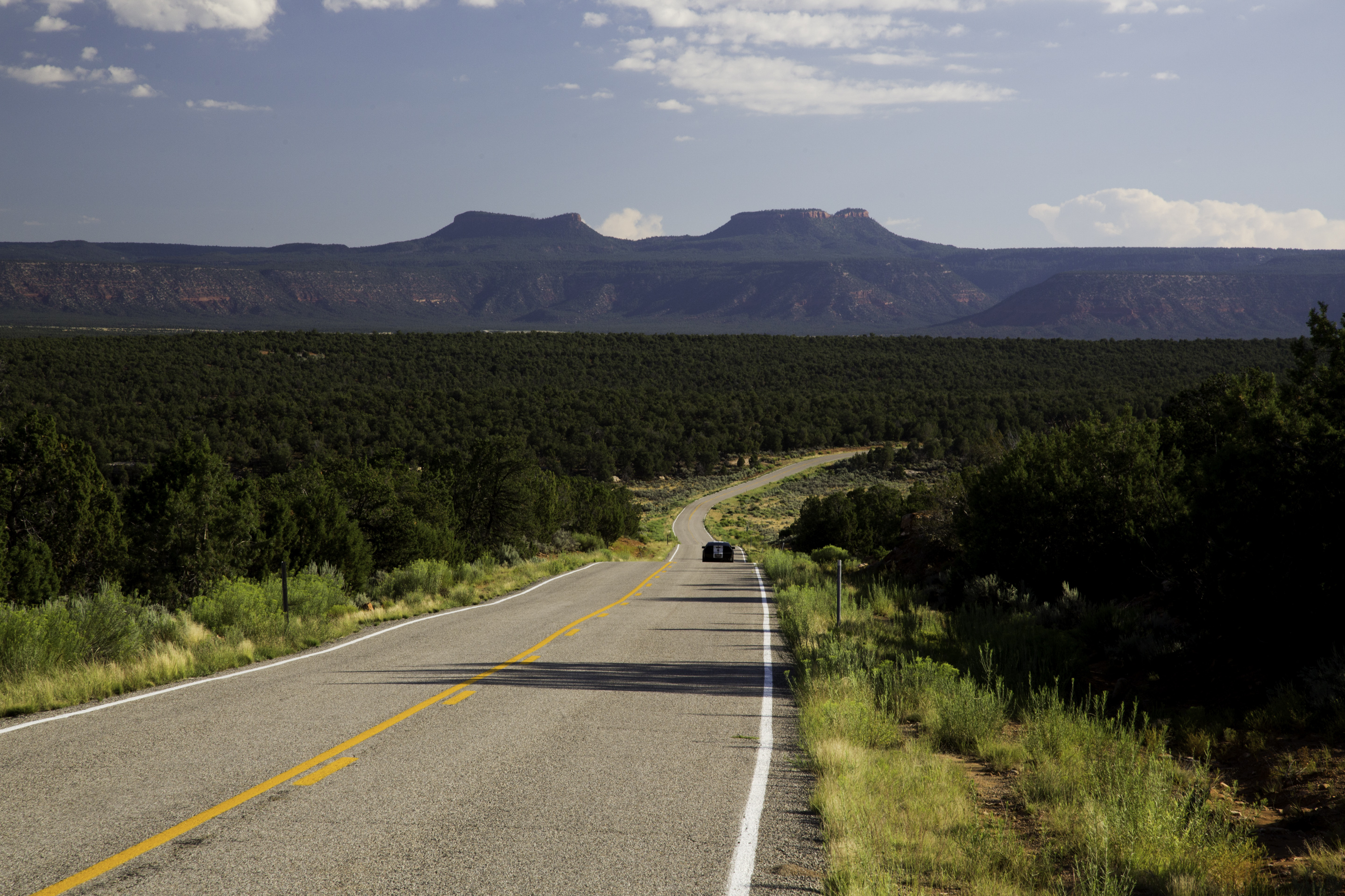
Bears Ears National Monument is a United States national monument located in San Juan County in southeastern Utah, established by President Barack Obama by presidential proclamation on December 28, 2016. The monument protects of public land surrounding the Bears Ears—a pair of buttes—and the Indian Creek corridor rock climbing area. The Native American names for the buttes have the same meaning in each of the languages represented in the region. The names are listed in the presidential proclamation as "''Hoon’Naqvut'', ''Shash Jáa'' icBegaye, Russell; Nez, Jonathan; et al. (April 16, 2016)"Letter to Obama re Bears Ears initiative" page 1. ''bearsearscoalition.org''. The Bears Ears Inter-Tribal Coalition. Retrieved May 14, 2018. "the Bears Ears Buttes (Shash Jaaʼ)" ''Kwiyaghatʉ Nükavachi/Kwiyagatu Nukavachi'', ''Ansh An Lashokdiwe''"—all four mean "Bears Ears". The area within the monument is largely undeveloped and contains a wide array of historic, cultural and ... [...More Info...] [...Related Items...] OR: [Wikipedia] [Google] [Baidu] |
Petroglyph
A petroglyph is an image created by removing part of a rock surface by incising, picking, carving, or abrading, as a form of rock art. Outside North America, scholars often use terms such as "carving", "engraving", or other descriptions of the technique to refer to such images. Petroglyphs are found worldwide, and are often associated with prehistoric peoples. The word comes from the Greek prefix , from meaning "stone", and meaning "carve", and was originally coined in French as . Another form of petroglyph, normally found in literate cultures, a rock relief or rock-cut relief is a relief sculpture carved on "living rock" such as a cliff, rather than a detached piece of stone. While these relief carvings are a category of rock art, sometimes found in conjunction with rock-cut architecture, they tend to be omitted in most works on rock art, which concentrate on engravings and paintings by prehistoric or nonliterate cultures. Some of these reliefs exploit the rock's nat ... [...More Info...] [...Related Items...] OR: [Wikipedia] [Google] [Baidu] |
Pueblo II Period
The Pueblo II Period (AD 900 to AD 1150) was the second pueblo period of the Ancestral Puebloans of the Four Corners region of the American southwest. During this period people lived in dwellings made of stone and mortar, enjoyed communal activities in kivas, built towers and dams for water conservation, and implemented milling bins for processing maize. Communities with low-yield farms traded pottery with other settlements for maize. The Pueblo II Period (Pecos Classification) is roughly similar to the second half of the "Developmental Pueblo Period" (AD 750 to AD 1100). It is preceded by the Pueblo I Period, and is followed by the Pueblo III Period. Architecture Villages were larger and had more community buildings than in the Pueblo I Period. Structures were generally made of stone masonry. By AD 1075, double-coursed masonry was sometimes used, which allowed for second story construction. [...More Info...] [...Related Items...] OR: [Wikipedia] [Google] [Baidu] |
Pueblo III Period
The Pueblo III Period (AD 1150 to AD 1350) was the third period, also called the "Great Pueblo period" when Ancestral Puebloans lived in large cliff-dwelling, multi-storied pueblo, or cliff-side talus house communities. By the end of the period, the ancient people of the Four Corners region migrated south into larger, centralized pueblos in central and southern Arizona and New Mexico. The Pueblo III Period (Pecos Classification) is roughly the same as the "Great Pueblo Period" and "Classic Pueblo Period" (AD 1100 to AD 1300). It is preceded by the Pueblo II Period, and is followed by the Pueblo IV Period. Architecture During the Pueblo III Period most people lived in communities with large multi-storied dwellings. Some moved into community centers at pueblos canyon heads, such as Sand Canyon and Goodman Point pueblos in the Montezuma Valley; others moved into cliff dwellings on canyon shelves such as Mesa Verde or Keet Seel in the Navajo National Monument. Typical villag ... [...More Info...] [...Related Items...] OR: [Wikipedia] [Google] [Baidu] |
Brigham Young University
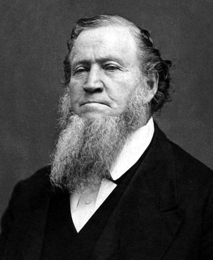
Brigham Young University (BYU, sometimes referred to colloquially as The Y) is a private research university in Provo, Utah. It was founded in 1875 by religious leader Brigham Young and is sponsored by the Church of Jesus Christ of Latter-day Saints (LDS Church). BYU offers a variety of academic programs including those in the liberal arts, engineering, agriculture, management, physical and mathematical sciences, nursing, and law. It has 186 undergraduate majors, 64 master's programs, and 26 doctoral programs. It is broadly organized into 11 colleges or schools at its main Provo campus, with some colleges and divisions defining their own admission standards. The university also administers two satellite campuses, one in Jerusalem and one in Salt Lake City, while its parent organization the Church Educational System (CES) sponsors sister schools in Hawaii and Idaho. The university is accredited by the Northwest Commission on Colleges and Universities. Almost all BYU students ... [...More Info...] [...Related Items...] OR: [Wikipedia] [Google] [Baidu] |
ProQuest
ProQuest LLC is an Ann Arbor, Michigan-based global information-content and technology company, founded in 1938 as University Microfilms by Eugene B. Power. ProQuest is known for its applications and information services for libraries, providing access to dissertations, theses, ebooks, newspapers, periodicals, historical collections, governmental archives, cultural archives,"Jisc and ProQuest Enable Access to Essential Digital Content" retrieved May 21, 2014 and other aggregated databases. This content was estimated to be around 125 billion digital pages, ... [...More Info...] [...Related Items...] OR: [Wikipedia] [Google] [Baidu] |


.jpg)
