|
Chengyang, Guangxi
Chengyang (程阳) is an area consisting of eight villages in the Sanjiang Dong Autonomous County of Guangxi province of China, located 4–5 hours from the Guilin city. It is known for its "Folk Custom Centre" and the Chengyang Bridge, a covered bridge known locally as a "wind and rain bridge" due to the protection it offers from the weather. The bridge is protected as a valued cultural relic of the Dong people, and was added to the UNESCO World Heritage A World Heritage Site is a landmark or area with legal protection by an international convention administered by the United Nations Educational, Scientific and Cultural Organization (UNESCO). World Heritage Sites are designated by UNESCO for h ... Tentative List on February 12, 1996, in the Cultural category. External links Geography of Guangxi Liuzhou {{Guangxi-geo-stub ... [...More Info...] [...Related Items...] OR: [Wikipedia] [Google] [Baidu] |
Village
A village is a clustered human settlement or community, larger than a hamlet but smaller than a town (although the word is often used to describe both hamlets and smaller towns), with a population typically ranging from a few hundred to a few thousand. Though villages are often located in rural areas, the term urban village is also applied to certain urban neighborhoods. Villages are normally permanent, with fixed dwellings; however, transient villages can occur. Further, the dwellings of a village are fairly close to one another, not scattered broadly over the landscape, as a dispersed settlement. In the past, villages were a usual form of community for societies that practice subsistence agriculture, and also for some non-agricultural societies. In Great Britain, a hamlet earned the right to be called a village when it built a church. [...More Info...] [...Related Items...] OR: [Wikipedia] [Google] [Baidu] |
Sanjiang Dong Autonomous County
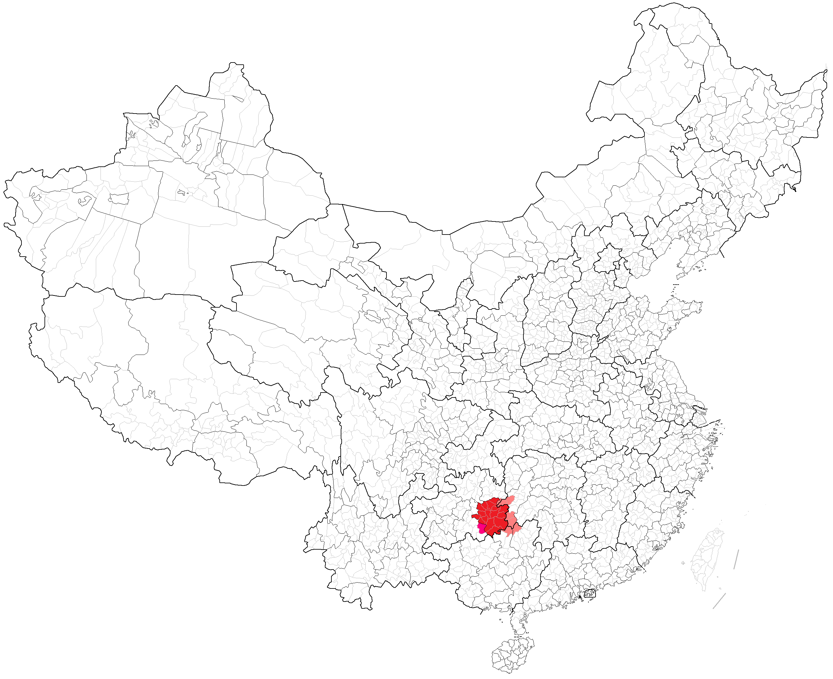
Sanjiang Dong Autonomous County (; Standard Zhuang: ) is under the administration of Liuzhou, Guangxi Zhuang Autonomous Region, China. It is a region traditionally inhabited by the Dong people, bordering the prefecture-level divisions of Qiandongnan (Guizhou) to the north, Huaihua (Hunan) to the northeast and Guilin to the west. It has an area of and a population of 297,244. official website of Sanjiang County Government Transportation * *Reach by bus from about 1.5 ...[...More Info...] [...Related Items...] OR: [Wikipedia] [Google] [Baidu] |
Guangxi
Guangxi (; ; Chinese postal romanization, alternately romanized as Kwanghsi; ; za, Gvangjsih, italics=yes), officially the Guangxi Zhuang Autonomous Region (GZAR), is an Autonomous regions of China, autonomous region of the People's Republic of China, located in South China and bordering Vietnam (Hà Giang Province, Hà Giang, Cao Bằng Province, Cao Bằng, Lạng Sơn Province, Lạng Sơn, and Quảng Ninh Provinces) and the Gulf of Tonkin. Formerly a Provinces of China, province, Guangxi became an autonomous region in 1958. Its current capital is Nanning. Guangxi's location, in mountainous terrain in the far south of China, has placed it on the frontier of Chinese civilization throughout much of History of China, Chinese history. The current name "Guang" means "expanse" and has been associated with the region since the creation of Guang Prefecture in 226 AD. It was given Administrative divisions of the Yuan dynasty, provincial level status during the Yuan dynasty, but ev ... [...More Info...] [...Related Items...] OR: [Wikipedia] [Google] [Baidu] |
China
China, officially the People's Republic of China (PRC), is a country in East Asia. It is the world's most populous country, with a population exceeding 1.4 billion, slightly ahead of India. China spans the equivalent of five time zones and borders fourteen countries by land, the most of any country in the world, tied with Russia. Covering an area of approximately , it is the world's third largest country by total land area. The country consists of 22 provinces, five autonomous regions, four municipalities, and two Special Administrative Regions (Hong Kong and Macau). The national capital is Beijing, and the most populous city and financial center is Shanghai. Modern Chinese trace their origins to a cradle of civilization in the fertile basin of the Yellow River in the North China Plain. The semi-legendary Xia dynasty in the 21st century BCE and the well-attested Shang and Zhou dynasties developed a bureaucratic political system to serve hereditary monarchies, or dyna ... [...More Info...] [...Related Items...] OR: [Wikipedia] [Google] [Baidu] |
Guilin
Guilin ( Standard Zhuang: ''Gveilinz''; alternatively romanized as Kweilin) is a prefecture-level city in the northeast of China's Guangxi Zhuang Autonomous Region. It is situated on the west bank of the Li River and borders Hunan to the north. Its name means "forest of sweet osmanthus", owing to the large number of fragrant sweet osmanthus trees located in the region. The city has long been renowned for its scenery of karst topography. Guilin is one of China's most popular tourist destinations, and the epithet "By water, by mountains, most lovely, Guilin" () is often associated with the city. The State Council of China has designated Guilin a National Famous Historical and Cultural City, doing so in the first edition of the list. History Before the Qin dynasty, Guilin region was settled by the Baiyue people. In 314 BC, a small settlement was established along the banks of the Li River. During the Qin dynasty's (221–206 BC) campaigns against the state of Nanyue, the fi ... [...More Info...] [...Related Items...] OR: [Wikipedia] [Google] [Baidu] |
Chengyang Bridge
The Yongji Bridge of Chengyang (), also called the Chengyang Wind and Rain Bridge (), is a bridge in Sanjiang County, of Guangxi, China. Chengyang Bridge is a special covered bridge or ''lángqiáo'', and one of several ''Fengyu'' bridges in the local Dong Minority region. It was completed in 1912. It is also called the Panlong Bridge (). Properties The bridge is a combination of bridge, corridor, veranda and Chinese pavilion. It has two platforms (one at each end of the bridge), 3 piers, 3 spans, 5 pavilions, 19 verandas, and three floors. The piers are made of stone, the upper structures are mainly wooden, and the roof is covered with tiles. The bridge has wooden handrails on both sides. The bridge has a total length of , and its corridor has a width of . The net height above the river is about . The bridge is located in Chengyang, and serves as the link between two populous villages. Guo Moruo, a famous Chinese author, loved the bridge at first sight and wrote a poem fo ... [...More Info...] [...Related Items...] OR: [Wikipedia] [Google] [Baidu] |
Covered Bridge
A covered bridge is a timber-truss bridge with a roof, decking, and siding, which in most covered bridges create an almost complete enclosure. The purpose of the covering is to protect the wooden structural members from the weather. Uncovered wooden bridges typically have a lifespan of only 20 years because of the effects of rain and sun, but a covered bridge could last over 100 years. In the United States, only about 1 in 10 survived the 20th century. The relatively small number of surviving bridges is due to deliberate replacement, neglect, and the high cost of restoration. European and North American truss bridges Typically, covered bridges are structures with longitudinal timber-trusses which form the bridge's backbone. Some were built as railway bridges, using very heavy timbers and doubled up lattice work. In Canada and the U.S., numerous timber covered bridges were built in the late 1700s to the late 1800s, reminiscent of earlier designs in Germany and Switzerland. Th ... [...More Info...] [...Related Items...] OR: [Wikipedia] [Google] [Baidu] |
Dong People
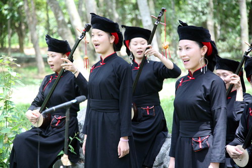
The Kam people, officially known in China as Dong people (; endonym: , ), a Kam–Sui people of Southern China, are one of the 56 ethnic groups officially recognized by the People's Republic of China. They are famed for their native-bred ''Kam Sweet Rice'' (), carpentry skills and unique architecture, in particular a form of covered bridge known as the "wind and rain bridge" (). The Kam people live mostly in Eastern Guizhou, Western Hunan and Northern Guangxi in China. Small pockets of Kam speakers are found in Tuyên Quang Province in Vietnam. The Kam people call themselves Kam, Geml, Jeml or Gaelm. History The Kam are thought to be the modern-day descendants of the ancient Liáo (僚) peoples who occupied much of southern China.D. Norman Geary, Ruth B. Geary, Ou Chaoquan, Long Yaohong, Jiang Daren, Wang Jiying (2003). ''The Kam People of China: Turning Nineteen''. (London / New York, RoutledgeCurzon 2003). . Kam legends generally maintain that the ancestors of the Kam migrate ... [...More Info...] [...Related Items...] OR: [Wikipedia] [Google] [Baidu] |
UNESCO
The United Nations Educational, Scientific and Cultural Organization is a specialized agency of the United Nations (UN) aimed at promoting world peace and security through international cooperation in education, arts, sciences and culture. It has 193 member states and 12 associate members, as well as partners in the non-governmental, intergovernmental and private sector. Headquartered at the World Heritage Centre in Paris, France, UNESCO has 53 regional field offices and 199 national commissions that facilitate its global mandate. UNESCO was founded in 1945 as the successor to the League of Nations's International Committee on Intellectual Cooperation.English summary). Its constitution establishes the agency's goals, governing structure, and operating framework. UNESCO's founding mission, which was shaped by the Second World War, is to advance peace, sustainable development and human rights by facilitating collaboration and dialogue among nations. It pursues this objective t ... [...More Info...] [...Related Items...] OR: [Wikipedia] [Google] [Baidu] |
World Heritage Site
A World Heritage Site is a landmark or area with legal protection by an international convention administered by the United Nations Educational, Scientific and Cultural Organization (UNESCO). World Heritage Sites are designated by UNESCO for having cultural, historical, scientific or other form of significance. The sites are judged to contain " cultural and natural heritage around the world considered to be of outstanding value to humanity". To be selected, a World Heritage Site must be a somehow unique landmark which is geographically and historically identifiable and has special cultural or physical significance. For example, World Heritage Sites might be ancient ruins or historical structures, buildings, cities, deserts, forests, islands, lakes, monuments, mountains, or wilderness areas. A World Heritage Site may signify a remarkable accomplishment of humanity, and serve as evidence of our intellectual history on the planet, or it might be a place of great natural beauty. A ... [...More Info...] [...Related Items...] OR: [Wikipedia] [Google] [Baidu] |


_bridge%2C_entrance%2C_circa_1877_-_DPLA_-_d729e9efdd48d34d1fce20fb80c6bd89.jpeg)
