|
Capalbio Scalo
Capalbio Scalo is a village in Tuscany, central Italy, administratively a frazione of the comune of Capalbio, province of Grosseto. It had a population of 551 as of 2011. Geography Capalbio Scalo is about 50 km from Grosseto and 9 km from Capalbio. It is in the plain of southern Maremma between the hills of Capalbio and the Tyrrhenian Sea. Capalbio Scalo lies on the shore of Lago di Burano, an important natural reserve. Main sights * Church of Santa Maria Goretti (20th century) is the main parish church of the village. It was built in 1986 and consecrated by bishop Eugenio Binini. * Tower of Buranaccio (16th century), built by the State of Presidi, is on the shore of the Burano Lake. * Tower of Macchiatonda (17th century), coastal defense tower built by the State of Presidi, was restructured during the 19th century. It was used as a location in the 1969 movie '' The Seed of Man'' by director Marco Ferreri. Transport Capalbio Scalo is located along the Via Aure ... [...More Info...] [...Related Items...] OR: [Wikipedia] [Google] [Baidu] |
Province Of Grosseto
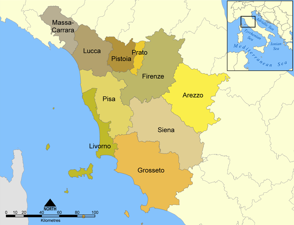
The province of Grosseto ( it, links=no, provincia di Grosseto) is a province in the Tuscany region of Italy. Its capital is the city of Grosseto. As of 2013 the province had a total population of 225,098 people. Geography The Province of Grosseto completely occupies the southern end of Tuscany, and with a territorial area of , it is the most extensive in the region and one of the least dense in population in Italy. The province is bordered to the northwest by the Province of Livorno, to the north by the Province of Pisa, to the northeast by the Province of Siena, and to the southeast by the Province of Viterbo in Lazio. To the south is the Tyrrhenian Sea, which includes the southern islands of the Tuscan archipelago, including Isola del Giglio and the smaller Giannutri islands and Formiche di Grosseto and Formica di Burano. The Arcipelago Toscano National Park spans both the provinces of Grosseto and Livorno, and includes the seven main islands of the Tuscan Archipelago: Elba ... [...More Info...] [...Related Items...] OR: [Wikipedia] [Google] [Baidu] |
The Seed Of Man
''Il seme dell'uomo'' (''The Seed of Man'') is a 1969 French-Italian film directed by Marco Ferreri Marco Ferreri (11 May 1928 – 9 May 1997) was an Italian film director, screenwriter and actor, who began his career in the 1950s directing three films in Spain, followed by 24 Italian films before his death in 1997. He is considered one of t .... A young couple argue about having a child in the days after a global plague wipes out most of Earth's population. References External links * 1969 films French fantasy drama films Italian fantasy drama films Films directed by Marco Ferreri 1960s Italian-language films 1960s Italian films 1960s French films {{1960s-Italy-film-stub ... [...More Info...] [...Related Items...] OR: [Wikipedia] [Google] [Baidu] |
Pescia Fiorentina
Pescia Fiorentina is a village in Tuscany, central Italy, administratively a of the of Capalbio, province of Grosseto. At the time of the 2001 census, its population amounted to 37. Geography Pescia Fiorentina is about from Grosseto and from Capalbio. It is situated in the plain of southern Maremma, in the valley of Fiora, between the hills of Capalbio and the Tyrrhenian Sea, on the border with the province of Viterbo, Lazio. It is located along the Provincial Road which links Capalbio to Chiarone Scalo. History Pescia Fiorentina was an important industrial centre with furnaces and ironworks in the 16th century. Main sights * ''Villa del Fontino'' (18th century) was the seat of customs between the Grand Duchy of Tuscany and the Papal States. The palace was then named after the families who lived there after the dismantling of customs: Boncompagni and Magrini. The palazzo was then transformed into a farmhouse hotel. * ' (Tarot Garden), situated in the hamlet of Garavicc ... [...More Info...] [...Related Items...] OR: [Wikipedia] [Google] [Baidu] |
La Torba
La Torba is a village in Tuscany, central Italy, administratively a frazione of the comune of Capalbio, province of Grosseto. At the time of the 2001 census its population amounted to 209. . Geography La Torba is about 50 km from and 12 km from Capalbio ...[...More Info...] [...Related Items...] OR: [Wikipedia] [Google] [Baidu] |
Giardino, Capalbio
Giardino is a rural area in Tuscany, central Italy, administratively a frazione of the comune of Capalbio, province of Grosseto. At the time of the 2001 census its population amounted to 15. Geography Giardino is about 50 km from Grosseto and 12 km from Capalbio. It is situated in the plain of southern Maremma between the hills of Capalbio, Manciano and Orbetello, and the Tyrrhenian Sea. The valley of Giardino is commonly known as ''Valle d'Oro'' (Golden Valley) and it is surrounded by various heights of mountains, of which the highest peaks are those of Monte Nebbiello (127 meters), Poggio Imperiale (147 m), Poggio dei Butteri (154 m), Poggio Farletta (180 m) and Poggio Capalbiaccio (238 m). History Recent archaeological excavations proved that the valley was inhabited by the Etruscans dependent on the city of Vulci, as well as the Romans, as the hinterland of the colony of Cosa. Capalbio, prende forma il Parco archeologico e paesaggistico Valle d'Oro', Maremma Ma ... [...More Info...] [...Related Items...] OR: [Wikipedia] [Google] [Baidu] |
Chiarone Scalo
Chiarone Scalo is a village in Tuscany, central Italy, administratively a frazione of the comune of Capalbio, province of Grosseto. At the time of the 2001 census its population amounted to 18. Geography Chiarone Scalo is about 58 km from Grosseto and 11 km from Capalbio, and it is situated in the plain of southern Maremma between the hills of Capalbio and the Tyrrhenian Sea, next to the mouth of the river Chiarone, which marks the border between the provinces of Grosseto and Viterbo, Lazio. Chiarone Scalo is the southernmost village in Tuscany. History The small town was born in the late 18th century as border point and customs between the Grand Duchy of Tuscany and the Papal States and it developed in the next century with the opening of the railway station (1867). With the Maremman ''Riforma agraria'' (land reform) in the 1950s it became the centre for various newborn rural villages which converge on it: the hamlet of ''Selva Nera'' and several others named afte ... [...More Info...] [...Related Items...] OR: [Wikipedia] [Google] [Baidu] |
Borgo Carige
Borgo Carige is a village in Tuscany, central Italy, administratively a frazione of the comune of Capalbio, province of Grosseto. At the time of the 2001 census its population amounted to 229. Borgo Carige is about 54 km from Grosseto and 5 km from Capalbio, and it is situated in the plain of southern Maremma between the hills of Capalbio and the Tyrrhenian Sea. It is located along the Via Aurelia highway which links Grosseto to Rome. The village is an important town born as a result of the Maremman ''Riforma agraria'' (land reform) in the 1950s. Main sights * Church of ''Cuore Immacolato'' (20th century), main parish church of the village, it was built in 1958 and designed by Riccardo Medici in a Neo-Romanesque style.M. Del Francia, B. Catalani, ''Architettura contemporanea del paesaggio toscano'', Edizioni Edifir, Firenze, 2008, p. 31. References Bibliography * Fabiola Favilli, ''Capalbio. Alla scoperta del borgo e del territorio'', Arcidosso, C&P Adver Eff ... [...More Info...] [...Related Items...] OR: [Wikipedia] [Google] [Baidu] |
Rome
, established_title = Founded , established_date = 753 BC , founder = King Romulus (legendary) , image_map = Map of comune of Rome (metropolitan city of Capital Rome, region Lazio, Italy).svg , map_caption = The territory of the ''comune'' (''Roma Capitale'', in red) inside the Metropolitan City of Rome (''Città Metropolitana di Roma'', in yellow). The white spot in the centre is Vatican City. , pushpin_map = Italy#Europe , pushpin_map_caption = Location within Italy##Location within Europe , pushpin_relief = yes , coordinates = , coor_pinpoint = , subdivision_type = Country , subdivision_name = Italy , subdivision_type2 = Region , subdivision_name2 = Lazio , subdivision_type3 = Metropolitan city , subdivision_name3 = Rome Capital , government_footnotes= , government_type = Strong Mayor–Council , leader_title2 = Legislature , leader_name2 = Capitoline Assemb ... [...More Info...] [...Related Items...] OR: [Wikipedia] [Google] [Baidu] |
Via Aurelia
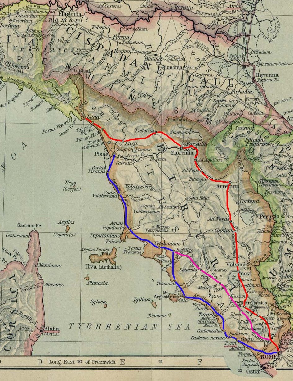
The ''Via Aurelia'' (Latin for "Aurelian Way") is a Roman road in Italy constructed in approximately 241 BC. The project was undertaken by Gaius Aurelius Cotta, who at that time was censor.Hornblower, Simon, & Antony Spawforth. ''The Oxford Classical Dictionary.'' 3rd ed. Oxford: Oxford University Press, 1996. Cotta had a history of building roads for Rome, as he had overseen the construction of a military road in Sicily (as consul in 252 BC, during the First Punic War) connecting ''Agrigentum'' (modern Agrigento) and ''Panormus'' (modern Palermo). Background In the middle Republic, a series of roads were built throughout Italy to serve the needs of Roman expansion, including swift army movements and reasonably quick communication with Roman colonies spread throughout Italy. There also was the unintended (but beneficial) consequence of an increase in trade among Italian cities and with Rome. The roads were standardized to wide allowing two chariots to pass, and distance was ma ... [...More Info...] [...Related Items...] OR: [Wikipedia] [Google] [Baidu] |
Marco Ferreri
Marco Ferreri (11 May 1928 – 9 May 1997) was an Italian film director, screenwriter and actor, who began his career in the 1950s directing three films in Spain, followed by 24 Italian films before his death in 1997. He is considered one of the greatest European cinematic provocateurs of his time and had a constant presence in prestigious festival circuit - including eight films in competition in Cannes Film Festival and a Golden Bear win in 1991 Berlin Film Festival. Three of his films are among 100 film italiani da salvare, 100 films selected for preservation for significant contribution to Italian cinema. Biography He was born in Milan. His best known film is ''La Grande Bouffe'' from 1973, starring Marcello Mastroianni, Michel Piccoli, Philippe Noiret and Ugo Tognazzi. He was a socialist and atheist.Tonino Lasconi, ''Dieci per amore'', Edizioni Paoline, 2001, p. 31. He died in Paris of a myocardial infarction, heart attack. Upon his death, Gilles Jacob, artistic director ... [...More Info...] [...Related Items...] OR: [Wikipedia] [Google] [Baidu] |
State Of Presidi
The State of the ''Presidi'' ( it, Stato dei Presidi,. In french: État des Présides. Dhondt uses "Tuscan ''presidia''". meaning "state of the garrisons") was a small territory in Italy between 1557 and 1801. It consisted of the remnants of the former Republic of Siena, five towns on the Tuscan coast—Porto Ercole and Porto Santo Stefano on the promontory of Monte Argentario, as well as Orbetello, Talamone and Ansedonia—and their hinterland, along with the islet of Giannutri and the fortress of Porto Longone on the island of Elba. The ''Presidi'' encompassed about 300 km2. They were effectively attached to the Kingdom of Naples and changed hands several times with it, resulting in three distinct historical periods. From 1557 to 1707, they were a possession of the Crown of Spain administered by the Spanish Habsburg viceroy of Naples; from 1708 to 1733, a possession of the Austrian Habsburgs administered by their viceroy in Naples; and from 1733 to 1801, a dependency of the ... [...More Info...] [...Related Items...] OR: [Wikipedia] [Google] [Baidu] |

.jpg)

