|
Giardino, Capalbio
Giardino is a rural area in Tuscany, central Italy, administratively a frazione of the comune of Capalbio, province of Grosseto. At the time of the 2001 census its population amounted to 15. Geography Giardino is about 50 km from Grosseto and 12 km from Capalbio. It is situated in the plain of southern Maremma between the hills of Capalbio, Manciano and Orbetello, and the Tyrrhenian Sea. The valley of Giardino is commonly known as ''Valle d'Oro'' (Golden Valley) and it is surrounded by various heights of mountains, of which the highest peaks are those of Monte Nebbiello (127 meters), Poggio Imperiale (147 m), Poggio dei Butteri (154 m), Poggio Farletta (180 m) and Poggio Capalbiaccio (238 m). History Recent archaeological excavations proved that the valley was inhabited by the Etruscans dependent on the city of Vulci, as well as the Romans, as the hinterland of the colony of Cosa. Capalbio, prende forma il Parco archeologico e paesaggistico Valle d'Oro', Maremma ... [...More Info...] [...Related Items...] OR: [Wikipedia] [Google] [Baidu] |
Province Of Grosseto
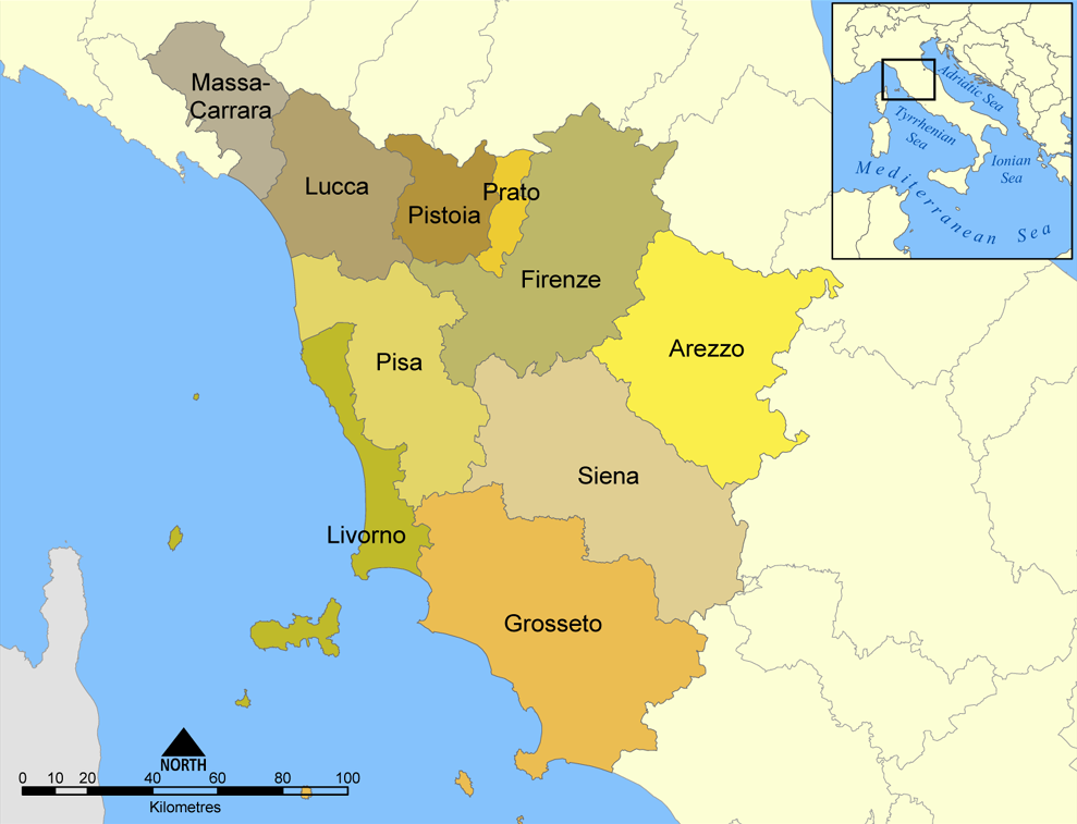
The province of Grosseto ( it, links=no, provincia di Grosseto) is a province in the Tuscany region of Italy. Its capital is the city of Grosseto. As of 2013 the province had a total population of 225,098 people. Geography The Province of Grosseto completely occupies the southern end of Tuscany, and with a territorial area of , it is the most extensive in the region and one of the least dense in population in Italy. The province is bordered to the northwest by the Province of Livorno, to the north by the Province of Pisa, to the northeast by the Province of Siena, and to the southeast by the Province of Viterbo in Lazio. To the south is the Tyrrhenian Sea, which includes the southern islands of the Tuscan archipelago, including Isola del Giglio and the smaller Giannutri islands and Formiche di Grosseto and Formica di Burano. The Arcipelago Toscano National Park spans both the provinces of Grosseto and Livorno, and includes the seven main islands of the Tuscan Archipelago: Elba ... [...More Info...] [...Related Items...] OR: [Wikipedia] [Google] [Baidu] |
Tyrrhenian Sea
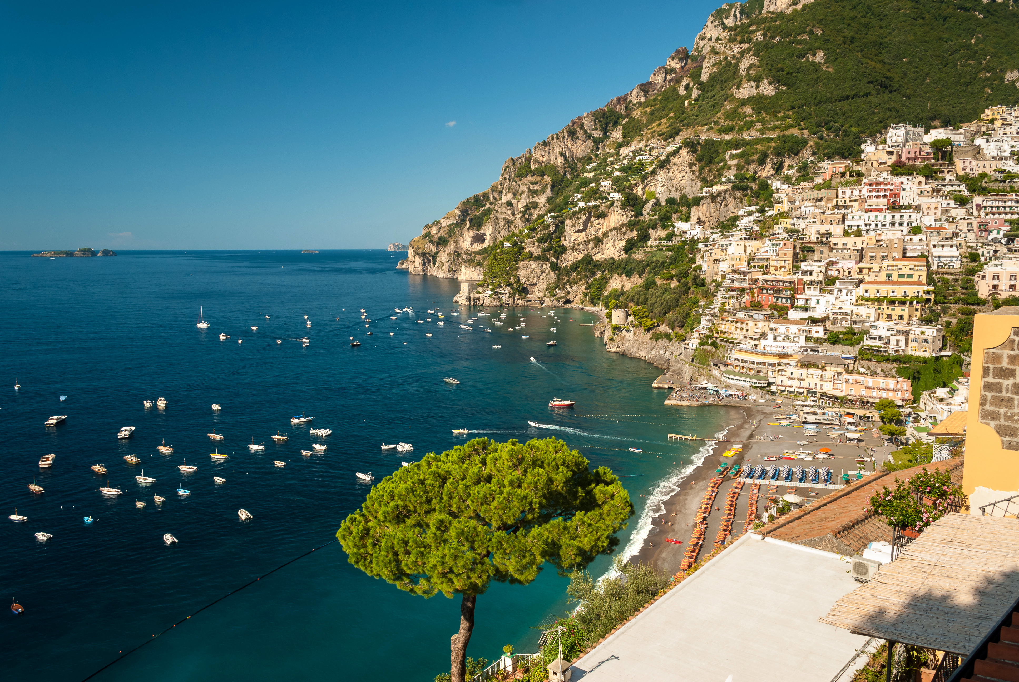
The Tyrrhenian Sea (; it, Mar Tirreno , french: Mer Tyrrhénienne , sc, Mare Tirrenu, co, Mari Tirrenu, scn, Mari Tirrenu, nap, Mare Tirreno) is part of the Mediterranean Sea off the western coast of Italy. It is named for the Tyrrhenian people identified with the Etruscans of Italy. Geography The sea is bounded by the islands of Corsica and Sardinia (to the west), the Italian Peninsula (regions of Tuscany, Lazio, Campania, Basilicata, and Calabria) to the north and east, and the island of Sicily (to the south). The Tyrrhenian Sea also includes a number of smaller islands like Capri, Elba, Ischia, and Ustica. The maximum depth of the sea is . The Tyrrhenian Sea is situated near where the African and Eurasian Plates meet; therefore mountain chains and active volcanoes such as Mount Marsili are found in its depths. The eight Aeolian Islands and Ustica are located in the southern part of the sea, north of Sicily. Extent The International Hydrographic Organiza ... [...More Info...] [...Related Items...] OR: [Wikipedia] [Google] [Baidu] |
La Torba
La Torba is a village in Tuscany, central Italy, administratively a frazione of the comune of Capalbio, province of Grosseto. At the time of the 2001 census its population amounted to 209. Istat. Geography La Torba is about 50 km from and 12 km from |
Chiarone Scalo
Chiarone Scalo is a village in Tuscany, central Italy, administratively a frazione of the comune of Capalbio, province of Grosseto. At the time of the 2001 census its population amounted to 18. Geography Chiarone Scalo is about 58 km from Grosseto and 11 km from Capalbio, and it is situated in the plain of southern Maremma between the hills of Capalbio and the Tyrrhenian Sea, next to the mouth of the river Chiarone, which marks the border between the provinces of Grosseto and Viterbo, Lazio. Chiarone Scalo is the southernmost village in Tuscany. History The small town was born in the late 18th century as border point and customs between the Grand Duchy of Tuscany and the Papal States and it developed in the next century with the opening of the railway station (1867). With the Maremman ''Riforma agraria'' (land reform) in the 1950s it became the centre for various newborn rural villages which converge on it: the hamlet of ''Selva Nera'' and several others named after ... [...More Info...] [...Related Items...] OR: [Wikipedia] [Google] [Baidu] |
Capalbio Scalo
Capalbio Scalo is a village in Tuscany, central Italy, administratively a frazione of the comune of Capalbio, province of Grosseto. It had a population of 551 as of 2011. Geography Capalbio Scalo is about 50 km from Grosseto and 9 km from Capalbio. It is in the plain of southern Maremma between the hills of Capalbio and the Tyrrhenian Sea. Capalbio Scalo lies on the shore of Lago di Burano, an important natural reserve. Main sights * Church of Santa Maria Goretti (20th century) is the main parish church of the village. It was built in 1986 and consecrated by bishop Eugenio Binini. * Tower of Buranaccio (16th century), built by the State of Presidi, is on the shore of the Burano Lake. * Tower of Macchiatonda (17th century), coastal defense tower built by the State of Presidi, was restructured during the 19th century. It was used as a location in the 1969 movie '' The Seed of Man'' by director Marco Ferreri. Transport Capalbio Scalo is located along the Via Aurelia ... [...More Info...] [...Related Items...] OR: [Wikipedia] [Google] [Baidu] |
Borgo Carige
Borgo Carige is a village in Tuscany, central Italy, administratively a frazione of the comune of Capalbio, province of Grosseto. At the time of the 2001 census its population amounted to 229. Borgo Carige is about 54 km from Grosseto and 5 km from Capalbio, and it is situated in the plain of southern Maremma between the hills of Capalbio and the Tyrrhenian Sea. It is located along the Via Aurelia highway which links Grosseto to Rome. The village is an important town born as a result of the Maremman ''Riforma agraria'' (land reform) in the 1950s. Main sights * Church of ''Cuore Immacolato'' (20th century), main parish church of the village, it was built in 1958 and designed by Riccardo Medici in a Neo-Romanesque style.M. Del Francia, B. Catalani, ''Architettura contemporanea del paesaggio toscano'', Edizioni Edifir, Firenze, 2008, p. 31. References Bibliography * Fabiola Favilli, ''Capalbio. Alla scoperta del borgo e del territorio'', Arcidosso, C&P Adver Effig ... [...More Info...] [...Related Items...] OR: [Wikipedia] [Google] [Baidu] |
Land Reform
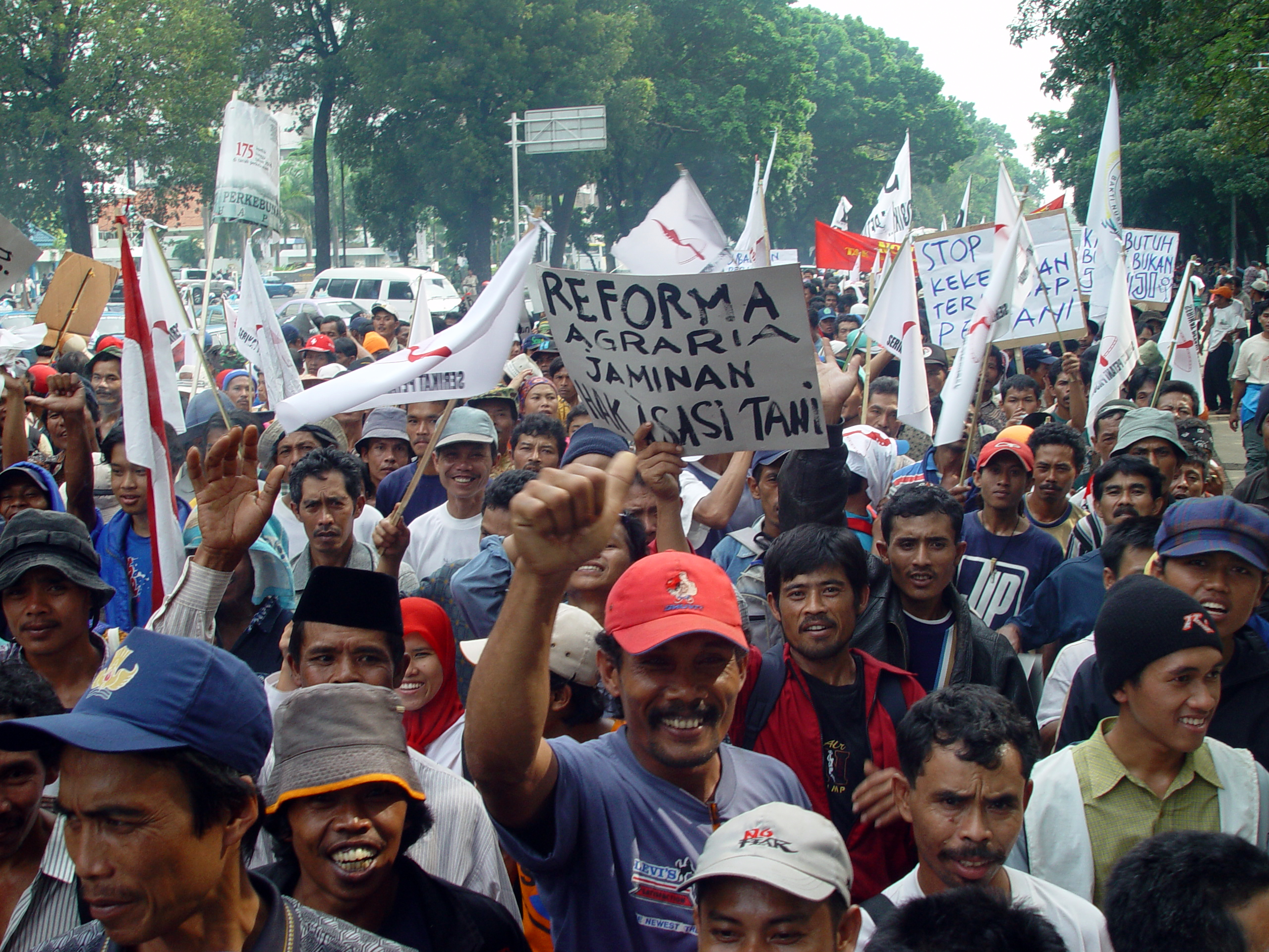
Land reform is a form of agrarian reform involving the changing of laws, regulations, or customs regarding land ownership. Land reform may consist of a government-initiated or government-backed property redistribution, generally of agricultural land. Land reform can, therefore, refer to transfer of ownership from the more powerful to the less powerful, such as from a relatively small number of wealthy or noble owners with extensive land holdings (e.g., plantations, large ranches, or agribusiness plots) to individual ownership by those who work the land. Such transfers of ownership may be with or without compensation; compensation may vary from token amounts to the full value of the land. Land reform may also entail the transfer of land from individual ownership—even peasant ownership in smallholdings—to government-owned collective farms; it has also, in other times and places, referred to the exact opposite: division of government-owned collective farms into smallholdin ... [...More Info...] [...Related Items...] OR: [Wikipedia] [Google] [Baidu] |
Cosa
Cosa was a Latin colony founded in southwestern Tuscany in 273 BC, on land confiscated from the Etruscans, to solidify the control of the Romans and offer the Republic a protected port. The Etruscan site (called ''Cusi'' or ''Cosia'') may have been where modern Orbetello stands; a fortification wall in polygonal masonry at Orbetello's lagoon may be in phase with the walls of Cosa. The position of Cosa is distinct, rising some 113 metres above sea level and is sited 140 km northwest of Rome on the Tyrrhenian Sea coast, on a hill near the small town of Ansedonia. The town experienced a hard life and was never truly a prosperous Roman city, although it has assumed a position of prominence in Roman archaeology owing to the circumstances of its excavation (cf. Dyson 2005, below). After the foundation, wars of the 3rd century BC affected the town. New colonists arrived in 197 BC. Cosa seems to have prospered until it was sacked in the 60s BC, perhaps by pirates - although a ... [...More Info...] [...Related Items...] OR: [Wikipedia] [Google] [Baidu] |
Roman Civilization
The history of Rome includes the history of the city of Rome as well as the civilisation of ancient Rome. Roman history has been influential on the modern world, especially in the history of the Catholic Church, and Roman law has influenced many modern legal systems. Roman history can be divided into the following periods: *Pre-historical and early Rome, covering Rome's earliest inhabitants and the legend of its founding by Romulus *The period of Etruscan dominance and the regal period, in which, according to tradition, Romulus was the first of seven kings *The Roman Republic, which commenced in 509 BCE when kings were replaced with rule by elected magistrates. The period was marked by vast expansion of Roman territory. During the 5th century BCE, Rome gained regional dominance in Latium. With the Punic Wars from 264 to 146 BCE, ancient Rome gained dominance over the Western Mediterranean, displacing Carthage as the dominant regional power. *The Roman Empire followed the Rep ... [...More Info...] [...Related Items...] OR: [Wikipedia] [Google] [Baidu] |
Vulci
Vulci or Volci (Etruscan: ''Velch'' or ''Velx'', depending on the romanization used) was a rich Etruscan city in what is now northern Lazio, central Italy. As George Dennis wrote, "Vulci is a city whose very name... was scarcely remembered, but which now, for the enormous treasures of antiquity it has yielded, is exalted above every other city of the ancient world." Vulci was located near the coast of the Tyrrhenian Sea about 80 km northwest of Rome, on the Fiora River, between Montalto di Castro and Canino. Remains of the city can be seen today. The Vulci, like other Etruscans, became master sculptors in bronze as acknowledged by ancient writers. Although most large bronzes have been lost, there remain some magnificent examples of Etruscan bronze work such as the Chimera of Arezzo and the Monteleone chariot, possibly made in Vulci. In the 19th century thousands of the ancient tombs of Vulci were discovered, and many were so well known and spectacular, such as the Tomb of ... [...More Info...] [...Related Items...] OR: [Wikipedia] [Google] [Baidu] |
Etruscan Civilization
The Etruscan civilization () was developed by a people of Etruria in ancient Italy with a common language and culture who formed a federation of city-states. After conquering adjacent lands, its territory covered, at its greatest extent, roughly what is now Tuscany, western Umbria, and northern Lazio, as well as what are now the Po Valley, Emilia-Romagna, south-eastern Lombardy, southern Veneto, and western Campania. The earliest evidence of a culture that is identifiably Etruscan dates from about 900BC. This is the period of the Iron Age Villanovan culture, considered to be the earliest phase of Etruscan civilization, which itself developed from the previous late Bronze Age Proto-Villanovan culture in the same region. Etruscan civilization endured until it was assimilated into Roman society. Assimilation began in the late 4thcenturyBC as a result of the Roman–Etruscan Wars; it accelerated with the grant of Roman citizenship in 90 BC, and became complete in 27 BC, whe ... [...More Info...] [...Related Items...] OR: [Wikipedia] [Google] [Baidu] |
Orbetello
Orbetello is a town and ''comune'' in the province of Grosseto (Tuscany), Italy. It is located about south of Grosseto, on the eponymous lagoon, which is home to an important Natural Reserve. History Orbetello was an ancient Etruscan settlement, which in 280 BC passed under the control of the Romans, who had founded their colony of Cosa (near the modern Ansedonia). The emperor Domitian had a substantial property here, which had belonged to the Domitii Ahenobarbi and he inherited through his wife Domitia Longina. He also built other sumptuous villas nearby for his courtiers. In the Middle Ages it was a possession of the Aldobrandeschi family, who held it until the 14th century, when it was acquired by the city of Orvieto. After several struggles with the Orsini of Pitigliano and Orvieto, in the following centuries Orbetello was captured by the Sienese Republic. In the mid-16th century it was part of the State of Presides, a Spanish possession, becoming its capital. ... [...More Info...] [...Related Items...] OR: [Wikipedia] [Google] [Baidu] |


.jpg)


