|
Portuguese Gold Coast
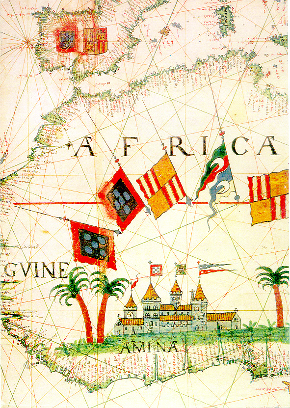
The Portuguese Gold Coast was a Portuguese colony on the West African Gold Coast (present-day Ghana) along the Gulf of Guinea. Established in 1482, the colony was officially incorporated into Dutch territory in 1642 following Portugal’s defeat in the Dutch-Portuguese War. From their seat of power at the fortress of São Jorge da Mina (located in modern Elmina), the Portuguese commanded a vast internal slave trade, creating a slave network that would expand after the end of Portuguese colonialism in the region. The primary export of the colony was gold, which was obtained through barter with the local population. Portuguese presence along the Gold Coast increased seamanship and trade in the Gulf, introduced American crops (such as maize and cassava) into the African agricultural landscape, and made Portuguese an enduring language of trade in the area. History Portuguese arrival on the Gold Coast In 1471, Portuguese explorers encountered fishing villages rich with ivory and ... [...More Info...] [...Related Items...] OR: [Wikipedia] [Google] [Baidu] |
Colony
In modern parlance, a colony is a territory subject to a form of foreign rule. Though dominated by the foreign colonizers, colonies remain separate from the administration of the original country of the colonizers, the ''metropole, metropolitan state'' (or "mother country"). This administrative colonial separation makes colonies neither incorporated territories nor client states. Some colonies have been organized either as dependent territory, dependent territories that are Chapter XI of the United Nations Charter, not sufficiently self-governed, or as self-governing colony, self-governed colonies controlled by settler colonialism, colonial settlers. The term colony originates from the ancient rome, ancient Roman ''colonia (Roman), colonia'', a type of Roman settlement. Derived from ''colon-us'' (farmer, cultivator, planter, or settler), it carries with it the sense of 'farm' and 'landed estate'. Furthermore the term was used to refer to the older Greek ''apoikia'' (), which w ... [...More Info...] [...Related Items...] OR: [Wikipedia] [Google] [Baidu] |
Maize
Maize ( ; ''Zea mays'' subsp. ''mays'', from es, maíz after tnq, mahiz), also known as corn (North American and Australian English), is a cereal grain first domesticated by indigenous peoples in southern Mexico about 10,000 years ago. The leafy stalk of the plant produces pollen inflorescences (or "tassels") and separate ovuliferous inflorescences called ears that when fertilized yield kernels or seeds, which are fruits. The term ''maize'' is preferred in formal, scientific, and international usage as a common name because it refers specifically to this one grain, unlike ''corn'', which has a complex variety of meanings that vary by context and geographic region. Maize has become a staple food in many parts of the world, with the total production of maize surpassing that of wheat or rice. In addition to being consumed directly by humans (often in the form of masa), maize is also used for corn ethanol, animal feed and other maize products, such as corn starch and ... [...More Info...] [...Related Items...] OR: [Wikipedia] [Google] [Baidu] |
World Heritage Site
A World Heritage Site is a landmark or area with legal protection by an international convention administered by the United Nations Educational, Scientific and Cultural Organization (UNESCO). World Heritage Sites are designated by UNESCO for having cultural, historical, scientific or other form of significance. The sites are judged to contain " cultural and natural heritage around the world considered to be of outstanding value to humanity". To be selected, a World Heritage Site must be a somehow unique landmark which is geographically and historically identifiable and has special cultural or physical significance. For example, World Heritage Sites might be ancient ruins or historical structures, buildings, cities, deserts, forests, islands, lakes, monuments, mountains, or wilderness areas. A World Heritage Site may signify a remarkable accomplishment of humanity, and serve as evidence of our intellectual history on the planet, or it might be a place of great natural beauty. A ... [...More Info...] [...Related Items...] OR: [Wikipedia] [Google] [Baidu] |
UNESCO
The United Nations Educational, Scientific and Cultural Organization is a specialized agency of the United Nations (UN) aimed at promoting world peace and security through international cooperation in education, arts, sciences and culture. It has 193 member states and 12 associate members, as well as partners in the non-governmental, intergovernmental and private sector. Headquartered at the World Heritage Centre in Paris, France, UNESCO has 53 regional field offices and 199 national commissions that facilitate its global mandate. UNESCO was founded in 1945 as the successor to the League of Nations's International Committee on Intellectual Cooperation.English summary). Its constitution establishes the agency's goals, governing structure, and operating framework. UNESCO's founding mission, which was shaped by the Second World War, is to advance peace, sustainable development and human rights by facilitating collaboration and dialogue among nations. It pursues this objective t ... [...More Info...] [...Related Items...] OR: [Wikipedia] [Google] [Baidu] |
Sub-Saharan Africa
Sub-Saharan Africa is, geographically, the area and regions of the continent of Africa that lies south of the Sahara. These include West Africa, East Africa, Central Africa, and Southern Africa. Geopolitically, in addition to the List of sovereign states and dependent territories in Africa, African countries and territories that are situated fully in that specified region, the term may also include polities that only have part of their territory located in that region, per the definition of the United Nations (UN). This is considered a non-standardized geographical region with the number of countries included varying from 46 to 48 depending on the organization describing the region (e.g. UN, WHO, World Bank, etc.). The Regions of the African Union, African Union uses a different regional breakdown, recognizing all 55 member states on the continent - grouping them into 5 distinct and standard regions. The term serves as a grouping counterpart to North Africa, which is instead ... [...More Info...] [...Related Items...] OR: [Wikipedia] [Google] [Baidu] |
Diogo De Azambuja
Diogo de Azambuja or Diego de Azambuja (1432–1518) was a Portuguese noble and explorer. Soldier He was born at Montemor-o-Velho, and became a knight of the Order of Aviz in the service of the Infante Dom Pedro, son of the Regent Infante Peter, Duke of Coimbra. After Peter's defeat and death in the battle of Alfarrobeira (1449), he accompanied his master into exile. In 1458, he fought on the side of Afonso V in the conquest of Alcácer-Ceguer in Morocco. He received several honours and became a counselor of the king. During the War of the Castilian Succession, he participated in the recapture of the town of Alegrete from the Castilians. He was injured in the leg during this engagement. Portuguese Gold Coast In 1481, Diogo was appointed by John II as captain of a fleet consisting of nine caravels and two ships with 600 soldiers and 100 masons and carpenters. They were sent, along with the necessary stone and other materials, to construct a fortress called São Jorge d ... [...More Info...] [...Related Items...] OR: [Wikipedia] [Google] [Baidu] |
Atlantic Ocean
The Atlantic Ocean is the second-largest of the world's five oceans, with an area of about . It covers approximately 20% of Earth's surface and about 29% of its water surface area. It is known to separate the " Old World" of Africa, Europe and Asia from the "New World" of the Americas in the European perception of the World. The Atlantic Ocean occupies an elongated, S-shaped basin extending longitudinally between Europe and Africa to the east, and North and South America to the west. As one component of the interconnected World Ocean, it is connected in the north to the Arctic Ocean, to the Pacific Ocean in the southwest, the Indian Ocean in the southeast, and the Southern Ocean in the south (other definitions describe the Atlantic as extending southward to Antarctica). The Atlantic Ocean is divided in two parts, by the Equatorial Counter Current, with the North(ern) Atlantic Ocean and the South(ern) Atlantic Ocean split at about 8°N. Scientific explorations of the A ... [...More Info...] [...Related Items...] OR: [Wikipedia] [Google] [Baidu] |
Shama, Ghana
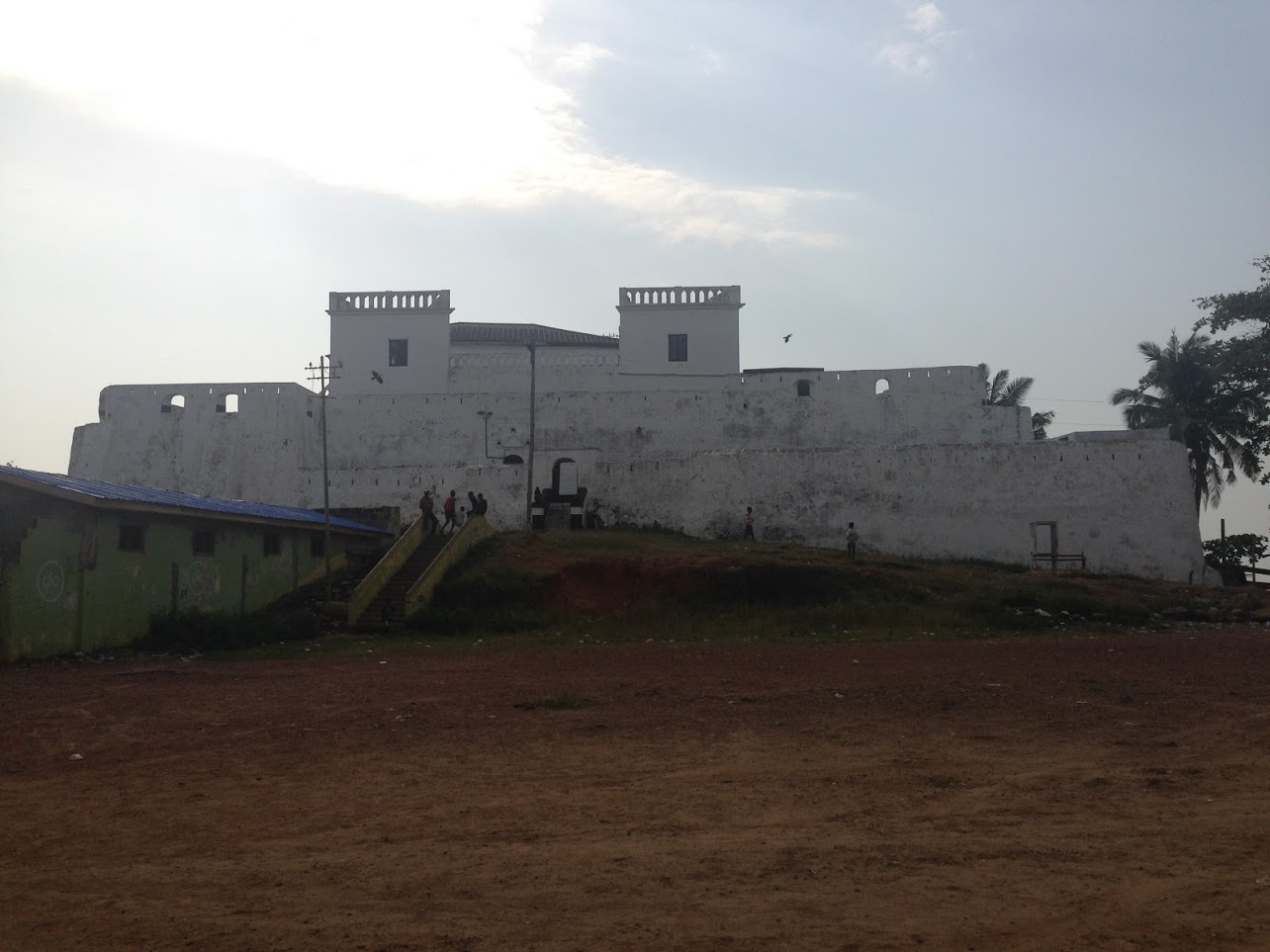
Shama or Shema is a town with a fishing village, and is the capital of Shama district, a district in the Western Region of Ghana.Shama District The town lies about 20 km east of , on the mouth of the . The town is home to , in whose graveyard philosopher |
Accra
Accra (; tw, Nkran; dag, Ankara; gaa, Ga or ''Gaga'') is the capital and largest city of Ghana, located on the southern coast at the Gulf of Guinea, which is part of the Atlantic Ocean. As of 2021 census, the Accra Metropolitan District, , had a population of 284,124 inhabitants, and the larger Greater Accra Region, , had a population of 5,455,692 inhabitants. In common usage, the name "Accra" often refers to the territory of the Accra Metropolitan District as it existed before 2008, when it covered .Sum of the land areas of Accra Metropolitan District, Ablekuma Central Municipal District, Ablekuma North Municipal District, Ablekuma West Municipal District, Ayawaso Central Municipal District, Ayawaso East Municipal District, Ayawaso North Municipal District, Ayawaso West Municipal District, Korle Klottey Municipal District, Krowor Municipal District, La Dadekotopon Municipal District, Ledzokuku Municipal District, and Okaikoi North Municipal District, as per the 2021 ce ... [...More Info...] [...Related Items...] OR: [Wikipedia] [Google] [Baidu] |
Osu, Accra
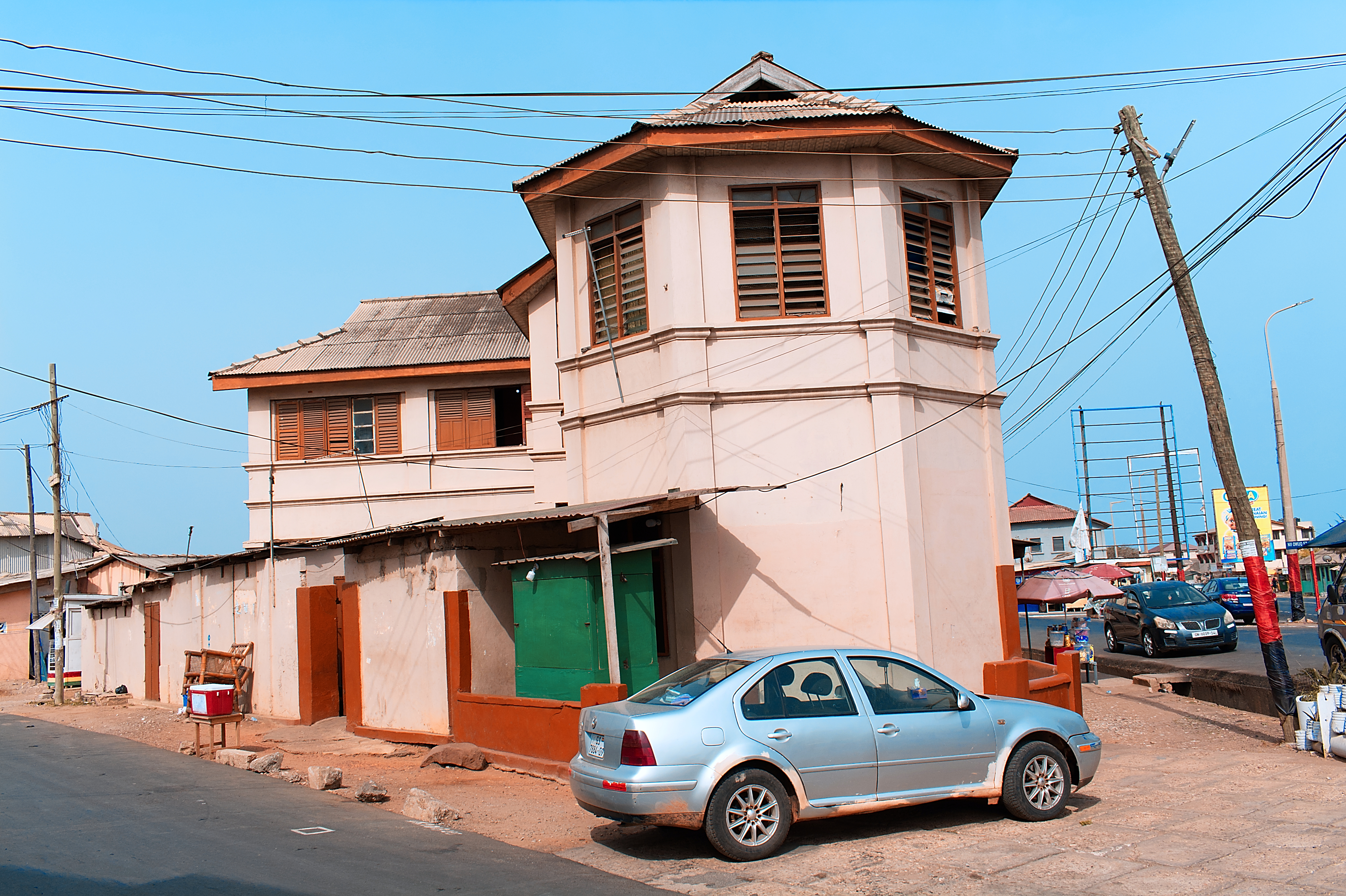
Located about east of the central business district, Osu is a neighborhood in central Accra, Ghana. It is locally known as the "West End" of Accra. Bounded to the south by the Gulf of Guinea, Osu's western boundary is the Independence Avenue. Osu is separated from the northern district of Labone by Ring Road. Due to its establishment as a settlement in the 17th century, Osu has a mix of houses dating from the early 20th century and modern office towers. Ringway Estates, a gated residential community between Gamel Abdul Nasser Avenue and Cantonments Road is located in the western section of Osu. The main thoroughfare, Cantonments Road (colloquially known as Oxford Street) has large supermarkets and appliance shops. At its southern end is the site of the 17th-century Fort Christiansborg, a former Danish colonial fort, which formerly housed the seat of government before being relocated to Golden Jubilee House. Economy The head office of Starbow is in Osu. [...More Info...] [...Related Items...] OR: [Wikipedia] [Google] [Baidu] |
Axim
Axim is a coastal town and the capital of Nzema East Municipal district, a district in Western Region of South Ghana. Axim lies 64 kilometers west of the port city of Sekondi-Takoradi in the Western Region, west of Cape Three Points. Axim has a 2013 settlement population of 27,719 people. History This area was occupied by the Nzema people. The Portuguese arrived by the early 16th century as traders. They built a prominent seaside fort, Fort Santo Antonio, in 1515. They exported some Africans as slaves to Europe and the Americas. Between 1642 and 1872, the fort was expanded and altered by the Dutch, who "ruled" during that period. The fort, now property of Ghana, is open to the public. Off-shore are some picturesque islands, including one with a lighthouse. Axim structure The town of Axim is divided into two parts: Upper Axim and Lower Axim. Fort Santo Antonio lies roughly on the division between the two parts, but closest to the centre of Upper Axim, the original European ... [...More Info...] [...Related Items...] OR: [Wikipedia] [Google] [Baidu] |
.jpg)


