|
Penmaenmawr
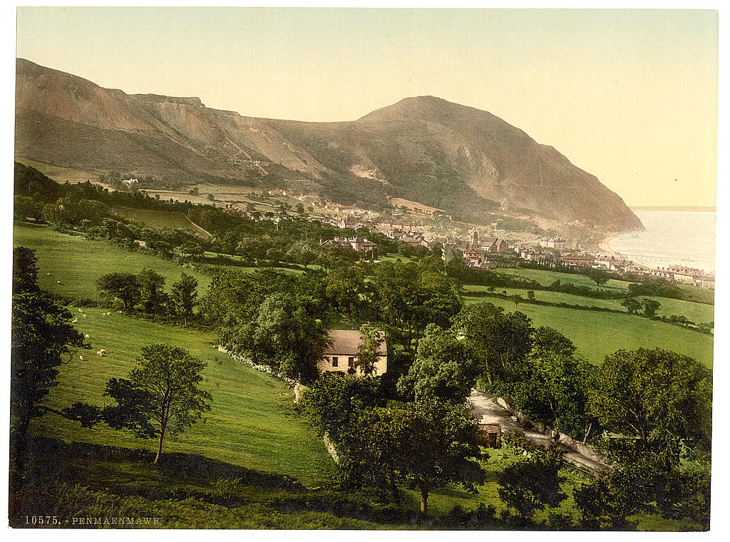
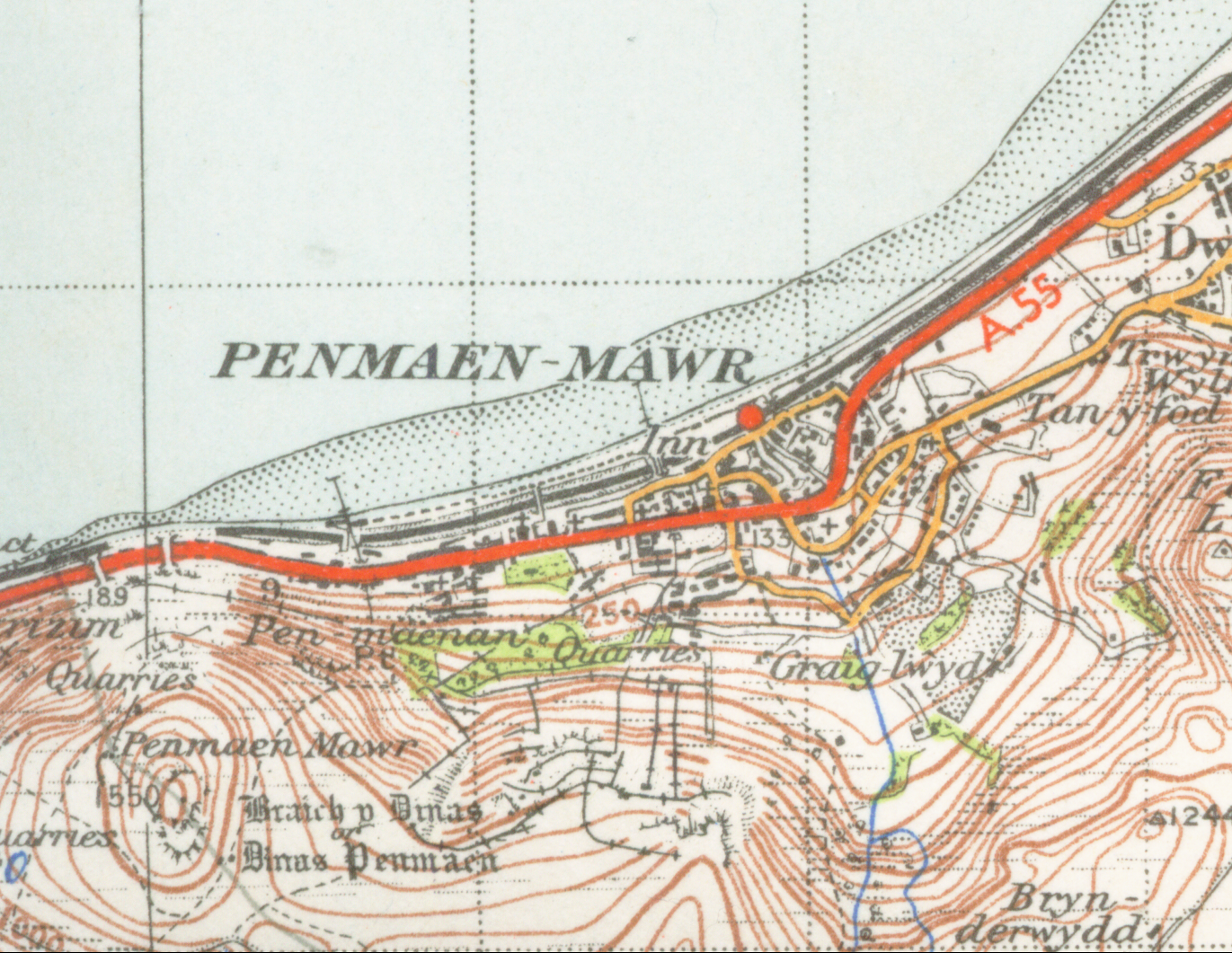
Penmaenmawr (, ) is a town and community in Conwy County Borough, Wales, which was formerly in the parish of Dwygyfylchi and the traditional county of Caernarfonshire. It is on the North Wales coast between Conwy and Llanfairfechan and was an important quarrying town, though quarrying is no longer a major employer. The population of the community was 4,353 in 2011, including Dwygyfylchi and Capelulo. The town itself having a population of 2,868 (2011). It was named after Penmaenmawr mountain, which stands above the sea immediately west of the town. Much of its formerly rounded top (with an old hill-fort) has been quarried away, leaving the present-day lower flat top. The town was bypassed by the A55 Expressway in the 1980s, losing its old Edwardian period promenade in the process, which was largely replaced by a modern one. Penmaenmawr is noted for its spectacular mountain and coastal walks. Nearby are the popular attractions of Bwlch Sychnant (Sychnant Pass) and Mynydd y Dre ... [...More Info...] [...Related Items...] OR: [Wikipedia] [Google] [Baidu] |
Penmaenmawr 001
Penmaenmawr (, ) is a town and community (Wales), community in Conwy County Borough, Wales, which was formerly in the parish of Dwygyfylchi and the traditional county of Caernarfonshire. It is on the North Wales coast between Conwy and Llanfairfechan and was an important quarrying town, though quarrying is no longer a major employer. The population of the community was 4,353 in 2011, including Dwygyfylchi and Capelulo. The town itself having a population of 2,868 (2011). It was named after Penmaenmawr mountain, which stands above the sea immediately west of the town. Much of its formerly rounded top (with an old hill-fort) has been quarried away, leaving the present-day lower flat top. The town was bypassed by the A55 road, A55 Limited-access road, Expressway in the 1980s, losing its old Edwardian period promenade in the process, which was largely replaced by a modern one. Penmaenmawr is noted for its spectacular mountain and coastal walks. Nearby are the popular attractions of ... [...More Info...] [...Related Items...] OR: [Wikipedia] [Google] [Baidu] |
Dwygyfylchi
Dwygyfylchi () is a village in Conwy County Borough, Wales. It is part of the community of Penmaenmawr which has a population of 4,353. The electoral ward of Capelulo which includes Dwygyfylchi had a population of 1,485 in 2011. It was formerly part of the historic county of Caernarfonshire. Name The name Dwygyfylchi is derived from the Welsh ''dwy'', "two", and ''cyfylchi'', a word used almost exclusively in placenames meaning a "circular fortress"; it was first recorded as "Dwykyvelchy" in 1287.Owen, Hywel W. (2015) ''The place-names of Wales'', University of Wales Press There are several old fortifications on the surrounding hills. The origin of the name Capelulo, the original settlement, lies in its association with Saint Ulo. Geography Approximately half of Dwygyfylchi forms the most northern tip of the Snowdonia National Park. Half a mile to the south-east of the main village lies Capelulo, which lies at the foot of the picturesque Sychnant Pass, which connects Dwygyfyl ... [...More Info...] [...Related Items...] OR: [Wikipedia] [Google] [Baidu] |
A55 Road
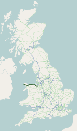
The A55, also known as the North Wales Expressway ( cy, Gwibffordd Gogledd Cymru) is a major road in Wales and England, connecting Cheshire and north Wales. The vast majority of its length from Chester to Holyhead is a dual carriageway primary route, with the exception of the Britannia Bridge over the Menai Strait and several short sections where there are gaps in between the two carriageways. All junctions are grade separated apart from a roundabout east of Penmaenmawr and another nearby in Llanfairfechan. Initially, the road ran from Chester to Bangor. In 2001, it was extended across Anglesey to the ferry port of Holyhead parallel to the A5. The road improvements have been part funded with European money, under the Trans-European Networks programme, as the route is designated part of Euroroute E22 ( Holyhead – Leeds – Amsterdam – Hamburg – Malmö – Riga – Moscow – Perm – Ekaterinburg – Ishim). Route The Chester southerly bypass The A55 begins ... [...More Info...] [...Related Items...] OR: [Wikipedia] [Google] [Baidu] |
Snowdonia National Park
Snowdonia or Eryri (), is a mountainous region in northwestern Wales and a national park of in area. It was the first to be designated of the three national parks in Wales, in 1951. Name and extent It was a commonly held belief that the name is derived from ("eagle"), and thus means "the abode/land of eagles", but recent evidence is that it means ''highlands'', and is related to the Latin (to rise) as leading Welsh scholar Sir proved. The term first appeared in a manuscript in the 9th-century , in an account of the downfall of the semi-legendary 5th-century king (Vortigern). In the Middle Ages, the title ''Prince of Wales and Lord of Snowdonia'' () was used by ; his grandfather used the title ''Prince of north Wales and Lord of Snowdonia.'' The name ''Snowdonia'' derives from '' Snowdon'', the highest mountain in the area and the highest mountain in Wales at . Before the boundaries of the national park were designated, "Snowdonia" was generally used to refer to a sm ... [...More Info...] [...Related Items...] OR: [Wikipedia] [Google] [Baidu] |
Eryri
Snowdonia or Eryri (), is a mountainous region in northwestern Wales and a national park of in area. It was the first to be designated of the National parks of Wales, three national parks in Wales, in 1951. Name and extent It was a commonly held belief that the name is derived from ("eagle"), and thus means "the abode/land of eagles", but recent evidence is that it means ''highlands'', and is related to the Latin (to rise) as leading Welsh scholar Sir proved. The term first appeared in a manuscript in the 9th-century , in an account of the downfall of the semi-legendary 5th-century king (Vortigern). In the Middle Ages, the title ''Prince of Wales and Lord of Snowdonia'' () was used by ; his grandfather used the title ''Prince of north Wales and Lord of Snowdonia.'' The name ''Snowdonia'' derives from ''Snowdon'', the highest mountain in the area and the highest mountain in Wales at . Before the boundaries of the national park were designated, "Snowdonia" was generall ... [...More Info...] [...Related Items...] OR: [Wikipedia] [Google] [Baidu] |
Sychnant Pass
Sychnant Pass (Welsh: ''Bwlch Sychnant'', "Dry-stream Pass") in Conwy County Borough, Wales, links Conwy to Penmaenmawr via Dwygyfylchi. Much of the pass is in Snowdonia National Park, and a large area of land within it has been designated a Site of Special Scientific Interest. At the bottom is the village of Capelulo, which lends its name to the community of Penmaenmawr. Before the coming of the railway to the North Wales coast, the road through Sychnant Pass was the route of choice for mail coaches at high tide, when the faster and safer route along the sands was unusable. After leaving Conwy, the route runs westward through the valley on the south side of Mynydd y Dref (Conwy Mountain), which is topped by the hillfort of Castell Caer Seion. There are parallel tracks and footpaths (including the North Wales Path) on Mynydd y Dref for most of the way. Also Allt-Wen () and Penmaenbach () can be climbed from here. At the western end of the valley, the Sychnant Pass Road runs ... [...More Info...] [...Related Items...] OR: [Wikipedia] [Google] [Baidu] |
Llanfairfechan
Llanfairfechan ("Little Mary, Mother of God, St Mary's llan (placename), Parish") is a town and Community (Wales), community in the Conwy County Borough, Wales. It is known as a seaside resort and had a population at the United Kingdom Census 2001, 2001 Census of 3,755, reducing to 3,637 at the 2011 Census. The history of the area dates back to at least Romano-British, Roman times, as demonstrated by the discovery of a large second century milestone, which is now preserved in the British Museum. Political boundary It was in Gwynedd from 1972 to 1996, and prior to that was in Caernarfonshire. For ceremonial and electoral boundary purposes it was transferred from the Preserved counties of Wales, preserved county of Gwynedd to that of Clwyd in 2003. For electoral purposes, the community of Llanfairfechan consists of three electoral wards, Bryn, Lafan and Pandy. Transport connections The town lies on the north coast on the route of the A55 road, between Penmaenmawr and Bangor, Wale ... [...More Info...] [...Related Items...] OR: [Wikipedia] [Google] [Baidu] |
Caernarfonshire
, HQ= County Hall, Caernarfon , Map= , Image= Flag , Motto= Cadernid Gwynedd (The strength of Gwynedd) , year_start= , Arms= ''Coat of arms of Caernarvonshire County Council'' , Code= CAE , CodeName= Chapman code , Government= Carnarvonshire County Council (1889 - 1926)Caernarvonshire County Council (1926-1974) , PopulationFirst= 66,448Vision of Britain 1831 Census/ref> , PopulationFirstYear= 1831 , AreaFirst= , AreaFirstYear= 1831 , DensityFirst= 0.2/acre , DensityFirstYear= 1831 , PopulationSecond= 125,043 , PopulationSecondYear= 1911 , AreaSecond= , AreaSecondYear= 1911 , DensitySecond= 0.3/acre , DensitySecondYear= 1911 , PopulationLast= 121,767 , PopulationLastYear= 1961 , AreaLast= , AreaLastYear= ... [...More Info...] [...Related Items...] OR: [Wikipedia] [Google] [Baidu] |
Conwy Bay
Conwy Bay ( Welsh ''Bae Conwy''), also known as Conway Bay, is an inlet of the Irish Sea. It is situated at the southeastern point of the coast of Anglesey at Bangor on the northern central coast of Wales, stretching from Puffin Island to Great Orme in the northeast. Bangor, Penmaenmawr, Beaumaris and Llandudno are notable towns on the bay. With its onshore winds and ebbing tide, the bay is popular with yachtsmen; Conwy Yacht Club hosts an annual regatta in June. Description Conwy Bay lies at the southeastern point of the coast of Anglesey at Bangor on the northern central coast of Wales. Puffin Island and the Great Orme mark the limits of the bay. The bay is entered between Trwyn-du and Great Ormes Head in the northeast and extends for approximately to the southwest at Bangor, marking the northeast entrance to the Menai Strait. Bangor, Penmaenmawr and Beaumaris lie on the bay, with Llandudno to the eastern extreme. The River Conwy flows into Conwy Bay in the southe ... [...More Info...] [...Related Items...] OR: [Wikipedia] [Google] [Baidu] |
Conwy
Conwy (, ), previously known in English as Conway, is a walled market town, community and the administrative centre of Conwy County Borough in North Wales. The walled town and castle stand on the west bank of the River Conwy, facing Deganwy on the east bank. The town formerly lay in Gwynedd and prior to that in Caernarfonshire. The community, which also includes Deganwy and Llandudno Junction, had a population of 14,753 at the 2011 census. Although the community of Conwy straddles the River Conwy, for postal purposes the areas on the east bank form part of the post town of Llandudno Junction, with the Conwy post town being confined to west bank of the river. The ward on the west bank of the river had a population of 4,065 at the 2011 census. The resident population of the wider Conwy County Borough was estimated to be 116,200 in an ONS-estimate. The name 'Conwy' derives from the old Welsh words ''cyn'' (chief) and ''gwy'' (water), the river being originally called the 'Cynwy'. ... [...More Info...] [...Related Items...] OR: [Wikipedia] [Google] [Baidu] |
Conwy County Borough
Conwy County Borough ( cy, Bwrdeistref Sirol Conwy) is a county borough in Wales. It borders Gwynedd to the west and south, and Denbighshire to the east. Other settlements in the county borough include Abergele, Betws-y-Coed, Colwyn Bay, Conwy, Llandudno, Llandudno Junction, Llanfairfechan, Llanrwst, and Penmaenmawr. Geography The River Conwy, after which the county borough is named, lies wholly within the area: rising in Snowdonia and flowing through Llanrwst and Trefriw en route to the Irish Sea by Conwy. The river here marks the border between the historic counties of Caernarfonshire and Denbighshire. One third of the land area of the county borough lies in the Snowdonia National Park, and the council appoint three of the 18 members of the Snowdonia National Park Authority. Its total area is , making it slightly larger than Hong Kong. The eastern part includes the larger section of Denbigh Moors. The vast majority of the population live on the coast; the only settlement o ... [...More Info...] [...Related Items...] OR: [Wikipedia] [Google] [Baidu] |
North Wales
, area_land_km2 = 6,172 , postal_code_type = Postcode , postal_code = LL, CH, SY , image_map1 = Wales North Wales locator map.svg , map_caption1 = Six principal areas of Wales commonly defined to be North Wales, for policing, fire and rescue, health and regional economy. North Wales ( cy, Gogledd Cymru) is a region of Wales, encompassing its northernmost areas. It borders Mid Wales to the south, England to the east, and the Irish Sea to the north and west. The area is highly mountainous and rural, with Snowdonia National Park ( and the Clwydian Range and Dee Valley (), known for its mountains, waterfalls and trails, wholly within the region. Its population is concentrated in the north-east and northern coastal areas, with significant Welsh-speaking populations in its western and rural areas. North Wales is imprecisely defined, lacking any exact definition or administrative structure. It is commonly defined adminis ... [...More Info...] [...Related Items...] OR: [Wikipedia] [Google] [Baidu] |


%2C_Wales)_LOC_3752435594.jpg)
