|
Crugmeer
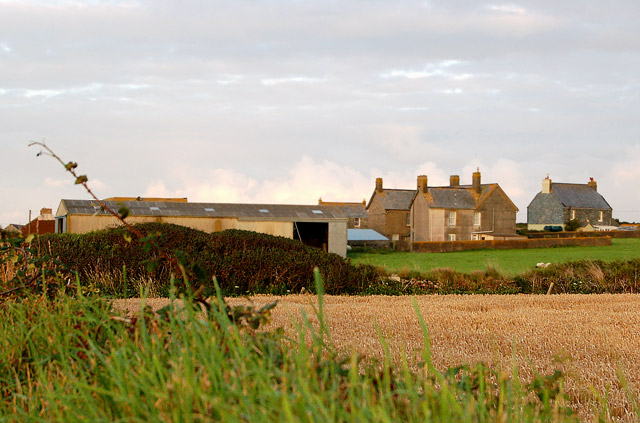
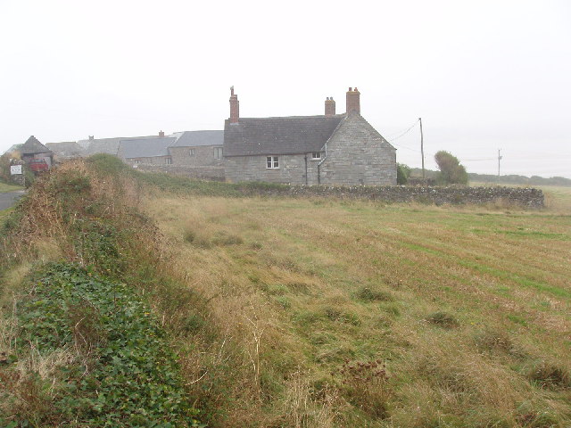
Crugmeer ( kw, Krugmeur, ''great barrow'') is a hamlet in north Cornwall, England, United Kingdom. It is situated one-and-a-half miles (2 kilometres) from Padstow to the west of the River Camel estuary. The hamlet consists of half-a-dozen houses and a farm at the junction of two lanes. One lane gives access to Crugmeer from the Padstow-St Merryn road then continues northeast to Lellizzick, Hawker's Cove and Stepper Point. The other lane leads west from Crugmeer to Trevone beach.Ordnance Survey: Landranger map sheet 200 ''Newquay & Bodmin'' Crugmeer lies within the Cornwall Area of Outstanding Natural Beauty The Cornwall Area of Outstanding Natural Beauty covers in Cornwall, England, UK; that is, about 27% of the total area of the county. It comprises 12 separate areas, designated under the National Parks and Access to the Countryside Act 1949 for ... (AONB). Almost a third of Cornwall has AONB designation, with the same status and protection as a National Park. ... [...More Info...] [...Related Items...] OR: [Wikipedia] [Google] [Baidu] |
Hawker's Cove, Cornwall
Hawker's Cove is a small coastal settlement in north Cornwall, England, United Kingdom. It is situated one-and-a-half miles (2 kilometres) north of Padstow on the west side of the River Camel estuary .Ordnance Survey: Landranger map sheet 200 ''Newquay & Bodmin'' The hamlet consists of two terraces of cottages, a few detached dwellings, a coastguard station and a boathouse with a slipway which once housed the Padstow lifeboat. The actor Edward Woodward lived there until his death in 2009. The first lifeboat, built by the Padstow Harbour Association, was kept at Hawker's Cove and in 1855 the Padstow branch of the RNLI was formed. A new boathouse with a roller slipway was built in 1931. By the 1960s, silting was becoming a problem and in October 1967 the Padstow lifeboat relocated to a new boathouse and slipway at Trevose Head, a few miles to the west. Facilities at Hawkers Cove are limited, although there is now a (tiny) tea garden at the back of the two-hundred-year-old ‘Coast ... [...More Info...] [...Related Items...] OR: [Wikipedia] [Google] [Baidu] |
Lellizzick
Lellizzick ( kw, Lan Wolesyk, meaning ''Woledic's church enclosure'') is a farmstead settlement in north Cornwall, England. It is situated approximately north of Padstow on the lane from Crugmeer to Hawkers Cove. A gated vehicle track leads north from Lellizzick to the National Coastwatch Institution watch station on Stepper Point. A permissive footpath leads south to Tregirls beach. Archaeology In the late 1990s, aerial photography by archaeologists revealed a number of circular and semi-circular crop marks in two clifftop fields near Lellizzick. Metal detectorists also discovered flints and pottery from the Mesolithic period as well as later artefacts from the post-Roman period.Report on Lellizzick investigation |
Padstow
Padstow (; kw, Lannwedhenek) is a town, civil parish and fishing port on the north coast of Cornwall, England. The town is situated on the west bank of the River Camel estuary approximately northwest of Wadebridge, northwest of Bodmin and northeast of Newquay. The population of Padstow civil parish was 3,162 in the 2001 census, reducing to 2,993 at the 2011 census. In addition an electoral ward with the same name exists but extends as far as Trevose Head. The population for this ward is 4,434 The geology of the low plateau south of Padstow has resulted in such features as Tregudda Gorge where erosion along the faultline has caused sheer cliffs to form; and the Marble Cliffs which have alternating black and white strata. The Round Hole is a collapsed sea cave. History In English, Padstow was originally named after Æthelstan who was reported by John Leland to be 'chief governor of privileges onto it'. was commuted into , , or 'Petrock's Place', after the Welsh missio ... [...More Info...] [...Related Items...] OR: [Wikipedia] [Google] [Baidu] |
Cornwall Council
Cornwall Council ( kw, Konsel Kernow) is the unitary authority for Cornwall in the United Kingdom, not including the Isles of Scilly, which has its own unitary council. The council, and its predecessor Cornwall County Council, has a tradition of large groups of independent councillors, having been controlled by independents in the 1970s and 1980s. Since the 2021 elections, it has been under the control of the Conservative Party. Cornwall Council provides a wide range of services to the approximately half a million people who live in Cornwall. In 2014 it had an annual budget of more than £1 billion and was the biggest employer in Cornwall with a staff of 12,429 salaried workers. It is responsible for services including: schools, social services, rubbish collection, roads, planning and more. History Establishment of the unitary authority On 5 December 2007, the Government confirmed that Cornwall was one of five councils that would move to unitary status. This was enacted b ... [...More Info...] [...Related Items...] OR: [Wikipedia] [Google] [Baidu] |
Cornwall
Cornwall (; kw, Kernow ) is a historic county and ceremonial county in South West England. It is recognised as one of the Celtic nations, and is the homeland of the Cornish people. Cornwall is bordered to the north and west by the Atlantic Ocean, to the south by the English Channel, and to the east by the county of Devon, with the River Tamar forming the border between them. Cornwall forms the westernmost part of the South West Peninsula of the island of Great Britain. The southwesternmost point is Land's End and the southernmost Lizard Point. Cornwall has a population of and an area of . The county has been administered since 2009 by the unitary authority, Cornwall Council. The ceremonial county of Cornwall also includes the Isles of Scilly, which are administered separately. The administrative centre of Cornwall is Truro, its only city. Cornwall was formerly a Brythonic kingdom and subsequently a royal duchy. It is the cultural and ethnic origin of the Cor ... [...More Info...] [...Related Items...] OR: [Wikipedia] [Google] [Baidu] |
North Cornwall (UK Parliament Constituency)
North Cornwall is a constituency represented in the House of Commons of the UK Parliament by Scott Mann, a Conservative since the 2015 general election. Like all British constituencies, the seat elects one Member of Parliament (MP) by the first past the post system of election at least every five years. The seat was created in 1918. Since 1950, the constituency has been held by MPs from either the Conservative Party or the Liberal Democrats (including the party's predecessor, the Liberal Party). History This constituency was created under the Representation of the People Act 1918. With exceptions in 1997 and 2001 the seat's margin of victory has been less than 20% of the vote; it has been consistently fought over between and won by the Conservative Party and the Liberal Democrats's candidate (or predecessor party in the latter case), and can be considered a marginal seat. In 1997 and 2001 the seat turned out strongly overall for the latter party. However, in the 2019 ... [...More Info...] [...Related Items...] OR: [Wikipedia] [Google] [Baidu] |
Hamlet (place)
A hamlet is a human settlement that is smaller than a town or village. Its size relative to a parish can depend on the administration and region. A hamlet may be considered to be a smaller settlement or subdivision or satellite entity to a larger settlement. The word and concept of a hamlet has roots in the Anglo-Norman settlement of England, where the old French ' came to apply to small human settlements. Etymology The word comes from Anglo-Norman ', corresponding to Old French ', the diminutive of Old French ' meaning a little village. This, in turn, is a diminutive of Old French ', possibly borrowed from ( West Germanic) Franconian languages. Compare with modern French ', Dutch ', Frisian ', German ', Old English ' and Modern English ''home''. By country Afghanistan In Afghanistan, the counterpart of the hamlet is the qala ( Dari: قلعه, Pashto: کلي) meaning "fort" or "hamlet". The Afghan ''qala'' is a fortified group of houses, generally with its ... [...More Info...] [...Related Items...] OR: [Wikipedia] [Google] [Baidu] |
River Camel
The River Camel ( kw, Dowr Kammel, meaning ''crooked river'') is a river in Cornwall, England. It rises on the edge of Bodmin Moor and with its tributaries its catchment area covers much of North Cornwall. The river flows into the eastern Celtic Sea between Stepper Point and Pentire Point having covered about 30 miles, making it the second longest river wholly in Cornwall. The river is tidal upstream to Egloshayle and is popular for sailing, birdwatching and fishing. The name ''Camel'' comes from the Cornish language for 'the crooked one', a reference to its winding course. Historically the river was divided into three named stretches. Heyl ( kw, Heyl, meaning ''estuary'') was the name for the estuary up to Egloshayle, the River Allen ( kw, Dowr Alen, meaning ''shining river'') was the stretch between Egloshayle and Trecarne, whilst the Camel was reserved for the stretch of river between its source and Trecarne. Geology and hydrology The River Camel rises on Hendraburnick D ... [...More Info...] [...Related Items...] OR: [Wikipedia] [Google] [Baidu] |
St Merryn
St Merryn ( kw, S. Meryn) is a civil parish and village in north Cornwall, England, United Kingdom. It is about south of the fishing port of Padstow and northeast of the coastal resort of Newquay. The village has a primary school, a veterinary practice, various shops, restaurants, and two public houses. The population at the 2011 census was 1,692. Geography The 3,798 acre parish of St Merryn is bounded by a millstream to the south that separates it from the St Ervan and St Eval parishes; more than of coastline along the Atlantic Ocean; and the Padstow parish and Lyn stream. The Seven Bays region of St Merryn includes (from west to east) Porthcothan Bay, Treyarnon Bay, Constantine Bay, Booby's Bay, Mother Ivey's Bay, Harlyn Bay and Trevone Bay.''Welcome to St Merryn Online.'' St Merryn Online. Retrieved 17 September 2012.< ... [...More Info...] [...Related Items...] OR: [Wikipedia] [Google] [Baidu] |
Stepper Point
Stepper Point ( kw, Penn Stuppert) is a headland on the Atlantic coast in north Cornwall, England, United Kingdom. It is at . Stepper Point and Pentire Point stand at either side of the mouth of the River Camel; Stepper to the south-west, Pentire to the north-east. Geography and Geology The headland rises to at its highest point. The land is used for farming and the remains of several defunct stone quarries can be seen. The coast to the east of Stepper Point is on the estuary of the River Camel. This side of the headland boasts the sandhills of Tregirls beach and St George's cove (which is easily accessed from the coast path). A little further north, Harbour Cove and Hawker's Cove (where the Padstow lifeboat was stationed until 1967) are connected at low water by an extensive sandy beach which forms part of a sandbank at the mouth of the estuary known as Doom Bar. Until the 1920s the deep water channel was located close to the headland as far as Harbour Cove, but this h ... [...More Info...] [...Related Items...] OR: [Wikipedia] [Google] [Baidu] |
Trevone
Trevone ( kw, Treavon, meaning ''river farm'') is a seaside village and bay ( kw, Porth Musyn, meaning ''Musun cove'') near Padstow in Cornwall, England, UK. Geography Trevone Bay is a Site of Special Scientific Interest (SSSI). It contains four Geological Conservation Review sites (GCR) and is within the Cornwall Area of Outstanding Natural Beauty (AONB). There are Goniatite fossils on Pentonwarra Point and Conodont fossils on Marble Cliff. The 'Sink Hole', a large blowhole formed by a collapsed sea cave, can be seen on a sloping field above the east side of the bay. Porthmissen Beach received the highest rating for water quality in 2008 and a good rating in 2002. No dogs are allowed on the beach during the summer months. Facilities The village has a village hall, a shop, a Surfing shop and small seasonal cafe. There is also a general store halfway between the top of the hill and the beach. Trevone has recently had its post office closed down, and the general store where t ... [...More Info...] [...Related Items...] OR: [Wikipedia] [Google] [Baidu] |
Cornwall Area Of Outstanding Natural Beauty
The Cornwall Area of Outstanding Natural Beauty covers in Cornwall, England, UK; that is, about 27% of the total area of the county. It comprises 12 separate areas, designated under the National Parks and Access to the Countryside Act 1949 for special landscape protection. Of the areas, eleven cover stretches of coastline; the twelfth is Bodmin Moor. The areas are together treated as a single Area of Outstanding Natural Beauty (AONB). Section 85 of the Countryside and Rights of Way Act 2000 places a duty on all relevant authorities when discharging any function affecting land within an AONB to have regard to the purpose of conserving and enhancing natural beauty. Section 89 places a statutory duty on Local Planning Authorities with an AONB within their administrative area to produce a 5-year management plan. Designation The areas were designated in 1959, except for the Camel estuary which was added in 1981. [...More Info...] [...Related Items...] OR: [Wikipedia] [Google] [Baidu] |


.jpg)


