|
Lellizzick
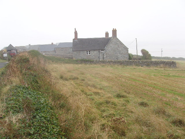
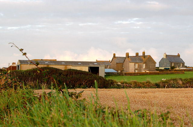
Lellizzick ( kw, Lan Wolesyk, meaning ''Woledic's church enclosure'') is a farmstead settlement in north Cornwall, England. It is situated approximately north of Padstow on the lane from Crugmeer to Hawkers Cove. A gated vehicle track leads north from Lellizzick to the National Coastwatch Institution watch station on Stepper Point. A permissive footpath leads south to Tregirls beach. Archaeology In the late 1990s, aerial photography by archaeologists revealed a number of circular and semi-circular crop marks in two clifftop fields near Lellizzick. Metal detectorists also discovered flints and pottery from the Mesolithic period as well as later artefacts from the post-Roman period.Report on Lellizzick investigation |
Hawkers Cove
Hawker's Cove is a small coastal settlement in north Cornwall, England, United Kingdom. It is situated one-and-a-half miles (2 kilometres) north of Padstow on the west side of the River Camel estuary .Ordnance Survey: Landranger map sheet 200 ''Newquay & Bodmin'' The hamlet consists of two terraces of cottages, a few detached dwellings, a coastguard station and a boathouse with a slipway which once housed the Padstow lifeboat. The actor Edward Woodward lived there until his death in 2009. The first lifeboat, built by the Padstow Harbour Association, was kept at Hawker's Cove and in 1855 the Padstow branch of the RNLI was formed. A new boathouse with a roller slipway was built in 1931. By the 1960s, silting was becoming a problem and in October 1967 the Padstow lifeboat relocated to a new boathouse and slipway at Trevose Head, a few miles to the west. Facilities at Hawkers Cove are limited, although there is now a (tiny) tea garden at the back of the two-hundred-year-old ‘Coast ... [...More Info...] [...Related Items...] OR: [Wikipedia] [Google] [Baidu] |
Crugmeer
Crugmeer ( kw, Krugmeur, ''great barrow'') is a hamlet in north Cornwall, England, United Kingdom. It is situated one-and-a-half miles (2 kilometres) from Padstow to the west of the River Camel estuary. The hamlet consists of half-a-dozen houses and a farm at the junction of two lanes. One lane gives access to Crugmeer from the Padstow-St Merryn road then continues northeast to Lellizzick, Hawker's Cove and Stepper Point. The other lane leads west from Crugmeer to Trevone beach.Ordnance Survey: Landranger map sheet 200 ''Newquay & Bodmin'' Crugmeer lies within the Cornwall Area of Outstanding Natural Beauty The Cornwall Area of Outstanding Natural Beauty covers in Cornwall, England, UK; that is, about 27% of the total area of the county. It comprises 12 separate areas, designated under the National Parks and Access to the Countryside Act 1949 for ... (AONB). Almost a third of Cornwall has AONB designation, with the same status and protection as a National Park. ... [...More Info...] [...Related Items...] OR: [Wikipedia] [Google] [Baidu] |
Stepper Point
Stepper Point ( kw, Penn Stuppert) is a headland on the Atlantic coast in north Cornwall, England, United Kingdom. It is at . Stepper Point and Pentire Point stand at either side of the mouth of the River Camel; Stepper to the south-west, Pentire to the north-east. Geography and Geology The headland rises to at its highest point. The land is used for farming and the remains of several defunct stone quarries can be seen. The coast to the east of Stepper Point is on the estuary of the River Camel. This side of the headland boasts the sandhills of Tregirls beach and St George's cove (which is easily accessed from the coast path). A little further north, Harbour Cove and Hawker's Cove (where the Padstow lifeboat was stationed until 1967) are connected at low water by an extensive sandy beach which forms part of a sandbank at the mouth of the estuary known as Doom Bar. Until the 1920s the deep water channel was located close to the headland as far as Harbour Cove, but this h ... [...More Info...] [...Related Items...] OR: [Wikipedia] [Google] [Baidu] |
Tregirls Beach
Tregirls ( kw, Tregryllas, meaning ''farmstead of the ruins of an ancient dwelling'') is a farmstead in Cornwall, United Kingdom. It is situated approximately half-a-mile (1 km) north of Padstow. The settlement consists of a farm and converted cottages which are let as holiday accommodation. Tregirls beach (which takes its name from the settlement) is 500 metres north at . The north-facing beach is in the River Camel estuary and is backed by dunes with a small stream trickling across the sand at low tide from the corner of the beach tucked hard behind Stepper Point known as Harbour Cove. Beyond Harbour Cove towards Stepper Point is Hawkers Cove, previously the location of the RNLI Padstow lifeboat, now too shallow even at high tide and dry sand at low tide, the result of the sands shifting over the years. The South West Coast Path runs behind the beach before climbing above the rocky side of the river at Hawkers Cove on its way to the Daymark on Stepper Point. Today at l ... [...More Info...] [...Related Items...] OR: [Wikipedia] [Google] [Baidu] |
Wessex Archaeology
Wessex Archaeology is a British company that provides archaeological and heritage services, as well as being an educational charity. Apart from advice and consultancy, it also does fieldwork and publishes research on the sites it surveys. The company has had a long association with the archaeological television programme '' Time Team''. Wessex Archaeology is a Chartered Institute for Archaeologists Registered Organisation. History Founded in 1979 as the Wessex Archaeological Committee, its name was changed in 1983 to the Trust for Wessex Archaeology. It was one of the first rescue archaeology units in the country, focussing on the numerous sites in and around Salisbury Plain. In 2005, it was renamed Wessex Archaeology Limited, trading as "Wessex Archaeology". Since the advent of developer-funded archaeology with PPG 16 and its successor, PPS5, it has expanded its commercial operations across the UK with offices in Maidstone Maidstone is the largest Town status in the Uni ... [...More Info...] [...Related Items...] OR: [Wikipedia] [Google] [Baidu] |
List Of Time Team Episodes
The following is a list of episodes of '' Time Team'', a British television programme about archaeology, that has aired on Channel 4 since 16 January 1994. , accessed 31 December 2014 The twentieth series started on 11 November 2012, with its final episode broadcast on 10 March 2013. Nine further specials (essentially an irregularly scheduled twenty-first series) aired through 2013 and 2014. The episode numbers follow the order of first transmission. Episodes Pilot Series 1 (1994) Series 2 (1995) Series 3 (1996) Series 4 (1997) Series 5 (1998) Series ...
|
Geophysical Survey
Geophysical survey is the systematic collection of geophysical data for spatial studies. Detection and analysis of the geophysical signals forms the core of Geophysical signal processing. The magnetic and gravitational fields emanating from the Earth's interior hold essential information concerning seismic activities and the internal structure. Hence, detection and analysis of the electric and Magnetic fields is very crucial. As the Electromagnetic and gravitational waves are multi-dimensional signals, all the 1-D transformation techniques can be extended for the analysis of these signals as well. Hence this article also discusses multi-dimensional signal processing techniques. Geophysical surveys may use a great variety of sensing instruments, and data may be collected from above or below the Earth's surface or from aerial, orbital, or marine platforms. Geophysical surveys have many applications in geology, archaeology, mineral and energy exploration, oceanography, and engineer ... [...More Info...] [...Related Items...] OR: [Wikipedia] [Google] [Baidu] |
Time Team
''Time Team'' is a British television programme that originally aired on Channel 4, Channel 4 from 16 January 1994 to 7 September 2014. It returned online in 2022 for two episodes released on YouTube. Created by television producer Tim Taylor (producer), Tim Taylor and presented by actor Tony Robinson, each episode featured a team of specialists carrying out an archaeology, archaeological Excavation (archaeology), dig over a period of three days, with Robinson explaining the process in lay terms. The specialists changed throughout the programme's run, although it consistently included professional archaeologists such as Mick Aston, Carenza Lewis, Francis Pryor and Phil Harding (archaeologist), Phil Harding. The sites excavated ranged in date from the Palaeolithic to the Second World War. In October 2012, Channel 4, Channel 4 announced that the final series would be broadcast in 2013. Series 20 was screened from January–March 2013 and nine ... [...More Info...] [...Related Items...] OR: [Wikipedia] [Google] [Baidu] |
Channel 4
Channel 4 is a British free-to-air public broadcast television network operated by the state-owned enterprise, state-owned Channel Four Television Corporation. It began its transmission on 2 November 1982 and was established to provide a fourth television service in the United Kingdom. At the time, the only other channels were the television licence, licence-funded BBC One and BBC Two, and a single commercial broadcasting network ITV (TV network), ITV. The network's headquarters are based in London and Leeds, with creative hubs in Glasgow and Bristol. It is publicly owned and advertising-funded; originally a subsidiary of the Independent Broadcasting Authority (IBA), the station is now owned and operated by Channel Four Television Corporation, a public corporation of the Department for Digital, Culture, Media and Sport, which was established in 1990 and came into operation in 1993. Until 2010, Channel 4 did not broadcast in Wales, but many of its programmes were re-broadcast ... [...More Info...] [...Related Items...] OR: [Wikipedia] [Google] [Baidu] |
Metal Detector
A metal detector is an instrument that detects the nearby presence of metal. Metal detectors are useful for finding metal objects on the surface, underground, and under water. The unit itself, consist of a control box, and an adjustable shaft, which holds a pickup coil, which can vary in shape and size. If the pickup coil comes near a piece of metal, the control box will register its presence by a changing tone, a flashing light, and or by a needle moving on an indicator. Usually the device gives some indication of distance; the closer the metal is, the higher the tone in the earphone or the higher the needle goes. Another common type are stationary "walk through" metal detectors used at access points in prisons, courthouses, airports and psychiatric hospitals to detect concealed metal weapons on a person's body. The simplest form of a metal detector consists of an oscillator producing an alternating current that passes through a coil producing an alternating magnetic field. ... [...More Info...] [...Related Items...] OR: [Wikipedia] [Google] [Baidu] |
Post-Roman Britain
Sub-Roman Britain is the period of late antiquity in Great Britain between the end of Roman rule and the Anglo-Saxon settlement. The term was originally used to describe archaeological remains found in 5th- and 6th-century AD sites that hinted at the decay of locally made wares from a previous higher standard under the Roman Empire. It is now used to describe the period that commenced with the evacuation of Roman troops to Gaul by Constantine III in 407 and to have concluded with the Battle of Deorham in 577. Meaning of terms The period of sub-Roman Britain traditionally covers the history of the area which subsequently became England from the end of Roman imperial rule, traditionally dated to be in 410, to the arrival of Saint Augustine in 597. The date taken for the end of this period is arbitrary in that the sub-Roman culture continued in northern England until the merger of Rheged (the kingdom of the Brigantes) with Northumbria by dynastic marriage in 633, and longer i ... [...More Info...] [...Related Items...] OR: [Wikipedia] [Google] [Baidu] |


