|
Creidlitz
Creidlitz is a southern suburb of 1705 inhabitants (30 June 2010) of the city of Coburg in the county of Upper Franconia in the state of Bavaria in Germany. Geography It is 4 kilometers (2.5 miles) south of Coburg and at the northern edge of the region of '. Creidlitz is bordered by Ahorn in the west, Niederfüllbach in the south, Grub am Forst in the east and by Ketschendorf in the north. History Creidlitz was first mentioned in about 870 as ''Grilizi'', the name is of Slavic origin. It belongs to Bavaria Slavica. On 1 July 1972 Creidlitz merged with the city of Coburg. The last mayor was Hans Blümlein from 1946 to 1972. Transport Car ''Bundesstraße 4'' ederal Highwayruns in the west, while ''Kreisstraße'' istrict RoadCOs 12 goes through the village itself. Railways Creidlitz station is on the Eisenach–Lichtenfels main line, which opened in 1859. In 1900, the Itz Valley Railway from Creidlitz to Rossach via Untersiemau and Großheirath Großheirath i ... [...More Info...] [...Related Items...] OR: [Wikipedia] [Google] [Baidu] |
Itz Valley Railway
The Itz Valley Railway (german: Itzgrundbahn) was a former, 8 kilometre long branch line in Bavaria, Germany, running from Creidlitz, in the borough of Coburg, to Rossach in the municipality of GroĂźheirath. The single-tracked line has a railway gauge of and was not electrified. History It took eight years of effort before the communities of the Duchy of Saxe-Coburg and Gotha in the Itz valley were given their railway connexion, branching off the Werra Railway near Creidlitz, on 4 December 1900. They had to make the land available for the railway at no cost. The line initially belonged to the Prussian state railways and was managed until 1945 by the Erfurt Reichsbahn division. Attempts to extend the route to Kaltenbrunn in the lower Itz valley as far as the Bavarian line from BreitengĂĽĂźbach to Dietersdorf, which had been opened in 1913, were never realised although it was only 6.7 kilometres distant. To begin with, it was shelved because it would compete with the 15 k ... [...More Info...] [...Related Items...] OR: [Wikipedia] [Google] [Baidu] |
Eisenach–Lichtenfels Railway
The Eisenach–Lichtenfels railway (also called the Werrabahn in German—Werra Railway) is a single-tracked main line with a standard gauge of in Thuringia and Bavaria in southern and central Germany, that runs mostly along the river Werra. It runs from Eisenach via Meiningen to Eisfeld and, formerly, continued to Coburg and Lichtenfels. It was opened in 1858 and is one of the oldest railways in Germany. The railway company that built it, the ''Werra Eisenbahngesellschaft'' with its headquarters in Meiningen was also often called the ''Werrabahn''. The company also ran various lines branching off the Werra Railway. History In 1841 the Grand Duchy of Saxe-Weimar-Eisenach and the duchies of Saxe-Coburg and Gotha and Saxe-Meiningen signed a treaty to establish a railway from Eisenach to Coburg. In 1845 an agreement was made with the Kingdom of Bavaria to connect the Werra Railway to the Ludwig South-North Railway in Lichtenfels and finally in 1855 the newly formed ''Werra R ... [...More Info...] [...Related Items...] OR: [Wikipedia] [Google] [Baidu] |
Coburg
Coburg () is a town located on the Itz river in the Upper Franconia region of Bavaria, Germany. Long part of one of the Thuringian states of the Wettin line, it joined Bavaria by popular vote only in 1920. Until the revolution of 1918, it was one of the capitals of the Duchy of Saxe-Coburg and Gotha and the Duchy of Saxe-Coburg-Saalfeld. Through successful dynastic policies, the ruling princely family married into several of the royal families of Europe, most notably in the person of Prince Albert, who married Queen Victoria in 1840. As a result of these close links with the royal houses of Europe in the late 19th and early 20th centuries, Coburg was frequently visited by the crowned heads of Europe and their families. Coburg is also the location of Veste Coburg, one of Germany's largest castles. In 1530, Martin Luther lived there for six months while translating the Bible into German (the Luther Bible). Today, Coburg's population is close to 41,500. Since it was little dam ... [...More Info...] [...Related Items...] OR: [Wikipedia] [Google] [Baidu] |
Ketschendorf (Coburg)
Ketschendorf is a southern suburb of the city of Coburg in the county of Upper Franconia, in the state of Bavaria in Germany. Geography The village is adjacent to the city of Coburg, along with the Coburger neighborhoods of Creidlitz and Seidmannsdorf as well as the municipalities of Ahorn and Grub am Forst. On June 30, 2010 Ketschendorf had 1631 inhabitants, giving a population density of 911 inhabitants per km ². The place is located above the mouth of the three-mile-long ''Ketschenbach'' etschen Brookat the Itz River, which originates in Seidmannsdorf. The ''Ketschendorfer Straße'' etschendorf Road the connecting route to Coburg, was built between 1786 and 1794 as a state road. Previously it was used as the present High Street. History The first positively documented mention of Ketschendorf is dated from the year 1100. In the copy books (Cartulary) of the Coburg provost of the Benedictine Cloister of Saalfeld, which are preserved in the State Archives of Coburg, t ... [...More Info...] [...Related Items...] OR: [Wikipedia] [Google] [Baidu] |
Wilhelm Volkert , the Dutch national anthem
{{Disambiguation ...
Wilhelm may refer to: People and fictional characters * William Charles John Pitcher, costume designer known professionally as "Wilhelm" * Wilhelm (name), a list of people and fictional characters with the given name or surname Other uses * Mount Wilhelm, the highest mountain in Papua New Guinea * Wilhelm Archipelago, Antarctica * Wilhelm (crater), a lunar crater See also * Wilhelm scream, a stock sound effect * SS ''Kaiser Wilhelm II'', or USS ''Agamemnon'', a German steam ship * Wilhelmus "Wilhelmus van Nassouwe", usually known just as "Wilhelmus" ( nl, Het Wilhelmus, italic=no; ; English translation: "The William"), is the national anthem of both the Netherlands and the Kingdom of the Netherlands. It dates back to at least 1572 ... [...More Info...] [...Related Items...] OR: [Wikipedia] [Google] [Baidu] |
Untersiemau
Untersiemau is a municipality in the district of Coburg in Bavaria in Germany. Geography Location Untersiemau lies about 10 kilometres (6.2 miles) south of Coburg at the eastern edge of Itz Valley. Subdivisions Untersiemau is divided into 9 '' Ortsteile'': * Birkach am Forst * Haarth * Meschenbach * Obersiemau * Scherneck * Stöppach * Untersiemau * Weißenbrunn am Forst * Ziegelsdorf History Untersiemau was first mentioned about 800 as ''Suome'', the name is of Slavic origin.Debus, Arno. ''1200 Jahre Untersiemau'' (in German). Transport Untersiemau can be reached by car via motorway A 73 Suhl-Coburg-Nuremberg. Untersiemau used to have a station at the Itz Valley Railway The Itz Valley Railway (german: Itzgrundbahn) was a former, 8 kilometre long branch line in Bavaria, Germany, running from Creidlitz, in the borough of Coburg, to Rossach in the municipality of Großheirath. The single-tracked line has a railway ..., which was lifted in 2005. References ... [...More Info...] [...Related Items...] OR: [Wikipedia] [Google] [Baidu] |
KreisstraĂźe
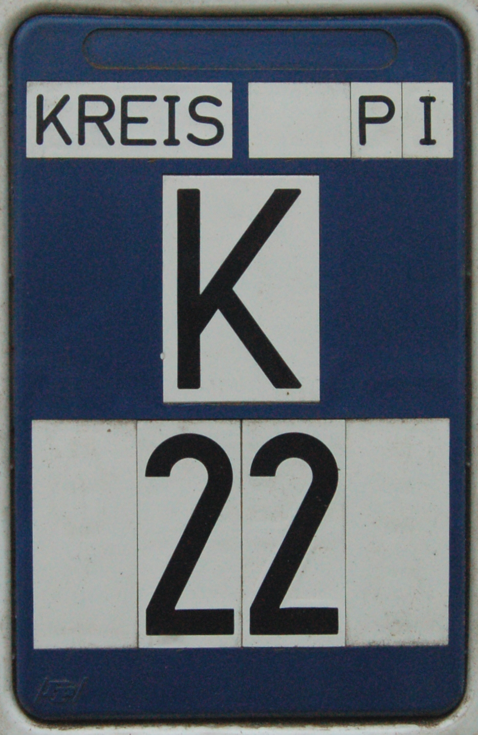
A KreisstraĂźe (literally: "district road" or "county road") is a class of road in Germany. It carries traffic between the towns and villages within a '' Kreis'' or district or between two neighbouring districts. In importance, the ''KreisstraĂźe'' ranks below a ''LandesstraĂźe'' (or, in Bavaria and Saxony, a ''StaatstraĂźe'', i.e. a state road), but above a ''GemeindestraĂźe'' or "local road". ''KreisstraĂźen'' are usually the responsibility of the respective rural district (''Landkreis'') or urban district (''Kreisfreie Stadt''), with the exception of high streets through larger towns and villages. KreisstraĂźen are usually dual-lane roads but, in a few cases, can be built as limited-access dual carriageways in densely populated areas. Numbering Unlike local roads (''GemeindestraĂźen'') the ''KreisstraĂźen'' are invariably numbered, but their numbering is not shown on signs. The abbreviation is a prefixed capital letter K followed by a serial number. In most states the car n ... [...More Info...] [...Related Items...] OR: [Wikipedia] [Google] [Baidu] |
BundesstraĂźe 4
The BundesstraĂźe 4 (abbr. B4) is a German federal highway running in a northwesterly to southly direction from the state of Schleswig-Holstein to Bavaria. It provides a direct route for motorists traveling between Hamburg and Nuremberg. The section north of Hamburg is paralleled by Bundesautobahn 7 and the road is down-graded to a ''LandstraĂźe'' (country road); the section between Hallstadt and Erlangen is paralleled by the A 70 and A 73 and is also down-graded to a ''StaatsstraĂźe'' (state road, same as country road). The BundesstraĂźe 4 is the former ReichsstraĂźe 4 (imperial road), on which north of Quickborn the last Commanding Admiral of the Kriegsmarine Friedeburg met with officers of the 2nd British Army to negotiate a truce with the Western Allied forces on May 4, 1945. See also *Transport in Hamburg Transport in Hamburg comprises an extensive, rail system, subway system, airports and maritime services for the more than 1.8 million inhabitants of th ... [...More Info...] [...Related Items...] OR: [Wikipedia] [Google] [Baidu] |
Bavaria Slavica
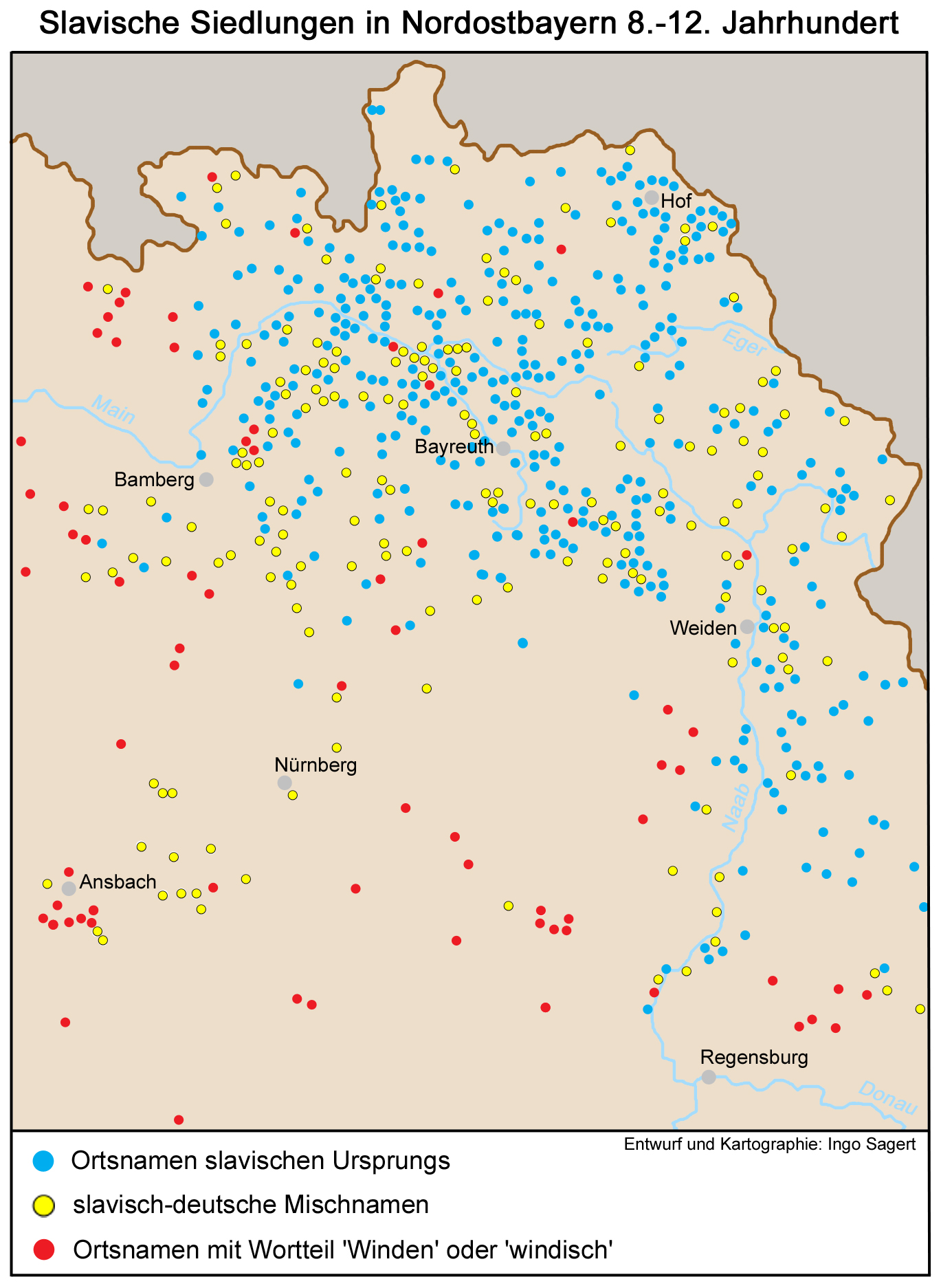
Bavaria Slavica is a historiographic term used to denote the areas populated by West Slavic people (Wends) between the 6th and the 12th centuries in northeastern Bavaria. The Wends settled in Bavaria in several waves between the 6th and the 9th centuries and then in the 10th and the 11th centuries. The settlement of loyal West Slavic Wends and other minor tribes was favoured under Frankish Emperor Charlemagne. Later, the East Frankish Empire also settled largely-Christianized Wends in regions that were rural or unpopulated or threatened by uprisings. After the migration had ended, they were quickly assimilated by the local Franks, who had always continued to form the majority and by the Baiuvarii. See also * Germania Slavica ''Germania Slavica'' is a historiographic term used since the 1950s to denote the landscape of the medieval language border (roughly east of the Elbe-Saale line) zone between Germans and Slavs in Central Europe on the one hand and a 20th-century s ... ... [...More Info...] [...Related Items...] OR: [Wikipedia] [Google] [Baidu] |
Upper Franconia
Upper Franconia (german: Oberfranken) is a ''Regierungsbezirk'' (administrative 'Regierungs''region 'bezirk'' of the state of Bavaria, southern Germany. It forms part of the historically significant region of Franconia, the others being Middle Franconia and Lower Franconia, which are all now part of the German Federal State of Bayern (''Bavaria''). With more than 200 independent breweries which brew approximately 1000 different types of beer, Upper Franconia has the world's highest brewery-density per capita. A special Franconian beer route (''Fränkische Brauereistraße'') runs through many popular breweries. Geography The administrative region borders on Thuringia (''Thüringen'') to the north, Lower Franconia (''Unterfranken'') to the west, Middle Franconia (''Mittelfranken'') to the south-west, and Upper Palatinate (''Oberpfalz'') to the south-east, Saxony (''Sachsen'') to the north-east and the Czech Republic to the east. History After the founding of the Kingdom of Bava ... [...More Info...] [...Related Items...] OR: [Wikipedia] [Google] [Baidu] |
Slavs
Slavs are the largest European ethnolinguistic group. They speak the various Slavic languages, belonging to the larger Balto-Slavic branch of the Indo-European languages. Slavs are geographically distributed throughout northern Eurasia, mainly inhabiting Central and Eastern Europe, and the Balkans to the west; and Siberia to the east. A large Slavic minority is also scattered across the Baltic states and Central Asia, while a substantial Slavic diaspora is found throughout the Americas, as a result of immigration. Present-day Slavs are classified into East Slavs (chiefly Belarusians, Russians, Rusyns, and Ukrainians), West Slavs (chiefly Czechs, Kashubians, Poles, Slovaks and Sorbs) and South Slavs (chiefly Bosniaks, Bulgarians, Croats, Macedonians, Montenegrins, Serbs and Slovenes). The vast majority of Slavs are traditionally Christians. However, modern Slavic nations and ethnic groups are considerably diverse both genetically and culturally, and relations between them â ... [...More Info...] [...Related Items...] OR: [Wikipedia] [Google] [Baidu] |


