|
Cramond Island
Cramond Island (Scottish Gaelic: ''Eilean Chathair Amain'') is one of several islands in the Firth of Forth in eastern Scotland, near Edinburgh. It lies off the foreshore at Cramond. It is long and covers .Wilson, Rev. John ''The Gazetteer of Scotland'' (Edinburgh, 1882) Published by W. & A.K. Johnstone The island is part of the Dalmeny Estate, owned by the Rosebery Estates Partnership, and is let to Cramond Boat Club. Geography Cramond Island is a tidal island about one mile (1.6 km) out to sea, which is connected to the mainland at low tide across the Drum Sands. A paved path, exposed at low water, allows easy access. This causeway runs at the foot of a row of concrete pylons on one side of the causeway, which were constructed as an anti-boat boom during the Second World War and are one of the most striking sights in the area. At high tide the path is covered by several feet of seawater which cuts the island off from the mainland. It is safe to walk along the raised ca ... [...More Info...] [...Related Items...] OR: [Wikipedia] [Google] [Baidu] |
Hectares
The hectare (; SI symbol: ha) is a non-SI metric unit of area equal to a square with 100-metre sides (1 hm2), or 10,000 m2, and is primarily used in the measurement of land. There are 100 hectares in one square kilometre. An acre is about and one hectare contains about . In 1795, when the metric system was introduced, the ''are'' was defined as 100 square metres, or one square decametre, and the hectare ("hecto-" + "are") was thus 100 ''ares'' or km2 (10,000 square metres). When the metric system was further rationalised in 1960, resulting in the International System of Units (), the ''are'' was not included as a recognised unit. The hectare, however, remains as a non-SI unit accepted for use with the SI and whose use is "expected to continue indefinitely". Though the dekare/decare daa (1,000 m2) and are (100 m2) are not officially "accepted for use", they are still used in some contexts. Description The hectare (), although not a unit of SI, is ... [...More Info...] [...Related Items...] OR: [Wikipedia] [Google] [Baidu] |
River Almond, Lothian
The River Almond ( gd, Abhainn Amain) is a river in Lothian, Scotland. It is approximately 28 miles (45 km) long, rising at Hirst Hill in Lanarkshire near Shotts, running through West Lothian and draining into the Firth of Forth at Cramond, Edinburgh. The name Almond/Amon is simply old Celtic for "river". Environment Running through areas that were dominated for much of the 20th century by heavy industry and shale- and coal mining, the River Almond has long been notorious for its high levels of pollution. With the demise of mining and heavy industry in Central Scotland, the river became cleaner, and it is being actively repopulated by wildlife: there is a healthy population of brown trout and there are improving runs of both Atlantic salmon (''Salmo salar'') and sea trout (''Salmo trutta''). There is also a good array of birds to be seen around the river banks, including dippers, kingfishers and grey herons, and increasing numbers of otters are being reported. The river is ... [...More Info...] [...Related Items...] OR: [Wikipedia] [Google] [Baidu] |
Cadafael Cadomedd Ap Cynfeddw
Cadafael ap Cynfeddw ( en, Cadafael son of Cynfeddw) was King of Gwynedd (reigned 634 – c. 655). He came to the throne when his predecessor, King Cadwallon ap Cadfan, was killed in battle, and his primary notability is in having gained the disrespectful sobriquet ''Cadafael Cadomedd'' (fully translated into en, Battle-Seizer the Battle-Decliner). Unusual for the era, King Cadafael was not a member of one of the leading families of Gwynedd. His name appears in the ''Welsh Triads'' as one of the ''"Three kings, who were of the sons of strangers"'' (sometimes referred to as the ''"Three Peasant Kings"''), where he is identified as "Cadafael, son of Cynfeddw in Gwynedd". Cadafael's reign was a critical time for the future of the ''Cymry'' (i.e., the Welsh and the Brythonic 'Men of the North' taken together, exclusive of all others). There was an alliance of the ''Cymry'' with Penda of Mercia initially forged by Cadwallon ap Cadfan, and there was ongoing warfare against the the ... [...More Info...] [...Related Items...] OR: [Wikipedia] [Google] [Baidu] |
Penda Of Mercia
Penda (died 15 November 655)Manuscript A of the ''Anglo-Saxon Chronicle'' gives the year as 655. Bede also gives the year as 655 and specifies a date, 15 November. R. L. Poole (''Studies in Chronology and History'', 1934) put forward the theory that Bede began his year in September, and consequently November 655 would actually fall in 654; Frank Stenton also dated events accordingly in his ''Anglo-Saxon England'' (1943). 1 Others have accepted Bede's given dates as meaning what they appear to mean, considering Bede's year to have begun on 25 December or 1 January (see S. Wood, 1983: "Bede's Northumbrian dates again"). The historian D. P. Kirby suggested the year 656 as a possibility, alongside 655, in case the dates given by Bede are off by one year (see Kirby's "Bede and Northumbrian Chronology", 1963). The ''Annales Cambriae'' gives the year as 657Annales Cambriae at Fordham University/ref> was a 7th-century king of Mercia, the Anglo-Saxon kingdom in what is today the Midland ... [...More Info...] [...Related Items...] OR: [Wikipedia] [Google] [Baidu] |
Kingdom Of Northumbria
la, Regnum Northanhymbrorum , conventional_long_name = Kingdom of Northumbria , common_name = Northumbria , status = State , status_text = Unified Anglian kingdom (before 876)North: Anglian kingdom (after 876)South: Danish kingdom (876–914)South: Norwegian kingdom (after 914) , life_span = 654–954 , flag_type = Oswald's Stripes, the provincial flag of Northumbria and red was previously purple , image_coat = , image_map = Map_of_the_Kingdom_of_Northumbria_around_700_AD.svg , image_map_size = 250 , image_map_caption = Northumbria around 700 AD , image_map2 = , image_map2_size = , image_map2_caption = , government_type = Monarchy , year_start = 653 , year_end = 954 , event_end = South is annexed by Kingdom of England , event1 = South is annexed by the Danelaw , date_even ... [...More Info...] [...Related Items...] OR: [Wikipedia] [Google] [Baidu] |
Oswiu
Oswiu, also known as Oswy or Oswig ( ang, Ōswīg; c. 612 – 15 February 670), was King of Bernicia from 642 and of Northumbria from 654 until his death. He is notable for his role at the Synod of Whitby in 664, which ultimately brought the church in Northumbria into conformity with the wider Catholic Church. One of the sons of Æthelfrith of Bernicia, Oswiu became king following the death of his brother Oswald in 642. Unlike Oswald, Oswiu struggled to exert authority over Deira, the other constituent kingdom of medieval Northumbria, for much of his reign. Oswiu and his brothers were raised in exile in the Irish kingdom of Dál Riata in present-day Scotland after their father's death at the hands of Edwin of Deira, only returning after Edwin's death in 633. Oswiu rose to the kingship when his brother Oswald was killed in battle against Penda of Mercia. The early part of his reign was defined by struggles to assert control over Deira and his contentious relationship with Penda ... [...More Info...] [...Related Items...] OR: [Wikipedia] [Google] [Baidu] |
Ecclesiastical History Of The English People
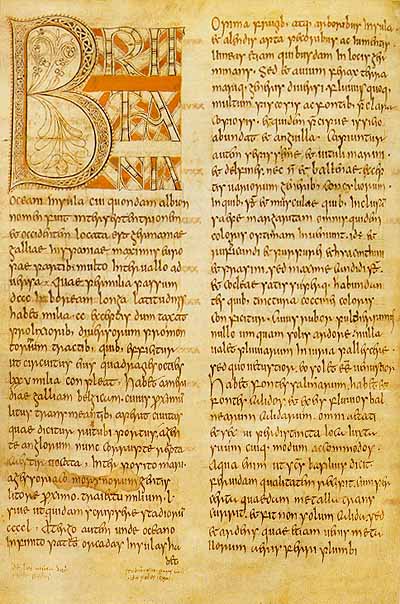
The ''Ecclesiastical History of the English People'' ( la, Historia ecclesiastica gentis Anglorum), written by Bede in about AD 731, is a history of the Christian Churches in England, and of England generally; its main focus is on the conflict between the pre-Schism Roman Rite and Celtic Christianity. It was composed in Latin, and is believed to have been completed in 731 when Bede was approximately 59 years old. It is considered one of the most important original references on Anglo-Saxon history, and has played a key role in the development of an English national identity. Overview The ''Historia ecclesiastica gentis Anglorum'', or ''An Ecclesiastical History of the English People'' is Bede's best-known work, completed in about 731. The first of the five books begins with some geographical background and then sketches the history of England, beginning with Julius Caesar's invasion in 55 BC. A brief account of Christianity in Roman Britain, including the martyrdom of St Alban ... [...More Info...] [...Related Items...] OR: [Wikipedia] [Google] [Baidu] |
Bede
Bede ( ; ang, Bǣda , ; 672/326 May 735), also known as Saint Bede, The Venerable Bede, and Bede the Venerable ( la, Beda Venerabilis), was an English monk at the monastery of St Peter and its companion monastery of St Paul in the Kingdom of Northumbria of the Angles (contemporarily Monkwearmouth–Jarrow Abbey in Tyne and Wear, England). Born on lands belonging to the twin monastery of Monkwearmouth–Jarrow in present-day Tyne and Wear, Bede was sent to Monkwearmouth at the age of seven and later joined Abbot Ceolfrith at Jarrow. Both of them survived a plague that struck in 686 and killed a majority of the population there. While Bede spent most of his life in the monastery, he travelled to several abbeys and monasteries across the British Isles, even visiting the archbishop of York and King Ceolwulf of Northumbria. He was an author, teacher (Alcuin was a student of one of his pupils), and scholar, and his most famous work, ''Ecclesiastical History of the English People ... [...More Info...] [...Related Items...] OR: [Wikipedia] [Google] [Baidu] |
Urbs Iudeu
Urbs Iudeu (Urbs Judeu/Ludeu) was a city besieged in 655 AD by Penda, King of Mercia, and Cadafael, King of Gwynedd. The siege was an important episode in a long-running war between Mercia and Northumbria in the years 616–679. This war was fought in the area north of the River Trent, in particular in and around the Peak District (Wirksworth) also around Heathfield (Doncaster), Elmet (Aberford) and Lindsey (Lincoln), as these were provinces of Northumbria at the time. Background and origins In or about 616 AD, the Northumbrians, apparently attempting to expand their kingdom under King Æthelfrith, fought the native Britons and their allies at the Battle of Chester. The Northumbrians had the victory and allegedly slaughtered a large number of monks nearby who had prayed for a British victory. The Northumbrians were then able to take control of the area north of the River Trent. The Britons (i.e. the Welsh), supported by the Mercians, then attempted to regain control of ... [...More Info...] [...Related Items...] OR: [Wikipedia] [Google] [Baidu] |
Melrose, Scotland
Melrose ( gd, Maolros, "bald moor") is a small town and civil parish in the Scottish Borders, historically in Roxburghshire. It lies within the Eildon committee area of Scottish Borders Council. History The original Melrose was ''Mailros'', meaning "the bare peninsula" in Old Welsh or Brythonic. This referred to a neck of land by the River Tweed several miles east of the present town, where in the 6th century a monastery was founded associated with St Cuthbert. It was recorded by Bede, and also in the Anglo-Saxon Chronicle with the name ''Magilros''. This monastery and settlement, later known as "Old Melrose", were long abandoned by the 12th century. King David I of Scotland took the throne in 1124, and sought to create a new Cistercian monastery on that site; however the monks preferred a site further west called "Fordel". So the monastery now known as Melrose Abbey was founded there in 1136, and the town of Melrose grew up on its present site around it. In the late Middle Ag ... [...More Info...] [...Related Items...] OR: [Wikipedia] [Google] [Baidu] |
Trimontium (Newstead)
Trimontium was a Roman fort complex in Scotland. It is located at Newstead, near Melrose, in the Scottish Borders, in view of the three Eildon Hills which probably gave its name (Latin: ''trium montium'', three hills). It was occupied from about 79 AD to 184 AD and was the largest of the "outpost" forts with associated ''vicus'' (settlement) still occupied after the construction of Hadrian's Wall in the 120s AD. It was located 60 miles north of the wall in seemingly "hostile" territory. Trimontium was about three times as big as any fort on Hadrian's Wall and in the later period became the most northerly settlement of the whole Roman Empire. Trimontium is also considered of international importance as the site of one of the largest caches of Roman military objects in Britain, found in 117 pits. It was identified by Ptolemy in his ''Geography.'' The fort sits on the banks of the River Tweed, with the Eildon Hills and the Iron Age hillfort atop Eildon North, a visible remin ... [...More Info...] [...Related Items...] OR: [Wikipedia] [Google] [Baidu] |
Cramond Roman Fort
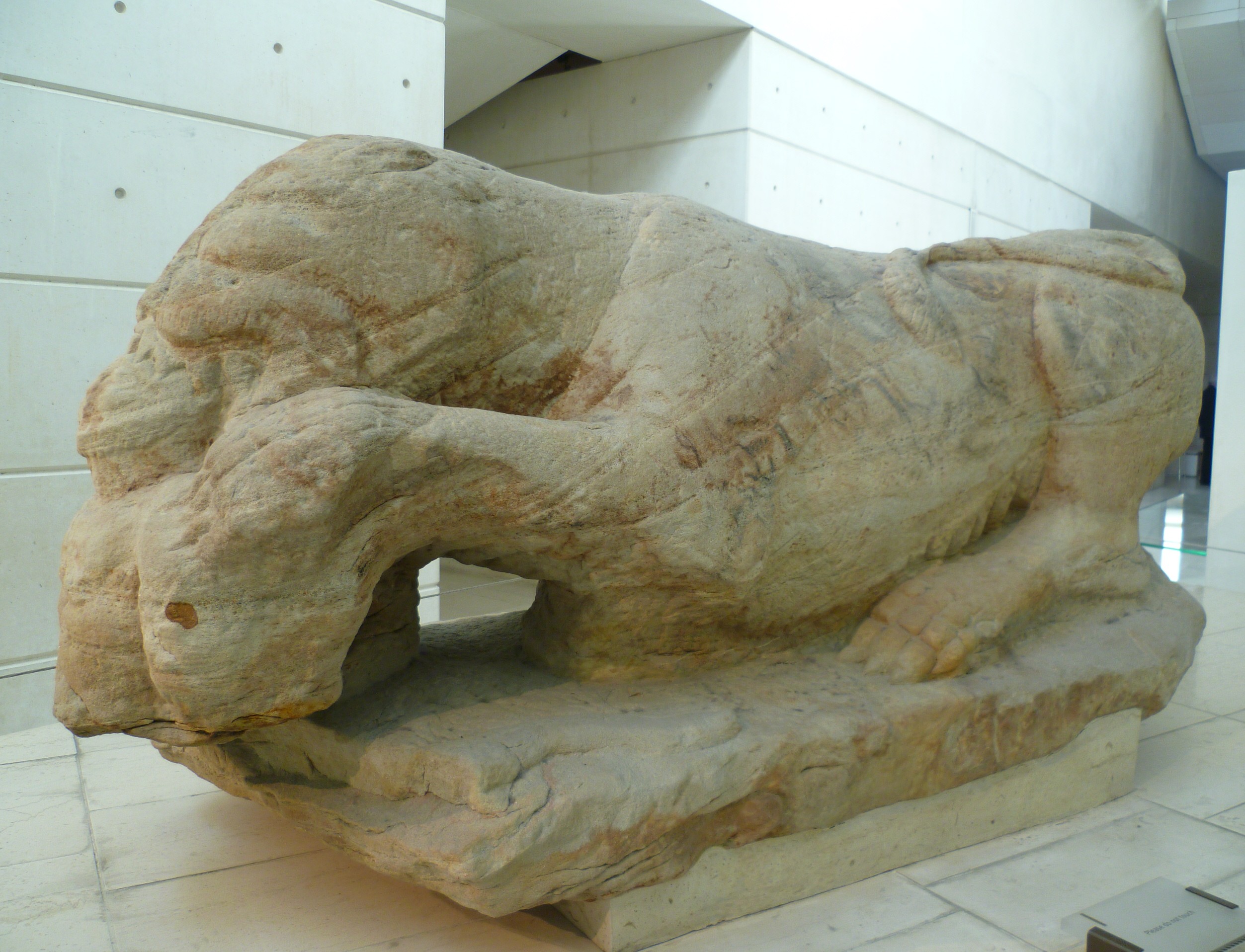
Cramond Roman Fort is a Roman-Era archaeological site at Cramond, Edinburgh, Scotland. The settlement may be the "Rumabo" listed in the 7th-century ''Ravenna Cosmography''. The fort was established around 140 AD and occupied until around 170 AD, with a further period of occupation from around 208 to 214 AD. Among the many archaeological finds, one of the most famous is a sculpture known as the Cramond Lioness. History The fort at Cramond was located on the River Almond at the point where it flows into the Forth. In Roman times, there was probably a natural harbour here. One suggested interpretation is that Cramond formed a chain of Lothian forts along with Carriden and Inveresk. The fort was established around 140 AD during the building of the Antonine Wall, and remained in use until around 170 AD when the Romans retreated south to Hadrian's Wall. [...More Info...] [...Related Items...] OR: [Wikipedia] [Google] [Baidu] |


