|
Coton-in-the-Elms
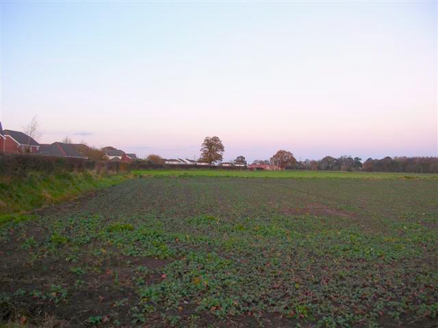
Coton in the Elms is a village and parish in the English county of Derbyshire. At from the coast, it is the one of the furthest places in the United Kingdom from coastal waters. The population of the civil parish as of the 2011 census was 896. It is located southwest of Swadlincote and south of Burton upon Trent. Church Flatts Farm, defined by the Ordnance Survey as the farthest point from the sea in Great Britain, is less than a mile southeast of the village. History Coton is mentioned over a thousand years ago when land was transferred to Wulfrige the Black in AD 942. It is also on the salt route known as Walton Way, which starts in nearby Walton-on-Trent. Coton in the Elms is mentioned in the Domesday book where it is then spelt ''Cotes''. The book says under the title of “The lands of the Abbey of Burton":The Abbey of Burton held a considerable number of manors including several in Derbyshire given to it by the King. These included Coton in the Elms, Stapenhill, ... [...More Info...] [...Related Items...] OR: [Wikipedia] [Google] [Baidu] |
South Derbyshire
South Derbyshire is a local government district in Derbyshire, England. The population of the local authority at the 2011 Census was 94,611. It contains a third of the National Forest, and the council offices are in Swadlincote. The district also forms part of the wider Burton upon Trent and Swadlincote Green Belt, which covers the towns of Burton-upon-Trent in East Staffordshire and Swadlincote in South Derbyshire. The district is also landlocked between the districts of Derby, Derbyshire Dales, East Staffordshire, Erewash District, Lichfield District, North Warwickshire, North West Leicestershire and Tamworth. The district was formed on 1 April 1974 as a merger of the Swadlincote urban district along with Repton Rural District and part of South East Derbyshire Rural District. Settlements Settlements in the district include: *Aston-on-Trent *Barrow upon Trent, Boulton Moor, Bretby *Calke, Castle Gresley, Cauldwell, Church Gresley, Church Broughton, Coton in the Elms *C ... [...More Info...] [...Related Items...] OR: [Wikipedia] [Google] [Baidu] |
Geld
Geld may refer to: * Gelding, equine castration * Danegeld Danegeld (; "Danish tax", literally "Dane yield" or tribute) was a tax raised to pay tribute or protection money to the Viking raiders to save a land from being ravaged. It was called the ''geld'' or ''gafol'' in eleventh-century sources. It ..., a tax paid to Viking raiders * Geld (surname) See also * Gel (other) * Gelt (other) {{disambiguation ... [...More Info...] [...Related Items...] OR: [Wikipedia] [Google] [Baidu] |
Neston
Neston is a town and civil parish on the Wirral Peninsula, in Cheshire, England. It is part of the unitary authority of Cheshire West and Chester. The village of Parkgate is located to the north west and the villages of Little Neston and Ness are to the south of Neston. At the 2001 census the population of Neston ward was recorded as 3,521, increasing to 4,329 at the 2011 census. The civil parish also includes Little Neston, Parkgate, Willaston and part of Burton and Ness, and had a population of 15,162 in 2001, increasing to 15,221 in 2011. History The name is of Viking origin, deriving from the Old Norse ''Nes-tún'', meaning 'farmstead or settlement at/near a promontory or headland'. Another Nesttun town can be found near Bergen, Norway. It is also mentioned in the Domesday Book as ''Nestone'' under the ownership of a William Fitznigel, with a population of eight households. Civic history A royal charter was granted to Neston in 1728 in support of its status as a ... [...More Info...] [...Related Items...] OR: [Wikipedia] [Google] [Baidu] |
Fosdyke
Fosdyke is a village and civil parish in the Borough of Boston, Lincolnshire, England. The population of the civil parish at the 2011 census was 480. It is situated approximately south from Boston, just off the A17, and east from the junction of the A17 with the A16. History The name derives from the Old English and Old Norse "fotrs dic", meaning Fotr's (personal name) ditch. Fosdyke's Grade II listed Anglican church is dedicated to All Saints. In 1871–72 the church was entirely rebuilt in brickCox, J. Charles (1916) ''Lincolnshire'' p. 128; Methuen & Co. Ltd on the site of an older church, in an Early English style.''Kelly's Directory of Lincolnshire with the port of Hull'' 1885, pp. 395, 396 The architect was Edward Browning. In 1885 ''Kelly's Directory'' reported the existence of a Primitive Methodist chapel, a coastguard station, and a row of 400-year-old almshouses, founded by Sir Thomas Middlecott for the Fosdyke and Algarkirk parishes. Geography The village is ... [...More Info...] [...Related Items...] OR: [Wikipedia] [Google] [Baidu] |
Burton-on-Trent
Burton upon Trent, also known as Burton-on-Trent or simply Burton, is a market town in the borough of East Staffordshire in the county of Staffordshire, England, close to the border with Derbyshire. In 2011, it had a population of 72,299. The demonym for residents of the town is ''Burtonian''. Burton is located south-west of Derby, north-west of Leicester, west-south-west of Nottingham and south of the southern entrance to the Peak District National Park. Burton is known for its brewing. The town grew up around Burton Abbey. Burton Bridge was also the site of two battles, in 1322, when Edward II defeated the rebel Earl of Lancaster and in 1643 when royalists captured the town during the First English Civil War. William Lord Paget and his descendants were responsible for extending the manor house within the abbey grounds and facilitating the extension of the River Trent Navigation to Burton. Burton grew into a busy market town by the early modern period. The town is ser ... [...More Info...] [...Related Items...] OR: [Wikipedia] [Google] [Baidu] |
Lullington, Derbyshire
Lullington is a village and civil parish in the district of South Derbyshire, England. The population of the civil parish at the 2011 Census was 121. It has an All Saints' Church, a village hall and a pub, the Colvile Arms (Charles Robert Colvile was living at Lullington Hall in the 1850s). Accessed June 2007 In 1850, it had a school that was designed to take fifty children. Together with neighbouring , it is the southernmost village in Derbyshire. History Lullington is mentioned in the |
Henry Isaac Stevens
Henry Isaac Stevens FRIBA was an architect based in Derby. He was born in London, in 1806, and died in 1873. In the late 1850s he changed his name to Isaac Henry Stevens. Family His parents were Isaac Stevens and Elizabeth Young. He married Anne, the daughter of William Martin on 7 August 1832 in Repton, Derbyshire. They had four children. In the 1861, census he is listed as Isaac H Stevens living in Ashbourne Road, Mackworth, Derbyshire. In the 1871, census he is listed as living at 20 Peartree Road in Litchurch, Derby. Career He was articled to William Martin in Bretby, and was also a pupil of George Maddox. He started in independent practice in 1834 in Hartshorne, Derbyshire. He moved to Derby in the late 1830s or early 1840s and was based at 16 Full Street in Derby. By 1847 he was at 49 Friargate, Derby. In 1857 he is listed as living in Mackworth. He was awarded a Fellowship of the Royal Institute of British Architects on 21 January 1850. He entered into a partnership ... [...More Info...] [...Related Items...] OR: [Wikipedia] [Google] [Baidu] |
Burton On Trent
Burton upon Trent, also known as Burton-on-Trent or simply Burton, is a market town in the borough of East Staffordshire in the county of Staffordshire, England, close to the border with Derbyshire. In 2011, it had a population of 72,299. The demonym for residents of the town is ''Burtonian''. Burton is located south-west of Derby, north-west of Leicester, west-south-west of Nottingham and south of the southern entrance to the Peak District National Park. Burton is known for its brewing. The town grew up around Burton Abbey. Burton Bridge was also the site of two battles, in 1322, when Edward II defeated the rebel Earl of Lancaster and in 1643 when royalists captured the town during the First English Civil War. William Lord Paget and his descendants were responsible for extending the manor house within the abbey grounds and facilitating the extension of the River Trent Navigation to Burton. Burton grew into a busy market town by the early modern period. The town is ser ... [...More Info...] [...Related Items...] OR: [Wikipedia] [Google] [Baidu] |
Tamworth, Staffordshire
Tamworth (, ) is a market town and borough in Staffordshire, England, north-east of Birmingham. The town borders North Warwickshire to the east and north, Lichfield to the north, south-west and west. The town takes its name from the River Tame, which flows through it. The population of Tamworth borough () was . The wider urban area had a population of 81,964. Tamworth was the principal centre of royal power of the Anglo-Saxon Kingdom of Mercia during the 8th and 9th centuries. It hosts a simple but elevated 12th century castle, a well-preserved medieval church (the Church of St Editha) and a Moat House. Tamworth was historically divided between Warwickshire and Staffordshire until 1889, when the town was placed entirely in Staffordshire. The town's industries include logistics, engineering, clothing, brick, tile and paper manufacture. Until 2001 one of its factories was Reliant, which produced the Reliant Robin three-wheeler car and the Reliant Scimitar sports car. The ... [...More Info...] [...Related Items...] OR: [Wikipedia] [Google] [Baidu] |
Battle Of Hastings
The Battle of Hastings nrf, Batâle dé Hastings was fought on 14 October 1066 between the Norman-French army of William the Conqueror, William, the Duke of Normandy, and an English army under the Anglo-Saxons, Anglo-Saxon King Harold Godwinson, beginning the Norman Conquest of England. It took place approximately northwest of Hastings, close to the present-day town of Battle, East Sussex, and was a decisive Normans, Norman victory. The background to the battle was the death of the childless King Edward the Confessor in January 1066, which set up a succession struggle between several claimants to his throne. Harold was crowned king shortly after Edward's death, but faced invasions by William, his own brother Tostig Godwinson, Tostig, and the Norwegian King Harald Hardrada (Harold III of Norway). Hardrada and Tostig defeated a hastily gathered army of Englishmen at the Battle of Fulford on 20 September 1066, and were in turn defeated by Harold at the Battle of Stamford Brid ... [...More Info...] [...Related Items...] OR: [Wikipedia] [Google] [Baidu] |
Edward The Confessor
Edward the Confessor ; la, Eduardus Confessor , ; ( 1003 – 5 January 1066) was one of the last Anglo-Saxon English kings. Usually considered the last king of the House of Wessex, he ruled from 1042 to 1066. Edward was the son of Æthelred the Unready and Emma of Normandy. He succeeded Cnut the Great's son – and his own half-brother – Harthacnut. He restored the rule of the House of Wessex after the period of Danish rule since Cnut conquered England in 1016. When Edward died in 1066, he was succeeded by his wife's brother Harold Godwinson, who was defeated and killed in the same year by the Normans under William the Conqueror at the Battle of Hastings. Edward's young great-nephew Edgar the Ætheling of the House of Wessex was proclaimed king after the Battle of Hastings in 1066 but was never crowned and was peacefully deposed after about eight weeks. Historians disagree about Edward's fairly long 24-year reign. His nickname reflects the traditional image ... [...More Info...] [...Related Items...] OR: [Wikipedia] [Google] [Baidu] |
Latin
Latin (, or , ) is a classical language belonging to the Italic branch of the Indo-European languages. Latin was originally a dialect spoken in the lower Tiber area (then known as Latium) around present-day Rome, but through the power of the Roman Republic it became the dominant language in the Italian region and subsequently throughout the Roman Empire. Even after the fall of Western Rome, Latin remained the common language of international communication, science, scholarship and academia in Europe until well into the 18th century, when other regional vernaculars (including its own descendants, the Romance languages) supplanted it in common academic and political usage, and it eventually became a dead language in the modern linguistic definition. Latin is a highly inflected language, with three distinct genders (masculine, feminine, and neuter), six or seven noun cases (nominative, accusative, genitive, dative, ablative, and vocative), five declensions, four verb conjuga ... [...More Info...] [...Related Items...] OR: [Wikipedia] [Google] [Baidu] |


