|
Corran Ferry
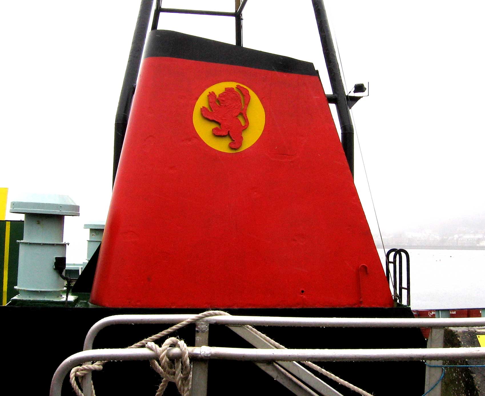
The Corran Ferry crosses Loch Linnhe at the Corran Narrows, south of Fort William, Scotland. Description Operated by Highland Council, the Corran Ferry is one of few remaining scheduled mainland vehicle ferries in Scotland. The route crosses Loch Linnhe from Nether Lochaber to Ardgour, at the Corran Narrows, south of Fort William. It was noted for the unusual sign "This is not the Ballachulish Ferry", placed there to avoid confusion with the nearby ferry at Ballachulish which crossed Loch Leven until being replaced by the Ballachulish Bridge in early 1976. The route lies on one of the ancient drove routes from the Hebrides to the cattle markets in Central Scotland. Today, the ferry is a crucial link between the main A82 road (serving Inverness, Fort William, and Glasgow) with the otherwise extremely remote Morvern and Ardnamurchan peninsulas. Use of the ferry saves over an hour from the land route between Ardgour and Corran (which would involve use of the A861 and the ... [...More Info...] [...Related Items...] OR: [Wikipedia] [Google] [Baidu] |
Loch Linnhe
Loch Linnhe () is a sea loch on the west coast of Scotland. The part upstream of Corran is known in Gaelic as (the black pool, originally known as Loch Abar), and downstream as (the salty pool). The name ''Linnhe'' is derived from the Gaelic word , meaning "pool". Loch Linnhe follows the line of the Great Glen Fault, and is the only sea loch along the fault. About long, it opens onto the Firth of Lorne at its southwestern end. The part of the loch upstream of Corran is long and an average of about wide. The southern part of the loch is wider, and its branch southeast of the island of Lismore is known as the Lynn of Lorne. Loch Eil feeds into Loch Linnhe at the latter's northernmost point, while from the east Loch Leven feeds in the loch just downstream of Corran and Loch Creran feeds into the Lynn of Lorne. The town of Fort William lies at the northeast end of the loch, at the mouth of the River Lochy. According to the Bard Fr. Allan MacDonald, an important figure ... [...More Info...] [...Related Items...] OR: [Wikipedia] [Google] [Baidu] |
A830 Road
The A830, also known as the Road to the Isles (though it forms only a part of the historic route) is a major road in Lochaber, Scottish Highlands. It connects the town of Fort William to the port of Mallaig. Route The A830 is 46 miles long. Throughout its length, the road follows the route of the West Highland Line from Fort William to Mallaig. It starts at a junction on the A82 north of Fort William and immediately crosses the River Lochy over the Victoria Bridge. The road passes through several small settlements, including Corpach, Glenfinnan and Arisaig and bypasses the village of Morar. It also follows the shorelines of Loch Eil and Loch Eilt, and passes between a series of several glens between these. The road ends at the quayside in the port of Mallaig adjacent to the railway station with onward ferry services to the isles of Muck, Eigg, Rùm, Canna, Skye and South Uist, and a ferry across to the neighbouring peninsula at Inverie which although on the mainland h ... [...More Info...] [...Related Items...] OR: [Wikipedia] [Google] [Baidu] |
Ferry Transport In Scotland
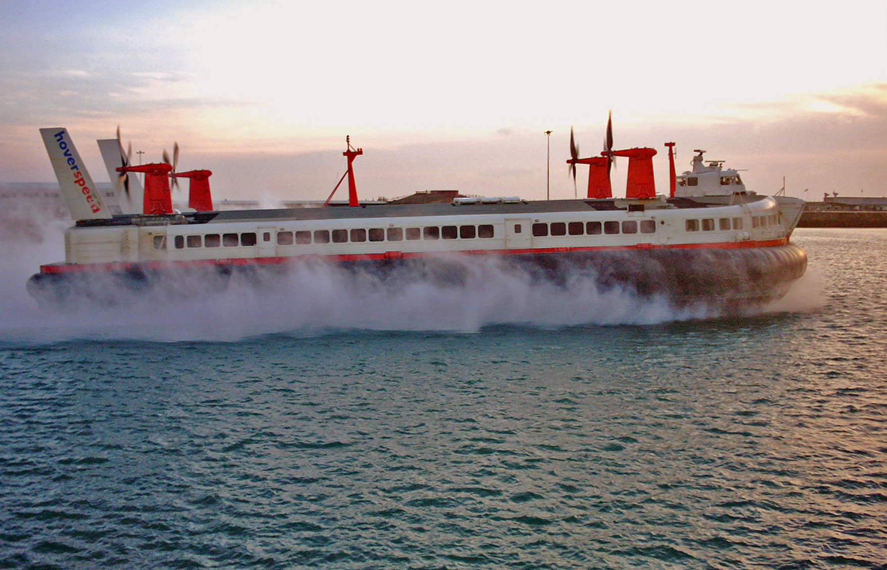
A ferry is a ship, watercraft or amphibious vehicle used to carry passengers, and sometimes vehicles and cargo, across a body of water. A passenger ferry with many stops, such as in Venice, Italy, is sometimes called a water bus or water taxi. Ferries form a part of the public transport systems of many waterside cities and islands, allowing direct transit between points at a capital cost much lower than bridges or tunnels. Ship connections of much larger distances (such as over long distances in water bodies like the Mediterranean Sea) may also be called ferry services, and many carry vehicles. History In ancient times The profession of the ferryman is embodied in Greek mythology in Charon, the boatman who transported souls across the River Styx to the Underworld. Speculation that a pair of oxen propelled a ship having a water wheel can be found in 4th century Roman literature "''Anonymus De Rebus Bellicis''". Though impractical, there is no reason why it could not work ... [...More Info...] [...Related Items...] OR: [Wikipedia] [Google] [Baidu] |
Kingston Upon Hull
Kingston upon Hull, usually abbreviated to Hull, is a port city and unitary authorities of England, unitary authority in the East Riding of Yorkshire, England. It lies upon the River Hull at its confluence with the Humber Estuary, inland from the North Sea and south-east of York, the historic county town. With a population of (), it is the fourth-largest city in the Yorkshire and the Humber region after Leeds, Sheffield and Bradford. The town of Wyke on Hull was founded late in the 12th century by the monks of Meaux Abbey as a port from which to export their wool. Renamed ''Kings-town upon Hull'' in 1299, Hull had been a market town, military supply port, trading centre, fishing and whaling centre and industrial metropolis. Hull was an early theatre of battle in the First English Civil War, English Civil Wars. Its 18th-century Member of Parliament, William Wilberforce, took a prominent part in the abolition of the slave trade in Britain. More than 95% of the city was ... [...More Info...] [...Related Items...] OR: [Wikipedia] [Google] [Baidu] |
Kessock Bridge
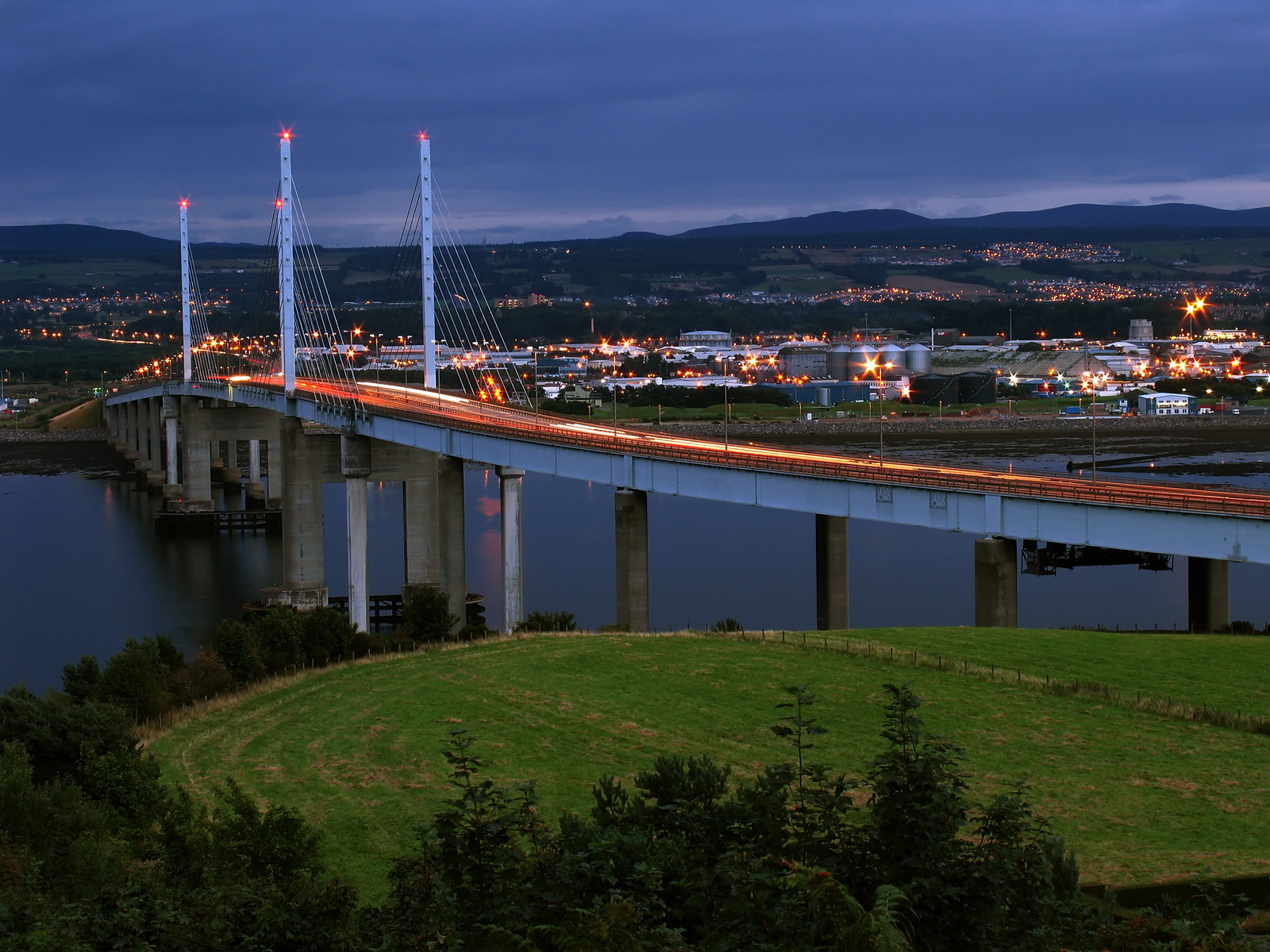
The Kessock Bridge ( gd, Drochaid Cheasaig) carries the A9 trunk road across the Beauly Firth at Inverness, Scotland. Description The Kessock Bridge is a cable-stayed bridge across the Beauly Firth, an inlet of the Moray Firth, between the village of North Kessock and the city of Inverness in the Scottish Highlands. The bridge has a total length of with a main span of . Designed by German engineer and built by Cleveland Bridge, it is similar to a bridge across the Rhine in Düsseldorf. The Beauly Firth is a navigable waterway and hence the bridge is raised high over sea level. The four bridge towers dominate the Inverness skyline, especially at night when they are lit. The bridge carries the A9 trunk road north from Inverness to the Black Isle. It is the southernmost of the "Three Firths" crossings (Beauly, Cromarty and Dornoch) which has transformed road transport in the Highlands. It has proved a key factor in the growth of the city of Inverness. To protect agains ... [...More Info...] [...Related Items...] OR: [Wikipedia] [Google] [Baidu] |
Kessock Ferry
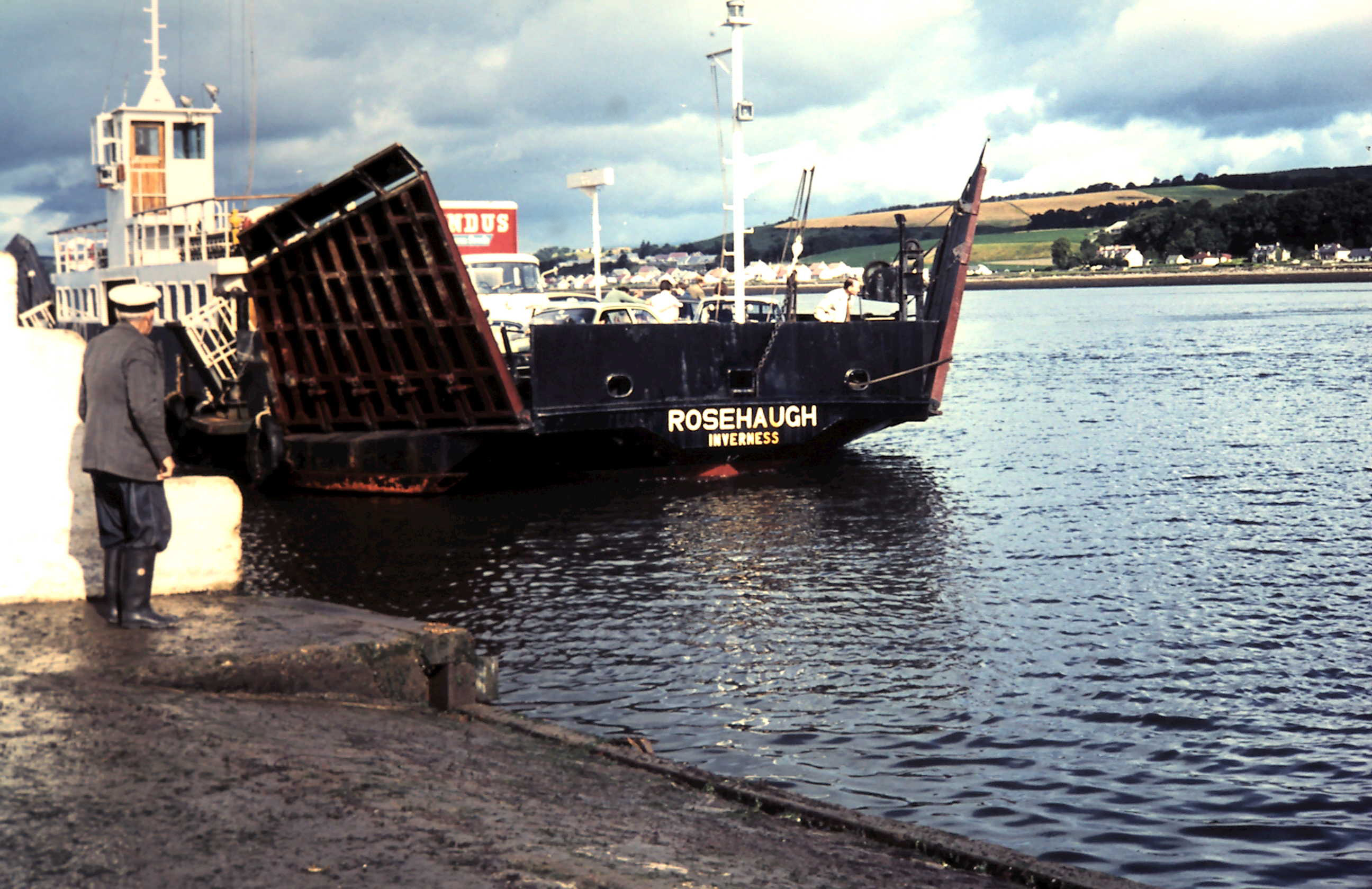
The Kessock Ferry used to ply between Inverness and the Black Isle, across the Beauly Firth. It was withdrawn on the opening of the Kessock Bridge in 1982. Service The ferry crossed between North and South Kessock at the narrows between the Moray and Beauly Firths. This was the first of three firths north of Inverness, and the ferry provided a vital service for the local farming community wishing to sell their produce in Inverness. Along with the Cromarty and Dornoch firths, the narrows at Kessock have been bridged by the A9. Ferries There is an early record of a ferry at Kessock in the 15th century. Over the years sail, steam and diesel-powered ferries have crossed the narrows to provide a direct link between the Black Isle and Inverness, until the opening of the Kessock Bridge in 1982. The ferry was caught in a storm early in the evening of 23 February 1894, leading to the death of three ferrymen and three coastguards who were attempting to rescue them. The tragedy was immo ... [...More Info...] [...Related Items...] OR: [Wikipedia] [Google] [Baidu] |
Kylesku
Kylesku ( gd, An Caolas Cumhang) is a small, remote fishing hamlet in Sutherland in the Scottish Highlands. Until 1984, it was the site of a free ferry. Village Kylesku is located where Loch Glencoul and Loch Gleann Dubh join to form a sea passage Loch a' Chàirn Bhàin which links to Eddrachillis Bay. It is in the Scottish council area of Highland. The village stretches back along the road from the slipway that used to be the southern end of the ferry crossing. Now by-passed by the main road carried over the bridge, the Kylesku Hotel overlooks the slipway. Nearby is Eas a' Chual Aluinn, Britain's highest waterfall. This can be visited on a boat trip aboard ''Rachael Clare''. Kylesku sits at the centre of a area which has become Scotland's first ' Global Geopark'. There is abundant wildlife and a wide range of outdoor pursuits in or on the lochs, mountains and white sandy beaches, including bird watching, seal and otter spotting, fishing, climbing and hill walking. Ferry ... [...More Info...] [...Related Items...] OR: [Wikipedia] [Google] [Baidu] |
Ferry
A ferry is a ship, watercraft or amphibious vehicle used to carry passengers, and sometimes vehicles and cargo, across a body of water. A passenger ferry with many stops, such as in Venice, Italy, is sometimes called a water bus or water taxi. Ferries form a part of the public transport systems of many waterside cities and islands, allowing direct transit between points at a capital cost much lower than bridges or tunnels. Ship connections of much larger distances (such as over long distances in water bodies like the Mediterranean Sea) may also be called ferry services, and many carry vehicles. History In ancient times The profession of the ferryman is embodied in Greek mythology in Charon, the boatman who transported souls across the River Styx to the Underworld. Speculation that a pair of oxen propelled a ship having a water wheel can be found in 4th century Roman literature "''Anonymus De Rebus Bellicis''". Though impractical, there is no reason why it co ... [...More Info...] [...Related Items...] OR: [Wikipedia] [Google] [Baidu] |
Tobermory, Mull
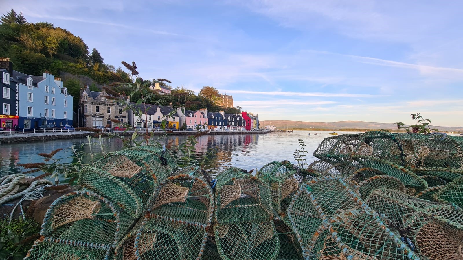
Tobermory (; gd, Tobar Mhoire) is the capital of, and until 1973 the only burgh on, the Isle of Mull in the Scottish Inner Hebrides. It is located on the east coast of Mishnish, the most northerly part of the island, near the northern entrance of the Sound of Mull. The village was founded as a fishing port in 1788; its layout was based on the designs of Dumfriesshire engineer Thomas Telford. It has a current population of about 1,000. Etymology The name ''Tobermory'' is derived from the Gaelic ', meaning "Mary's well". The name refers to a well located nearby which was dedicated in ancient times to the Virgin Mary. Prehistory and archaeology Archaeological Excavations have taken place at Baliscate just outside of the town. The site was first noted by Hylda Marsh and Beverley Langhorn as part of the Scotland's Rural Past. In 2009, it was partially excavated Time Team and a further longer excavation took place in 2012 as part of a community archaeology project through the ... [...More Info...] [...Related Items...] OR: [Wikipedia] [Google] [Baidu] |
Fishnish
Fishnish ( gd, Finnsinis) is a ferry terminal on the Isle of Mull, roughly halfway between Tobermory and Craignure. It is owned and operated by Caledonian MacBrayne. It is served by the ferry that crosses the Sound of Mull to and from Lochaline Lochaline ( gd, Loch Àlainn) is the main village in the Morvern area of Highland, Scotland. The coastal village is situated at the mouth of Loch Aline, on the northern shore of the Sound of Mull. A ferry operates regularly over to Fishnish .... It consists of a slipway sticking out into the Sound of Mull with a vehicle queuing area stretching back onto the road, a car park next to the slipway, and a small café next to the slipway with public toilets and an electronic display showing ferry times and other information. There is a forest open to the public for walks in and around Fishnish. Beside the current Fishnish is Ceadha Leth Torcail (Gaelic for "the pier of Torquil's half-share", an historic cattle harbour). Footnotes ... [...More Info...] [...Related Items...] OR: [Wikipedia] [Google] [Baidu] |
Isle Of Mull
The Isle of Mull ( gd, An t-Eilean Muileach ) or just Mull (; gd, Muile, links=no ) is the second-largest island of the Inner Hebrides (after Skye) and lies off the west coast of Scotland in the council area of Argyll and Bute. Covering , Mull is the fourth-largest island in Scotland and Great Britain. From 2001 to 2020, the population has gradually increased: during 2020 the populace was estimated to be 3,000, in the 2011 census it was approximately 2,800, and in 2001, it was measured at 2,667 people. It has the eighth largest Island population in Scotland. In the summer, these numbers are augmented by an influx of many tourists. Much of the year-round population lives in the colourful main settlement of Tobermory. There are two distilleries on the island: the Tobermory distillery, formerly named Ledaig, produces single malt Scotch whisky and another, opened in 2019 and located in the vicinity of Tiroran, which produces Whitetail Gin. Mull is host to numerous sport ... [...More Info...] [...Related Items...] OR: [Wikipedia] [Google] [Baidu] |
Caledonian MacBrayne
Caledonian MacBrayne ( gd, Caledonian Mac a' Bhriuthainn), usually shortened to CalMac, is the major operator of passenger and vehicle ferries, and ferry services, between the mainland of Scotland and 22 of the major islands on Scotland's west coast. Since 2006, the company's official name has been CalMac Ferries Ltd, although it still operates as Caledonian MacBrayne. In 2006, it also became a subsidiary of holding company David MacBrayne, which is owned by the Scottish Government. History David MacBrayne MacBrayne's, initially known as David Hutcheson & Co., began in 1851 as a private steamship operator when G. and J. Burns, operators of the largest of the Clyde fleets, decided to concentrate on coastal and transatlantic services and handed control of their river and Highland steamers to a new company in which Hutcheson, their manager of these services, became senior partner. One of the other partners was David MacBrayne (1817-1907), nephew of Messrs. Burns. In 1878, th ... [...More Info...] [...Related Items...] OR: [Wikipedia] [Google] [Baidu] |


