|
Conroy Road (Ottawa)
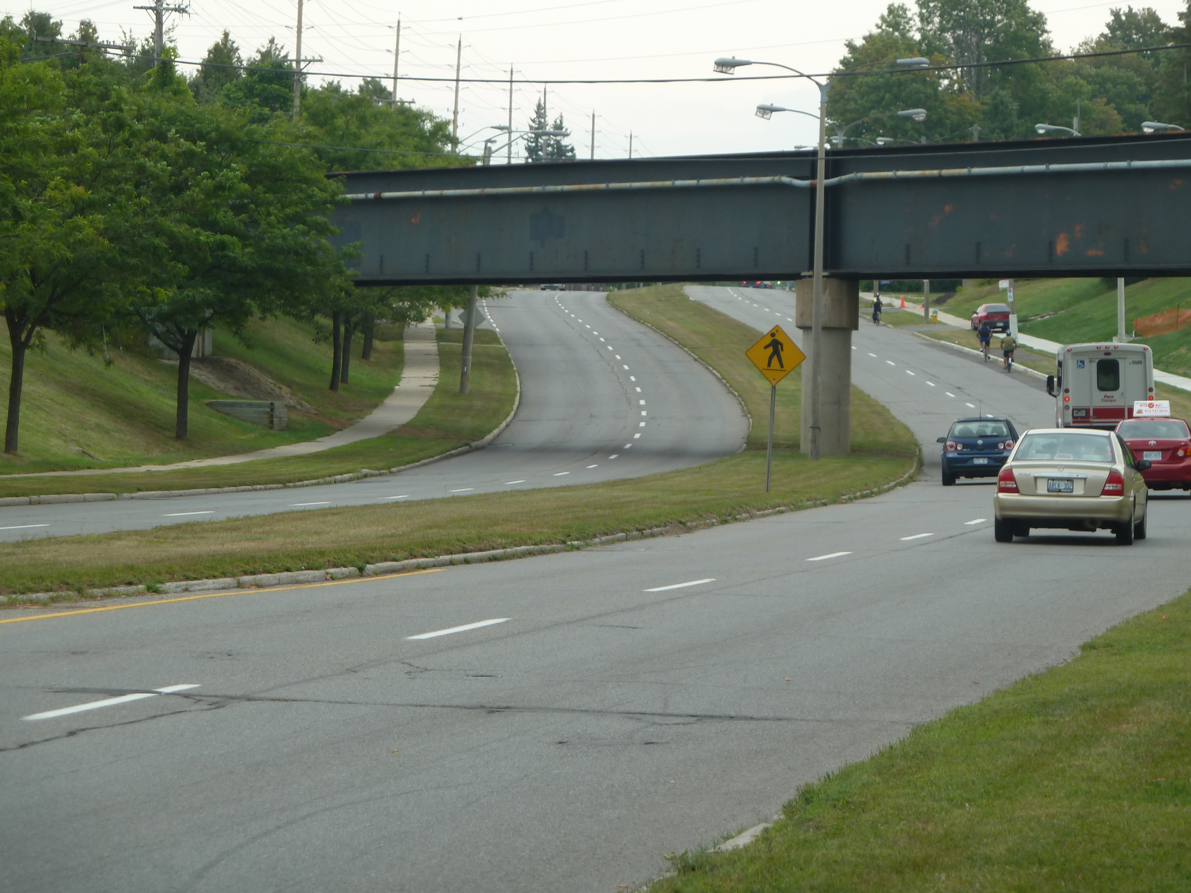
Conroy Road is a road in the City of Ottawa, Ontario, Canada. It runs from Walkley Road in the north to Bank Street in the south. Conroy Road forms the eastern fringe of the neighbourhood of Blossom Park, Ontario and ends in the community of Kemp Park, Ontario. Conroy Road is home to Pine Grove Forest and the Conroy Pit (see Greenbelt), owned by the National Capital Commission. Conroy Road has recently expanded, and divided between Walkley Road and Hunt Club Road due to residential expansion in Ottawa's south end. The intersection of Conroy and Walkley may be the southern terminus of the controversial Alta Vista Parkway Alta or ALTA may refer to: Acronyms * Alt-A, short for Alternative A-paper, is a type of U.S. mortgage * American Land Title Association, a national trade association representing the land title industry * American Literary Translators Associati .... Conroy Road is also known as Ottawa Road #125. This road may be widened in the future due to rapid growth in the s ... [...More Info...] [...Related Items...] OR: [Wikipedia] [Google] [Baidu] |
Ottawa
Ottawa (, ; Canadian French: ) is the capital city of Canada. It is located at the confluence of the Ottawa River and the Rideau River in the southern portion of the province of Ontario. Ottawa borders Gatineau, Quebec, and forms the core of the Ottawa–Gatineau census metropolitan area (CMA) and the National Capital Region (NCR). Ottawa had a city population of 1,017,449 and a metropolitan population of 1,488,307, making it the fourth-largest city and fourth-largest metropolitan area in Canada. Ottawa is the political centre of Canada and headquarters to the federal government. The city houses numerous foreign embassies, key buildings, organizations, and institutions of Canada's government, including the Parliament of Canada, the Supreme Court, the residence of Canada's viceroy, and Office of the Prime Minister. Founded in 1826 as Bytown, and incorporated as Ottawa in 1855, its original boundaries were expanded through numerous annexations and were ultimately ... [...More Info...] [...Related Items...] OR: [Wikipedia] [Google] [Baidu] |
Ontario
Ontario ( ; ) is one of the thirteen provinces and territories of Canada.Ontario is located in the geographic eastern half of Canada, but it has historically and politically been considered to be part of Central Canada. Located in Central Canada, it is Canada's most populous province, with 38.3 percent of the country's population, and is the second-largest province by total area (after Quebec). Ontario is Canada's fourth-largest jurisdiction in total area when the territories of the Northwest Territories and Nunavut are included. It is home to the nation's capital city, Ottawa, and the nation's most populous city, Toronto, which is Ontario's provincial capital. Ontario is bordered by the province of Manitoba to the west, Hudson Bay and James Bay to the north, and Quebec to the east and northeast, and to the south by the U.S. states of (from west to east) Minnesota, Michigan, Ohio, Pennsylvania, and New York. Almost all of Ontario's border with the United States f ... [...More Info...] [...Related Items...] OR: [Wikipedia] [Google] [Baidu] |
Walkley Road
Walkley Road ( Ottawa Road #74) is a major road in Ottawa, Ontario, Canada. It runs from Riverside Drive to Ramseyville Road (formerly Baseline Road). It is mostly a four-lane divided road which runs through both residential and industrial areas of the southern part of urban Ottawa. See also * List of roads in Ottawa This is a list of major roads in Ottawa, Ontario, Canada: * Airport Parkway * Albert Street * Albion Road *Alta Vista Drive * Anderson Road * Aviation Parkway * Bank Street *Bankfield Road *Baseline Road *Beechwood Avenue * Blair Road ... External links Ottawa 2020 Transportation Master Plan Roads in Ottawa {{Ottawa-stub ... [...More Info...] [...Related Items...] OR: [Wikipedia] [Google] [Baidu] |
Bank Street (Ottawa)
Bank Street (French: ''Rue Bank'') is the major commercial north-south street in Ottawa, Ontario, Canada. It runs south from Wellington Street in downtown Ottawa, south through the neighbourhoods of Centretown, The Glebe, Old Ottawa South, Alta Vista, Hunt Club, and then through the villages of Blossom Park, Leitrim, South Gloucester, Greely, Metcalfe, Spring Hill, and Vernon before exiting the city limits at Belmeade Road. Bank Street made up much of Highway 31 before it was downloaded in 1998 (all of it south of Heron Road). Currently it is also known as Ottawa Road #31. Features Between Wellington Street and Gladstone Avenue in downtown, Bank Street is a shopping and business development district officially known as the "Bank Street Promenade" and the street is lined with common signage affixed to streetlights and street-level advertising billboards showing this distinction. The area between Somerset Street West and Gladstone Avenue (within the Bank Street ... [...More Info...] [...Related Items...] OR: [Wikipedia] [Google] [Baidu] |
Blossom Park, Ontario
Blossom Park is a neighbourhood in Gloucester-Southgate Ward in the south-end of the city of Ottawa, Ontario, Canada. Before the 2001 city of Ottawa amalgamation it was a suburb of the city of Gloucester. The current limits of the neighbourhood are: Hunt Club Road to the north, Airport Parkway to the west, Conroy Road to the east and the Greenbelt to the south (near Lester Road). According to the Canada 2016 Census, the population of the neighbourhood was 14,190. History The area was cleared and farmed by settlers who began to arrive in the early decades of the 19th century. Early settlers included Charles Kinmond, a native of Perthshire, Scotland, James Spratt, Leonard Wood (1805–1888) and his wife Martha (1821–1905) and John Halpenny (1818–1873) who hailed from Wicklow, Ireland. Their farms were accessed by the Prescott Road, which was established on its present course in 1844, was later known as the Metcalfe Road and subsequently became part of Highway 31. It is no ... [...More Info...] [...Related Items...] OR: [Wikipedia] [Google] [Baidu] |
Kemp Park, Ontario
Kempark (sometimes spelled Kemp Park) is a community in Gloucester-Southgate Ward in the south end of Ottawa, Ontario, Canada. Prior to amalgamation in 2001, it located in City of Gloucester. The community is located at the south end of Conroy Road when it meets with Bank Street. It is located right next to the village of Leitrim, Ontario Leitrim is a dispersed rural community in the South Gloucester section of Ottawa, Ontario, Canada, and is named for the Irish County Leitrim. The area comprises the rapidly growing Findlay Creek suburban neighbourhood. The area is bounded by Leit .... It is about 12 km south of Downtown Ottawa. The community is home to approximately 200 people. References Neighbourhoods in Ottawa {{Ottawa-stub ... [...More Info...] [...Related Items...] OR: [Wikipedia] [Google] [Baidu] |
Pine Grove Forest
A pine is any conifer tree or shrub in the genus ''Pinus'' () of the family Pinaceae. ''Pinus'' is the sole genus in the subfamily Pinoideae. The World Flora Online created by the Royal Botanic Gardens, Kew and Missouri Botanical Garden accepts 187 species names of pines as current, together with more synonyms. The American Conifer Society (ACS) and the Royal Horticultural Society accept 121 species. Pines are commonly found in the Northern Hemisphere. ''Pine'' may also refer to the lumber derived from pine trees; it is one of the more extensively used types of lumber. The pine family is the largest conifer family and there are currently 818 named cultivars (or trinomials) recognized by the ACS. Description Pine trees are evergreen, coniferous resinous trees (or, rarely, shrubs) growing tall, with the majority of species reaching tall. The smallest are Siberian dwarf pine and Potosi pinyon, and the tallest is an tall ponderosa pine located in southern Oregon's Rogue R ... [...More Info...] [...Related Items...] OR: [Wikipedia] [Google] [Baidu] |
Greenbelt (Ottawa)
The Greenbelt (french: Ceinture de verdure) is a protected green belt traversing Ottawa, Ontario, Canada. It includes green space, forests, farms, and wetland A wetland is a distinct ecosystem that is flooded or saturated by water, either permanently (for years or decades) or seasonally (for weeks or months). Flooding results in oxygen-free (anoxic) processes prevailing, especially in the soils. The ...s from Shirleys Bay in the west and to Green's Creek (Ontario), Green's Creek in the east. It is the largest publicly owned green belt in the world and the most ecologically diverse area in Eastern Ontario. The National Capital Commission (NCC) owns and manages , and the rest is held by other Government of Canada, federal government departments and private interests. Real estate development within the Greenbelt is strictly controlled. The Greenbelt lies within eight kilometers of Parliament Hill in downtown Ottawa and ranges in width from two to ten kilometers. It encircles ... [...More Info...] [...Related Items...] OR: [Wikipedia] [Google] [Baidu] |
National Capital Commission
The National Capital Commission (NCC; french: Commission de la capitale nationale, CCN) is the Crown corporation responsible for development, urban planning, and conservation in Canada's Capital Region (Ottawa, Ontario and Gatineau, Quebec), including administering most lands and buildings owned by the Government of Canada in the region. The NCC is the capital's largest property owner, owning and managing over 11% of all lands in the Capital Region. It also owns over 1,600 properties in its real estate portfolio, including the capital's six official residences; commercial, residential and heritage buildings; and agricultural facilities. The NCC reports to the Parliament of Canada through whichever minister in the Cabinet of Canada is designated responsible for the ''National Capital Act'', currently the Minister of Public Services and Procurement. History Ottawa Improvement Commission (1899–1927) Through the 19th century, the character of what is known today as the Natio ... [...More Info...] [...Related Items...] OR: [Wikipedia] [Google] [Baidu] |
Hunt Club Road (Ottawa)
Hunt Club Road, also known as Ottawa Road 32, is a major east–west route in Ottawa, Ontario, Canada. It originally ran from a dead end east of Bank Street to the Ottawa Hunt and Golf Club; later, there were many extensions due to the 1970s housing boom, first westward to Riverside Drive, then eastward to Hawthorne Road in the late 1980s. The section between Bank Street and Riverside Drive, originally only one lane in each direction, was expanded to two lanes in each direction in 1993–1994. It was further extended across the Rideau River and the southern edge of the suburbs to Richmond Road by the late 1990s; this extension is signed as West Hunt Club Road by the City of Ottawa. Construction to extend Hunt Club eastward to Highway 417 near Ramsayville was completed on August 21, 2014. Most of Hunt Club Road is a four-lane divided principal arterial road with limited access, particularly between just west of Merivale Road and Highway 416 where it is an at-grade urban expre ... [...More Info...] [...Related Items...] OR: [Wikipedia] [Google] [Baidu] |
Alta Vista Parkway
Alta or ALTA may refer to: Acronyms * Alt-A, short for Alternative A-paper, is a type of U.S. mortgage * American Land Title Association, a national trade association representing the land title industry * American Literary Translators Association, an association of literary translators in the US * Amur Leopard and Tiger Alliance or ALTA, an initiative to conserve the Amur leopard and Amur tiger * Atlanta Lawn Tennis Association * Australasian Language Technology Association * Accelerated life testing or Accelerated life testing analysis Places Canada * Alta Creek, the official name of the River of Golden Dreams, in Whistler, British Columbia * Alta Lake (British Columbia), a lake in Whistler, British Columbia * Alta Lake, British Columbia, a community now part of Whistler, British Columbia * Mont Alta, a hill in the Laurentides zone of the Laurentian Mountains of Quebec, that is the basis of the Ski Mont Alta ski hill; see List of former ski areas of Quebec *Alberta, Canada ... [...More Info...] [...Related Items...] OR: [Wikipedia] [Google] [Baidu] |


