|
Colorado State Highway 325
State Highway 325 (SH 325) is a state highway in Garfield County, Colorado, United States, that connects Colorado State Highway 13 (SH 13), north of Rifle, with Rifle Mountain Park. Route description SH 325 runs , starting at a junction with SH 13 north of Rifle. The highway goes north to Rifle Gap State Park. From there it follows East Rifle Creek east and then north to Rifle Falls State Park. After passing the falls it continues north along the creek, ending at the entrance to Rifle Mountain Park. Major intersections See also * List of state highways in Colorado * ''Valley Curtain ''Valley Curtain'' was a 1972 environmental artwork in which artists Christo and Jeanne-Claude raised an orange curtain of fabric across a mountainous span of Colorado State Highway 325. Preparations began within a year of their Australian ''Wr ...'' References External links 325 Transportation in Garfield County, Colorado {{Colorado-road-st ... [...More Info...] [...Related Items...] OR: [Wikipedia] [Google] [Baidu] |
Rifle, Colorado
Rifle is a List of municipalities in Colorado#Home rule municipality, home rule municipality in and the most populous community of Garfield County, Colorado, Garfield County, Colorado, United States. The population was 10,437 at the 2020 United States Census, 2020 census. Rifle is a regional center of the Ranch, cattle ranching industry located along Interstate 70 in Colorado, Interstate 70 and the Colorado River just east of the Roan Plateau, which dominates the western skyline of the town. The town was founded in 1882 by Abram Maxfield, and was incorporated in 1905 along Rifle Creek, near its mouth on the Colorado. The community takes its name from the creek.''Rifle Shots: The Story of Rifle, Colorado'', compiled by the Reading Club of Rifle, Colorado, 1973. History The land that Rifle resides on was once in the heart of the Ute people, Ute Nation, a classification of the Indigenous peoples of the Great Basin. The most common tribe in the area were the Tabagauche, who hunted a ... [...More Info...] [...Related Items...] OR: [Wikipedia] [Google] [Baidu] |
Garfield County, Colorado
Garfield County is a county located in the U.S. state of Colorado. As of the 2020 census, the population was 61,685. The county seat is Glenwood Springs. The county is named in honor of United States President James A. Garfield. Garfield County is included in the Glenwood Springs, CO Micropolitan Statistical Area, which is also included in the Edwards-Glenwood Springs, CO Combined Statistical Area. Geography According to the U.S. Census Bureau, the county has a total area of , of which is land and (0.3%) is water. Adjacent counties * Rio Blanco County - north *Routt County - northeast *Eagle County - east *Pitkin County - southeast * Mesa County - south *Grand County, Utah - southwest *Uintah County, Utah - northwest Major highways * Interstate 70 * * * U.S. Highway 6 * State Highway 13 * State Highway 82 * State Highway 133 * State Highway 139 * State Highway 325 Protected areas * Flat Tops Wilderness *Grand Mesa National Forest *Harvey Gap State Park *Rifle ... [...More Info...] [...Related Items...] OR: [Wikipedia] [Google] [Baidu] |
State Highway
A state highway, state road, or state route (and the equivalent provincial highway, provincial road, or provincial route) is usually a road that is either ''numbered'' or ''maintained'' by a sub-national state or province. A road numbered by a state or province falls below numbered national highways (Canada being a notable exception to this rule) in the hierarchy (route numbers are used to aid navigation, and may or may not indicate ownership or maintenance). Roads maintained by a state or province include both nationally numbered highways and un-numbered state highways. Depending on the state, "state highway" may be used for one meaning and "state road" or "state route" for the other. In some countries such as New Zealand, the word "state" is used in its sense of a sovereign state or country. By this meaning a state highway is a road maintained and numbered by the national government rather than local authorities. Countries Australia Australia's State Route system covers u ... [...More Info...] [...Related Items...] OR: [Wikipedia] [Google] [Baidu] |
Colorado
Colorado (, other variants) is a state in the Mountain West subregion of the Western United States. It encompasses most of the Southern Rocky Mountains, as well as the northeastern portion of the Colorado Plateau and the western edge of the Great Plains. Colorado is the eighth most extensive and 21st most populous U.S. state. The 2020 United States census enumerated the population of Colorado at 5,773,714, an increase of 14.80% since the 2010 United States census. The region has been inhabited by Native Americans and their ancestors for at least 13,500 years and possibly much longer. The eastern edge of the Rocky Mountains was a major migration route for early peoples who spread throughout the Americas. "''Colorado''" is the Spanish adjective meaning "ruddy", the color of the Fountain Formation outcroppings found up and down the Front Range of the Rocky Mountains. The Territory of Colorado was organized on February 28, 1861, and on August 1, 1876, U.S. President Ulyss ... [...More Info...] [...Related Items...] OR: [Wikipedia] [Google] [Baidu] |
Colorado State Highway 13
State Highway 13 (SH 13) in the U.S. state of Colorado is a north–south mountain route that travels from Rifle to the Wyoming border near Baggs, Wyoming, through the Rocky Mountains. Route description The route begins at a diamond interchange with Interstate 70 south of Rifle. It then crosses the Colorado River and intersects U.S. Highway 6 at the south side of Rifle. Along the north side of town the road turns slightly northeastward as it passes through the northern Rifle and into grassland, where it intersects State Highway 325. As the road turns back northward and then slightly northwestward, the surrounding terrain turns into a more barren land dotted with occasional shrubs and grass. As the road continues northwestward, the shrubs and trees become more dense along hillsides. SH 13 then crosses into Rio Blanco County, when the direction becomes straight north. SH 13 then interchanges with State Highway 64, which meets its east end here, and turns abruptly eastward. ... [...More Info...] [...Related Items...] OR: [Wikipedia] [Google] [Baidu] |
Rifle Gap Dam
Rifle Gap Dam (National ID # CO01692) is a dam in Garfield County, Colorado, about five and a half miles north of Rifle. The earthen dam was constructed between 1964 and 1967 by the United States Bureau of Reclamation, with a height of and a length of feet at its crest. It impounds East Rifle Creek and West Rifle Creek about feet upstream from their previous point of confluence. The dam was built for irrigation water storage, is owned by the Bureau, and is operated by the local Silt Water Conservancy District. The reservoir it creates, Rifle Gap Reservoir, has a water surface of and a maximum capacity of . Recreation includes scuba diving in its clear water, fishing (for rainbow and German brown trout, walleye, perch, and smallmouth and largemouth bass, etc.), wildlife watching, boating, year-round camping, and hiking. See also *Rifle Gap State Park Rifle Gap State Park is a Colorado State Park located in Garfield County near Rifle, Colorado. The park established in ... [...More Info...] [...Related Items...] OR: [Wikipedia] [Google] [Baidu] |
Colorado State Highway 13
State Highway 13 (SH 13) in the U.S. state of Colorado is a north–south mountain route that travels from Rifle to the Wyoming border near Baggs, Wyoming, through the Rocky Mountains. Route description The route begins at a diamond interchange with Interstate 70 south of Rifle. It then crosses the Colorado River and intersects U.S. Highway 6 at the south side of Rifle. Along the north side of town the road turns slightly northeastward as it passes through the northern Rifle and into grassland, where it intersects State Highway 325. As the road turns back northward and then slightly northwestward, the surrounding terrain turns into a more barren land dotted with occasional shrubs and grass. As the road continues northwestward, the shrubs and trees become more dense along hillsides. SH 13 then crosses into Rio Blanco County, when the direction becomes straight north. SH 13 then interchanges with State Highway 64, which meets its east end here, and turns abruptly eastward. ... [...More Info...] [...Related Items...] OR: [Wikipedia] [Google] [Baidu] |
Rifle Gap State Park
Rifle Gap State Park is a Colorado State Park located in Garfield County near Rifle, Colorado. The park established in 1966 includes a reservoir. Plant communities are pinyon-juniper woodlands, sagebrush shrubland with deciduous riparian forest in places along the edge of the Rifle Gap Reservoir. Commonly observed wildlife include mule deer, elk and great horned owl The great horned owl (''Bubo virginianus''), also known as the tiger owl (originally derived from early naturalists' description as the "winged tiger" or "tiger of the air"), or the hoot owl, is a large owl native to the Americas. It is an extre ...s. Park facilities include a visitors center, campgrounds, picnic sites and a boat ramp. References * Protected areas of Garfield County, Colorado Geography of Colorado Protected areas established in 1966 State parks of Colorado 1966 establishments in Colorado {{Colorado-geo-stub ... [...More Info...] [...Related Items...] OR: [Wikipedia] [Google] [Baidu] |
Rifle Falls State Park
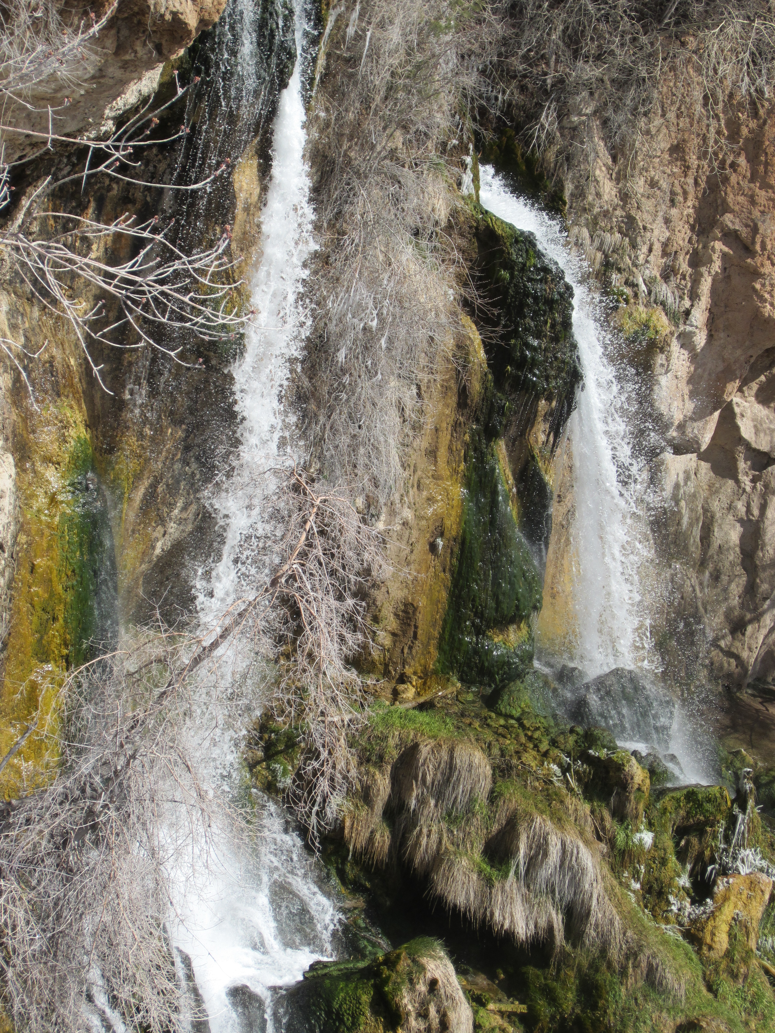
Rifle Falls State Park is a Colorado State Park located in Garfield County northeast of Rifle, Colorado. The central feature of the park is a triple waterfall flowing over a travertine dam on East Rifle Creek. Commonly seen wildlife includes mule deer, elk, coyote, and golden-mantled ground squirrel. Rainbow A rainbow is a meteorological phenomenon that is caused by reflection, refraction and dispersion of light in water droplets resulting in a spectrum of light appearing in the sky. It takes the form of a multicoloured circular arc. Rainbows c ... and brown trout can be caught in the creek. Limestone cliffs near the falls have a few small caves and three species of bats. Visitor facilities include campsites, picnic sites and of hiking trails. Rifle Falls State Park is a very accessible and scenic location. The falls is located approximately 50 yards from the parking area with a relatively flat path adjoining the two areas. It is an easy walk to reach the fa ... [...More Info...] [...Related Items...] OR: [Wikipedia] [Google] [Baidu] |
Three-way Junction
A three-way junction (or three-way intersection) is a type of road intersection with three arms. A Y junction (or Y intersection) generally has three arms of equal size coming at an acute or obtuse angle to each other; while a T junction (or T intersection) also has three arms, but one of the arms is generally a smaller road joining a larger road at right angle. Right-of-way Some three-way junctions are controlled by traffic lights, while others rely upon drivers to obey right-of-way rules, which vary from place to place: *In some jurisdictions, chiefly in European countries except the U.K. and Ireland, a driver is always obliged to yield right-of-way for every vehicle oncoming from the right at a junction without traffic signals and priority signs (including T junctions). *In other jurisdictions (mainly in the U.K., USA, Australia and Taiwan), a driver turning in a three-way junction must yield for every vehicle approaching the junction (on the way straight ahead) and, if the dr ... [...More Info...] [...Related Items...] OR: [Wikipedia] [Google] [Baidu] |
List Of State Highways In Colorado
The state highways of Colorado are a system of public paved roads funded and maintained by the Colorado Department of Transportation (CDOT) in the U.S. state of Colorado. These are state highways, which are typically abbreviated SH. The numbered highways within the state begin at 1 and increase, with exception of numbers already designated as United States Numbered Highways or Interstate Highway The Dwight D. Eisenhower National System of Interstate and Defense Highways, commonly known as the Interstate Highway System, is a network of controlled-access highways that forms part of the National Highway System in the United States. Th ...s. In 1953, many highways were decommissioned or lost mileage. Before the 1968 Colorado state highway renumbering, highways were cosigned with U.S. Highways and Interstate Highways, and there were highways matching U.S. Highway and Interstate Highway numbers. State highways ... [...More Info...] [...Related Items...] OR: [Wikipedia] [Google] [Baidu] |
Valley Curtain
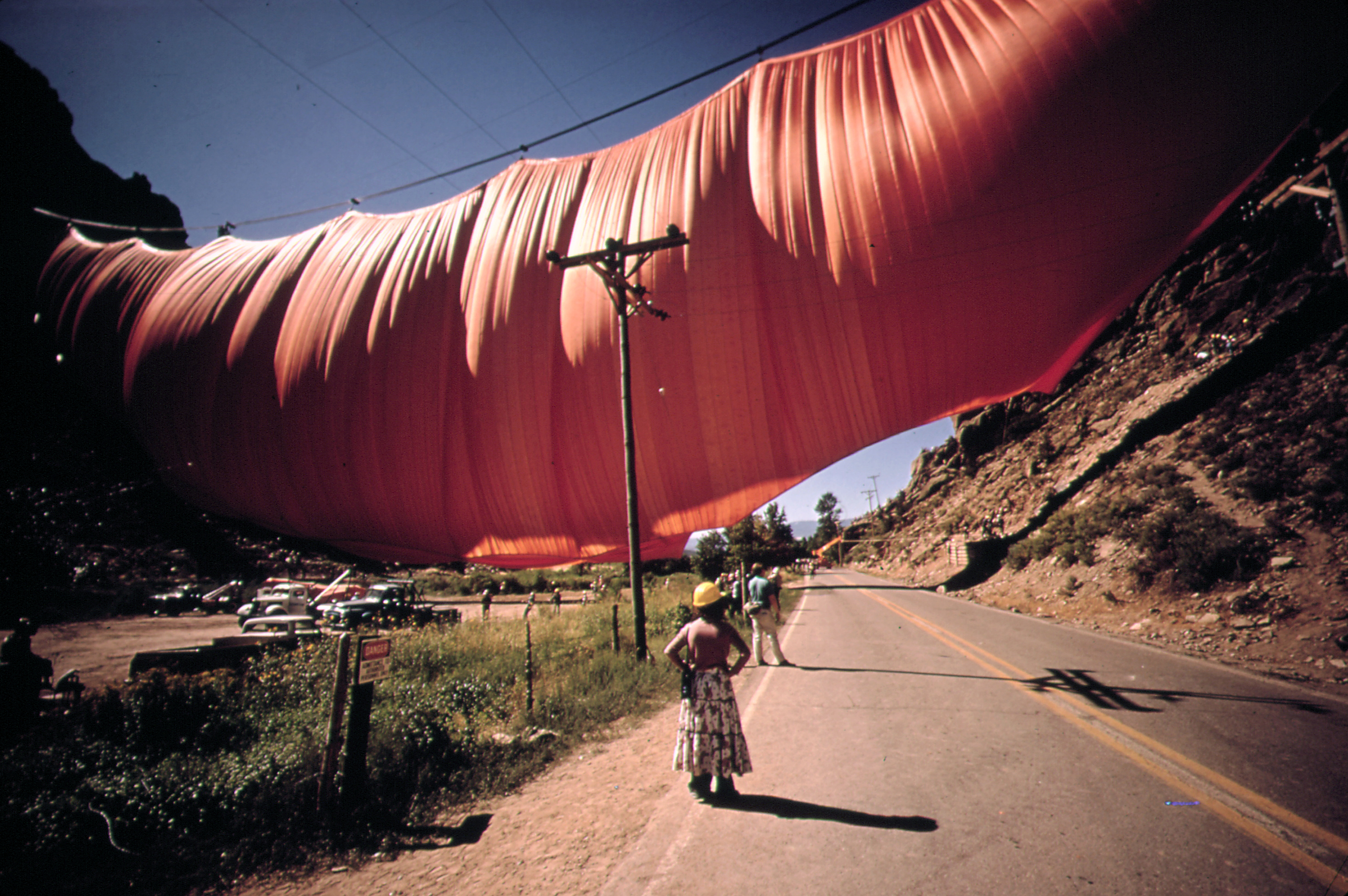
''Valley Curtain'' was a 1972 environmental artwork in which artists Christo and Jeanne-Claude raised an orange curtain of fabric across a mountainous span of Colorado State Highway 325. Preparations began within a year of their Australian ''Wrapped Coast''. The artists formed a corporation to benefit from tax and other liabilities, a form they used for later projects. Following a failed attempt to mount the curtain in late 1971, a new engineer and builder-contractor raised the fabric in August 1972. The work only stood for 28 hours before the wind again destroyed the fabric. This work, their most expensive to date and first to involve construction workers, was captured in a documentary by David and Albert Maysles. ''Christo's Valley Curtain'' was nominated for Academy Award for Documentary Short Subject, Best Documentary Short in the 46th Academy Awards, 1974 Academy Awards. Notes Bibliography * * * * External links [...More Info...] [...Related Items...] OR: [Wikipedia] [Google] [Baidu] |
.jpg)


