Rifle Falls State Park on:
[Wikipedia]
[Google]
[Amazon]
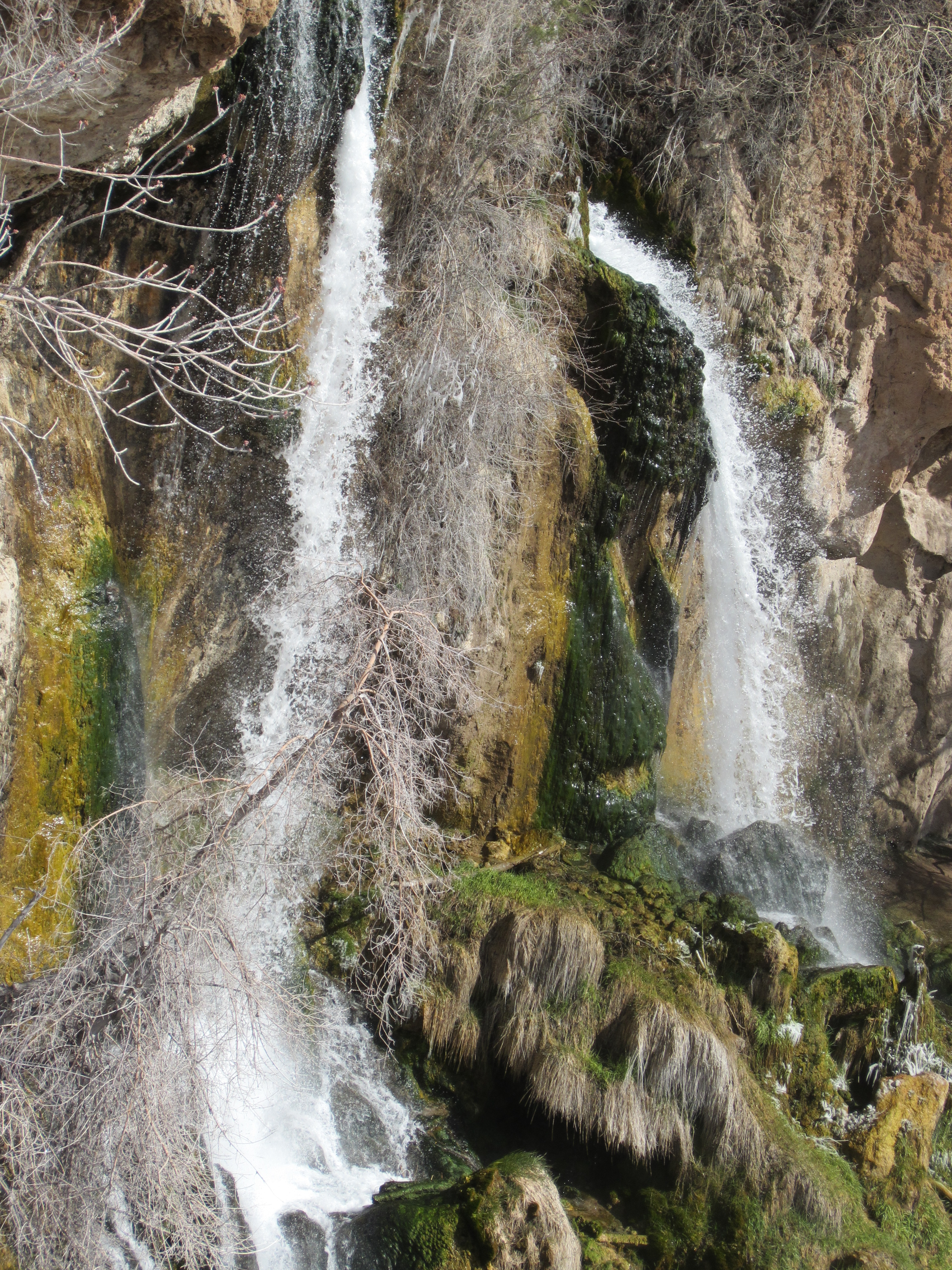
Rifle Falls State Park is a  Rifle Falls State Park is a very accessible and scenic location. The falls is located approximately 50 yards from the parking area with a relatively flat path adjoining the two areas. It is an easy walk to reach the falls, which are lovely nearly any time of year. The picnic and camping area near the parking lot offers grassy yard, restrooms, and potable water.
There is a short hike which leads up and around the top of the falls. The trail is fairly steep and rocky, but is only about one mile round trip. Along the way there are several caves which visitors can explore. The hike also leads to a rock ledge behind one of the falls offering a lovely (if a little bit misty) view.
Colorado State Park
The system of state parks in Colorado integrates outdoor recreation with tourism. There are currently forty-two parks open to the public, and there is one in development. Colorado State Parks host over eleven million visitors each year. Colorado ...
located in Garfield County northeast of Rifle, Colorado
Colorado (, other variants) is a state in the Mountain states, Mountain West subregion of the Western United States. It encompasses most of the Southern Rocky Mountains, as well as the northeastern portion of the Colorado Plateau and the wes ...
. The central feature of the park is a triple waterfall flowing over a travertine
Travertine ( ) is a form of terrestrial limestone deposited around mineral springs, especially hot springs. It often has a fibrous or concentric appearance and exists in white, tan, cream-colored, and even rusty varieties. It is formed by a p ...
dam on East Rifle Creek. Commonly seen wildlife includes mule deer
The mule deer (''Odocoileus hemionus'') is a deer indigenous to western North America; it is named for its ears, which are large like those of the mule. Two subspecies of mule deer are grouped into the black-tailed deer.
Unlike the related whi ...
, elk, coyote, and golden-mantled ground squirrel. Rainbow
A rainbow is a meteorological phenomenon that is caused by reflection, refraction and dispersion of light in water droplets resulting in a spectrum of light appearing in the sky. It takes the form of a multicoloured circular arc. Rainbows c ...
and brown trout can be caught in the creek. Limestone cliffs near the falls have a few small caves and three species of bats. Visitor facilities include campsites, picnic sites and of hiking trails.
 Rifle Falls State Park is a very accessible and scenic location. The falls is located approximately 50 yards from the parking area with a relatively flat path adjoining the two areas. It is an easy walk to reach the falls, which are lovely nearly any time of year. The picnic and camping area near the parking lot offers grassy yard, restrooms, and potable water.
There is a short hike which leads up and around the top of the falls. The trail is fairly steep and rocky, but is only about one mile round trip. Along the way there are several caves which visitors can explore. The hike also leads to a rock ledge behind one of the falls offering a lovely (if a little bit misty) view.
References
* State parks of Colorado Protected areas of Garfield County, Colorado Protected areas established in 1966 Waterfalls of Colorado Landforms of Garfield County, Colorado {{Colorado-geo-stub