|
Clifton Lock
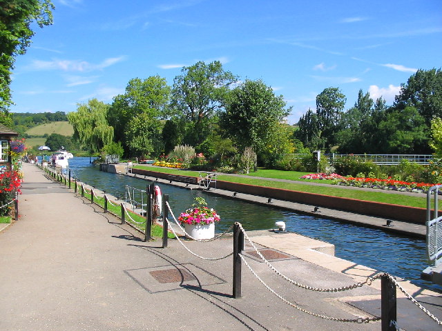
Clifton Lock is a lock on River Thames in Oxfordshire, England. It is located south of the village of Clifton Hampden and north of Long Wittenham. It is at the start of the Clifton Cut, which bypasses the river to the north of Long Wittenham. The lock was completed in 1822 by the Thames Navigation Commissioners. The main weir, which was built thirteen years later than the lock, runs across the old navigation of the river. A smaller weir runs just above the lock. History Clifton is one of the few lock sites on the non-tidal river where there was not a pre-existing weir and flash lock, although there was an important ferry. Problems to navigation had long been recognised and the first suggestions for creating a lock "near Clifton Ferry" occurred in 1793, being raised again in 1811. The construction of the lock cut was delayed because the owner of the land was "a lunatic", but it was eventually completed in 1822 together with the lock. No weir was built at the time, giving r ... [...More Info...] [...Related Items...] OR: [Wikipedia] [Google] [Baidu] |
River Thames
The River Thames ( ), known alternatively in parts as the The Isis, River Isis, is a river that flows through southern England including London. At , it is the longest river entirely in England and the Longest rivers of the United Kingdom, second-longest in the United Kingdom, after the River Severn. The river rises at Thames Head in Gloucestershire, and flows into the North Sea near Tilbury, Essex and Gravesend, Kent, via the Thames Estuary. From the west it flows through Oxford (where it is sometimes called the Isis), Reading, Berkshire, Reading, Henley-on-Thames and Windsor, Berkshire, Windsor. The Thames also drains the whole of Greater London. In August 2022, the source of the river moved five miles to beyond Somerford Keynes due to the heatwave in July 2022. The lower reaches of the river are called the Tideway, derived from its long tidal reach up to Teddington Lock. Its tidal section includes most of its London stretch and has a rise and fall of . From Oxford to th ... [...More Info...] [...Related Items...] OR: [Wikipedia] [Google] [Baidu] |
Appleford Railway Bridge
Appleford Railway Bridge carries the Cherwell Valley Line from Didcot to Oxford across the River Thames near the village of Appleford-on-Thames, Oxfordshire, England. It crosses the Thames on the reach between Clifton Lock and Culham Lock. Originally, a timber bridge was built at the approximate location of the present bridge; by December 1843, it was reportedly under construction, and was completed during the following year. By the 1850s, it has been replaced by a more substantial bridge principally composed of wrought iron so that heavier trains could be run along the line. A third bridge was completed in 1927, which was built out of steel; it is this structure that is presently used as of the 2010s. See also * Crossings of the River Thames The River Thames is the second-longest river in the United Kingdom, passes through the capital city, and has many crossings. Counting every channel – such as by its islands linked to only one bank – it is crossed by ove ... [...More Info...] [...Related Items...] OR: [Wikipedia] [Google] [Baidu] |
1822 Establishments In England
Eighteen or 18 may refer to: * 18 (number), the natural number following 17 and preceding 19 * one of the years 18 BC, AD 18, 1918, 2018 Film, television and entertainment * ''18'' (film), a 1993 Taiwanese experimental film based on the short story ''God's Dice'' * ''Eighteen'' (film), a 2005 Canadian dramatic feature film * 18 (British Board of Film Classification), a film rating in the United Kingdom, also used in Ireland by the Irish Film Classification Office * 18 (''Dragon Ball''), a character in the ''Dragon Ball'' franchise * "Eighteen", a 2006 episode of the animated television series ''12 oz. Mouse'' Music Albums * ''18'' (Moby album), 2002 * ''18'' (Nana Kitade album), 2005 * '' 18...'', 2009 debut album by G.E.M. Songs * "18" (5 Seconds of Summer song), from their 2014 eponymous debut album * "18" (One Direction song), from their 2014 studio album ''Four'' * "18", by Anarbor from their 2013 studio album '' Burnout'' * "I'm Eighteen", by Alice Cooper commonly ... [...More Info...] [...Related Items...] OR: [Wikipedia] [Google] [Baidu] |
Day's Lock
Day's Lock is a lock on the River Thames near Dorchester-on-Thames, Oxfordshire, England on the Dorchester side of the river. The pound lock was built in 1789 by the Thames Navigation Commissioner. The lock is across the river from the small village of Little Wittenham and is overlooked from the south by the hills of Wittenham Clumps, with a particularly good view from Round Hill. The weir runs straight across the river from the other side of the lock island. Day's Lock is the main gauging station for the measurement of the water flow in the River Thames. The Thames Path crosses the river here. The ''World Poohsticks Championships'', on behalf of the RNLI, have taken place annually here since 1983. History The name ''Day's Lock'' comes from the Day family, local Catholic yeomen since the 17th century. During the 16th century, there was a flash lock here. The pound lock was staked out in August 1788. It was judged best to build it on the Oxfordshire bank provided the exi ... [...More Info...] [...Related Items...] OR: [Wikipedia] [Google] [Baidu] |
Culham Lock
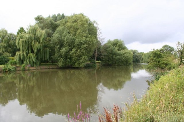
Culham Lock is a lock on the River Thames in England close to Culham, Oxfordshire. It is on a lock cut to the north of the main stream, which approaches the large village of Sutton Courtenay. The lock was built of stone by the Thames Navigation Commission in 1809. The associated weirs are on the old course of the river under the massive causeway which separates the millstream from picturesque Sutton Pools. The causeway is very old and was thought to have been built by Saxon labour. History The river originally passed close to Sutton Courtenay and under a large mill there. In 1667 occurs the first reference to a pound lock underneath this mill. This had a set of gates beneath the mill floor and included a wide pool at the back of the mill. Consequently, it required a very large volume of water to fill it and so incurred a heavy toll. There were complaints to the Thames Navigation Commission in 1772 that the floor of the mill was a great obstruction to navigation. Although it ... [...More Info...] [...Related Items...] OR: [Wikipedia] [Google] [Baidu] |
Locks On The River Thames
The English River Thames is navigable from Cricklade (for very small, shallow boats) or Lechlade (for larger boats) to the sea, and this part of the river falls 71 meters (234 feet). There are 45 locks on the river, each with one or more adjacent weirs. These lock and weir combinations are used for controlling the flow of water down the river, most notably when there is a risk of flooding, and provide for navigation above the tideway. History From ancient times there were many obstructions across the Thames, for fish-pounds and millers' weirs. They are referred to by Asserius Menevensis in the ninth century and Magna Carta (1215) states that "weirs, for the time to come, shall be demolished in the Thames and Medway, except on the sea coast." It appears this never happened. In the Middle Ages, the fall on the river in its middle and upper sections was used to drive watermills for the production of flour and paper and various other purposes such as metal-beating. This involv ... [...More Info...] [...Related Items...] OR: [Wikipedia] [Google] [Baidu] |
Thames Path
The Thames Path is a National Trail following the River Thames from its source near Kemble, Gloucestershire, Kemble in Gloucestershire to the Woolwich foot tunnel, south east London. It is about long. A path was first proposed in 1948 but it only opened in 1996. The Thames Path's entire length can be walked, and a few parts can be cycled. Some parts of the Thames Path, particularly west of Oxford, are subject to flooding during the winter. The river is also Tide, tidal downstream from Teddington Lock and the lower parts of these paths may be underwater if there is a particularly high tide, although the Thames Barrier protects London from catastrophic flooding. The Thames Path uses the river towpath between Inglesham and Putney and available paths elsewhere. Historically, towpath traffic crossed the river using many ferry, ferries, but few of these crossings exist now and some diversion from the towpath is necessary. Description and access to the river The general aim of the pa ... [...More Info...] [...Related Items...] OR: [Wikipedia] [Google] [Baidu] |
Sutton Pools
Sutton Pools are a picturesque backwater formed by a number of weirs, islands, footbridges and barriers on the course of the River Thames at Sutton Courtenay, Oxfordshire, England. The higher level of the river is separated from the lower pools by a causeway which dates from Saxon times. This river stretch ceased to be the main navigable route after Culham Cut was constructed in the early 19th century, which also created an island to the north of the Pools. In addition there are three smaller islands, linked by footbridges over the weirs, part of a footpath between Sutton Courtenay and the village of Culham Culham is a village and civil parish in a bend of the River Thames, south of Abingdon in Oxfordshire. The parish includes Culham Science Centre and Europa School UK (formerly the European School, Culham, which was the only Accredited Europea .... The upper river channel at Sutton Pools used to pass beneath a paper mill, though this closed in 1897 and has been demolishe ... [...More Info...] [...Related Items...] OR: [Wikipedia] [Google] [Baidu] |
Sutton Courtenay
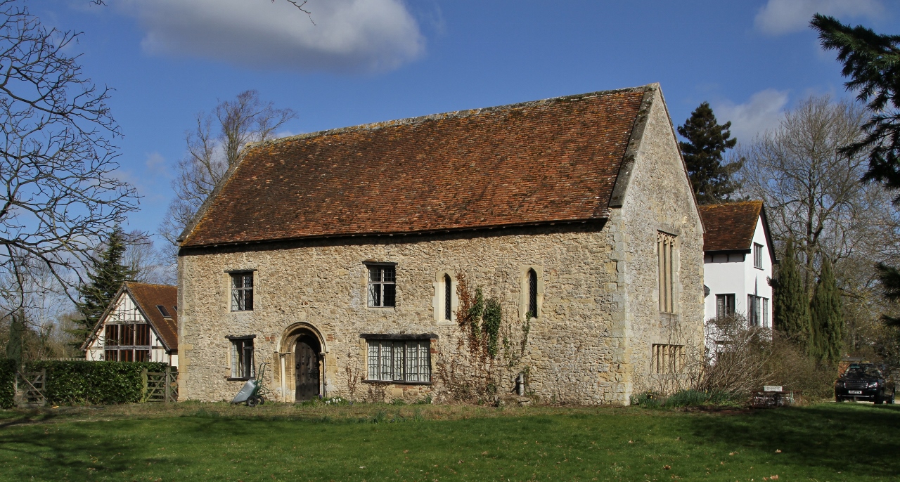
Sutton Courtenay is a village and civil parish on the River Thames south of Abingdon-on-Thames and northwest of Didcot. Historically part of Berkshire, it has been administered as part of Oxfordshire since the 1974 boundary changes. The 2011 Census recorded the parish's population as 2,421. Sutton Courtenay is home to some important structures, such as The Abbey, the Manor House, All Saints' Church, a twelfth-century Norman hall, the Sutton Bridge, and Didcot power station. Archaeology and history A Neolithic stone hand axe was found at Sutton Courtenay. Petrological analysis in 1940 identified the stone as epidotised tuff from Stake Pass in the Lake District, to the north. Stone axes from the same source have been found at Abingdon, Alvescot, Kencot and Minster Lovell. Excavations have revealed rough Saxon huts from the early stages of Anglo-Saxon settlement of Britain, but their most important enduring monument in Sutton was the massive causeway and weirs that separa ... [...More Info...] [...Related Items...] OR: [Wikipedia] [Google] [Baidu] |
Sutton Bridge, Oxfordshire
Sutton Bridge is a road bridge across the River Thames near the village of Sutton Courtenay, Oxfordshire, England. It is a stone structure built in 1807 with three arches over the main river and two smaller ones across the flood plain. An extension was built in 1809 across the Culham Cut, just below Culham Lock. It was originally a toll bridge and replaced an earlier multi-arch bridge over the original weir and a ferry at this site. It is a Grade II listed building. See also *Crossings of the River Thames The River Thames is the second-longest river in the United Kingdom, passes through the capital city, and has many crossings. Counting every channel – such as by its islands linked to only one bank – it is crossed by over 300 brid ... References Bridges across the River Thames Bridges in Oxfordshire Bridges completed in 1807 Former toll bridges in England Grade II listed buildings in Oxfordshire Grade II listed bridges Vale of White Horse { ... [...More Info...] [...Related Items...] OR: [Wikipedia] [Google] [Baidu] |
Oxfordshire
Oxfordshire is a ceremonial and non-metropolitan county in the north west of South East England. It is a mainly rural county, with its largest settlement being the city of Oxford. The county is a centre of research and development, primarily due to the work of the University of Oxford and several notable science parks. These include the Harwell Science and Innovation Campus and Milton Park, both situated around the towns of Didcot and Abingdon-on-Thames. It is a landlocked county, bordered by six counties: Berkshire to the south, Buckinghamshire to the east, Wiltshire to the south west, Gloucestershire to the west, Warwickshire to the north west, and Northamptonshire to the north east. Oxfordshire is locally governed by Oxfordshire County Council, together with local councils of its five non-metropolitan districts: City of Oxford, Cherwell, South Oxfordshire, Vale of White Horse, and West Oxfordshire. Present-day Oxfordshire spanning the area south of the Thames was h ... [...More Info...] [...Related Items...] OR: [Wikipedia] [Google] [Baidu] |


