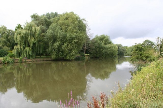
Sutton Pools on:
[Wikipedia]
[Google]
[Amazon]
 Sutton Pools are a picturesque backwater formed by a number of
 Sutton Pools are a picturesque backwater formed by a number of
 weirs
A weir or low head dam is a barrier across the width of a river that alters the flow characteristics of water and usually results in a change in the height of the river level. Weirs are also used to control the flow of water for outlets of l ...
, islands, footbridges and barriers on the course of the River Thames
The River Thames ( ), known alternatively in parts as the The Isis, River Isis, is a river that flows through southern England including London. At , it is the longest river entirely in England and the Longest rivers of the United Kingdom, se ...
at Sutton Courtenay
Sutton Courtenay is a village and civil parish on the River Thames south of Abingdon-on-Thames and northwest of Didcot. Historically part of Berkshire, it has been administered as part of Oxfordshire since the 1974 boundary changes. The 201 ...
, Oxfordshire
Oxfordshire is a ceremonial and non-metropolitan county in the north west of South East England. It is a mainly rural county, with its largest settlement being the city of Oxford. The county is a centre of research and development, primarily ...
, England. The higher level of the river is separated from the lower pools by a causeway which dates from Saxon times. This river stretch ceased to be the main navigable route after Culham Cut was constructed in the early 19th century, which also created an island to the north of the Pools. In addition there are three smaller islands, linked by footbridges over the weirs, part of a footpath between Sutton Courtenay and the village of Culham
Culham is a village and civil parish in a bend of the River Thames, south of Abingdon in Oxfordshire. The parish includes Culham Science Centre and Europa School UK (formerly the European School, Culham, which was the only Accredited Europea ...
.
The upper river channel at Sutton Pools used to pass beneath a paper mill, though this closed in 1897 and has been demolished. The river route is blocked by a fence here as it passes through the gardens of Mill House. A wooden footbridge and kissing gate lead to the main village.
References
{{coord, 51, 38, 48, N, 1, 16, 21, W, type:landmark_region:GB, display=title Weirs on the River Thames Crossings of the River Thames Islands of Oxfordshire