|
Culham Lock
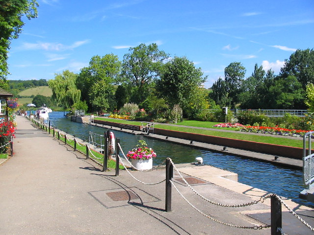
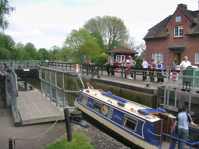
Culham Lock is a lock on the River Thames in England close to Culham, Oxfordshire. It is on a lock cut to the north of the main stream, which approaches the large village of Sutton Courtenay. The lock was built of stone by the Thames Navigation Commission in 1809. The associated weirs are on the old course of the river under the massive causeway which separates the millstream from picturesque Sutton Pools. The causeway is very old and was thought to have been built by Saxon labour. History The river originally passed close to Sutton Courtenay and under a large mill there. In 1667 occurs the first reference to a pound lock underneath this mill. This had a set of gates beneath the mill floor and included a wide pool at the back of the mill. Consequently, it required a very large volume of water to fill it and so incurred a heavy toll. There were complaints to the Thames Navigation Commission in 1772 that the floor of the mill was a great obstruction to navigation. Although it ... [...More Info...] [...Related Items...] OR: [Wikipedia] [Google] [Baidu] |
River Thames
The River Thames ( ), known alternatively in parts as the The Isis, River Isis, is a river that flows through southern England including London. At , it is the longest river entirely in England and the Longest rivers of the United Kingdom, second-longest in the United Kingdom, after the River Severn. The river rises at Thames Head in Gloucestershire, and flows into the North Sea near Tilbury, Essex and Gravesend, Kent, via the Thames Estuary. From the west it flows through Oxford (where it is sometimes called the Isis), Reading, Berkshire, Reading, Henley-on-Thames and Windsor, Berkshire, Windsor. The Thames also drains the whole of Greater London. In August 2022, the source of the river moved five miles to beyond Somerford Keynes due to the heatwave in July 2022. The lower reaches of the river are called the Tideway, derived from its long tidal reach up to Teddington Lock. Its tidal section includes most of its London stretch and has a rise and fall of . From Oxford to th ... [...More Info...] [...Related Items...] OR: [Wikipedia] [Google] [Baidu] |
Culham Bridge
Culham Bridge is a medieval bridge crossing a present backwater of the River Thames in England at Culham, Oxfordshire, near the town of Abingdon. The bridge crosses Swift Ditch which was at one time the main navigation channel of the River Thames until Abingdon Lock was built in 1790. The bridge formerly carried the A415 road from Abingdon to Dorchester, Oxfordshire, but was superseded in 1928 by a modern road bridge. It is a Grade II* listed building. History Culham Bridge was built of stone between 1416 and 1422 to replace an ancient ford called Culham Hythe by a religious body known as The Brotherhood of Christ (later Christ's Hospital) who subsequently looked after its upkeep. It was built as part of an improvement scheme, together with the two bridges at Abingdon and a causeway across Andersey Island. It is recorded that the completion of Abingdon Bridge severely damaged trade at Wallingford.Fred. S. Thacker ''The Thames Highway: Volume II Locks and Weirs'' 1920 - re ... [...More Info...] [...Related Items...] OR: [Wikipedia] [Google] [Baidu] |
Rowing On The River Thames
The Thames is one of the main rowing rivers in Europe. Dorney Lake between Slough and Windsor, Berkshire is an international Cup, standard-distance rowing lake besides the Thames, and hosts the three main annual entry regattas for Henley: still named Marlow (International), Wallingford and Metropolitan. Other rowing lakes near the Thames are the Redgrave Pinsent Rowing Lake between Reading and Henley used by the Great Britain squad and Royal Albert Dock near North Woolwich, London. History Rowing races on the River Thames have been documented as early as 1725, and the Thames was the venue for the 1908 London Olympics rowing races. Contemporary events, groups and modern history The sport and recreational/touring rowing takes place on the Tideway and on the 45 separate lock reaches on the non-tidal section. The river hosts a televised succession of races on which bets are placed – traditionally named The Boat Race and for some decades a men-only event – it is now ... [...More Info...] [...Related Items...] OR: [Wikipedia] [Google] [Baidu] |
Locks On The River Thames
The English River Thames is navigable from Cricklade (for very small, shallow boats) or Lechlade (for larger boats) to the sea, and this part of the river falls 71 meters (234 feet). There are 45 locks on the river, each with one or more adjacent weirs. These lock and weir combinations are used for controlling the flow of water down the river, most notably when there is a risk of flooding, and provide for navigation above the tideway. History From ancient times there were many obstructions across the Thames, for fish-pounds and millers' weirs. They are referred to by Asserius Menevensis in the ninth century and Magna Carta (1215) states that "weirs, for the time to come, shall be demolished in the Thames and Medway, except on the sea coast." It appears this never happened. In the Middle Ages, the fall on the river in its middle and upper sections was used to drive watermills for the production of flour and paper and various other purposes such as metal-beating. This involv ... [...More Info...] [...Related Items...] OR: [Wikipedia] [Google] [Baidu] |
Clifton Lock
Clifton Lock is a lock on River Thames in Oxfordshire, England. It is located south of the village of Clifton Hampden and north of Long Wittenham. It is at the start of the Clifton Cut, which bypasses the river to the north of Long Wittenham. The lock was completed in 1822 by the Thames Navigation Commissioners. The main weir, which was built thirteen years later than the lock, runs across the old navigation of the river. A smaller weir runs just above the lock. History Clifton is one of the few lock sites on the non-tidal river where there was not a pre-existing weir and flash lock, although there was an important ferry. Problems to navigation had long been recognised and the first suggestions for creating a lock "near Clifton Ferry" occurred in 1793, being raised again in 1811. The construction of the lock cut was delayed because the owner of the land was "a lunatic", but it was eventually completed in 1822 together with the lock. No weir was built at the time, giving r ... [...More Info...] [...Related Items...] OR: [Wikipedia] [Google] [Baidu] |
Abingdon Lock
Abingdon Lock is a lock on the River Thames in England, less than 1 mile east and upstream of Abingdon, Oxfordshire, on the opposite bank of the river. It was originally built in 1790 by the Thames Navigation Commission. The weir runs across from the Abingdon side to the lock island, and has a pedestrian walkway across it. According to a tablet above the front door, the current lock-keeper's house dates from 1928. Ice creams and refreshments have been sold from the door of the house for at least 30 years. History The navigation route in the vicinity of Abingdon has been subject to change over the centuries. The Swift Ditch further to the east was the original course of the river Thames. The stream to the town was developed by the monks of Abingdon Abbey and the original weir is reputed to have been built by them during the 10th century. A pound lock was built on the Swift Ditch by the Oxford-Burcot Commission in 1635 making it then the navigation route. In 1788 several cit ... [...More Info...] [...Related Items...] OR: [Wikipedia] [Google] [Baidu] |
Thames Path
The Thames Path is a National Trail following the River Thames from its source near Kemble, Gloucestershire, Kemble in Gloucestershire to the Woolwich foot tunnel, south east London. It is about long. A path was first proposed in 1948 but it only opened in 1996. The Thames Path's entire length can be walked, and a few parts can be cycled. Some parts of the Thames Path, particularly west of Oxford, are subject to flooding during the winter. The river is also Tide, tidal downstream from Teddington Lock and the lower parts of these paths may be underwater if there is a particularly high tide, although the Thames Barrier protects London from catastrophic flooding. The Thames Path uses the river towpath between Inglesham and Putney and available paths elsewhere. Historically, towpath traffic crossed the river using many ferry, ferries, but few of these crossings exist now and some diversion from the towpath is necessary. Description and access to the river The general aim of the pa ... [...More Info...] [...Related Items...] OR: [Wikipedia] [Google] [Baidu] |
Abingdon Abbey
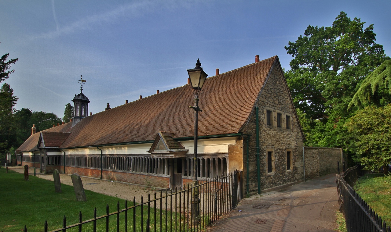
Abingdon Abbey ( '' " St Mary's Abbey " '' ) was a Benedictine monastery located in the centre of Abingdon-on-Thames beside the River Thames. The abbey was founded c.675 AD in honour of The Virgin Mary. The Domesday Book of 1086 informs us that the abbey was a wealthy and powerful landowner : * There is nothing to see today of the abbey church. The existing buildings include : * Checker Hall ( Unicorn Theatre ). * The Checker. * The Long Gallery. * The Lower Hall. * Thames Street, the Mill and the Mill stream. Extant buildings There is nothing to see today of the abbey church. Apparent ruins in the Abbey Gardens are Trendell's Folly, built in the nineteenth century. Some of the stones may come from St Helen's Church. Associated monastic buildings do, however, survive, including the Abbey Exchequer, the timber-framed Long Gallery, the Abbey bakehouse, (all in the care of the Friends of Abingdon Civic Society) the Abbey gateway, St John's hospitium ( pilg ... [...More Info...] [...Related Items...] OR: [Wikipedia] [Google] [Baidu] |
Nag's Head Island
Nag's Head Island is an island in the River Thames in England at Abingdon. It sits in the middle of the two Abingdon Bridges on the reach above Culham Lock. The part of the island on the upstream side of the bridge is occupied by the Nag's Head public house, which gave the island its name, a nag being a useless horse. From the top of the island here a daily river boat service to runs to Oxford. The frontage downstream of the bridge is occupied by a riverside cafe, chandlers and navigation stores, and boat hire facilities. Behind this is an extensive public open space. See also *Islands in the River Thames This article lists the islands in the River Thames, or at the mouth of a tributary (marked †), in England. It excludes human-made islands built as part of the building of forty-five two-gate locks which each accompany a weir, and islets subordi ... References Islands of Oxfordshire Islands of the River Thames {{Oxfordshire-geo-stub ... [...More Info...] [...Related Items...] OR: [Wikipedia] [Google] [Baidu] |
River Ock
The River Ock is a small English river which is a tributary of the River Thames. It has as its catchment area the Vale of White Horse, a low-lying and wide valley in south Oxfordshire, and flows into the River Thames, at Abingdon on the reach above Culham Lock. Course The River Ock rises near the village of Little Coxwell. It collects tributaries from each village along the base of the White Horse Hills, where springs emanating from the chalk hills allowed settlements to flourish in former times. Among these tributaries is the Osse Stream, rising in Cumnor. From Little Coxwell, the Ock runs around Longcot and flows past Stanford in the Vale, where it is about wide. The name of Stanford comes from ''stony ford'', possibly alluding to the Ock crossing at Stanford Mill. Thence it runs past Charney Bassett, Lyford, Garford and Marcham Mill, before losing its identity and its waters to the Thames at Abingdon by the old Hygienic Laundry building. An iron bridge crosses at the ... [...More Info...] [...Related Items...] OR: [Wikipedia] [Google] [Baidu] |
Abingdon, Oxfordshire
Abingdon-on-Thames ( ), commonly known as Abingdon, is a historic market town and civil parish in the ceremonial county of Oxfordshire, England, on the River Thames. Historically the county town of Berkshire, since 1974 Abingdon has been administered by the Vale of White Horse district within Oxfordshire. The area was occupied from the early to middle Iron Age and the remains of a late Iron Age and Roman defensive enclosure lies below the town centre. Abingdon Abbey was founded around 676, giving its name to the emerging town. In the 13th and 14th centuries, Abingdon was an agricultural centre with an extensive trade in wool, alongside weaving and the manufacture of clothing. Charters for the holding of markets and fairs were granted by various monarchs, from Edward I to George II. The town survived the dissolution of the abbey in 1538, and by the 18th and 19th centuries, with the building of Abingdon Lock in 1790, and Wilts & Berks Canal in 1810, was a key link between ... [...More Info...] [...Related Items...] OR: [Wikipedia] [Google] [Baidu] |
Abingdon Bridge
Abingdon Bridge crosses the River Thames at the town of Abingdon, Oxfordshire, England. It carries the A415 road from Abingdon to Dorchester, Oxfordshire, over the reach of the Thames between Culham Lock and Abingdon Lock. The bridge is actually two bridges, linked by Nag's Head Island. Abingdon Bridge is the northern part towards the town which has six arches and crosses the backwater and mill stream. The southern part is technically called Burford Bridge and has one main arch and four minor arches at the river and two minor arches on the floodplain. This crosses the main navigation channel. Furthermore, to complete the Thames crossing, Culham Bridge crossing the Swift Ditch should also be considered as an extension. History Abingdon Bridge was begun in 1416 and completed in 1422, using local limestone quarried at Besselsleigh and Dry Sandford. The bridge was funded by Abingdon's religious guild, the Fraternity of the Holy Cross, and chiefly by two of the guild's member ... [...More Info...] [...Related Items...] OR: [Wikipedia] [Google] [Baidu] |


