|
Clayton, Denver
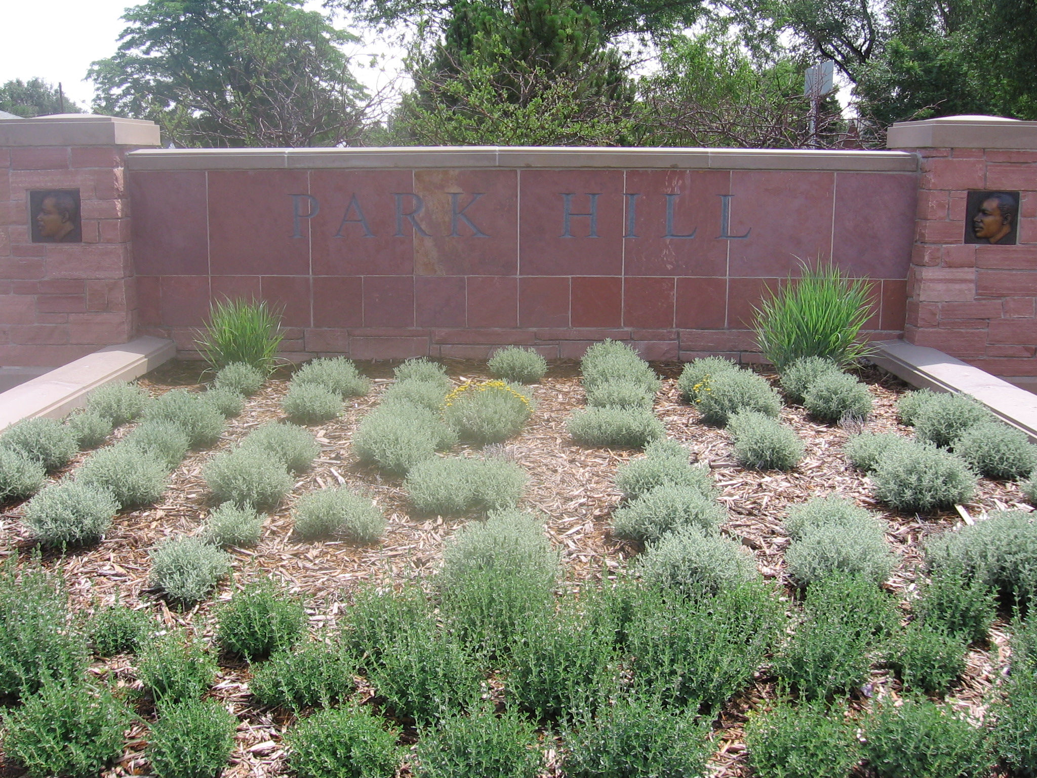
Clayton is a neighborhood located in the city and county Denver, Colorado. Often confused with Park Hill, Cole, or the City Park neighborhoods, Clayton is a distinct neighborhood as defined by the city of Denver. The neighborhood is named for the historical former George W. Clayton Trust and College located on the northwest corner of Martin Luther King Blvd. and Colorado Blvd. This college has been listed on the National Register of Historic Places. Geography Clayton is bounded by York Street on the west, Colorado Blvd. on the east, Martin Luther King Blvd on the south and 40th Avenue on the north. Landmarks and parks * George W. Clayton Trust and College (former): Located on the northwest corner of Martin Luther King Blvd. and Colorado Blvd. This former college has been listed on the National Register of Historic Places. * Denver Medical Depot: Located at 3800 York St. Also listed on the National Register of Historic Places. * The City of Nairobi Park: Located at East 36th Aven ... [...More Info...] [...Related Items...] OR: [Wikipedia] [Google] [Baidu] |
Neighborhood
A neighbourhood (British English, Irish English, Australian English and Canadian English) or neighborhood (American English; see spelling differences) is a geographically localised community within a larger city, town, suburb or rural area, sometimes consisting of a single street and the buildings lining it. Neighbourhoods are often social communities with considerable face-to-face interaction among members. Researchers have not agreed on an exact definition, but the following may serve as a starting point: "Neighbourhood is generally defined spatially as a specific geographic area and functionally as a set of social networks. Neighbourhoods, then, are the spatial units in which face-to-face social interactions occur—the personal settings and situations where residents seek to realise common values, socialise youth, and maintain effective social control." Preindustrial cities In the words of the urban scholar Lewis Mumford, "Neighbourhoods, in some annoying, inchoate fashi ... [...More Info...] [...Related Items...] OR: [Wikipedia] [Google] [Baidu] |
Denver
Denver () is a consolidated city and county, the capital, and most populous city of the U.S. state of Colorado. Its population was 715,522 at the 2020 census, a 19.22% increase since 2010. It is the 19th-most populous city in the United States and the fifth most populous state capital. It is the principal city of the Denver–Aurora–Lakewood, CO Metropolitan Statistical Area and the first city of the Front Range Urban Corridor. Denver is located in the Western United States, in the South Platte River Valley on the western edge of the High Plains just east of the Front Range of the Rocky Mountains. Its downtown district is immediately east of the confluence of Cherry Creek and the South Platte River, approximately east of the foothills of the Rocky Mountains. It is named after James W. Denver, a governor of the Kansas Territory. It is nicknamed the ''Mile High City'' because its official elevation is exactly one mile () above sea level. The 105th meridian we ... [...More Info...] [...Related Items...] OR: [Wikipedia] [Google] [Baidu] |
Colorado
Colorado (, other variants) is a state in the Mountain West subregion of the Western United States. It encompasses most of the Southern Rocky Mountains, as well as the northeastern portion of the Colorado Plateau and the western edge of the Great Plains. Colorado is the eighth most extensive and 21st most populous U.S. state. The 2020 United States census enumerated the population of Colorado at 5,773,714, an increase of 14.80% since the 2010 United States census. The region has been inhabited by Native Americans and their ancestors for at least 13,500 years and possibly much longer. The eastern edge of the Rocky Mountains was a major migration route for early peoples who spread throughout the Americas. "''Colorado''" is the Spanish adjective meaning "ruddy", the color of the Fountain Formation outcroppings found up and down the Front Range of the Rocky Mountains. The Territory of Colorado was organized on February 28, 1861, and on August 1, 1876, U.S. President Ulyss ... [...More Info...] [...Related Items...] OR: [Wikipedia] [Google] [Baidu] |
Park Hill, Denver
Park Hill is a neighborhood in Denver, Colorado, U.S. Located in the northeastern quadrant of the city, it is bordered by Colorado Boulevard on the west, East Colfax Avenue on the south, Quebec Street on the east, and East 52nd Avenue on the north. The entire Park Hill neighborhood is located in the area known as East Denver. It is further divided by the City and County of Denver into three administrative neighborhoods, South Park Hill, North Park Hill, and Northeast Park Hill. History In 1887, Baron Alois von Winckler platted the original Park Hill development on of land he owned east of City Park. This development was bordered by present-day Montview Boulevard on the south, Colorado Boulevard on the west, East 26th Avenue on the north, and Dahlia Street on the east, placing it in what is now the western portion of South Park Hill. The first homes in Park Hill were offered for sale in 1900. As the neighborhood grew, settlers from many nations, including England, Denmark, Germ ... [...More Info...] [...Related Items...] OR: [Wikipedia] [Google] [Baidu] |
Cole, Denver
Cole is a neighborhood of Denver, Colorado. It is in the area commonly known as North Denver. According to the Piton Foundation in 2007 the population of the neighborhood was 6,041, and there were 1,794 housing units. At the time of the 2010 census, the racial breakdown of the neighborhood was 19.59% non-Hispanic white, 16.7% African American, 61.21% Hispanic or Latino, 0.43% Native American, and 0.45% Asian Asian may refer to: * Items from or related to the continent of Asia: ** Asian people, people in or descending from Asia ** Asian culture, the culture of the people from Asia ** Asian cuisine, food based on the style of food of the people from Asi .... Boundaries The shape of the neighborhood is like that of a square with the northwest corner cut off. The neighborhood is bordered on the west by Downing Street, on the northwest by Walnut Street, on the north by 40th Avenue, on the east by York Street, and on the south by Martin Luther King Jr. Blvd. (32nd Avenue). Landmarks ... [...More Info...] [...Related Items...] OR: [Wikipedia] [Google] [Baidu] |
George W
George Walker Bush (born July 6, 1946) is an American politician who served as the 43rd president of the United States from 2001 to 2009. A member of the Republican Party, Bush family, and son of the 41st president George H. W. Bush, he previously served as the 46th governor of Texas from 1995 to 2000. While in his twenties, Bush flew warplanes in the Texas Air National Guard. After graduating from Harvard Business School in 1975, he worked in the oil industry. In 1978, Bush unsuccessfully ran for the House of Representatives. He later co-owned the Texas Rangers of Major League Baseball before he was elected governor of Texas in 1994. As governor, Bush successfully sponsored legislation for tort reform, increased education funding, set higher standards for schools, and reformed the criminal justice system. He also helped make Texas the leading producer of wind powered electricity in the nation. In the 2000 presidential election, Bush defeated Democratic incum ... [...More Info...] [...Related Items...] OR: [Wikipedia] [Google] [Baidu] |
National Register Of Historic Places Listings In Northeast Denver, Colorado
__NOTOC__ This is a list of the National Register of Historic Places listings in Northeast Denver, Colorado. This is intended to be a complete list of the properties and districts on the National Register of Historic Places in northeastern Denver, Colorado, United States. Northeast Denver is defined as being all of the city east of the Platte River north of Sixth Avenue, excluding the downtown neighborhoods of Capitol Hill, Central Business District, Civic Center, Five Points, North Capitol Hill, and Union Station. The locations of National Register properties and districts may be seen in an online map. There are 300 properties and districts listed on the National Register in Denver. Northeast Denver includes 72 of these properties and districts, including 4 that extend into other regions; the city's remaining properties and districts are listed elsewhere. Another property in Northeast Denver was listed but has been removed. Current listings ... [...More Info...] [...Related Items...] OR: [Wikipedia] [Google] [Baidu] |
Nairobi
Nairobi ( ) is the capital and largest city of Kenya. The name is derived from the Maasai phrase ''Enkare Nairobi'', which translates to "place of cool waters", a reference to the Nairobi River which flows through the city. The city proper had a population of 4,397,073 in the 2019 census, while the metropolitan area has a projected population in 2022 of 10.8 million. The city is commonly referred to as the Green City in the Sun. Nairobi was founded in 1899 by colonial authorities in British East Africa, as a rail depot on the Uganda - Kenya Railway.Roger S. Greenway, Timothy M. Monsma, ''Cities: missions' new frontier'', (Baker Book House: 1989), p.163. The town quickly grew to replace Mombasa as the capital of Kenya in 1907. After independence in 1963, Nairobi became the capital of the Republic of Kenya. During Kenya's colonial period, the city became a centre for the colony's coffee, tea and sisal industry. The city lies in the south central part of Kenya, at an elevation ... [...More Info...] [...Related Items...] OR: [Wikipedia] [Google] [Baidu] |
Kenya
) , national_anthem = "Ee Mungu Nguvu Yetu"() , image_map = , map_caption = , image_map2 = , capital = Nairobi , coordinates = , largest_city = Nairobi , official_languages = Constitution (2009) Art. 7 ational, official and other languages"(1) The national language of the Republic is Swahili. (2) The official languages of the Republic are Swahili and English. (3) The State shall–-–- (a) promote and protect the diversity of language of the people of Kenya; and (b) promote the development and use of indigenous languages, Kenyan Sign language, Braille and other communication formats and technologies accessible to persons with disabilities." , languages_type = National language , languages = Swahili , ethnic_groups = , ethnic_groups_year = 2019 census , religion = , religion_year = 2019 census , demonym = ... [...More Info...] [...Related Items...] OR: [Wikipedia] [Google] [Baidu] |

%2C_the_Indian_territories.jpg)


