|
Chevy Chase (Washington, D.C.)
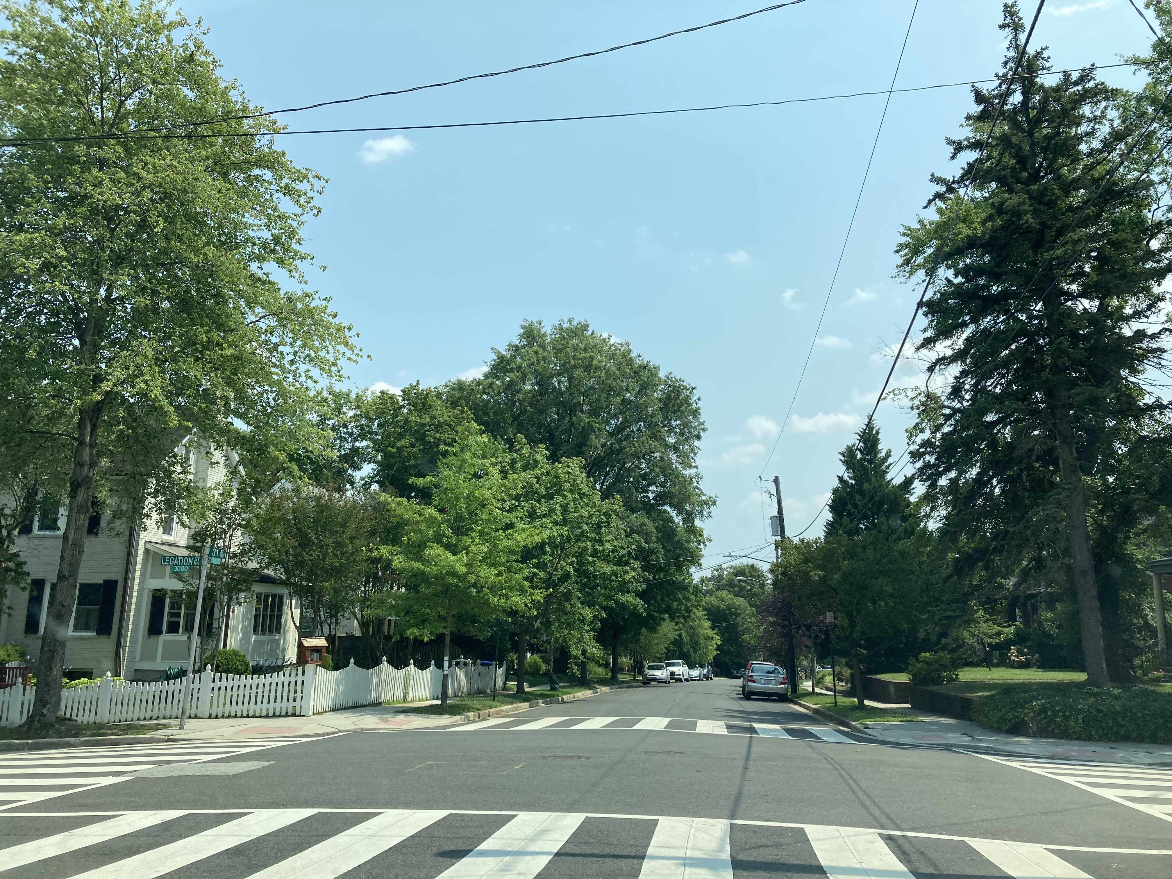
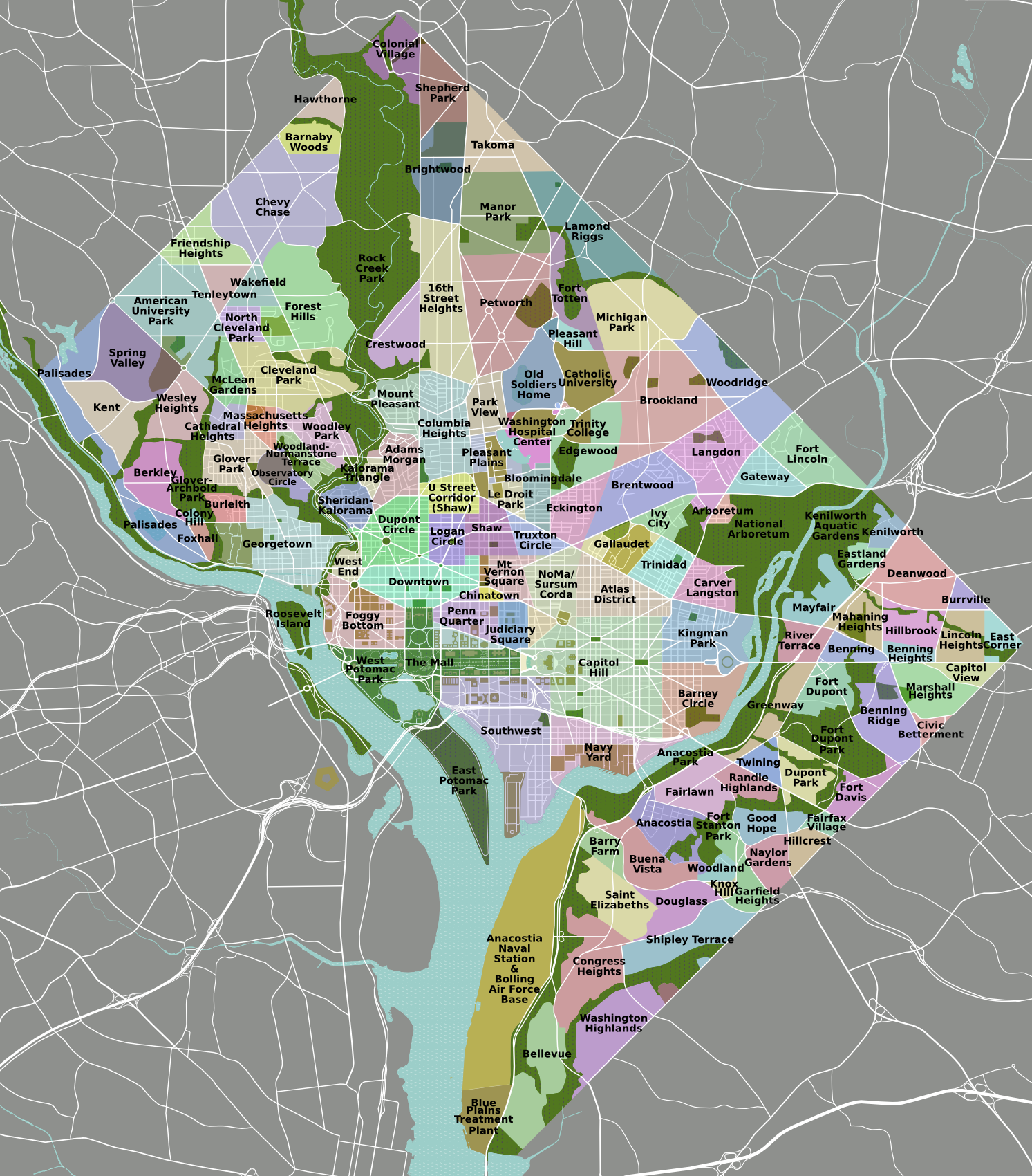
Chevy Chase () is a neighborhood in northwest Washington, D.C. It borders Chevy Chase, Maryland, a collection of similarly affluent neighborhoods. Geography The neighborhood is generally agreed to be bounded by Rock Creek Park on the east, Western Avenue (which divides D.C. and Maryland) and Tennyson Street on the north, and, to the west, Reno Road and the Friendship Heights neighborhood. Opinions differ on the southern boundary, where Chevy Chase meets Forest Hills, but many residents consider it to be Broad Branch Road between 32nd and 27th streets. The main roads leading in and out of Chevy Chase, D.C. are Connecticut Avenue, Nebraska Avenue, Reno Road, Military Road and Western Avenue. The area is served by the M4, L1, L2, L8, E2, E4 and E6 Metrobus lines. Chevy Chase is within walking distance of three Red Line stations: Van Ness-UDC, Tenleytown-AU, and Friendship Heights. The public schools that serve Chevy Chase are Lafayette Elementary, Ben W. Murch Elementary, Alice ... [...More Info...] [...Related Items...] OR: [Wikipedia] [Google] [Baidu] |
List Of Neighborhoods Of The District Of Columbia By Ward
Neighbourhood, Neighborhoods in Washington, D.C., are distinguished by their history, culture, architecture, demographics, and geography. The names of 131 neighborhoods are unofficially defined by the D.C. Office of Planning. Neighborhoods can be defined by the boundaries of wards, historic districts, Advisory Neighborhood Commissions, civic associations, and business improvement districts (BIDs); these boundaries will overlap. The eight wards each elect a member to the Council of the District of Columbia and are redistricted every ten years. As the capital of the United States, Washington's local neighborhood history and culture is often presented as being distinct from that of the national government. List of neighborhoods by ward Ward 1 :Council of the District of Columbia, Ward 1 Councilmember: Brianne Nadeau :Population (2021): 91,673 *Adams Morgan *Columbia Heights (Washington, D.C.), Columbia Heights *Howard University *Kalorama, Washington, D.C., Kalorama *LeDroit P ... [...More Info...] [...Related Items...] OR: [Wikipedia] [Google] [Baidu] |
Advisory Neighborhood Commission
Advisory Neighborhood Commissions are bodies of local government in District of Columbia, in the United States. The ANC system was created in 1974 through a District referendum (73 percent voted "yes") in the District of Columbia Home Rule Act. The first elections for Advisory Neighborhood Commissioners were held in the fall of 1975, and commissions began operating in 1976. Congressman Don Fraser (D-Minn) and DC resident Milton Kotler helped to draft the ANC language in the District of Columbia Home Rule Act based on the success of Adams Morgan Organization (AMO) in Adams Morgan and on a 1970 report of the Minneapolis Citizen League, as well as on related neighborhood corporations in Pittsburgh, Brooklyn, Chicago and Columbus, Ohio. ANCs consider a wide range of policies and programs affecting their neighborhoods, including traffic, parking, recreation, street improvements, liquor licenses, zoning, economic development, police protection, sanitation and trash collection, and the ... [...More Info...] [...Related Items...] OR: [Wikipedia] [Google] [Baidu] |
Gerrymandering
In representative democracies, gerrymandering (, originally ) is the political manipulation of electoral district boundaries with the intent to create undue advantage for a party, group, or socioeconomic class within the constituency. The manipulation may involve "cracking" (diluting the voting power of the opposing party's supporters across many districts) or "packing" (concentrating the opposing party's voting power in one district to reduce their voting power in other districts). Gerrymandering can also be used to protect incumbents. Wayne Dawkins describes it as politicians picking their voters instead of voters picking their politicians. The term ''gerrymandering'' is named after American politician Elbridge Gerry, Vice President of the United States at the time of his death, who, as governor of Massachusetts in 1812, signed a bill that created a partisan district in the Boston area that was compared to the shape of a mythological salamander. The term has negative con ... [...More Info...] [...Related Items...] OR: [Wikipedia] [Google] [Baidu] |
Council Of The District Of Columbia
The Council of the District of Columbia is the legislative branch of the local government of the District of Columbia, the capital of the United States. As permitted in the United States Constitution, the district is not part of any U.S. state and is overseen directly by the federal government. Since 1975, the United States Congress has devolved to the Council certain powers that are typically exercised by city councils elsewhere in the country, as well as many powers normally held by state legislatures. However, the Constitution vests Congress with ultimate authority over the federal district, and therefore all acts of the council are subject to congressional review. They may be overturned by Congress and the president. Congress also has the power to legislate for the district and even revoke the home rule charter altogether. The council meets in the John A. Wilson Building in downtown Washington. History Under the Constitution, Congress has the power to legislate for the d ... [...More Info...] [...Related Items...] OR: [Wikipedia] [Google] [Baidu] |
Sears Catalog Home
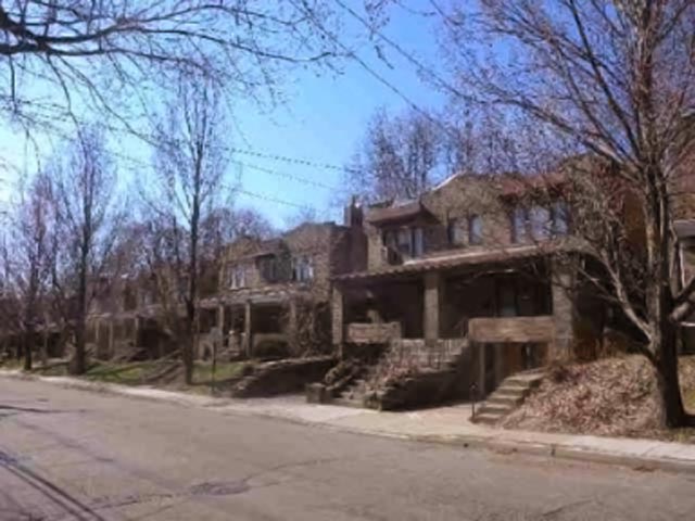
Sears Modern Homes were catalog and kit houses sold primarily through mail order by Sears, Roebuck and Co., an American retailer. From 1908 to 1942, Sears sold more than 70,000 of these houses in North America, by the company's count. Sears Modern Homes were purchased primarily by customers in East Coast and Midwest states, but have been located as far south as Florida, as far west as California, and as far north as Alaska and Canada. No comprehensive list of their locations exists. Sears Modern Homes offered more than 370 designs in a wide range of architectural styles and sizes over the line's 34-year history. Many included the latest technology available to house buyers in the early part of the twentieth century, such as central heating, indoor plumbing, and electricity. Primarily shipped via railroad boxcars, these kits included most of the materials needed to build a house. Once delivered, many of these houses were assembled by the new homeowner, relatives, friends and ... [...More Info...] [...Related Items...] OR: [Wikipedia] [Google] [Baidu] |
Chevy Chase Line
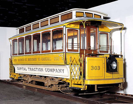
The Capital Traction Company was the smaller of the two major street railway companies in Washington, D.C., in the early 20th century. It was formed in 1895 through a merger of the Rock Creek Railway and the Washington and Georgetown Railroad Company. The company's streetcars connected the Washington, D.C., neighborhoods of Georgetown, Capitol Hill, the Armory, and Mount Pleasant; and the suburb of Chevy Chase, Maryland. In 1933, it merged with its major competitor, the Washington Railway and Electric Company, to form the Capital Transit Company. Origins In the mid-1890s, numerous streetcar companies operated in the District. Congress tried to deal with this fractured transit system by requiring them to accept transfers and set standard pricing, and by allowing them to use one another's track. But eventually it became clear that consolidation was the best solution. On March 1, 1895, Congress authorized the Rock Creek Railway to purchase and merge with any connecting company, ... [...More Info...] [...Related Items...] OR: [Wikipedia] [Google] [Baidu] |
The Chevy Chase Land Company
The Chevy Chase Land Company is a real estate holding and development company based in suburban Washington, D.C. Founded in 1890 by Francis G. Newlands to develop all-white residential suburbs, it continues to operate today as a privately held firm. Among the company's developments are the Village of Chevy Chase, the Town of Chevy Chase, and the D.C. neighborhood of Chevy Chase. History 19th century Around 1886 or 1887, Newlands launched an all-but-unprecedented effort to create a major streetcar suburb of Washington, D.C. Using his inheritance from his deceased wife's father, and attracting other investment partners—particularly Nevada politicians known as the "California Syndicate"—Newlands directed the quiet purchase of land along a straight line from just north of Dupont Circle, which was at the time the northwestern edge of urban development, into an unincorporated area of Maryland's Montgomery County and up to today's Jones Bridge Road. Newlands initially inte ... [...More Info...] [...Related Items...] OR: [Wikipedia] [Google] [Baidu] |
Washington Streetcars
Streetcars in Washington, D.C. transported people across the city and region from 1862 until 1962. The first streetcars in Washington, D.C., were drawn by horse car, horses and carried people short distances on flat terrain; but the introduction of cleaner and faster electric streetcars, capable of climbing steeper inclines, opened up the hilly suburbs north of the old city and in Anacostia. Several of the district's streetcar lines were extended into Maryland, and two Virginia lines crossed into the district. The city experimented briefly with cable car (railway), cable cars, but by the beginning of the 20th century, the streetcar system was fully electrified. By 1901, a series of mergers dubbed the "Great Streetcar Consolidation" gathered most local transit firms into two major companies. In 1933, a second consolidation brought all streetcars under one company, Capital Transit. Over the next decades, the streetcar system shrank amid the rising popularity of the automobile a ... [...More Info...] [...Related Items...] OR: [Wikipedia] [Google] [Baidu] |
Streetcar Suburb
A streetcar suburb is a residential community whose growth and development was strongly shaped by the use of streetcar lines as a primary means of transportation. Such suburbs developed in the United States in the years before the automobile, when the introduction of the electric trolley or streetcar allowed the nation’s burgeoning middle class to move beyond the central city’s borders. Early suburbs were served by horsecars, but by the late 19th century cable cars and electric streetcars, or trams, were used, allowing residences to be built farther away from the urban core of a city. Streetcar suburbs, usually called additions or extensions at the time, were the forerunner of today's suburbs in the United States and Canada. San Francisco's Western Addition is one of the best examples of streetcar suburbs before westward and southward expansion occurred. Although most closely associated with the electric streetcar, the term can be used for any suburb originally built with stre ... [...More Info...] [...Related Items...] OR: [Wikipedia] [Google] [Baidu] |
Montgomery County, Maryland
Montgomery County is the most populous county in the state of Maryland. As of the 2020 census, the county's population was 1,062,061, increasing by 9.3% from 2010. The county seat and largest municipality is Rockville, although the census-designated place of Germantown is the most populous place within the county. Montgomery County, which adjoins Washington, D.C., is part of the Washington–Arlington–Alexandria, DC–VA–MD–WV metropolitan statistical area, which in turn forms part of the Baltimore–Washington combined statistical area. Most of the county's residents live in unincorporated locales, of which the most urban are Silver Spring and Bethesda, although the incorporated cities of Rockville and Gaithersburg are also large population centers, as are many smaller but significant places. The average household income in Montgomery County is among the highest in the United States. It has the highest percentage (29.2%) of residents over 25 years of age who hold po ... [...More Info...] [...Related Items...] OR: [Wikipedia] [Google] [Baidu] |
Nevada
Nevada ( ; ) is a U.S. state, state in the Western United States, Western region of the United States. It is bordered by Oregon to the northwest, Idaho to the northeast, California to the west, Arizona to the southeast, and Utah to the east. Nevada is the List of U.S. states and territories by area, 7th-most extensive, the List of U.S. states and territories by population, 32nd-most populous, and the List of U.S. states and territories by population density, 9th-least densely populated of the U.S. states. Nearly three-quarters of Nevada's people live in Clark County, Nevada, Clark County, which contains the Las Vegas–Paradise, NV MSA, Las Vegas–Paradise metropolitan area, including three of the state's four largest incorporated cities. Nevada's capital is Carson City, Nevada, Carson City. Las Vegas is the largest city in the state. Nevada is officially known as the "Silver State" because of the importance of silver to its history and economy. It is also known as the "Battle ... [...More Info...] [...Related Items...] OR: [Wikipedia] [Google] [Baidu] |


.png)
.png)