|
Charlotte Murchison
Charlotte Murchison (''née'' Hugonin; 18 April 1788 – 9 February 1869) was a British geologist born in Hampshire, England. She was married to the nineteenth-century geologist Roderick Impey Murchison. Several times during her life, the couple travelled throughout continental Europe, visiting places such as France, the Alps, and Italy. She also created numerous sketches of geological features, such as cliffs and fossils, in England during their numerous excursions throughout the country, including the Yorkshire coast in 1826. Charlotte built a significant collection of fossils during the Murchisons’ travels, as well as studying and drawing as a lifelong pursuit. Applying what she had been taught by the painter Paul Sandby, she created geological sketches of important features. With many of her sketches, she often did not focus on the geological features in detail, but instead created a more emotive illustration of the landscape. Through her work, she also helped her husban ... [...More Info...] [...Related Items...] OR: [Wikipedia] [Google] [Baidu] |
Petersfield, Hampshire
Petersfield is a market town and civil parish in the East Hampshire district of Hampshire, England. It is north of Portsmouth. The town has its own railway station on the Portsmouth Direct line, the mainline rail link connecting Portsmouth and London. Situated below the northern slopes of the South Downs, Petersfield lies wholly within the South Downs National Park. The town is on the crossroads of well-used north–south (formerly the A3 road which now bypasses the town) and east–west routes (today the A272 road) and it grew as a coach stop on the Portsmouth to London route. Petersfield is twinned with Barentin in France, and Warendorf in Germany. History Petersfield Heath's burial mounds may be up to 4,000 years old; their distribution is mainly to the east and south east of the Heath. These are considered to be one of the more important lowland barrow groups in this country. The barrows indicate that the area of the Heath was occupied by people who may have come to reg ... [...More Info...] [...Related Items...] OR: [Wikipedia] [Google] [Baidu] |
William Buckland
William Buckland Doctor of Divinity, DD, Royal Society, FRS (12 March 1784 – 14 August 1856) was an English theologian who became Dean of Westminster. He was also a geologist and paleontology, palaeontologist. Buckland wrote the first full account of a fossil dinosaur, which he named ''Megalosaurus''. His work proved that Kirkdale Cave in North Yorkshire had been a prehistoric hyena den, for which he was awarded the Copley Medal. It was praised as an example of how scientific analysis could reconstruct distant events. He pioneered the use of fossilised Feces, faeces in reconstructing ecosystems, coining the term coprolites. Buckland followed the Gap creationism, Gap Theory in interpreting the biblical account of ''Genesis'' as two widely separated episodes of creation. It had emerged as a way to reconcile the scriptural account with discoveries in geology suggesting the earth was very old. Early in his career Buckland believed he had found evidence of the Deluge myth, biblic ... [...More Info...] [...Related Items...] OR: [Wikipedia] [Google] [Baidu] |
Nice
Nice ( , ; Niçard: , classical norm, or , nonstandard, ; it, Nizza ; lij, Nissa; grc, Νίκαια; la, Nicaea) is the prefecture of the Alpes-Maritimes department in France. The Nice agglomeration extends far beyond the administrative city limits, with a population of nearly 1 millionDemographia: World Urban Areas , Demographia.com, April 2016 on an area of . Located on the , the southeastern coast of France on the , at the foot of the |
Fréjus
Fréjus (; ) is a commune in the Var department in the Provence-Alpes-Côte d'Azur region in Southeastern France. In 2019, it had a population of 54,458. It neighbours Saint-Raphaël, effectively forming one urban agglomeration. The north of the commune forms part of the Massif de l'Esterel. On 2 December 1959, the Malpasset Dam, on the Reyran River above the city of Fréjus, ruptured, killing over 400 people. History The origins of Frejus probably lie with the Celto- Ligurian people who settled around the natural harbour of Aegytna. The remains of a defensive wall are still visible on Mont Auriasque and Cap Capelin. The Phocaeans of Marseille later established an outpost on the site. Foundation Frejus was strategically situated at an important crossroads formed by the Via Julia Augusta (which ran between Italy and the Rhône) and the Via Domitia. Although there are only few traces of a settlement at that time, it is known that the poet Cornelius Gallus was born there in 6 ... [...More Info...] [...Related Items...] OR: [Wikipedia] [Google] [Baidu] |
Limestone
Limestone ( calcium carbonate ) is a type of carbonate sedimentary rock which is the main source of the material lime. It is composed mostly of the minerals calcite and aragonite, which are different crystal forms of . Limestone forms when these minerals precipitate out of water containing dissolved calcium. This can take place through both biological and nonbiological processes, though biological processes, such as the accumulation of corals and shells in the sea, have likely been more important for the last 540 million years. Limestone often contains fossils which provide scientists with information on ancient environments and on the evolution of life. About 20% to 25% of sedimentary rock is carbonate rock, and most of this is limestone. The remaining carbonate rock is mostly dolomite, a closely related rock, which contains a high percentage of the mineral dolomite, . ''Magnesian limestone'' is an obsolete and poorly-defined term used variously for dolomite, for limes ... [...More Info...] [...Related Items...] OR: [Wikipedia] [Google] [Baidu] |
Lake
A lake is an area filled with water, localized in a basin, surrounded by land, and distinct from any river or other outlet that serves to feed or drain the lake. Lakes lie on land and are not part of the ocean, although, like the much larger oceans, they do form part of the Earth's water cycle. Lakes are distinct from lagoons, which are generally coastal parts of the ocean. Lakes are typically larger and deeper than ponds, which also lie on land, though there are no official or scientific definitions. Lakes can be contrasted with rivers or streams, which usually flow in a channel on land. Most lakes are fed and drained by rivers and streams. Natural lakes are generally found in mountainous areas, rift zones, and areas with ongoing glaciation. Other lakes are found in endorheic basins or along the courses of mature rivers, where a river channel has widened into a basin. Some parts of the world have many lakes formed by the chaotic drainage patterns left over from the la ... [...More Info...] [...Related Items...] OR: [Wikipedia] [Google] [Baidu] |
Aurillac
Aurillac (; oc, Orlhac ) is the prefecture of the Cantal department, in the Auvergne-Rhône-Alpes region of France. The inhabitants of the commune are known as ''Aurillacois'' or ''Aurillacoises''. Geography Aurillac is at above sea level and located at the foot of the Cantal mountains in a small Sedimentary basin. The city is built on the banks of the Jordanne, a tributary of the Cère. It is south of Paris and north of Toulouse. Aurillac was part of a former Auvergne province called Haute-Auvergne and is only away from the heart of the Auvergne Volcano Park. Access to the commune is by numerous roads including the D922 from Naucelles in the north, the D17 from Saint-Simon in the north-east, Route nationale N122 from Polminhac in the east which continues to Sansac-de-Marmiesse in the south-west, the D920 to Arpajon-sur-Cère in the south-east, and the D18 to Ytrac in the west. Aurillac station, in the centre of town, lies on the Figeac-Arvant railway. It has rail con ... [...More Info...] [...Related Items...] OR: [Wikipedia] [Google] [Baidu] |
Mont-Dore
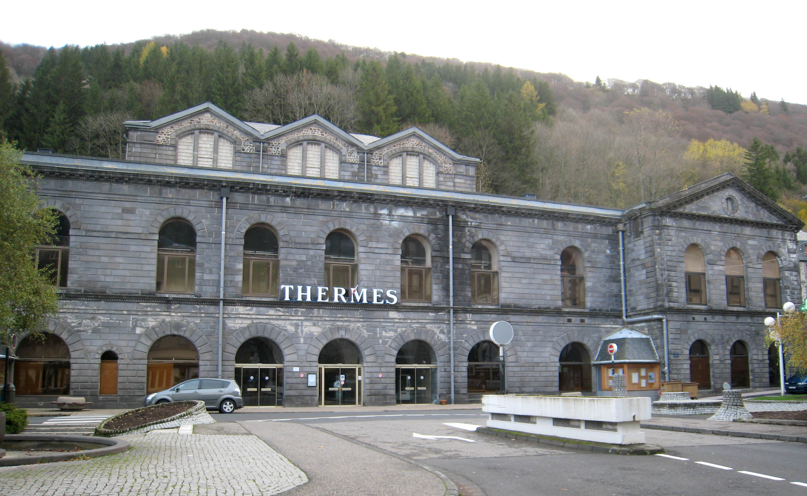
Mont-DoreCommune de Mont-Dore (63236) code officiel géographique, INSEE (; ''Mont Dòr'' in , and ''Mont-Dore-les-Bains''), in common usage ''Le Mont-Dore'', is a in the department in Auvergne-Rhône-Alpes [...More Info...] [...Related Items...] OR: [Wikipedia] [Google] [Baidu] |
Clermont-Ferrand
Clermont-Ferrand (, ; ; oc, label=Auvergnat (dialect), Auvergnat, Clarmont-Ferrand or Clharmou ; la, Augustonemetum) is a city and Communes of France, commune of France, in the Auvergne-Rhône-Alpes regions of France, region, with a population of 146,734 (2018). Its metropolitan area (''aire d'attraction'') had 504,157 inhabitants at the 2018 census.Comparateur de territoire: Aire d'attraction des villes 2020 de Clermont-Ferrand (022), Unité urbaine 2020 de Clermont-Ferrand (63701), Commune de Clermont-Ferrand (63113) INSEE It is the Prefectures in France, prefecture (capital) of the Puy-de-Dôme departments of France, department. Olivier Bi ... [...More Info...] [...Related Items...] OR: [Wikipedia] [Google] [Baidu] |
Puy De Dôme
Puy de Dôme (, ; oc, label=Auvergnat, Puèi Domat or ) is a lava dome and one of the youngest volcanoes in the region of Massif Central in central France. This chain of volcanoes including numerous cinder cones, lava domes and maars is far from the edge of any tectonic plate. Puy de Dôme was created by a Peléan eruption, some 10,700 years ago. Puy de Dôme is approximately from Clermont-Ferrand. The Puy-de-Dôme is named after the volcano. History In pre-Christian Europe, Puy de Dôme served as an assembly place for spiritual ceremonies. Temples were built at the summit, including a Gallo-Roman temple of Mercury, the ruins of which were discovered in 1873. In 1648, Florin Périer, at the urging of Blaise Pascal, supported Evangelista Torricelli's theory that barometric observations were caused by the weight of air by measuring the height of a column of mercury at three elevations on Puy de Dôme. In 1875, a physics laboratory was built at the summit. Since 1956, ... [...More Info...] [...Related Items...] OR: [Wikipedia] [Google] [Baidu] |
Massif Central
The (; oc, Massís Central, ; literally ''"Central Massif"'') is a highland region in south-central France, consisting of mountains and plateaus. It covers about 15% of mainland France. Subject to volcanism that has subsided in the last 10,000 years, these central mountains are separated from the Alps by a deep north–south cleft created by the Rhône river and known in French as the ' (literally "Rhône furrow"). The region was a barrier to transport within France until the opening of the A75 motorway, which not only made north–south travel easier, but also opened access to the massif itself. Geography and geology The is an old massif, formed during the Variscan orogeny, consisting mostly of granitic and metamorphic rocks. It was powerfully raised and made to look geologically younger in the eastern section by the uplift of the Alps during the Paleogene period and in the southern section by the uplift of the Pyrenees. The massif thus presents a strongly asymmet ... [...More Info...] [...Related Items...] OR: [Wikipedia] [Google] [Baidu] |
British Association For The Advancement Of Science
The British Science Association (BSA) is a charity and learned society founded in 1831 to aid in the promotion and development of science. Until 2009 it was known as the British Association for the Advancement of Science (BA). The current Chief Executive is Katherine Mathieson. The BSA's mission is to get more people engaged in the field of science by coordinating, delivering, and overseeing different projects that are suited to achieve these goals. The BSA "envisions a society in which a diverse group of people can learn and apply the sciences in which they learn." and is managed by a professional staff located at their Head Office in the Wellcome Wolfson Building. The BSA offers a wide variety of activities and events that both recognize and encourage people to be involved in science. These include the British Science Festival, British Science Week, the CREST Awards, Huxley Summit, Media Fellowships Scheme, along with regional and local events. History Foundation The Asso ... [...More Info...] [...Related Items...] OR: [Wikipedia] [Google] [Baidu] |


