|
Cerro Tacarcuna
Cerro Tacarcuna is a mountain located in the Darién Province of Panama, very close to the Colombia–Panama border. With a height of above sea level, it is the highest point in the Serranía del Darién. Overview The tropical forests of Cerro Tacarcuna are recognized for their extremely high biodiversity and for presenting a large number of endemisms. They are protected by the Darién National Park and the Los Katíos National Park in Colombia and Panama respectively. According to Kuna mythology, this ethnic group considers that the Cerro Tacarcuna, or Dakarkunyala in the Tule language, is the original place of origin and that from there they spread throughout the Darién and the San Blas archipelago (Caribbean Sea, in Panama); the hill is 1,875 meters above sea level. References Tacarcuna ''Tacarcuna'' is a genus of plants in the Phyllanthaceae first described as a genus in 1989. It is native to Panama, Colombia, Venezuela, and Peru. It is apparently dioecious, with mal ... [...More Info...] [...Related Items...] OR: [Wikipedia] [Google] [Baidu] |
Panama
Panama ( , ; es, link=no, Panamá ), officially the Republic of Panama ( es, República de Panamá), is a transcontinental country spanning the southern part of North America and the northern part of South America. It is bordered by Costa Rica to the west, Colombia to the southeast, the Caribbean Sea to the north, and the Pacific Ocean to the south. Its capital and largest city is Panama City, whose metropolitan area is home to nearly half the country's million people. Panama was inhabited by indigenous tribes before Spanish colonists arrived in the 16th century. It broke away from Spain in 1821 and joined the Republic of Gran Colombia, a union of Nueva Granada, Ecuador, and Venezuela. After Gran Colombia dissolved in 1831, Panama and Nueva Granada eventually became the Republic of Colombia. With the backing of the United States, Panama seceded from Colombia in 1903, allowing the construction of the Panama Canal to be completed by the United States Army Corps of ... [...More Info...] [...Related Items...] OR: [Wikipedia] [Google] [Baidu] |
Darién Province
Darién (, , ) is a province in Panama whose capital city is La Palma. With an area of , it is located at the eastern end of the country and bordered to the north by the province of Panamá and the region of Kuna Yala. To the south, it is bordered by the Pacific Ocean and Colombia. To the east, it borders Colombia; to the west, it borders the Pacific Ocean and the province of Panama. The area surrounding the border with Colombia is known as the Darién Gap, a large swath of undeveloped swampland and forest. With no roads, it is the missing link of the Pan-American Highway. Place names The name originates from the language spoken by the Cueva, an Indigenous tribe destroyed by the white European conquistadors during the 16th century. The Tanela River, which flows toward Atrato, was Hispanicized to Darién; the region and its communities took the same name. Santa María la Antigua del Darién, the first city founded in Tierra Firme, also took its name from the river. Subseque ... [...More Info...] [...Related Items...] OR: [Wikipedia] [Google] [Baidu] |
Colombia–Panama Border
The Colombia–Panama border is the international boundary between Colombia and Panama. It also splits the Darién Gap, a break across the South American and North American continents. This large watershed, forest, and mountainous area is in the north-western portion of Colombia's Chocó Department and south-eastern portion of Panama's Darién Province. There is also a gap in the Pan-American Highway that begins in Turbo, Colombia, and ends in Yaviza, Panama, and is long. Road-building through this area is expensive and the environmental cost is high, and no political consensus in favour of road construction has emerged. Description The border starts in the north at Cabo Tiburón on the Caribbean Sea coast and proceeds overland to the south-west and then south-east via various peaks of the Serranía del Darién range as far as Alto Limón. It then proceeds south-westwards, except for a northwards Colombian protrusion in the vicinity of Cerro Pirre, terminating in the south o ... [...More Info...] [...Related Items...] OR: [Wikipedia] [Google] [Baidu] |
Serranía Del Darién
The Serranía del Darién is a small mountain range on the Colombia–Panama border, border between Colombia and Panamá in the area called the Darién Gap. It is located in the southeastern part of the Darién Province of Panamá and the northwestern part of the Chocó Department of Colombia. There are two major protected areas here: Darién National Park in Panamá and Los Katíos National Park in Colombia. Serranía del Darién range's average elevation above sea level is . These mountains have sparse settlements, with just two people living in every square kilometer. This lack of human settlements is reflected in the fact that the nearest town with a population of 50,000 is over 12 hours by road. Geological hazards The Serranía del Darién is notorious for strong earthquakes; on average earthquakes measuring between 6 and 7 occur here every 50 years. The area is also susceptible to floods and landslides, both of which have been classified as medium to high intensity hazards ... [...More Info...] [...Related Items...] OR: [Wikipedia] [Google] [Baidu] |
Darién National Park
Darién National Park ( es, Parque Nacional Darién) is a World Heritage Site in Panama. It is about 325 kilometers from Panama City, and is the most extensive of all national parks of Panama and is one of the most important world heritage sites in Central America. The Darién National Park is a natural bridge spanning North and South America. In 1972 an area of became part of the Alto Darién Protection Forest. In 1980 the area was declared a National Park. In 1983 an area of became a UNESCO biosphere reserve. The park covers . It is located in southernmost Panama in Darién province and its southern boundary extends along 90% of the Panama-Colombian border. It lies between the range, which parallels ... [...More Info...] [...Related Items...] OR: [Wikipedia] [Google] [Baidu] |
Los Katíos National Park
Los Katíos National Natural Park ( es, Parque Nacional Natural (PNN) Los Katíos) is a protected area located in northwest Colombia which covers about . The elevation ranges between . It is a part of the Darién Gap, a densely forested area shared by Panama and Colombia, and is contiguous with the Darién National Park in Panama. The Pan-American Highway, when completed as proposed, would pass near or through Los Katíos. The park was declared a UNESCO World Heritage Site in 1994 due to the extraordinary diversity of plant and animal species represented. The topography of the Los Katios National Park is diverse, with low hills, forests and wet plains comprising its total area. The two largest parts of the park are the Serranía del Darién mountains, which lie to the west, and the Atrato River floodplains in the east. The floodplains hold exceptionally fertile soil and consist of alluvial plains of two types. One consists of low-lying terraces that flood often and the ... [...More Info...] [...Related Items...] OR: [Wikipedia] [Google] [Baidu] |
Guna People
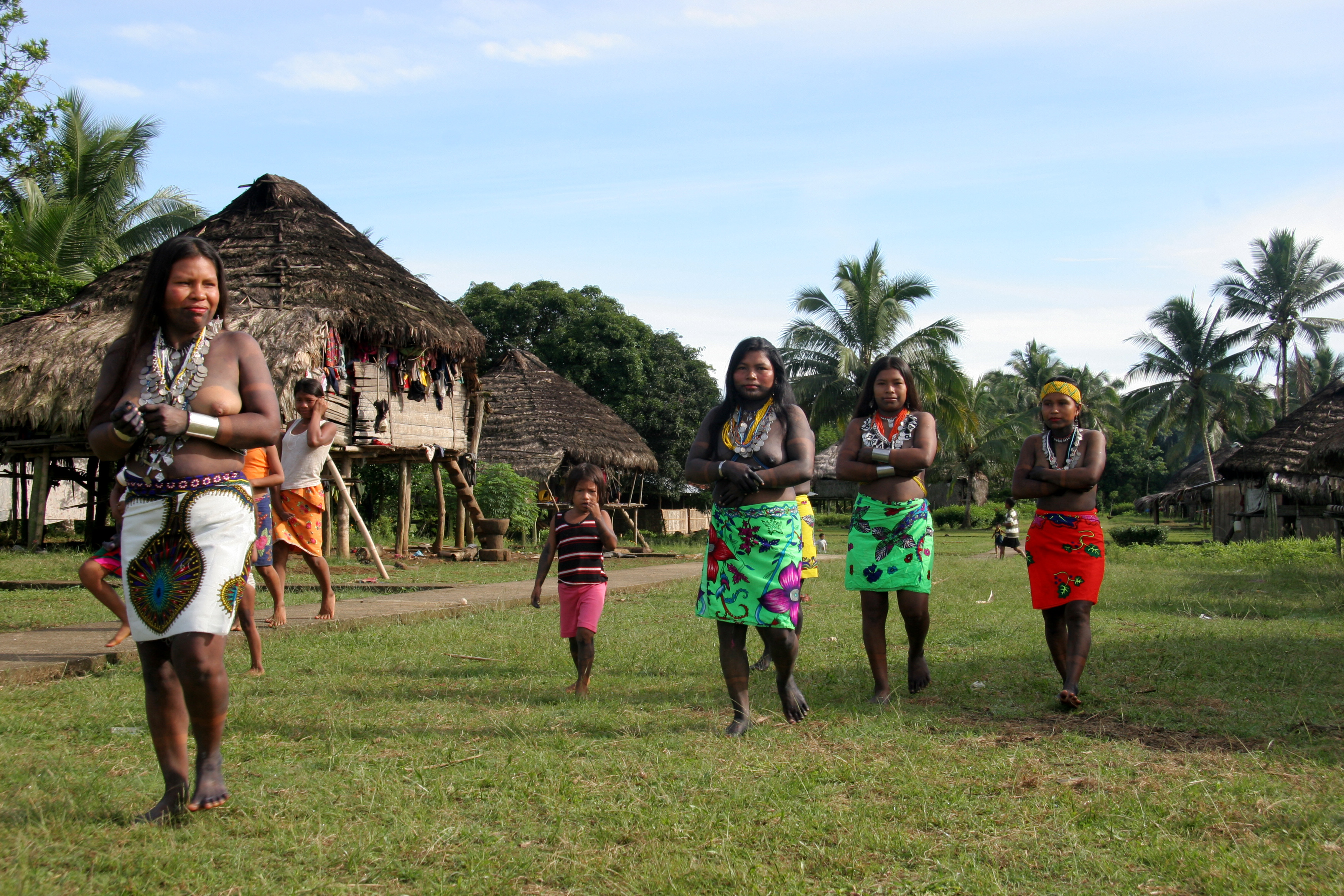
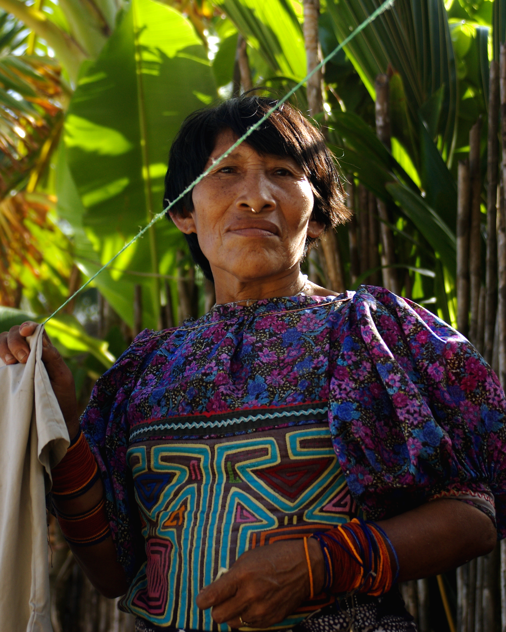
The Guna, are an Indigenous people of Panama and Colombia. In the Guna language, they call themselves ''Dule'' or ''Tule'', meaning "people", and the name of the language is ''Dulegaya'', literally "people-mouth". The term was in the language itself spelled ''Kuna'' prior to a 2010 orthographic reform, but the Congreso General de la Nación Gunadule since 2010 has promoted the spelling ''Guna''. Location Guna people live in three politically autonomous ''comarcas'' or autonomous reservations in Panama, and in a few small villages in Colombia. There are also communities of Guna people in Panama City, Colón, and other cities. Most Gunas live on small islands off the coast of the comarca of Guna Yala known as the San Blas Islands. The other two Guna comarcas in Panama are Kuna de Madugandí and Kuna de Wargandí. They are Guna-speaking people who once occupied the central region of what is now Panama and the neighboring San Blas Islands and still survive in marginal areas. ... [...More Info...] [...Related Items...] OR: [Wikipedia] [Google] [Baidu] |
Mountains Of Panama
A mountain is an elevated portion of the Earth's crust, generally with steep sides that show significant exposed bedrock. Although definitions vary, a mountain may differ from a plateau in having a limited summit area, and is usually higher than a hill, typically rising at least 300 metres (1,000 feet) above the surrounding land. A few mountains are isolated summits, but most occur in mountain ranges. Mountains are formed through tectonic forces, erosion, or volcanism, which act on time scales of up to tens of millions of years. Once mountain building ceases, mountains are slowly leveled through the action of weathering, through slumping and other forms of mass wasting, as well as through erosion by rivers and glaciers. High elevations on mountains produce colder climates than at sea level at similar latitude. These colder climates strongly affect the ecosystems of mountains: different elevations have different plants and animals. Because of the less hospitable terrain and ... [...More Info...] [...Related Items...] OR: [Wikipedia] [Google] [Baidu] |


.jpg)

