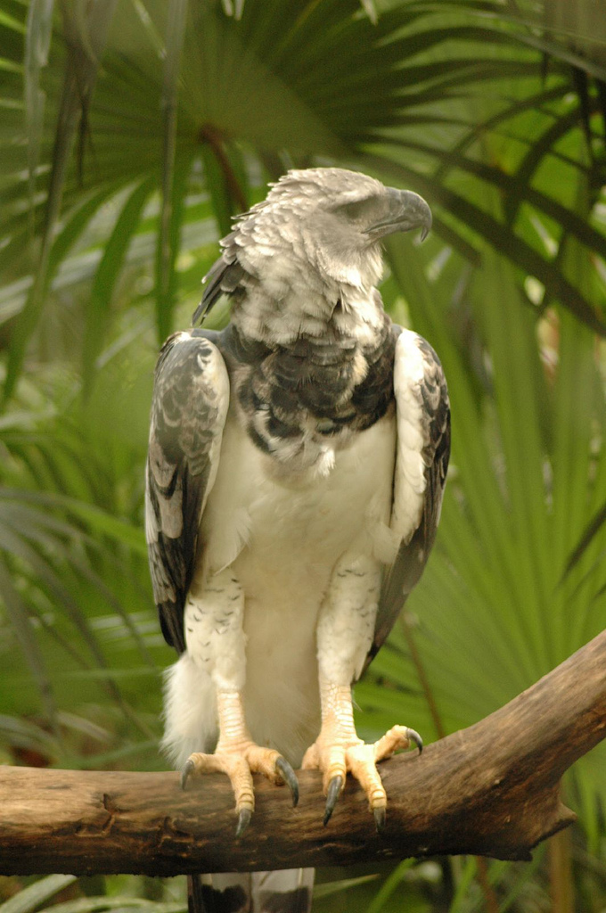
Darién National Park on:
[Wikipedia]
[Google]
[Amazon]
Darién National Park () is a
/ref>Official UNESCO website entry
/ref> The park covers .


World Heritage Site
World Heritage Sites are landmarks and areas with legal protection under an treaty, international treaty administered by UNESCO for having cultural, historical, or scientific significance. The sites are judged to contain "cultural and natural ...
in Panama
Panama, officially the Republic of Panama, is a country in Latin America at the southern end of Central America, bordering South America. It is bordered by Costa Rica to the west, Colombia to the southeast, the Caribbean Sea to the north, and ...
. It is about from Panama City
Panama City, also known as Panama, is the capital and largest city of Panama. It has a total population of 1,086,990, with over 2,100,000 in its metropolitan area. The city is located at the Pacific Ocean, Pacific entrance of the Panama Canal, i ...
, is the most extensive of all national parks of Panama, and is one of the most important World Heritage Sites in Central America.
Geography
The Darién National Park is a natural bridge spanning North and South America. It is located in southernmost Panama in Darién province and its southern boundary extends along 90 percent of theColombia–Panama border
The Colombia–Panama border is the international boundary between Colombia and Panama. It also splits the Darién Gap, a break across the North American and South American continents. This large watershed, forest, and mountainous area is in ...
. It lies between the Serranía del Darién
The Serranía del Darién is a small mountain range on the border between Colombia and Panama in the area called the Darién Gap. It is located in the southeastern part of the Darién Province of Panama and the northwestern part of the Chocó ...
range, which parallels the Caribbean Sea
The Caribbean Sea is a sea of the Atlantic Ocean, North Atlantic Ocean in the tropics of the Western Hemisphere, located south of the Gulf of Mexico and southwest of the Sargasso Sea. It is bounded by the Greater Antilles to the north from Cuba ...
to the north-east, and the Pacific Ocean coast. It is adjacent to the Los Katíos National Park in Colombia
Colombia, officially the Republic of Colombia, is a country primarily located in South America with Insular region of Colombia, insular regions in North America. The Colombian mainland is bordered by the Caribbean Sea to the north, Venezuel ...
.
In 1972, an area of became part of the Alto Darién Protection Forest. In 1980, the area was declared a national park. In 1983, an area of became a UNESCO biosphere reserve
A nature reserve (also known as a wildlife refuge, wildlife sanctuary, biosphere reserve or bioreserve, natural or nature preserve, or nature conservation area) is a protected area of importance for flora, fauna, funga, or features of geologic ...
.World Conservation Monitoring Centre/ref>Official UNESCO website entry
/ref> The park covers .
Environment
The Darien National Park has myriad habitats, ranging from rocky coastlines to sandy beaches to mangroves. The park also has expansive swamps and large areas of tropical forests. It is rich in biodiversity and contains numerous threatened species. It has been designated anImportant Bird Area
An Important Bird and Biodiversity Area (IBA) is an area identified using an internationally agreed set of criteria as being globally important for the conservation of bird populations.
IBA was developed and sites are identified by BirdLife Int ...
(IBA) by BirdLife International
BirdLife International is a global partnership of non-governmental organizations that strives to conserve birds and their habitats. BirdLife International's priorities include preventing extinction of bird species, identifying and safeguarding i ...
.
Indigenous inhabitants
The park is one of the few examples remaining in the world of a protected area inhabited by humans. Two native tribes dwell in the park.

Access
Due to its extreme isolation, the Darién National Park is not very accessible. There are, however, two places where the park is often visited. Santa Cruz de Cana (more simply known as Cana) is one of them. Set in the middle of the park near the eastern slope of Cerro Pirre, Cana is one of Panama's most incredible outdoor areas. It has been called one of the world's ten greatest bird watching spots. There are several trails and a ranger station there. The second point of access is Pirre Station. This is an ANAM ranger station set on the opposite side of Cerro Pirre. This area has primary forests and an abundance of wildlife, including several types of monkeys, sloths, and many bird species. There are several trails leading away from the ranger station that can be hiked. Travelers can stay in a basic dormitory at the ranger station. The park is notable for theDarién Gap
The Darién Gap (, , ) is a geographic region that connects the Americas, American continents, stretching across southern Panama's Darién Province and the northern portion of Colombia's Chocó Department. Consisting of a large drainage basin, ...
, the only break in the Pan-American Highway
The Pan-American Highway is a vast network of roads that stretches about 30,000 kilometers (about 19,000 miles) from Prudhoe Bay, Alaska, in the northernmost part of North America to Ushuaia, Argentina, at the southern tip of South America. I ...
on its intercontinental path from Argentina to Alaska.
References
---- {{DEFAULTSORT:Darien National Park National parks of Panama Darién Province Biosphere reserves of Panama Important Bird Areas of Panama World Heritage Sites in Panama Chocó–Darién moist forests