|
Carter Mountain
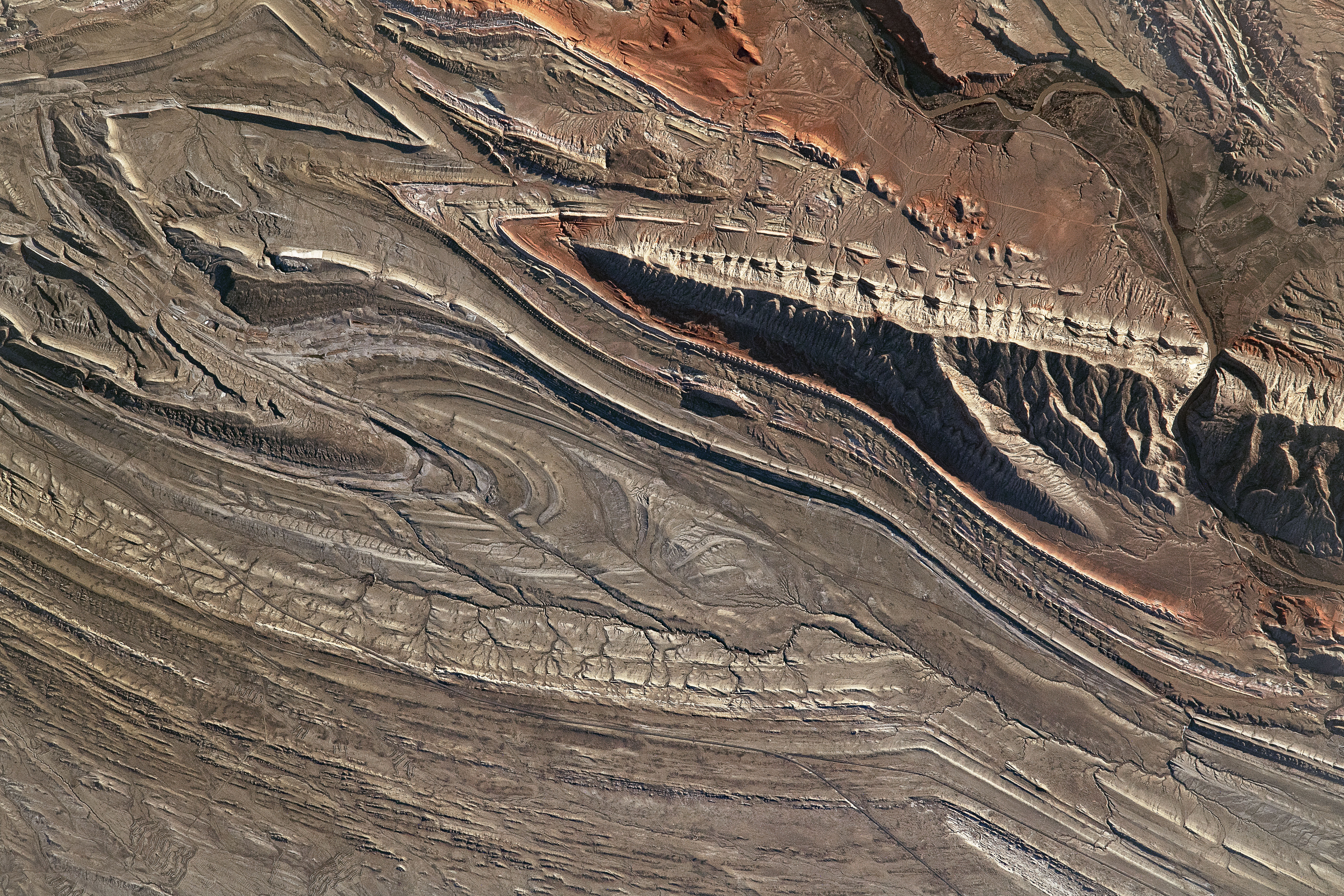
Carter Mountain () is in Shoshone National Forest in the U.S. state of Wyoming. Carter Mountain slopes gently up from the Bighorn Basin to the east but has steep cliffs on its western face. The region is well known for large herds of bighorn sheep, pronghorn and elk The elk (''Cervus canadensis''), also known as the wapiti, is one of the largest species within the deer family, Cervidae, and one of the largest terrestrial mammals in its native range of North America and Central and East Asia. The common .... References Shoshone National Forest Mountains of Park County, Wyoming {{Wyoming-geo-stub ... [...More Info...] [...Related Items...] OR: [Wikipedia] [Google] [Baidu] |
Park County, Wyoming
Park County is a county in the U.S. state of Wyoming. As of the 2020 United States Census, the population was 29,624. The county seat is Cody. Park County is a major tourism destination. The county has over 53 percent of Yellowstone National Park's land area. Many attractions abound, including the Buffalo Bill Historical Center, the Cody Stampede Rodeo, the Ghost Town of Kirwin, and the western museum Old Trail Town. History Wyoming gained separate territorial status in 1868. Before that, most of the state's area was included in either Laramie County (part of the Dakota Territory) or as unorganized territory within the Dakota Territory. Wyoming Territory was established on July 25, 1868, at which time Laramie County was assigned to this jurisdiction. The area now known as Park County was established as Carter County, then Sweetwater County. In 1884 it was assigned to Fremont County; this continued until 1896, when it was assigned to Big Horn County. Wyoming achieved statehood ... [...More Info...] [...Related Items...] OR: [Wikipedia] [Google] [Baidu] |
Absaroka Range
The Absaroka Range ( or ) is a sub-range of the Rocky Mountains in the United States. The range stretches about across the Montana–Wyoming border, and at its widest, forming the eastern boundary of Yellowstone National Park along Paradise Valley, and the western side of the Bighorn Basin. The range borders the Beartooth Mountains to the north and the Wind River Range to the south. The northern edge of the range rests along I-90 and Livingston, Montana. The highest peak in the range is Francs Peak, located in Wyoming at . There are 46 other peaks over . Geography The range is drained by the Yellowstone River and various tributaries, including the Bighorn River. Most of the range lies within protected lands including Yellowstone Park, the Absaroka-Beartooth Wilderness, North Absaroka Wilderness, Teton Wilderness, and Washakie Wilderness, spanning the Bridger-Teton National Forest, Custer National Forest, Gallatin National Forest, and Shoshone National Forest. U.S. Highway ... [...More Info...] [...Related Items...] OR: [Wikipedia] [Google] [Baidu] |
United States Geological Survey
The United States Geological Survey (USGS), formerly simply known as the Geological Survey, is a scientific agency of the United States government. The scientists of the USGS study the landscape of the United States, its natural resources, and the natural hazards that threaten it. The organization's work spans the disciplines of biology, geography, geology, and hydrology. The USGS is a fact-finding research organization with no regulatory responsibility. The agency was founded on March 3, 1879. The USGS is a bureau of the United States Department of the Interior; it is that department's sole scientific agency. The USGS employs approximately 8,670 people and is headquartered in Reston, Virginia. The USGS also has major offices near Lakewood, Colorado, at the Denver Federal Center, and Menlo Park, California. The current motto of the USGS, in use since August 1997, is "science for a changing world". The agency's previous slogan, adopted on the occasion of its hundredt ... [...More Info...] [...Related Items...] OR: [Wikipedia] [Google] [Baidu] |
Shoshone National Forest
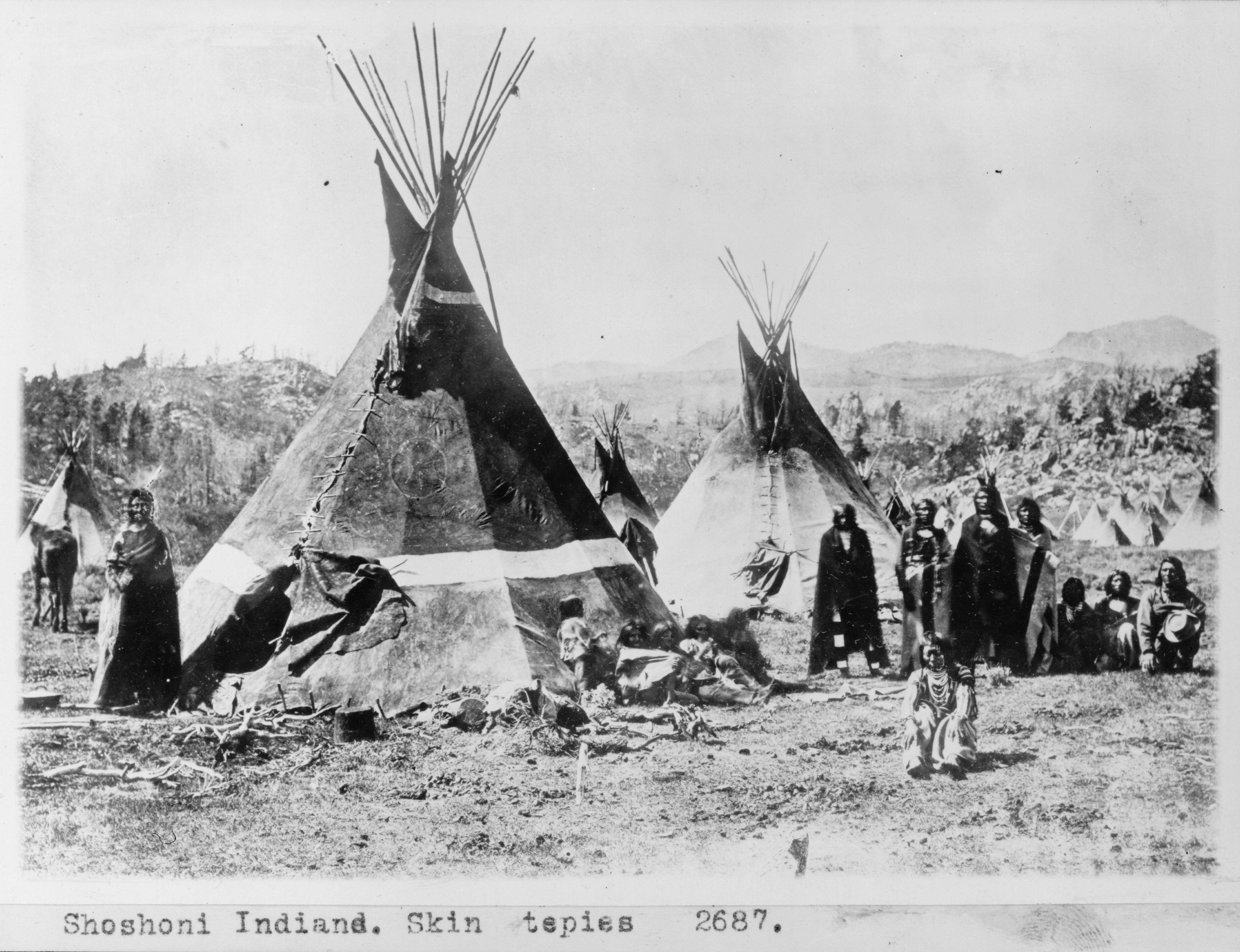
Shoshone National Forest ( ) is the first federally protected National Forest in the United States and covers nearly in the state of Wyoming. Originally a part of the Yellowstone Timberland Reserve, the forest is managed by the United States Forest Service and was created by an act of Congress and signed into law by U.S. President Benjamin Harrison in 1891. Shoshone National Forest is one of the first nationally protected land areas anywhere. Native Americans have lived in the region for at least 10,000 years, and when the region was first explored by European adventurers, forestlands were occupied by several different tribes. Never heavily settled or exploited, the forest has retained most of its wildness. Shoshone National Forest is a part of the Greater Yellowstone Ecosystem, a nearly unbroken expanse of federally protected lands encompassing an estimated . The Absaroka and Beartooth Mountains are partly in the northern section of the forest. The Wind River Range is ... [...More Info...] [...Related Items...] OR: [Wikipedia] [Google] [Baidu] |
Wyoming
Wyoming () is a U.S. state, state in the Mountain states, Mountain West subregion of the Western United States. It is bordered by Montana to the north and northwest, South Dakota and Nebraska to the east, Idaho to the west, Utah to the southwest, and Colorado to the south. With a population of 576,851 in the 2020 United States census, Wyoming is the List of U.S. states and territories by population, least populous state despite being the List of U.S. states and territories by area, 10th largest by area, with the List of U.S. states by population density, second-lowest population density after Alaska. The state capital and List of municipalities in Wyoming, most populous city is Cheyenne, Wyoming, Cheyenne, which had an estimated population of 63,957 in 2018. Wyoming's western half is covered mostly by the ranges and rangelands of the Rocky Mountains, while the eastern half of the state is high-elevation prairie called the High Plains (United States), High Plains. It is drier ... [...More Info...] [...Related Items...] OR: [Wikipedia] [Google] [Baidu] |
Bighorn Basin
The Bighorn Basin is a plateau region and intermontane basin, approximately 100 miles (160 km) wide, in north-central Wyoming in the United States. It is bounded by the Absaroka Range on the west, the Pryor Mountains on the north, the Bighorn Mountains on the east, and the Owl Creek Mountains and Bridger Mountains on the south. It is drained to the north by tributaries of the Bighorn River, which enters the basin from the south, through a gap between the Owl Creek and Bridger Mountains, as the Wind River, and becomes the Bighorn as it enters the basin. The region is semi-arid, receiving only 6–10 in (15–25 cm) of rain annually. The largest cities in the basin include the Wyoming towns of Cody, Thermopolis, Worland, and Powell. Sugar beets, pinto beans, sunflowers, barley, oats, corn and alfalfa hay are grown on irrigated farms in the region. History The basin was explored by John Colter in 1807. Just west of Cody, he discovered geothermal features that were la ... [...More Info...] [...Related Items...] OR: [Wikipedia] [Google] [Baidu] |
Bighorn Sheep
The bighorn sheep (''Ovis canadensis'') is a species of sheep native to North America. It is named for its large horns. A pair of horns might weigh up to ; the sheep typically weigh up to . Recent genetic testing indicates three distinct subspecies of ''Ovis canadensis'', one of which is endangered: ''O. c. sierrae''. Sheep originally crossed to North America over the Bering Land Bridge from Siberia; the population in North America peaked in the millions, and the bighorn sheep entered into the mythology of Native Americans. By 1900, the population had crashed to several thousand, due to diseases introduced through European livestock and overhunting. Taxonomy and genetics ''Ovis canadensis'' is one of two species of mountain sheep in North America; the other species being ''O. dalli'', the Dall sheep. Wild sheep crossed the Bering land bridge from Siberia into Alaska during the Pleistocene (about 750,000 years ago) and subsequently spread through western North America as far s ... [...More Info...] [...Related Items...] OR: [Wikipedia] [Google] [Baidu] |
Pronghorn
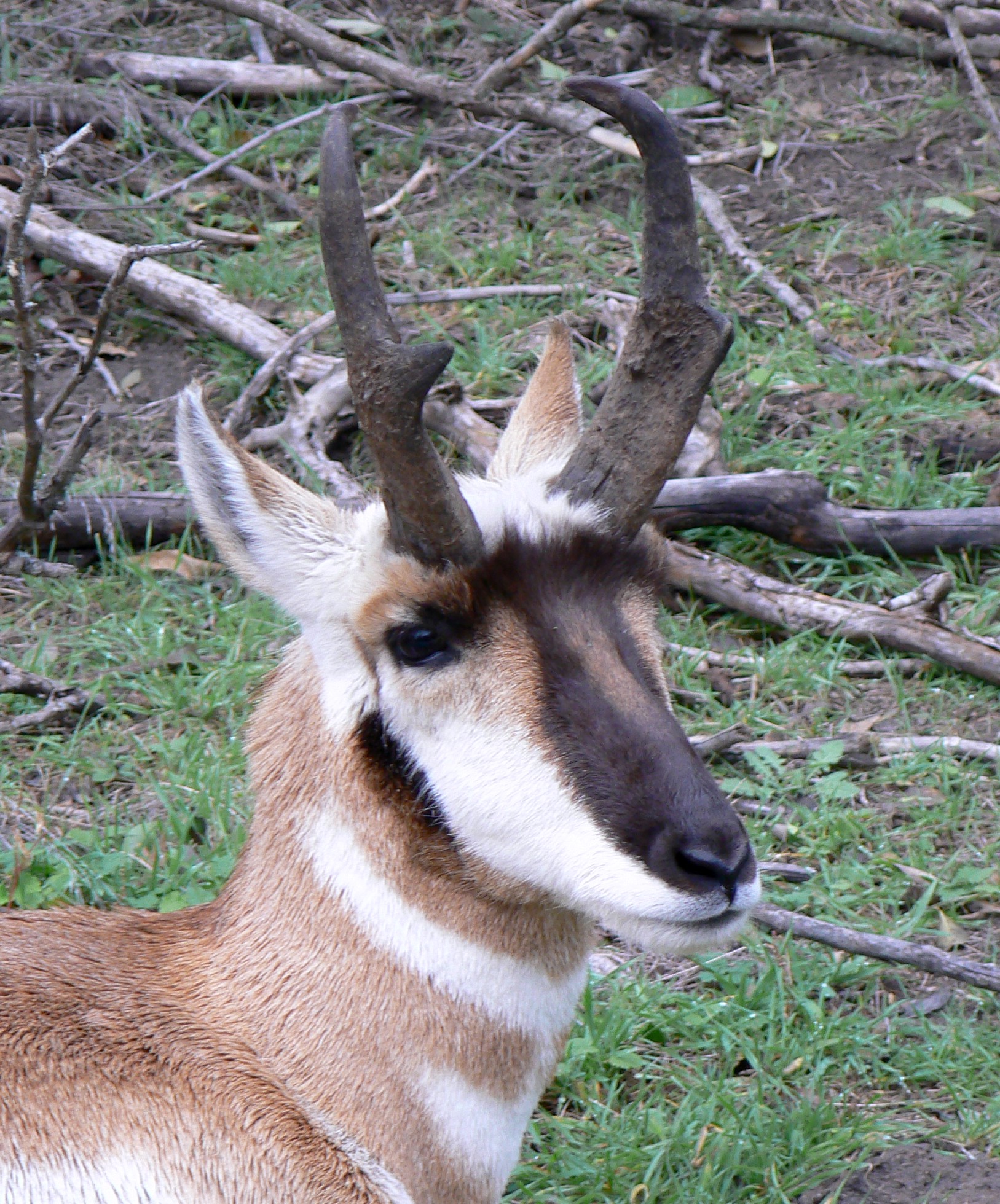
The pronghorn (, ) (''Antilocapra americana'') is a species of artiodactyl (even-toed, hoofed) mammal indigenous to interior western and central North America. Though not an antelope, it is known colloquially in North America as the American antelope, prong buck, pronghorn antelope and prairie antelope, because it closely resembles the antelopes of the Old World and fills a similar ecological niche due to parallel evolution. It is the only surviving member of the family Antilocapridae. During the Pleistocene epoch, about 11 other antilocaprid species existed in North America.Smithsonian Institution. North American MammalsPronghorn ''Antilocapra americana''/ref> Three other genera (''Capromeryx'', '' Stockoceros'' and ''Tetrameryx'') existed when humans entered North America but are now extinct. As a member of the superfamily Giraffoidea, the pronghorn's closest living relatives are the giraffe and okapi. See Fig. S10 in Supplementary Information. The Giraffoidea are in tu ... [...More Info...] [...Related Items...] OR: [Wikipedia] [Google] [Baidu] |
Carter Mountain, West Aspect
Carter(s), or Carter's, Tha Carter, or The Carter(s), may refer to: Geography United States * Carter, Arkansas, an unincorporated community * Carter, Mississippi, an unincorporated community * Carter, Montana, a census-designated place * Carter, Oklahoma, a town * Carter, South Dakota, an unincorporated community * Carter, Texas, a census-designated place * Carter, Forest County, Wisconsin, an unincorporated community * Carter, Iron County, Wisconsin, an unincorporated community * Carter, Wyoming, a census-designated place * Carters, Georgia, an unincorporated community * Carter County (other) Elsewhere * Carter Islands, in Nunavut, Canada * Carter Road Promenade, former name of Sangeet Samrat Naushad Ali Marg in Mubai, India People and fictional characters * Carter (name), a surname and a given name, including a list of people and fictional characters * Carter (artist), American artist and film director John Carter (born 1970) * Carter, someone whose occupation is tran ... [...More Info...] [...Related Items...] OR: [Wikipedia] [Google] [Baidu] |


