|
Shoshone National Forest
Shoshone National Forest ( ) is the first federally protected National Forest in the United States and covers nearly in the state of Wyoming. Originally a part of the Yellowstone Timberland Reserve, the forest is managed by the United States Forest Service and was created by an act of Congress and signed into law by U.S. President Benjamin Harrison in 1891. Shoshone National Forest is one of the first nationally protected land areas anywhere. Native Americans have lived in the region for at least 10,000 years, and when the region was first explored by European adventurers, forestlands were occupied by several different tribes. Never heavily settled or exploited, the forest has retained most of its wildness. Shoshone National Forest is a part of the Greater Yellowstone Ecosystem, a nearly unbroken expanse of federally protected lands encompassing an estimated . The Absaroka and Beartooth Mountains are partly in the northern section of the forest. The Wind River Range is ... [...More Info...] [...Related Items...] OR: [Wikipedia] [Google] [Baidu] |
Francs Peak
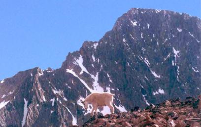
Francs Peak, elevation , is the highest point in the Absaroka Range which extends from north-central Wyoming into south-central Montana, in the United States. It is in the Washakie Wilderness of Shoshone National Forest, and the peak is also the highest point in Park County, Wyoming, which includes much of Yellowstone National Park. It was named after Otto Franc, a cattle baron and homesteader in the Big Horn Basin. See also * 4000 meter peaks of North America * Central Rocky Mountains * Mountain peaks of North America * Mountain peaks of the Rocky Mountains * Mountain peaks of the United States This article comprises three sortable tables of major mountain peaksThis article defines a significant summit as a summit with at least of topographic prominence, and a major summit as a summit with at least of topographic prominence. All su ... References External links Shoshone National Forest Mountains of Wyoming Mountains of Park County, Wyoming North American ... [...More Info...] [...Related Items...] OR: [Wikipedia] [Google] [Baidu] |
Absaroka Mountains
The Absaroka Range ( or ) is a sub-range of the Rocky Mountains in the United States. The range stretches about across the Montana–Wyoming border, and at its widest, forming the eastern boundary of Yellowstone National Park along Paradise Valley, and the western side of the Bighorn Basin. The range borders the Beartooth Mountains to the north and the Wind River Range to the south. The northern edge of the range rests along I-90 and Livingston, Montana. The highest peak in the range is Francs Peak, located in Wyoming at . There are 46 other peaks over . Geography The range is drained by the Yellowstone River and various tributaries, including the Bighorn River. Most of the range lies within protected lands including Yellowstone Park, the Absaroka-Beartooth Wilderness, North Absaroka Wilderness, Teton Wilderness, and Washakie Wilderness, spanning the Bridger-Teton National Forest, Custer National Forest, Gallatin National Forest, and Shoshone National Forest. U.S. Highway ... [...More Info...] [...Related Items...] OR: [Wikipedia] [Google] [Baidu] |
Oregon Trail
The Oregon Trail was a east–west, large-wheeled wagon route and Westward Expansion Trails, emigrant trail in the United States that connected the Missouri River to valleys in Oregon. The eastern part of the Oregon Trail spanned part of what is now the state of Kansas and nearly all of what are now the states of Nebraska and Wyoming. The western half of the trail spanned most of the current states of Idaho and Oregon. The Oregon Trail was laid by fur traders and trappers from about 1811 to 1840 and was only passable on foot or on horseback. By 1836, when the first migrant wagon train was organized in Independence, Missouri, a wagon trail had been cleared to Fort Hall, Idaho. Wagon trails were cleared increasingly farther west and eventually reached all the way to the Willamette Valley in Oregon, at which point what came to be called the Oregon Trail was complete, even as almost annual improvements were made in the form of bridges, cutoffs, ferries, and roads, which made the t ... [...More Info...] [...Related Items...] OR: [Wikipedia] [Google] [Baidu] |
Montana
Montana () is a state in the Mountain West division of the Western United States. It is bordered by Idaho to the west, North Dakota and South Dakota to the east, Wyoming to the south, and the Canadian provinces of Alberta, British Columbia, and Saskatchewan to the north. It is the fourth-largest state by area, the eighth-least populous state, and the third-least densely populated state. Its state capital is Helena. The western half of Montana contains numerous mountain ranges, while the eastern half is characterized by western prairie terrain and badlands, with smaller mountain ranges found throughout the state. Montana has no official nickname but several unofficial ones, most notably "Big Sky Country", "The Treasure State", "Land of the Shining Mountains", and " The Last Best Place". The economy is primarily based on agriculture, including ranching and cereal grain farming. Other significant economic resources include oil, gas, coal, mining, and lumber. The health ca ... [...More Info...] [...Related Items...] OR: [Wikipedia] [Google] [Baidu] |
Custer National Forest
Custer National Forest is located primarily in the south central part of the U.S. state of Montana but also has separate sections in northwestern South Dakota. With a total area of , the forest comprises over 10 separate sections. While in the westernmost sections, Custer National Forest is a part of the Greater Yellowstone Ecosystem, the easternmost sections are a combination of forest "islands" and grasslands. A portion of the forest is also part of the Absaroka-Beartooth Wilderness and constitutes over a third of the wilderness land. South of Red Lodge, Montana, the Beartooth Highway (U.S. 212) passes through the forest en route to Yellowstone National Park. The eastern areas are dominated by large stands of ponderosa pine surrounded by grasslands, which are often leased to local ranchers for cattle grazing. Administration Since 2014, the Custer and Gallatin National Forests are managed together as the Custer-Gallatin National Forest with headquarters in Bozeman, Montana. The ... [...More Info...] [...Related Items...] OR: [Wikipedia] [Google] [Baidu] |
Arapahoe
The Arapaho (; french: Arapahos, ) are a Native American people historically living on the plains of Colorado and Wyoming. They were close allies of the Cheyenne tribe and loosely aligned with the Lakota and Dakota. By the 1850s, Arapaho bands formed two tribes, namely the Northern Arapaho and Southern Arapaho. Since 1878, the Northern Arapaho have lived with the Eastern Shoshone on the Wind River Reservation in Wyoming and are federally recognized as the Arapahoe Tribe of the Wind River Reservation. The Southern Arapaho live with the Southern Cheyenne in Oklahoma. Together, their members are enrolled as the federally recognized Cheyenne and Arapaho Tribes. Names It is uncertain where the word 'Arapaho' came from. Europeans may have derived it from the Pawnee word for "trader", ''iriiraraapuhu'', or it may have been a corruption of a Crow word for "tattoo", ''alapúuxaache''. The Arapaho autonym is or ("our people" or "people of our own kind"). They refer to their tribe as ... [...More Info...] [...Related Items...] OR: [Wikipedia] [Google] [Baidu] |
Shoshone
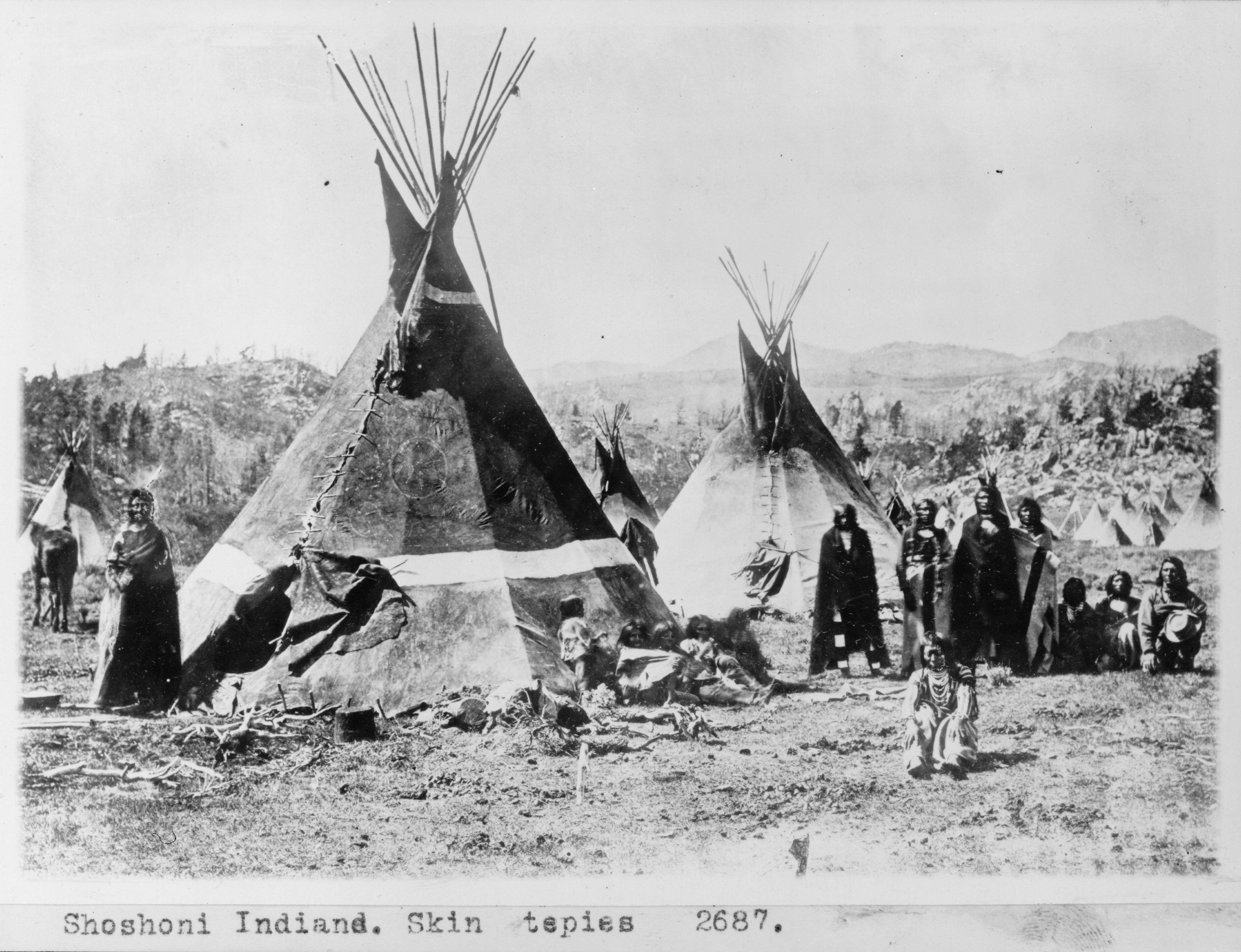
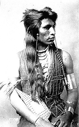
The Shoshone or Shoshoni ( or ) are a Native American tribe with four large cultural/linguistic divisions: * Eastern Shoshone: Wyoming * Northern Shoshone: southern Idaho * Western Shoshone: Nevada, northern Utah * Goshute: western Utah, eastern Nevada They traditionally speak the Shoshoni language, part of the Numic languages branch of the large Uto-Aztecan language family. The Shoshone were sometimes called the Snake Indians by neighboring tribes and early American explorers. Their peoples have become members of federally recognized tribes throughout their traditional areas of settlement, often co-located with the Northern Paiute people of the Great Basin. Etymology The name "Shoshone" comes from ''Sosoni'', a Shoshone word for high-growing grasses. Some neighboring tribes call the Shoshone "Grass House People," based on their traditional homes made from ''sosoni''. Shoshones call themselves ''Newe'', meaning "People".Loether, Christopher"Shoshones."''Encyclopedia of the Gr ... [...More Info...] [...Related Items...] OR: [Wikipedia] [Google] [Baidu] |
Wind River Indian Reservation
The Wind River Indian Reservation, in the west-central portion of the U.S. state of Wyoming, is shared by two Native American tribes, the Eastern Shoshone ( shh, Gweechoon Deka, ''meaning: "buffalo eaters"'') and the Northern Arapaho ( arp, hoteiniiciihehe'). Roughly east to west by north to south, the Indian reservation is located in the Wind River Basin, and includes portions of the Wind River Range, Owl Creek Mountains, and Absaroka Range. The Wind River Indian Reservation is the seventh-largest American Indian reservation in the United States by area and the fifth-largest by population. The land area is approximately , and the total area (land and water) is . The reservation constitutes just over one-third of Fremont County and over one-fifth of Hot Springs County. The 2000 census reported the population of Fremont County as 40,237. According to the 2010 census, only 26,490 people now live on the reservation, with about 15,000 of the residents being non-Indians on ce ... [...More Info...] [...Related Items...] OR: [Wikipedia] [Google] [Baidu] |
Bureau Of Land Management
The Bureau of Land Management (BLM) is an agency within the United States Department of the Interior responsible for administering federal lands. Headquartered in Washington DC, and with oversight over , it governs one eighth of the country's landmass. President Harry S. Truman created the BLM in 1946 by combining two existing agencies: the General Land Office and the Grazing Service. The agency manages the federal government's nearly of subsurface mineral estate located beneath federal, state and private lands severed from their surface rights by the Homestead Act of 1862. Most BLM public lands are located in these 12 western states: Alaska, Arizona, California, Colorado, Idaho, Montana, Nevada, New Mexico, Oregon, Utah, Washington and Wyoming. The mission of the BLM is "to sustain the health, diversity, and productivity of the public lands for the use and enjoyment of present and future generations." Originally BLM holdings were described as "land nobody wanted" because home ... [...More Info...] [...Related Items...] OR: [Wikipedia] [Google] [Baidu] |
Continental Divide Of The Americas
The Continental Divide of the Americas (also known as the Great Divide, the Western Divide or simply the Continental Divide; ) is the principal, and largely mountainous, hydrological divide of the Americas. The Continental Divide extends from the Bering Strait to the Strait of Magellan, and separates the watersheds that drain into the Pacific Ocean from those river systems that drain into the Atlantic and (in northern North America) Arctic oceans (including those that drain into the Gulf of Mexico, the Caribbean Sea and Hudson Bay). Although there are many other hydrological divides in the Americas, the Continental Divide is by far the most prominent of these because it tends to follow a line of high peaks along the main ranges of the Rocky Mountains and Andes, at a generally much higher elevation than the other hydrological divisions. Geography Beginning at the westernmost point of the Americas’ mainland (Cape Prince of Wales, just south of the Arctic Circle), the Conti ... [...More Info...] [...Related Items...] OR: [Wikipedia] [Google] [Baidu] |
Yellowstone National Park
Yellowstone National Park is an American national park located in the western United States, largely in the northwest corner of Wyoming and extending into Montana and Idaho. It was established by the 42nd U.S. Congress with the Yellowstone National Park Protection Act and signed into law by President Ulysses S. Grant on March 1, 1872. Yellowstone was the first national park in the U.S. and is also widely held to be the first national park in the world. The park is known for its wildlife and its many geothermal features, especially the Old Faithful geyser, one of its most popular. While it represents many types of biomes, the subalpine forest is the most abundant. It is part of the South Central Rockies forests ecoregion. While Native Americans have lived in the Yellowstone region for at least 11,000 years, aside from visits by mountain men during the early-to-mid-19th century, organized exploration did not begin until the late 1860s. Management and control of the park ... [...More Info...] [...Related Items...] OR: [Wikipedia] [Google] [Baidu] |


