|
Caloundra
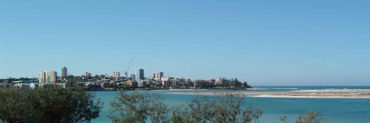
Caloundra ( ) is a coastal town and the southernmost town in the Sunshine Coast Region in South East Queensland, Australia. Geography Caloundra is north of the Brisbane central business district. Caloundra is accessible from Landsborough railway station, 21 km away, and the Caloundra bus station. Bribie Island North is located across the Pumicestone Passage. Caloundra marks the coastal, northern extent of the Moreton Bay Marine Park. History Caloundra lies within the Aboriginal Gubbi Gubbi (Kabi Kabi, Cabbee, Carbi, Gabi Gabi) language region. The name ''Caloundra'' is from the Gubbi Gubbi language ''Cullowundoor'' with ''Kal Owen'' meaning 'beech tree' ('' Gmelina leichhardtii'') and ''Dha'' meaning 'place'. Caloundra Head was previously known as Petrie Point and Point Wickham (or Wickham Point). Point Wickham takes its name from John Clements Wickham, who did a hydrographic survey of the northern section of Moreton Bay in 1846 and was later the Government Resi ... [...More Info...] [...Related Items...] OR: [Wikipedia] [Google] [Baidu] |
City Of Caloundra
The City of Caloundra was a local government area about north of Brisbane in the Sunshine Coast region of South East Queensland, Australia. The shire covered an area of ; it existed as a local government entity from 1912 until 2008, when it amalgamated with councils further north to form the Sunshine Coast Region. The City covered the urban localities of Caloundra and Kawana Waters and surrounding suburbs, the northern half of Bribie Island and the western hinterland towns of Landsborough, Maleny and Witta. History In 1868, the Queensland Government opened up large areas of land for settlement in the Caloundra area which became home to pioneers and timber cutters seeking red cedar wood. The area was originally incorporated as part of the Caboolture Division on 11 November 1879 under the ''Divisional Boards Act 1879''. With the passage of the ''Local Authorities Act 1902'', Caboolture Division became Shire of Caboolture on 31 March 1903. On 22 February 1912, part of th ... [...More Info...] [...Related Items...] OR: [Wikipedia] [Google] [Baidu] |
Sunshine Coast Region
The Sunshine Coast Region is a local government area located in the Sunshine Coast district of South East Queensland, Australia. It was created by the amalgamation in 2008 of the City of Caloundra and the Shires of Maroochy and Noosa. It contains of roads, of coastline and a population of 351,424 in January 2021. The budget for the 2020–2021 financial year totals A$782 million including $243 million for Capital Works. On 1 January 2014, the Shire of Noosa was re-established independent of the Sunshine Coast Regional council. History '' Gubbi Gubbi (Kabi Kabi, Cabbee, Carbi, Gabi Gabi)'' is an Australian Aboriginal language spoken on Gubbi Gubbi country. The Gubbi Gubbi language region includes the landscape within the local government boundaries of the Sunshine Coast Region and Gympie Region, particularly the towns of Caloundra, Noosa Heads, Gympie and extending north towards Maryborough and south to Caboolture''.'' Prior to 2008, the new Sunshine Coast Regio ... [...More Info...] [...Related Items...] OR: [Wikipedia] [Google] [Baidu] |
Electoral District Of Caloundra
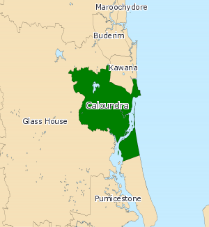
Caloundra is a Legislative Assembly of Queensland electoral district on the Sunshine Coast in the Australian state of Queensland. The electorate is centred on the city of Caloundra and stretches north to Wurtulla, south to Pelican Waters and west to the Bruce Highway. The seat was held by Mark McArdle, the first deputy leader of the Liberal National Party from 2008 to 2009, and prior to that state Liberal leader from November 2007 to July 2008. McArdle succeeded former Liberal leader Joan Sheldon upon her retirement in 2004. On 27 June 2019, McArdle announced he would retire from politics at the 2020 state election. The seat was won by Labor's Jason Hunt at the 2020 election. Members for Caloundra Election results References External links Electorate Profile(Antony Green, ABC) {{Electoral districts of Queensland Caloundra Caloundra ( ) is a coastal town and the southernmost town in the Sunshine Coast Region in South East Queensland, Australia. Geography ... [...More Info...] [...Related Items...] OR: [Wikipedia] [Google] [Baidu] |
Bribie Island North
Bribie Island North is a locality on Bribie Island in the Sunshine Coast Region, Queensland, Australia. In the , Bribie Island North had a population of 0 people. It is the only part of Bribie Island in the Sunshine Coast Region with all the rest of the Bribie Island being part of the Moreton Bay Region. Geography As the name suggests, Bribie Island North is the northerly peninsula of Bribie Island. It lies very close to the mainland, narrowly separated by the Pumicestone Passage which forms the western border of the locality, while the eastern border is the Pacific Ocean. To the north, it tapers to a long low narrow sandspit. The locality is undeveloped land, most of it being within the Bribie Island National Park. This section of the Pumicestone Passage is very narrow and very shallow (less than ) with shifting sand and mud banks, which makes the northern sandspit highly dynamic in shape through natural processes of sand/mud buildup and erosion. During storms, waves may ... [...More Info...] [...Related Items...] OR: [Wikipedia] [Google] [Baidu] |
Caloundra Bus Station
Caloundra bus station was opened on 16 April 1992 by Minister for Transport David Hamill. It is serviced by six Sunbus routes. It is in Zone 5 of the TransLink integrated public transport system. Located in Cooma Terrace, Caloundra the interchange boasts an air-conditioned waiting room and travel agent. A two-storey car park is located above the bus station. Services Sunbus operate six routes via Caloundra bus station: *600: to Maroochydore via Mooloolaba *602: to Maroochydore via Mountain Creek *603: Bellavista to Corbould Park *605: to Landsborough station *607: to University of the Sunshine Coast The University of the Sunshine Coast (UniSC) is a public university based on the Sunshine Coast, Queensland, Australia. After opening with 524 students in 1996 as the Sunshine Coast University College, it was later renamed the University of th ... *609: to Pelican Waters References {{TransLink (SEQ) bus network Bus stations in South East Queensland Caloundra Public tr ... [...More Info...] [...Related Items...] OR: [Wikipedia] [Google] [Baidu] |
Electoral District Of Kawana
Kawana is an electoral district of the Legislative Assembly in the Australian state of Queensland. Based on the Sunshine Coast, the district has been held by both sides of politics over its short history. Geography A coastal urban electorate lying to the east of the Bruce Highway, Kawana includes the suburbs of Kawana Waters, Sippy Downs, Minyama, Buddina, Parrearra, Warana, Bokarina and Birtinya. It also includes Aroona, Little Mountain, Wurtulla and parts of Currimundi and Caloundra West, all of which were added to the district at the redistribution ahead of the 2009 state election. Originally the district stretched further north and west to include the suburbs of Buderim, Mountain Creek and Tanawha. However, these parts were redistributed into the new district of Buderim by the aforementioned redistribution. History First created for the 2001 state election, Kawana essentially replaced the abolished district of Mooloolah. The sitting member for Mooloolah, Bruc ... [...More Info...] [...Related Items...] OR: [Wikipedia] [Google] [Baidu] |
Pumicestone Passage
Pumicestone Channel, also known as the Pumicestone Passage, is a narrow waterway between Bribie Island and the mainland in Queensland, Australia. The northern extent of the passage is at Caloundra, while at the south is Deception Bay. The waterway is a two way tidal estuary that has 11 creeks flowing into it. At each end of the passage the channels are the deepest and widest. During periods of unusually high tides and large waves, the passage is infiltrated by inflows through channels in dunes at the northern tip of Bribie Island. History The channel was originally shown as Pumice-stone River on the maps of Matthew Flinders as he found an abundance of pumice stone lining the shoreline. He was the first European explorer to enter Moreton Bay in 1799 on the Sloop H. M. 'Norfolk' and spent two weeks exploring the bay and surrounds and naming Point Skirmish and Pumice-stone River. Environment Gazetted in 1986, Pumicestone Passage Marine Park (now part of the Moreton Ba ... [...More Info...] [...Related Items...] OR: [Wikipedia] [Google] [Baidu] |
Gmelina Leichhardtii
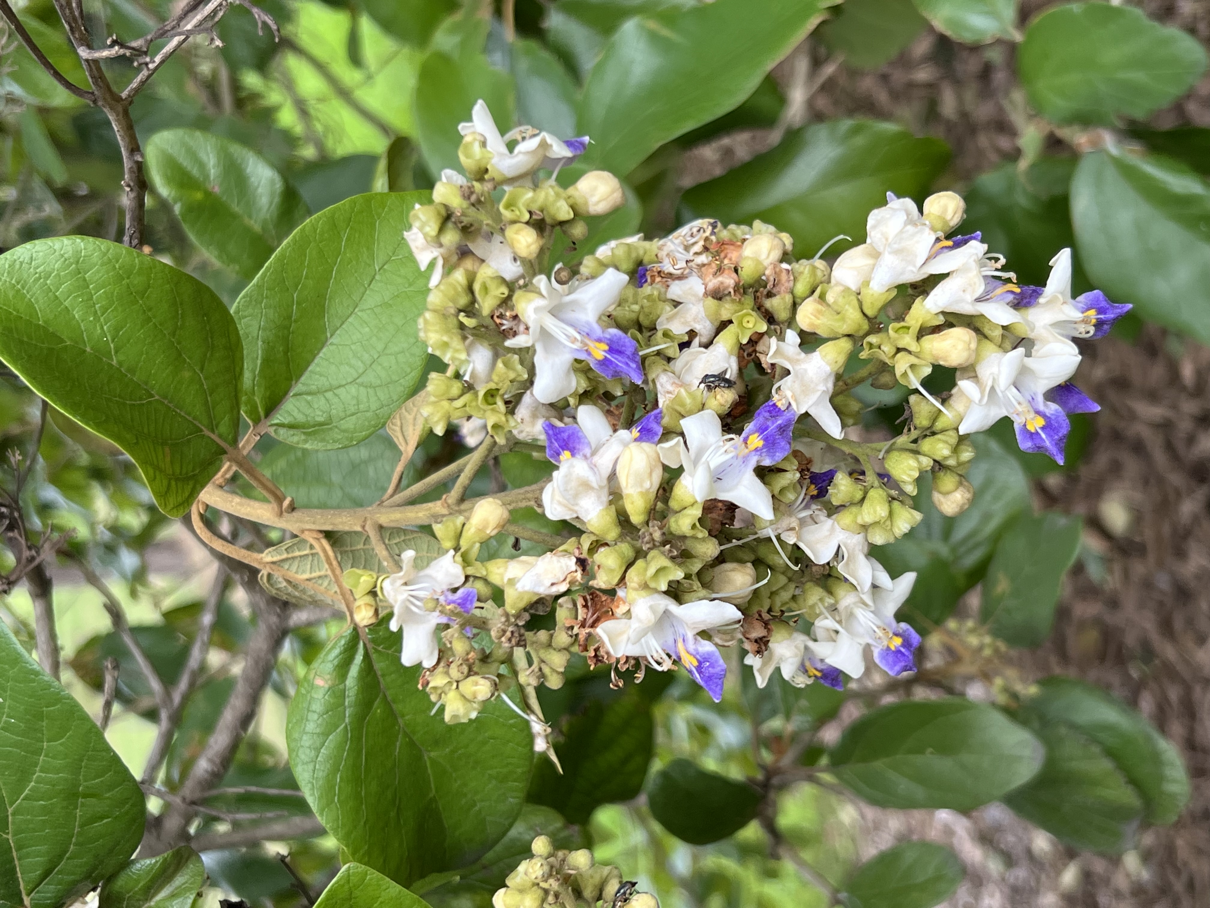
''Gmelina leichhardtii'', the white beech, is a tree of eastern Australia. Scattered individuals or small groups of trees naturally occur from the Illawarra district of New South Wales (34½° S) to near Proserpine in tropical Queensland. The white beech or grey teak is a fast-growing tree, growing on volcanic and alluvial soils in areas of moderate to high rainfall. It also grows on poorer sedimentary soils in fire free areas. White beech may occasionally be seen in Australian rainforests, though their status is considered "uncommon". Unlike the Australian red cedar, the white beech has not recovered particularly well after logging in the 19th and 20th centuries. Taxonomy and naming Ferdinand von Mueller described the white beech as ''Vitex leichhardtii'' in 1862, from collections near Myall Creek by Ludwig Leichhardt and Clarence River by Dr. Hermann Beckler. George Bentham reassigned it to the genus ''Gmelina'' in his 1870 ''Flora Australiensis''. The genus name honou ... [...More Info...] [...Related Items...] OR: [Wikipedia] [Google] [Baidu] |
Queensland Country Women's Association
The Queensland Country Women's Association (QCWA) is the Queensland chapter of the Country Women's Association in Australia. The association seeks to serve the interests of women and children in rural areas in Australia through a network of local branches. Established in 1922, local branches provide friendship and mutual support to their members while contributing to the betterment of life in their local communities. Over time, many branches have evolved to include support for wider issues such as domestic violence campaigns and fund-raising for international initiatives such as orphanages. In 2019 the QWCA received a Queensland Greats Award from the Queensland Government.2019 Queensland Greats recipients , Queensland Government website. Retrieved 11 June 2019. History |
Leslie Wilson (politician)
Sir Leslie Orme Wilson, (1 August 1876 – 29 September 1955) was a Royal Marines officer, Conservative politician, and colonial governor. He served as Governor of Bombay from 1923 to 1926 and as Governor of Queensland from 1932 to 1946. Personal life Wilson was the son of Henry Wilson, a stockbroker, and his wife Ada Alexandrina (née Orme), and was educated at St Michael's School, Westgate, and St Paul's School, London. Wilson married Winifred May, daughter of Charles Smith, of Sydney, Australia, in 1909. They lived at the Manor House at Waltham St Lawrence in Berkshire. They had three children, two sons and a daughter: * Peter Leslie Orme, born 4 June 1910 in London, farmer and grazier, died 6 July 1980 aged 70 years in Queensland and buried in Caloundra cemetery; * David Orme, who was killed on 30 November 1941 in North Africa during the Second World War; * Marjorie Orme. On his retirement as Governor of Queensland, Wilson and his wife Winifred returned to live in S ... [...More Info...] [...Related Items...] OR: [Wikipedia] [Google] [Baidu] |
Landsborough Railway Station
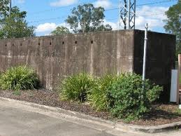
Landsborough railway station is located on the North Coast line in Queensland, Australia. It serves the town of Landsborough in the Sunshine Coast Region. History In 1998, construction began on Platform 2. In December 2006, the State Government announced the station would be upgraded. The work was completed in late 2007, and included the building of new platforms, rainwater tanks, shelters, lighting, and toilets. A new cark park was also built. These upgrades were part of an overhaul of the Caboolture to Landsborough section of the North Coast line. The section was to be duplicated in full by 2012, but so far only the Caboolture to Beerburrum section has been completed. This is now scheduled to be completed by 2021. On the eastern side of the station, a locomotive turning triangle remains in use, making Landsborough a popular destination for steam trains from Brisbane. The station has the Landsborough Air Raid Shelter, one of the few remaining examples of World War I ... [...More Info...] [...Related Items...] OR: [Wikipedia] [Google] [Baidu] |
Moreton Bay Marine Park
The Moreton Bay Marine Park was established in 1992 to protect ecologically significant habitats in Moreton Bay. The marine park extends from Caloundra south to the southern tip of South Stradbroke Island. The marine park's border extends up to the highest tidal mark and covers a total of 3,400 km2. The marine park provides protection to sensitive reef sites near Tangalooma and Flinders Reef. It includes waterways such as Coombabah Lake, sheltered inlets, open ocean, mangrove forests, swamps, marshes, tidal mudflats, sandflats and seagrass beds. It is a temporary home to migrating shorebirds that inhabit wetlands. Dugongs, whales and turtles swim in the waters of the bay. Six of the world's seven species of sea turtles habitat the park. The marine park is managed by the Queensland Parks and Wildlife Service. In 1971, a total of 18 countries signed a Convention on Wetlands of International Significance. It was signed in Ramsar, a city in Iran, and came to be known as the Ram ... [...More Info...] [...Related Items...] OR: [Wikipedia] [Google] [Baidu] |


