|
California, Birmingham
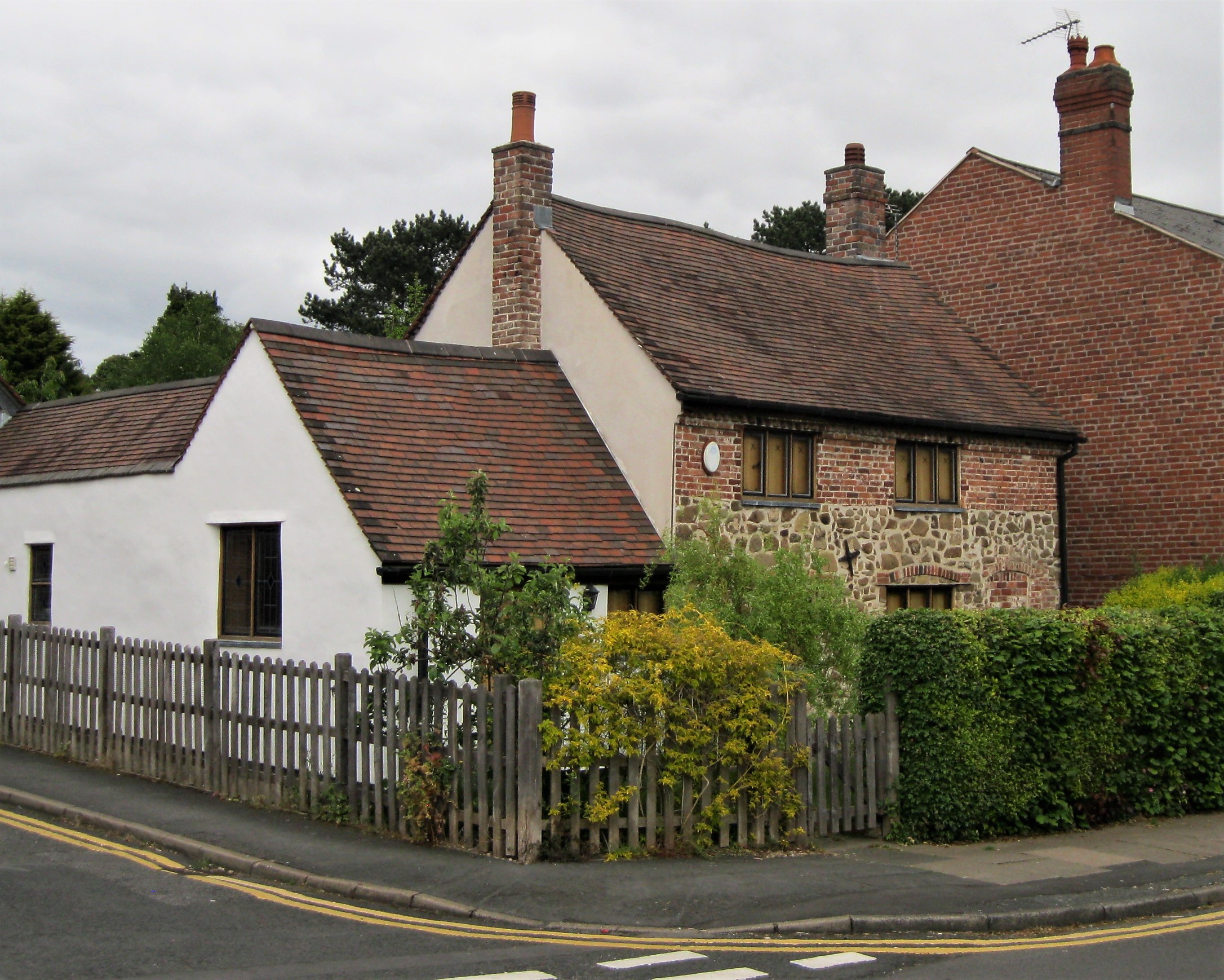
California is small suburban area of Birmingham, England. It lies within Bartley Ward and the Birmingham Edgbaston constituency and is located on the edge of Woodgate Valley Country Park. History Originally located in the parish of Northfield and part of Worcestershire the settlement of California takes its name from the California Inn built by Isaac Flavell on the junction of Barnes Hill and Alwold Road. Flavell bought Stonehouse Farm and the surrounding land in 1842, and set up a brick building business. There are tales that the name of the California Inn was taken from the state of California where Flavell had earlier made "something of a fortune" in the California Gold Rush;, ''One Thousand Years of Brum'', p. 33. however, the Gold Rush did not start until 1848, and records show that Flavell was established in business well before that, with operations at Gas Street, as well as the Stonehouse site. The village became well known for its brick making which was helped by the prese ... [...More Info...] [...Related Items...] OR: [Wikipedia] [Google] [Baidu] |
Birmingham
Birmingham ( ) is a city and metropolitan borough in the metropolitan county of West Midlands in England. It is the second-largest city in the United Kingdom with a population of 1.145 million in the city proper, 2.92 million in the West Midlands metropolitan county, and approximately 4.3 million in the wider metropolitan area. It is the largest UK metropolitan area outside of London. Birmingham is known as the second city of the United Kingdom. Located in the West Midlands region of England, approximately from London, Birmingham is considered to be the social, cultural, financial and commercial centre of the Midlands. Distinctively, Birmingham only has small rivers flowing through it, mainly the River Tame and its tributaries River Rea and River Cole – one of the closest main rivers is the Severn, approximately west of the city centre. Historically a market town in Warwickshire in the medieval period, Birmingham grew during the 18th century during the Midla ... [...More Info...] [...Related Items...] OR: [Wikipedia] [Google] [Baidu] |
Staffordshire
Staffordshire (; postal abbreviation Staffs.) is a landlocked county in the West Midlands region of England. It borders Cheshire to the northwest, Derbyshire and Leicestershire to the east, Warwickshire to the southeast, the West Midlands County and Worcestershire to the south and Shropshire to the west. The largest settlement in Staffordshire is Stoke-on-Trent, which is administered as an independent unitary authority, separately from the rest of the county. Lichfield is a cathedral city. Other major settlements include Stafford, Burton upon Trent, Cannock, Newcastle-under-Lyme, Rugeley, Leek, and Tamworth. Other towns include Stone, Cheadle, Uttoxeter, Hednesford, Brewood, Burntwood/Chasetown, Kidsgrove, Eccleshall, Biddulph and the large villages of Penkridge, Wombourne, Perton, Kinver, Codsall, Tutbury, Alrewas, Barton-under-Needwood, Shenstone, Featherstone, Essington, Stretton and Abbots Bromley. Cannock Chase AONB is within the county as well as parts of the ... [...More Info...] [...Related Items...] OR: [Wikipedia] [Google] [Baidu] |
Edgbaston
Edgbaston () is an affluent suburban area of central Birmingham, England, historically in Warwickshire, and curved around the southwest of the city centre. In the 19th century, the area was under the control of the Gough-Calthorpe family and the Gillott family who refused to allow factories or warehouses to be built in Edgbaston, thus making it attractive for the wealthier residents of the city. It then came to be known as "where the trees begin". One of these private houses is grade one listed and open to the public. The majority of Edgbaston that falls under the B15 postcode finds itself being part of the Calthorpe Estate. The estate is an active conservation area, and it is here that the areas most prized properties are situated. The exclusivity of Edgbaston is down to its array of multi-million listed Georgian and Victorian villas, making it one of the most expensive postcodes outside of London. Edgbaston boasts facilities such as Edgbaston Cricket Ground, a Test mat ... [...More Info...] [...Related Items...] OR: [Wikipedia] [Google] [Baidu] |
National Express West Midlands
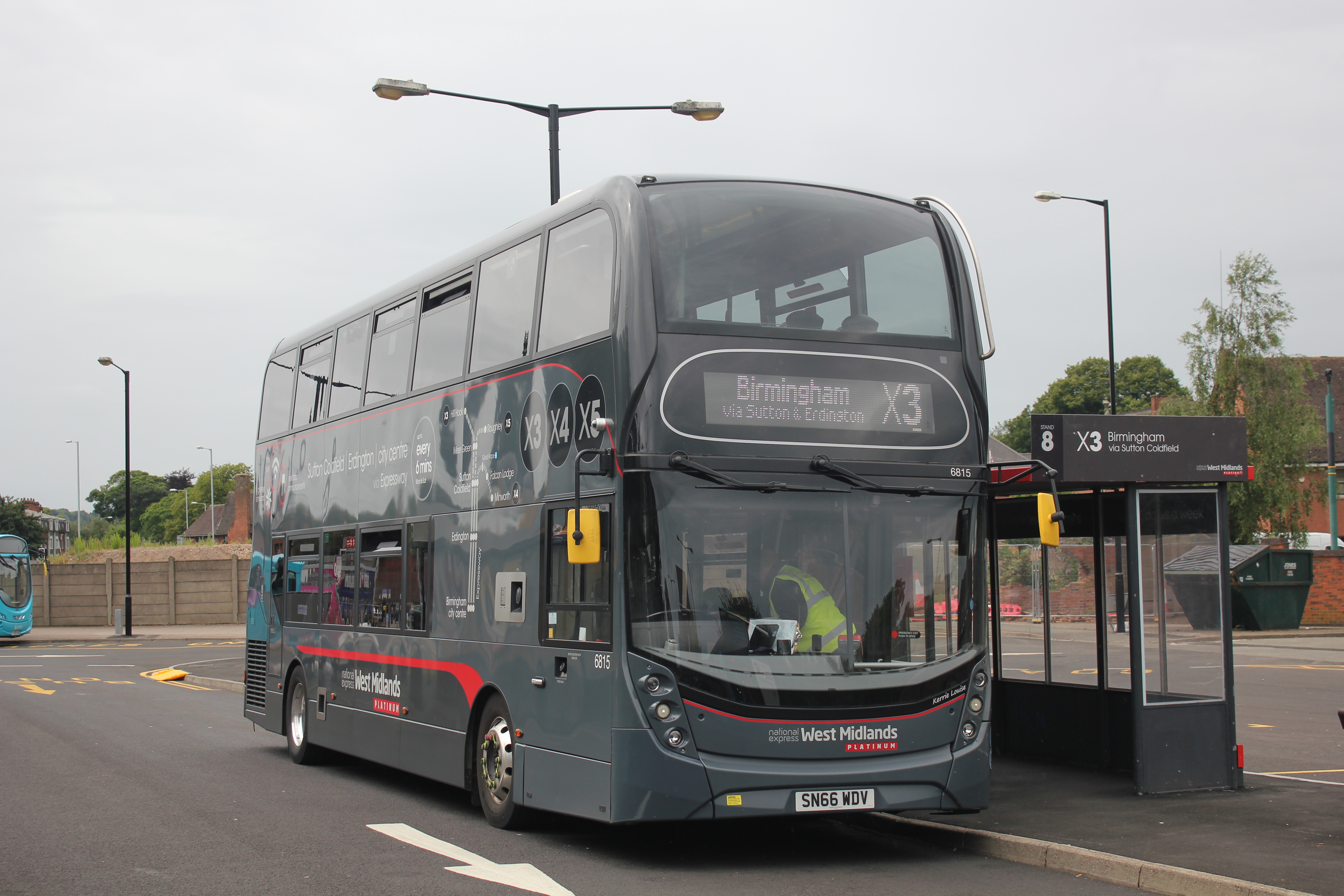
National Express West Midlands (NXWM) is a bus operator in the West Midlands that operates services in Birmingham, Dudley, Sandwell, Walsall, Wolverhampton, and Solihull, as well as limited routes outside of the general area of Birmingham, such as thX1to Coventry, or th144Ato Bromsgrove. NXWM is a subsidiary of National Express. History On 26 October 1986 as part of the deregulation of bus services, West Midlands Travel was formed. It was previously the bus operations of the West Midlands Passenger Transport Executive, which ceased to be a bus operator, but successor organisation Transport for West Midlands retains a co-ordinating role, funding infrastructure like bus stations, providing information, paying for socially necessary services, and concessionary fares. West Midlands Travel remained in public ownership under the West Midlands Passenger Transport Authority until December 1991, when it was sold in an Employee Share Ownership Plan to its management and employees. I ... [...More Info...] [...Related Items...] OR: [Wikipedia] [Google] [Baidu] |
Birmingham City Centre
Birmingham City Centre, also known as Central Birmingham and often known locally as town, is the central business district of Birmingham, England. Following the removal of the Inner Ring Road, the city centre is now defined as being the area within the Middle Ring Road. The city centre is undergoing massive redevelopment with the Big City Plan, which means there are now nine emerging districts and the city centre is approximately five times bigger. Districts *City Centre Core * Westside * Eastside *Southside *Jewellery Quarter *Gun Quarter *Highgate *Ladywood * Digbeth History Following the removal of the Inner Ring Road, which acted as a "concrete collar" "under which pedestrians would be forced to walk through intimidating, dark and stinking underpasses" and prevented the expansion of the city centre, a massive urban regeneration project known as the Big City Plan has begun. Geography Running through the city centre is the Birmingham Fault, a sandstone ridge. The "High ... [...More Info...] [...Related Items...] OR: [Wikipedia] [Google] [Baidu] |
Quinton, Birmingham
Quinton, is a residential area and ward of Birmingham, England just under west of the city centre. Formerly part of Halesowen parish, Quinton became part of Birmingham in 1909. Quinton was a village and the surrounding area was farmland until the 1930s when the first housing estates were developed. Most of the farmland had been built on by 1980 but some countryside remains in the form of Woodgate Valley Country Park. Along with Bartley Green, Harborne and Edgbaston, Quinton is a part of the Birmingham Edgbaston constituency. History The name of Quinton is thought to derive from ''Cweningtun'', meaning the queen's settlement. Quinton was formerly part of the ancient parish of Halesowen and was largely owned in medieval times by the wealthy abbey at Lapal near Halesowen. In the 1840s, when called ''The Quinton'', mention was made of two small coal mines in the area and that the inhabitants were employed in nail manufacturing. The parish was generally known as ''Ridgacre'' un ... [...More Info...] [...Related Items...] OR: [Wikipedia] [Google] [Baidu] |
Cotteridge
Cotteridge is an area of Birmingham, England and part of the Bournville ward. It is about miles south of Birmingham city centre. It has a shopping centre with a mixture of local shops, eateries and national brands. Church The Cotteridge Church is a Church of England, Methodist and United Reformed Church. local ecumenical partnership. Its building on Pershore Road was originally the Methodist church. The building was enlarged when the Church of England and URC churches were demolished to make way for a supermarket and the three congregations were merged. The Church of England parish church was St Agnes', which began in 1898 with a mission room when it was licensed as a mission of St Nicolas', Kings Norton. A new Gothic Revival church was built in 1902 and consecrated in 1903. The benefice of St Agnes was in the gift of the Vicar of Kings Norton until 1916, when part of St Nicolas' parish was detached to form a separate parish of St Agnes. In 1937 part of St Agnes' parish was det ... [...More Info...] [...Related Items...] OR: [Wikipedia] [Google] [Baidu] |
Weoley Castle
Weoley Castle is a residential suburban district in south-west Birmingham, England. The area is part of the Weoley local authority electoral ward, and also comes under the Northfield local council constituency. The suburb of Weoley Castle is bordered by Selly Oak to the east, Harborne to the north, Bartley Green to the west, and Weoley Hill and Shenley Fields to the south. Weoley Castle Square Weoley Castle Square is a shopping area at the heart of Weoley Castle. It includes a very large traffic island and during the 1950s prefabricated bungalows of a type known locally as 'prefabs' were on this central island.Castle Square Shopping Centre Volume 2. This is available for reference at Weoley Castle Library. Today Birmingham City Council maintains the island as a recreation area with benches trees and mown grass. Round the recreation area are a health centre, shops selling economically priced goods and a market. Shops have also been there since at least the 1930s. Toponym ... [...More Info...] [...Related Items...] OR: [Wikipedia] [Google] [Baidu] |
Bartley Green
Bartley Green is a residential suburban area and electoral ward in Birmingham, England, south west of the city centre. The ward is part of the Birmingham Edgbaston constituency and is represented in parliament by Labour Co-operative MP Preet Gill. History Bartley Green was first noted in the Domesday Book of 1086 as ''Berchelai''. This means either the birch tree wood or the clearing in the birch trees (from the Old English "beorc leah"). Bartley Green was in the possession of the manor of Weoley. Bartley Green was again mentioned in 1657, however, this time it was under its current name. Most of the land occupied by Bartley Reservoir was in the parish of Northfield, Birmingham, originally in Worcestershire. It was transferred to Warwickshire when Northfield became part of Birmingham in November 1911. Bartley Green became more built up after the end of the Second World War in 1945, with a mix of private and council housing being built. The Athol Farm council estate was a no ... [...More Info...] [...Related Items...] OR: [Wikipedia] [Google] [Baidu] |
Harborne
Harborne is an area of south-west Birmingham, England. It is one of the most affluent areas of the Midlands, southwest from Birmingham Birmingham ( ) is a city and metropolitan borough in the metropolitan county of West Midlands in England. It is the second-largest city in the United Kingdom with a population of 1.145 million in the city proper, 2.92 million in the We ... city centre. It is a Birmingham City Council ward (politics), ward in the Government of Birmingham, England#Districts, formal district and in the United Kingdom constituencies, parliamentary constituency of Birmingham Edgbaston (UK Parliament constituency), Birmingham Edgbaston. Geography Harborne lies to the west of Edgbaston, to the north of Selly Oak, to the east of Quinton, Birmingham, Quinton, and to the south of the Bearwood, West Midlands, Bearwood and Oldbury, West Midlands, Warley areas of neighbouring Sandwell. As a parish, it covered an area of , of which was of woodland and planta ... [...More Info...] [...Related Items...] OR: [Wikipedia] [Google] [Baidu] |
Lapal Tunnel
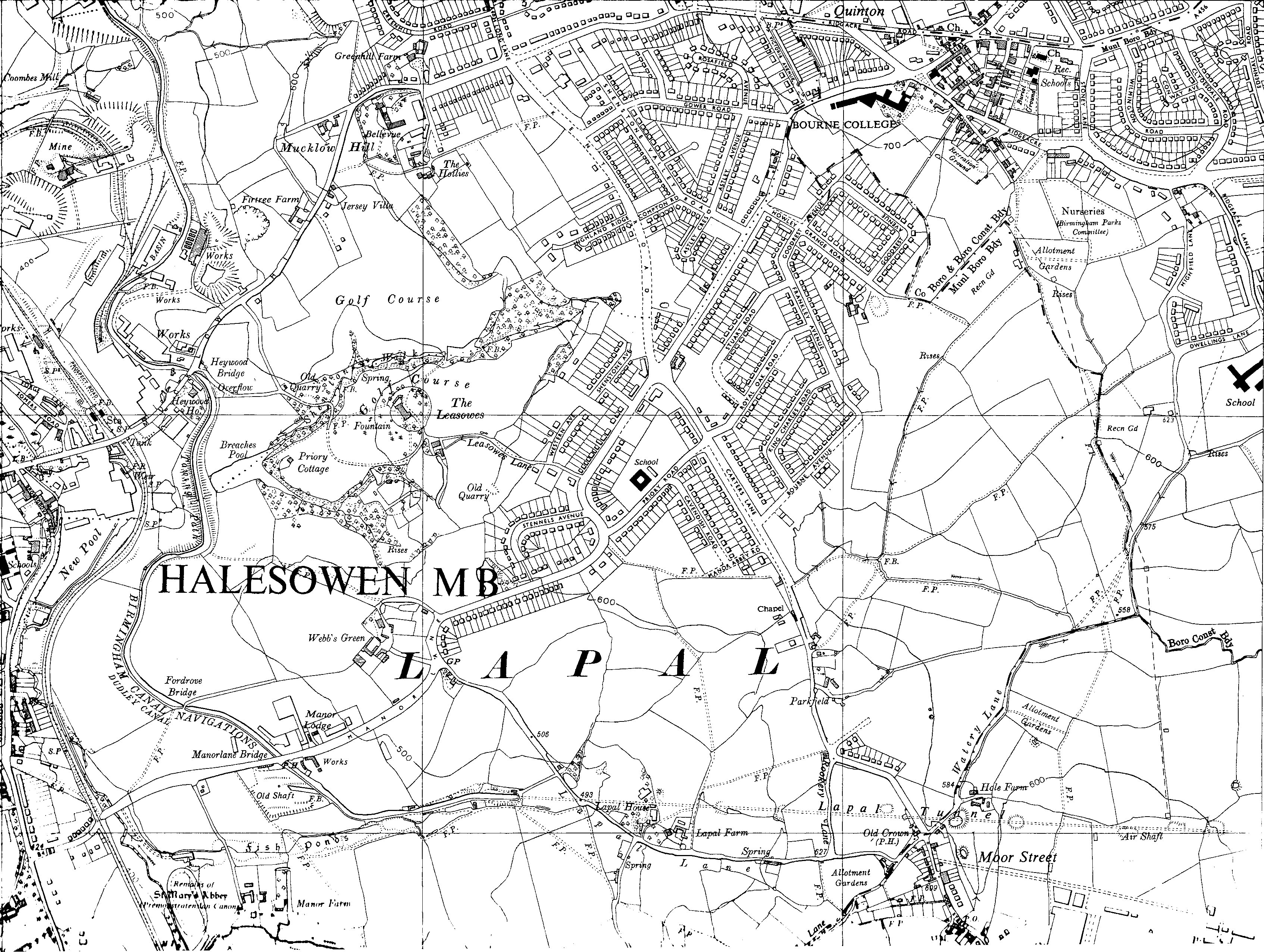
The Lapal Tunnel (old spelling Lappal Tunnel) is a disused canal tunnel on the five mile dry section of the Dudley No. 2 Canal in the West Midlands, England. It takes its name from the settlement of Lapal. History The narrow brick-lined tunnel, built in 1798 by William Underhill, had no towpath. It had a very small bore — at 7 feet 9 inches, barely wider than the boats which used it, with a headroom of only 6 feet. Boats originally took about three hours to complete the passage by legging or poling, so in 1841 a steam engine was built at the Halesowen end which drove a scoop wheel to load the tunnel with water. Stop gates could be opened at either end to assist boats along the tunnel in either direction. The tunnel suffered many collapses, and after a collapse in 1917 due to mining subsidence it was abandoned. It runs under Lapal, the M5 motorway near junction 3 and Woodgate Valley Country Park. The canal between Halesowen and Selly Oak is disused and some sections ha ... [...More Info...] [...Related Items...] OR: [Wikipedia] [Google] [Baidu] |
West Midlands (county)
West Midlands is a metropolitan county in the West Midlands Region, England, with a 2021 population of 2,919,600, making it the second most populous county in England after Greater London. It was created in 1974 by the Local Government Act 1972, from parts of Staffordshire, Worcestershire and Warwickshire. The county is a NUTS 2 region within the wider NUTS 1 region of the same name. It embraces seven metropolitan boroughs: the cities of Birmingham, Coventry and Wolverhampton, and the boroughs of Dudley, Sandwell, Solihull and Walsall. The county is overseen by the West Midlands Combined Authority, which covers all seven boroughs and other non-constituent councils, on economy, transport and housing. Status The metropolitan county exists in law, as a geographical frame of reference, and as a ceremonial county. As such it has a Lord Lieutenant. and a High Sheriff. Between 1974 and 1986, the West Midlands County Council was the administrative body covering the county; t ... [...More Info...] [...Related Items...] OR: [Wikipedia] [Google] [Baidu] |


.jpg)

