|
Calatabiano
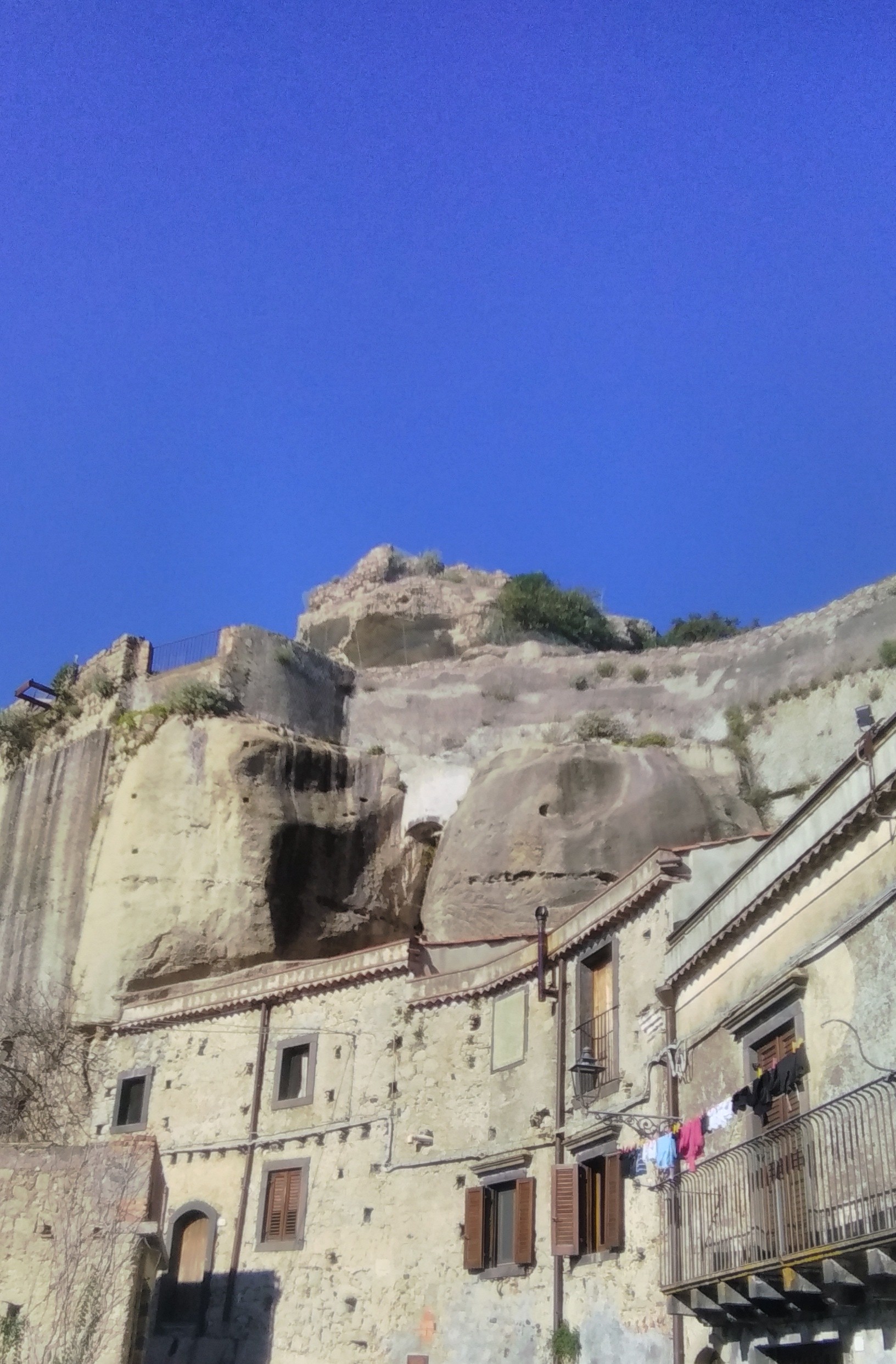
Calatabiano ( scn, Cattabbianu) is a ''comune'' (municipality) in the Metropolitan City of Catania in Sicily, southern Italy. Geography Calatabiano is located about 60 metres above the sea level. It is located about 42 kilometres northeast of Catania. about 58 kilometres southwest of Messina and about 175 kilometres east of Palermo. The population is about 75% in the center of the town, and about 25% is located in Pasteria Lapide. Calatabiano borders the following municipalities: Castiglione di Sicilia, Fiumefreddo di Sicilia, Giardini-Naxos, Linguaglossa, Piedimonte Etneo, Taormina. The municipality of Calatabiano is a part of Parco fluviale dell'Alcantara (Alcantara River Park). History The history of Calatabiano is closely linked to its castle, located 160 meters above the sea level. Calatabiano Castle was founded by the Arabs, who moved from Calatabiano to conquer Taormina in 902. The Arab presence in Calatabiano is clearly visible from the name of the town, which is di ... [...More Info...] [...Related Items...] OR: [Wikipedia] [Google] [Baidu] |
Fiumefreddo Di Sicilia
Fiumefreddo di Sicilia (; scn, Ciumifriddu) is a ''comune'' in the Metropolitan City of Catania on the coast of the Ionian Sea on the island of Sicily, southern Italy. It shares its borders with the municipalities of Calatabiano to the north, Mascali to the south and Piedimonte Etneo to the west. The commune gets its name from the Fiumefreddo River which runs alongside the territory of the comune. The word "fiumefreddo" means literally "cold river", a reference to the fact that the river is fed by snow melts from Mount Etna. Fiumefreddo di Sicilia is near the major Etna tourist centres. The SS120 to Mount Etna and Randazzo start from there. Fiumefreddo di Sicilia was so named to distinguish it from Fiumefreddo Bruzio, in the Province of Cosenza. Currently the town has almost 10,000 inhabitants. Geography Fiumefreddo stands along the SS 114 and A18, both roads running from Catania to Messina. Fiumefreddo di Sicilia is in the heart of a road and railway network, near Taormi ... [...More Info...] [...Related Items...] OR: [Wikipedia] [Google] [Baidu] |
Metropolitan City Of Catania
The Metropolitan City of Catania ( it, Città metropolitana di Catania) is a Metropolitan cities of Italy, metropolitan city in Sicily, southern Italy. Its capital is the city of Catania. It replaced the Province of Catania and comprises the city of Catania and other 57 municipalities (''comuni''). History It was first created by the reform of local authorities (Law 142/1990) and then established by the regional law 15 August 2015. Geography Territory The metropolitan city borders with the Metropolitan City of Messina (the former Province of Messina), the Province of Enna, the Province of Syracuse, the Province of Ragusa and the Province of Caltanissetta. Part of its territory includes the Catania metropolitan area, Metropolitan area of Catania. The Metropolitan City faces the Ionian Sea to the east, the Metropolitan City of Messina to the north, the Province of Enna and the Province of Caltanissetta to the west, the Province of Siracusa and the Province of Ragusa to the south. M ... [...More Info...] [...Related Items...] OR: [Wikipedia] [Google] [Baidu] |
Piedimonte Etneo
Piedimonte Etneo ( Sicilian: ''Piemunti'') is a ''comune'' (municipality) in the Metropolitan City of Catania in the Italian region Sicily, located about east of Palermo and about northeast of Catania. Piedimonte Etneo borders the following municipalities: Calatabiano, Castiglione di Sicilia, Fiumefreddo di Sicilia, Linguaglossa, Mascali, Sant'Alfio Saint Alphys (in Italian: Sant'Alfio) or ( scn, Sant'Arfiu) is a ''comune'' (municipality) in the Metropolitan City of Catania in the Italian region Sicily, about east of Palermo and about north of Catania. Saint Alphys borders the following mu .... References External links Official website Cities and towns in Sicily {{Sicily-geo-stub ... [...More Info...] [...Related Items...] OR: [Wikipedia] [Google] [Baidu] |
Castiglione Di Sicilia
Castiglione di Sicilia ( Sicilian: ''Castigghiuni di Sicilia'') is a ''comune'' (municipality) in the Metropolitan City of Catania in Sicily, southern Italy. Castiglione di Sicilia lies about east of Palermo and about north of Catania. It borders the following municipalities: Adrano, Belpasso, Biancavilla, Bronte, Calatabiano, Francavilla di Sicilia, Gaggi, Graniti, Linguaglossa, Maletto, Malvagna, Mojo Alcantara, Motta Camastra, Nicolosi, Piedimonte Etneo, Randazzo, Roccella Valdemone, Sant'Alfio, Taormina, Zafferana Etnea. Passopisciaro Passopisciaro is a ''frazione'' of Castiglione di Sicilia situated from Castiglione di Sicilia, at above sea level on the northern slopes of Mount Etna. Nowadays Passopisciaro has a population of about 500 but in years gone by the population was as high as 1,500 people. The village can be reached by taking the SS120 Roman road from Fiumefreddo di Sicilia, or by the Circumetnea Railway. Passopisciaro's main industry is wine making ... [...More Info...] [...Related Items...] OR: [Wikipedia] [Google] [Baidu] |
Hohenstaufen
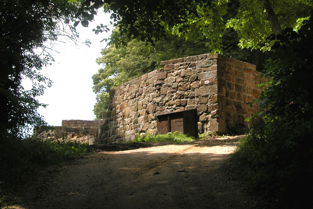
The Hohenstaufen dynasty (, , ), also known as the Staufer, was a noble family of unclear origin that rose to rule the Duchy of Swabia from 1079, and to royal rule in the Holy Roman Empire during the Middle Ages from 1138 until 1254. The dynasty's most prominent rulers – Frederick I (1155), Henry VI (1191) and Frederick II (1220) – ascended the imperial throne and also reigned over Italy and Burgundy. The non-contemporary name of 'Hohenstaufen' is derived from the family's Hohenstaufen Castle on the Hohenstaufen mountain at the northern fringes of the Swabian Jura, near the town of Göppingen. Under Hohenstaufen rule, the Holy Roman Empire reached its greatest territorial extent from 1155 to 1268. Name The name Hohenstaufen was first used in the 14th century to distinguish the 'high' (''hohen'') conical hill named Staufen in the Swabian Jura (in the district of Göppingen) from the village of the same name in the valley below. The new name was only applied to the hill ... [...More Info...] [...Related Items...] OR: [Wikipedia] [Google] [Baidu] |
Malta
Malta ( , , ), officially the Republic of Malta ( mt, Repubblika ta' Malta ), is an island country in the Mediterranean Sea. It consists of an archipelago, between Italy and Libya, and is often considered a part of Southern Europe. It lies south of Sicily (Italy), east of Tunisia, and north of Libya. The official languages are Maltese and English, and 66% of the current Maltese population is at least conversational in the Italian language. Malta has been inhabited since approximately 5900 BC. Its location in the centre of the Mediterranean has historically given it great strategic importance as a naval base, with a succession of powers having contested and ruled the islands, including the Phoenicians and Carthaginians, Romans, Greeks, Arabs, Normans, Aragonese, Knights of St. John, French, and British, amongst others. With a population of about 516,000 over an area of , Malta is the world's tenth-smallest country in area and fourth most densely populated sovereign cou ... [...More Info...] [...Related Items...] OR: [Wikipedia] [Google] [Baidu] |
Mount Etna
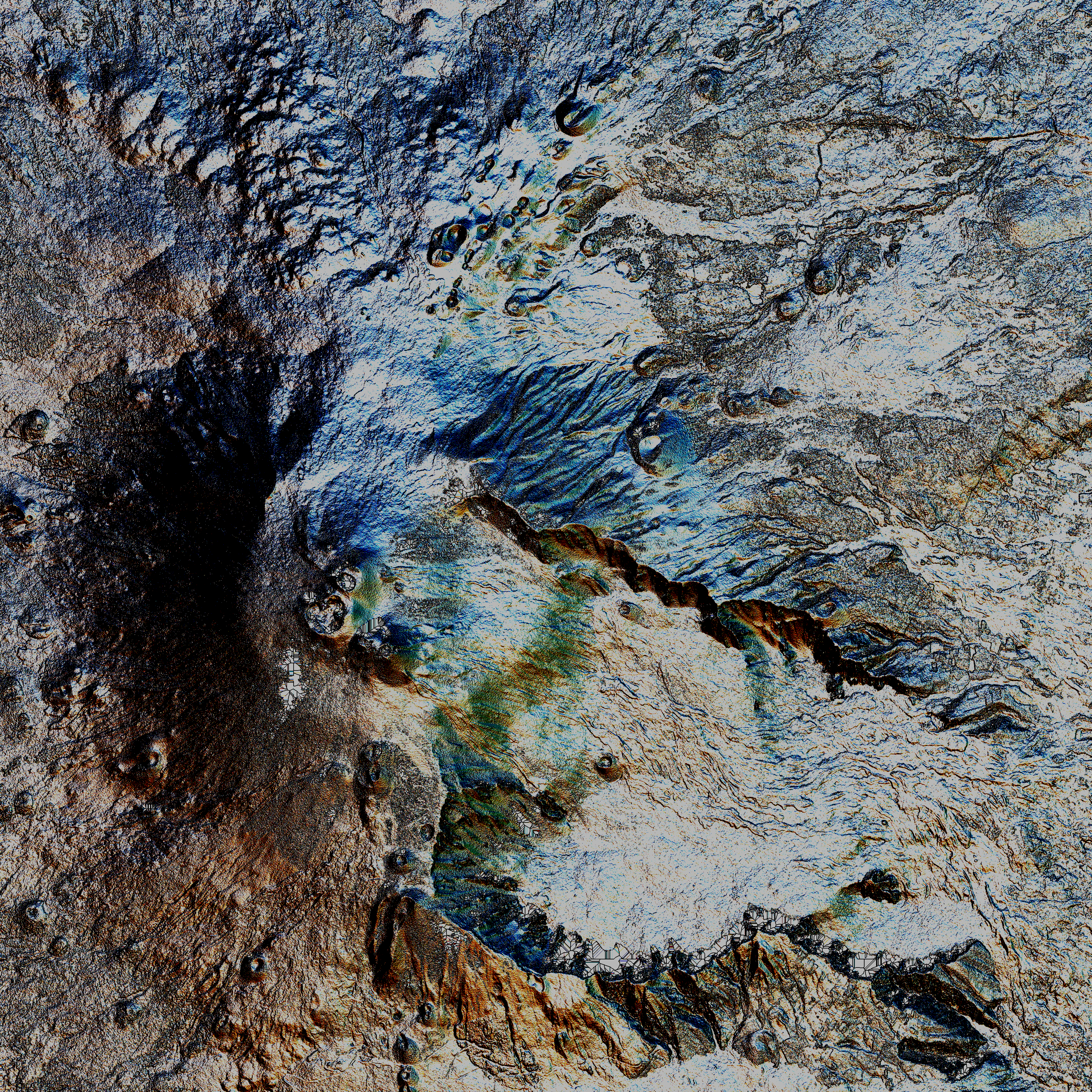
Mount Etna, or simply Etna ( it, Etna or ; scn, Muncibbeḍḍu or ; la, Aetna; grc, Αἴτνα and ), is an active stratovolcano on the east coast of Sicily, Italy, in the Metropolitan City of Catania, between the cities of Messina and Catania. It lies above the convergent plate margin between the African Plate and the Eurasian Plate. It is one of the tallest active volcanoes in Europe, and the tallest peak in Italy south of the Alps with a current height (July 2021) of , though this varies with summit eruptions. Over a six-month period in 2021, Etna erupted so much volcanic material that its height increased by approximately , and the southeastern crater is now the tallest part of the volcano. Etna covers an area of with a basal circumference of . This makes it by far the largest of the three active volcanoes in Italy, being about two and a half times the height of the next largest, Mount Vesuvius. Only Mount Teide on Tenerife in the Canary Islands surpasses it in ... [...More Info...] [...Related Items...] OR: [Wikipedia] [Google] [Baidu] |
Byzantine Era
The Byzantine calendar, also called the Roman calendar, the Creation Era of Constantinople or the Era of the World ( grc, Ἔτη Γενέσεως Κόσμου κατὰ Ῥωμαίους, also or , abbreviated as ε.Κ.; literal translation of Ancient Greek Roman year since the creation of the universe), was the calendar used by the Eastern Orthodox Church from c. 691 to 1728 in the Ecumenical Patriarchate. "Οικουμενικόν Πατριαρχείον", ΘΗΕ, τόμ. 09, εκδ. Μαρτίνος Αθ., Αθήνα 1966, στ. 778. "Ecumenical Patriarchate". ''Religious and Ethical Encyclopedia''. Vol. 9., Athens, 1966. p. 778. It was also the official calendar of the Byzantine Empire from 988 to 1453 and of Kievan Rus' and Russia from c. 988 to 1700. This calendar was used also in other areas of the Byzantine commonwealth such as in Serbia, where it is found in old Serbian legal documents such as Dušan's Code, thus being referred to as the Serbian Calendar as w ... [...More Info...] [...Related Items...] OR: [Wikipedia] [Google] [Baidu] |
Sicily
(man) it, Siciliana (woman) , population_note = , population_blank1_title = , population_blank1 = , demographics_type1 = Ethnicity , demographics1_footnotes = , demographics1_title1 = Sicilian , demographics1_info1 = 98% , demographics1_title2 = , demographics1_info2 = , demographics1_title3 = , demographics1_info3 = , timezone1 = CET , utc_offset1 = +1 , timezone1_DST = CEST , utc_offset1_DST = +2 , postal_code_type = , postal_code = , area_code_type = ISO 3166 code , area_code = IT-82 , blank_name_sec1 = GDP (nominal) , blank_info_sec1 = €89.2 billion (2018) , blank1_name_sec1 = GDP per capita , blank1_info_sec1 ... [...More Info...] [...Related Items...] OR: [Wikipedia] [Google] [Baidu] |
Dragut
Dragut ( tr, Turgut Reis) (1485 – 23 June 1565), known as "The Drawn Sword of Islam", was a Muslim Ottoman naval commander, governor, and noble, of Turkish or Greek descent. Under his command, the Ottoman Empire's maritime power was extended across North Africa. Recognized for his military genius, and as being among "the most dangerous" of corsairs, Dragut has been referred to as "the greatest pirate warrior of all time", "undoubtedly the most able of all the Turkish leaders", and "the uncrowned king of the Mediterranean". He was described by a French admiral as "A living chart of the Mediterranean, skillful enough on land to be compared to the finest generals of the time. No one was more worthy than he to bear the name of king". In addition to serving as Admiral and Corsair in the Ottoman Empire's Navy under Suleiman the Magnificent, Dragut was also appointed Bey of Algiers and Djerba, Beylerbey of the Mediterranean, as well as Bey, and subsequently Pasha, of Tripoli. While ... [...More Info...] [...Related Items...] OR: [Wikipedia] [Google] [Baidu] |
Shore
A shore or a shoreline is the fringe of land at the edge of a large body of water, such as an ocean, sea, or lake. In physical oceanography, a shore is the wider fringe that is geologically modified by the action of the body of water past and present, while the beach is at the edge of the shore, representing the intertidal zone where there is one. In contrast to a coast, a shore can border any body of water, while the coast must border an ocean or a sea. Therefore, in that sense, a coast is a type of shore. However, the word "coast" often refers to an area far wider than the shore, often stretching miles into the interior. Shores are influenced by the topography of the surrounding landscape, as well as by water induced erosion, such as waves. The geological composition of rock and soil dictates the type of shore which is created. Rivieras ''Riviera'' is an Italian word for "shoreline", ultimately derived from Latin ''ripa'' ("riverbank"). It came to be applied as a proper n ... [...More Info...] [...Related Items...] OR: [Wikipedia] [Google] [Baidu] |
Baron
Baron is a rank of nobility or title of honour, often hereditary, in various European countries, either current or historical. The female equivalent is baroness. Typically, the title denotes an aristocrat who ranks higher than a lord or knight, but lower than a viscount or count. Often, barons hold their fief – their lands and income – directly from the monarch. Barons are less often the vassals of other nobles. In many kingdoms, they were entitled to wear a smaller form of a crown called a ''coronet''. The term originates from the Latin term , via Old French. The use of the title ''baron'' came to England via the Norman Conquest of 1066, then the Normans brought the title to Scotland and Italy. It later spread to Scandinavia and Slavic lands. Etymology The word '' baron'' comes from the Old French , from a Late Latin "man; servant, soldier, mercenary" (so used in Salic law; Alemannic law has in the same sense). The scholar Isidore of Seville in the 7th century t ... [...More Info...] [...Related Items...] OR: [Wikipedia] [Google] [Baidu] |


