|
Botley Hill
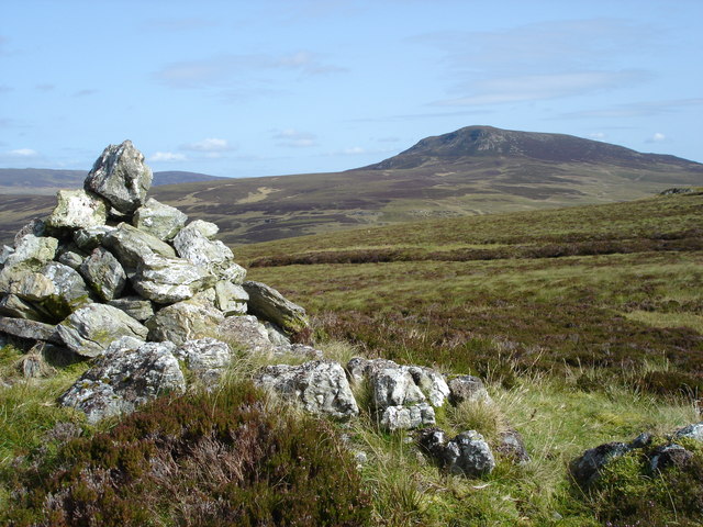
Botley Hill is a hill in Surrey and is the highest point of the North Downs with a height of . The Prime Meridian crosses the hill. Geography Botley Hill is a Marilyn (a hill with topographic prominence of at least 150m), and the third highest point in the county (after the peaks of Leith Hill south of Dorking and Gibbet Hill in Hindhead, both on the Greensand Ridge). Botley Hill was a main surveying point for the Anglo-French Survey (1784–1790) which sought to precisely measure the relative positions of the Royal Greenwich Observatory and the Paris Observatory. This task was led by General William Roy. By coincidence Botley Hill lies due south of the Greenwich Observatory, as the Prime Meridian of the world passes over the top of the hill, just to the west of the summit. The summit lies at the edge of a water tower enclosure to the north of The Ridge, less than 1 km from the North Downs Way. Previously the location of the Marilyn was given as the trig point at ... [...More Info...] [...Related Items...] OR: [Wikipedia] [Google] [Baidu] |
Leith Hill
Leith Hill in southern England is the highest summit of the Greensand Ridge, approximately southwest of Dorking, Surrey and southwest of Charing Cross, central London. It reaches above mean sea level, above sea level, and is the second highest point in southeast England, after Walbury Hill in southwest Berkshire, (which is high). Leith Hill is the highest ground for . Four areas of woodland surrounding the hill comprise the Leith Hill SSSI, Leith Hill Site of Special Scientific Interest, although the summit is excluded from this designation. The nearest railway station is Holmwood railway station, Holmwood station, to the east, served by Southern (train operating company), Southern trains to London Victoria station, London Victoria. Leith Hill Tower On the summit of Leith Hill is an 18th-century Gothic tower. In 1764–65 Richard Hull of nearby Leith Hill Place built "Prospect House", later to become known as Leith Hill Tower, with the intention of raising the hill abo ... [...More Info...] [...Related Items...] OR: [Wikipedia] [Google] [Baidu] |
Paris Observatory
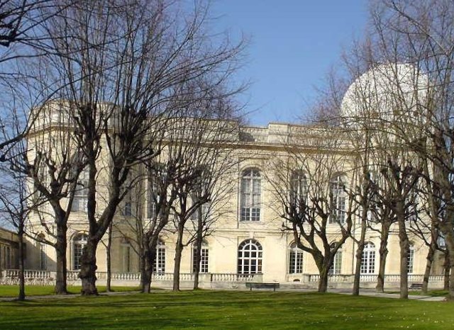
The Paris Observatory (french: Observatoire de Paris ), a research institution of the Paris Sciences et Lettres University, is the foremost astronomical observatory of France, and one of the largest astronomical centers in the world. Its historic building is on the Left Bank of the Seine in central Paris, but most of the staff work on a satellite campus in Meudon, a suburb southwest of Paris. The Paris Observatory was founded in 1667. Construction was completed by the early 1670s and coincided with a major push for increased science, and the founding of the Royal Academy of Sciences. King Louis XIV's minister of finance organized a "scientific powerhouse" to increase understanding of astronomy, maritime navigation, and science in general. Through the centuries the Paris Observatory has continued in support of astronomical activities, and in the 21st century connects multiple sites and organizations, supporting astronomy and science, past and present. Constitution Administrat ... [...More Info...] [...Related Items...] OR: [Wikipedia] [Google] [Baidu] |
Thames Basin
The River Thames ( ), known alternatively in parts as the River Isis, is a river that flows through southern England including London. At , it is the longest river entirely in England and the second-longest in the United Kingdom, after the River Severn. The river rises at Thames Head in Gloucestershire, and flows into the North Sea near Tilbury, Essex and Gravesend, Kent, via the Thames Estuary. From the west it flows through Oxford (where it is sometimes called the Isis), Reading, Henley-on-Thames and Windsor. The Thames also drains the whole of Greater London. In August 2022, the source of the river moved five miles to beyond Somerford Keynes due to the heatwave in July 2022. The lower reaches of the river are called the Tideway, derived from its long tidal reach up to Teddington Lock. Its tidal section includes most of its London stretch and has a rise and fall of . From Oxford to the Estuary the Thames drops by 55 metres. Running through some of the drier parts of ... [...More Info...] [...Related Items...] OR: [Wikipedia] [Google] [Baidu] |
Hampstead
Hampstead () is an area in London, which lies northwest of Charing Cross, and extends from Watling Street, the A5 road (Roman Watling Street) to Hampstead Heath, a large, hilly expanse of parkland. The area forms the northwest part of the London Borough of Camden, a borough in Inner London which for the purposes of the London Plan is designated as part of Central London. Hampstead is known for its intellectual, liberal, artistic, musical, and literary associations. It has some of the most expensive housing in the London area. Hampstead has more millionaires within its boundaries than any other area of the United Kingdom.Wade, David"Whatever happened to Hampstead Man?" ''The Daily Telegraph'', 8 May 2004 (retrieved 3 March 2016). History Toponymy The name comes from the Old English, Anglo-Saxon words ''ham'' and ''stede'', which means, and is a cognate of, the Modern English "homestead". To 1900 Early records of Hampstead can be found in a grant by King Ethelred the Unread ... [...More Info...] [...Related Items...] OR: [Wikipedia] [Google] [Baidu] |
Highgate
Highgate ( ) is a suburban area of north London at the northeastern corner of Hampstead Heath, north-northwest of Charing Cross. Highgate is one of the most expensive London suburbs in which to live. It has two active conservation organisations, the ''Highgate Society'' and the ''Highgate Neighbourhood Forum'' to protect and enhance its character and amenities. Until late Victorian times it was a distinct village outside London, sitting astride the main road to the north. The area retains many green expanses including the eastern part of Hampstead Heath, three ancient woods, Waterlow Park and the eastern-facing slopes known as Highgate bowl. At its centre is Highgate village, largely a collection of Georgian shops, pubs, restaurants, residential streets, and the Sacred Spirits Distillery interspersed with diverse landmarks such as St Michael's Church and steeple, St. Joseph's Church and its green copper dome, Highgate School (1565), Jacksons Lane arts centre housed in a Gra ... [...More Info...] [...Related Items...] OR: [Wikipedia] [Google] [Baidu] |
Primrose Hill
Primrose Hill is a Grade II listed public park located north of Regent's Park in London, England, first opened to the public in 1842.Mills, A., ''Dictionary of London Place Names'', (2001) It was named after the natural hill in the centre of the park, the second highest natural point in the London Borough of Camden. The hill summit has a clear view of central London, as well as Hampstead and Belsize Park to the north and is adorned by an engraved quotation from William Blake. Based on the popularity of the park, the surrounding district and electoral ward were named Primrose Hill. The Primrose Hill district is in the London Borough of Camden, England. Amenities of the park include an outdoor gym known as the Hill Trim Trail, a children's playground, and toilets, all located on the south side near Primrose Hill bridge which connects to London Zoo and Regent's Park. History Like the Regent's Park, Primrose Hill was once part of a great chase appropriated by Henry VIII. ... [...More Info...] [...Related Items...] OR: [Wikipedia] [Google] [Baidu] |
Stanmore
Stanmore is part of the London Borough of Harrow in London. It is centred northwest of Charing Cross, lies on the outskirts of the London urban area and includes Stanmore Hill, one of the highest points of London, at high. The district, which developed from the ancient Middlesex parishes of Great and Little Stanmore, lies immediately west of Roman Watling Street (the A5 road) and forms the eastern part of the modern London Borough of Harrow. Stanmore is the location of the former RAF Bentley Priory station - base of the Fighter Command during both world wars - along with its accommodating Bentley Priory mansion, notably the last residence of Queen Adelaide. Some members of the Bernays family were also based here, including Adolphus Bernays and his son and grandson who were both rectors of St John's church; the Bernays Institute and Bernays Gardens are public amenities in the centre of the old village. The district increasingly developed into a London suburb during the 20t ... [...More Info...] [...Related Items...] OR: [Wikipedia] [Google] [Baidu] |
Alexandra Palace
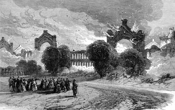
Alexandra Palace is a Grade II listed entertainment and sports venue in London, situated between Wood Green and Muswell Hill in the London Borough of Haringey. It is built on the site of Tottenham Wood and the later Tottenham Wood Farm. Originally built by John Johnson and Alfred Meeson, it opened in 1873 but following a fire two weeks after its opening, was rebuilt by Johnson. Intended as "The People's Palace" and often referred to as "Ally Pally", its purpose was to serve as a public centre of recreation, education and entertainment; North London's counterpart to the Crystal Palace in South London. At first a private venture, in 1900, the owners planned to sell it and Alexandra Park for development. A group of neighbouring local authorities managed to acquire it. An Act of Parliament created the Alexandra Palace and Park Trust. The Act required the trustees to maintain the building and park and make them available for the free use and recreation of the public forever. Th ... [...More Info...] [...Related Items...] OR: [Wikipedia] [Google] [Baidu] |
Croydon
Croydon is a large town in south London, England, south of Charing Cross. Part of the London Borough of Croydon, a local government district of Greater London. It is one of the largest commercial districts in Greater London, with an extensive shopping district and night-time economy. The entire town had a population of 192,064 as of 2011, whilst the wider borough had a population of 384,837. Historically an ancient parish in the Wallington hundred of Surrey, at the time of the Norman conquest of England Croydon had a church, a mill, and around 365 inhabitants, as recorded in the Domesday Book of 1086. Croydon expanded in the Middle Ages as a market town and a centre for charcoal production, leather tanning and brewing. The Surrey Iron Railway from Croydon to Wandsworth opened in 1803 and was an early public railway. Later 19th century railway building facilitated Croydon's growth as a commuter town for London. By the early 20th century, Croydon was an important industria ... [...More Info...] [...Related Items...] OR: [Wikipedia] [Google] [Baidu] |
Oxted
Oxted is a town and civil parish in the Tandridge district of Surrey, England, at the foot of the North Downs. It is south south-east of Croydon in Greater London, west of Sevenoaks in Kent, and north of East Grinstead in West Sussex. Oxted is a commuter town with a railway station, with direct train services to London and has the district council offices. Its main developed area is contiguous with the village of Limpsfield. Six intermittent headwaters of the River Eden unite in the occasional market town including its furthest source, east of Titsey Place. The Eden feeds into Kent's longest river, the Medway. Only the southern slope of the North Downs is steep and its towns and farmland form the Vale of Holmesdale, a series of headwaters across Surrey and Kent to separate rivers. The settlements of Hurst Green and Holland within the civil parish to the south, including a public house named after Oxted, are continuous but almost wholly residential areas (contiguous neighb ... [...More Info...] [...Related Items...] OR: [Wikipedia] [Google] [Baidu] |
Spot Height
A spot height is an exact point on a map with an elevation recorded beside it that represents its height above a given datum.Whittow, John (1984). ''Dictionary of Physical Geography''. London: Penguin, 1984, p. 506. . In the UK this is the Ordnance Datum. Unlike a bench-mark, which is marked by a disc or plate, there is no official indication of a spot height on the ground although, in open country, spot heights may sometimes be marked by cairns. In geoscience, it can be used for showing elevations on a map, alongside contours, bench marks, etc. See also * Surveying * Benchmark (surveying) * Triangulation station A triangulation station, also known as a trigonometrical point, and sometimes informally as a trig, is a fixed surveying station, used in geodetic surveying and other surveying projects in its vicinity. The nomenclature varies regionally: they a ... References Cartography Geodesy Surveying Vertical position {{geodesy-stub ... [...More Info...] [...Related Items...] OR: [Wikipedia] [Google] [Baidu] |
North Downs Way
The North Downs Way National Trail is a long-distance path in southern England, opened in 1978. It runs from Farnham to Dover, past Guildford, Dorking, Merstham, Otford and Rochester, along the Surrey Hills Area of Outstanding Natural Beauty (AONB) and Kent Downs AONB. History Planning for a new Long Distance Path, as they were classified in 1949, began in Kent in 1950. After an extensive survey, it was agreed that a route on "a line which offers the best scenic qualities for the walker" along the ridge of the North Downs, rather than the Pilgrim's Way (which even in the 1960s was predominantly metalled road), was preferred. Working alongside Surrey County Council, plans were eventually submitted in 1966. The North Downs Way was officially designated by the then Minister of Housing and Local Government, Anthony Greenwood, on 14 July 1969, and opened in parts shortly afterwards, becoming fully open in 1978. At that time, it was long, of which were newly created public righ ... [...More Info...] [...Related Items...] OR: [Wikipedia] [Google] [Baidu] |


_-_0036B.jpg)

