|
Borama
Borama ( so, Boorama, ar, بورما) is the Second capital city of Somaliland and the largest city of the northwestern Awdal region of Somaliland The commercial seat of the province, it is situated near the border with Ethiopia. During the Middle Ages, Borama was ruled by the Adal Sultanate. It later formed a part of the British Somaliland protectorate in the first half of the 20th century. According to the UNDP in 2014, the city had a population of around 398,609 making it one of the largest cities inside Somaliland. It has been a leading example in community organizing, having been the first area in Somaliland to adopt a self-help scheme in the wake of the civil war. History As with several nearby towns such as Amud, numerous archaeological finds have been discovered in the Borama area that point to an eventful past. The latter include ancient remains of tombs, houses and mosques, in addition to sherds of Oriental wares, particularly Chinese porcelain. The artefacts a ... [...More Info...] [...Related Items...] OR: [Wikipedia] [Google] [Baidu] |
Awdal
Awdal ( so, Awdal, ar, أودَل) is an administrative region ('' gobol'') in western Somaliland. It was separated from Woqooyi Galbeed and became a province in 1984 and is the most northwesterly province of Somaliland. To the east it borders Maroodi Jeex and Sahil; to its north-west it borders Djibouti; to its south and south-west lies Ethiopia; and the Gulf of Aden to its north. The province has an estimated population of 673,263. The region comprises the four districts of Borama, the regional capital, Baki, Lughaya, and Zeila. Overview Awdal (أودل) takes its name from the medieval Adal Sultanate (عَدَل), which was originally centered on Zeila. The area along the Ethiopian border is abundant with ruined cities, which were described by the British explorer Richard F. Burton. Topographical Arabian plate Awdal region is three distinct topographical zones: the coastal, mountainous and plateau (Ogo) zones. Starting from the north along the sea is the coastal ... [...More Info...] [...Related Items...] OR: [Wikipedia] [Google] [Baidu] |
Mayor Of Borama
The Mayor of Borama is head of the executive branch of Borama City, the capital of Awdal region. The current mayor is Mohamed Ahmed Warsame, who was elected on 17 June 2021. List of mayors See also * Mayor of Berbera * Mayor of Burao * Mayor of Erigavo * Mayor of Hargeisa * Mayor of Las Anod The Mayor of Las Anod is the chief executive of the city of Las Anod, the capital of Sool, Somalia, Sool region in Somaliland. The current mayor is Abdirahim Ali Ismail, who took office on 20 June 2021. List of mayors See also * Mayor of Be ... References Mayors of places in Somaliland {{Somaliland-gov-off-stub ... [...More Info...] [...Related Items...] OR: [Wikipedia] [Google] [Baidu] |
Somaliland
Somaliland,; ar, صوماليلاند ', ' officially the Republic of Somaliland,, ar, جمهورية صوماليلاند, link=no ''Jumhūrīyat Ṣūmālīlānd'' is a ''List of states with limited recognition, de facto'' sovereign state in the Horn of Africa, still considered internationally to be part of Somalia. Somaliland lies in the Horn of Africa, on the southern coast of the Gulf of Aden. It is bordered by Djibouti to the northwest, Ethiopia to the south and west, and Somalia to the east.Encyclopædia Britannica, ''The New Encyclopædia Britannica'', (Encyclopædia Britannica: 2002), p.835 Its claimed territory has an area of , with approximately 5.7 million residents as of 2021. The capital and largest city is Hargeisa. The government of Somaliland regards itself as the Succession of states, successor state to British Somaliland, which, as the briefly independent State of Somaliland, united in 1960 with the Trust Territory of Somaliland (the former Italian Soma ... [...More Info...] [...Related Items...] OR: [Wikipedia] [Google] [Baidu] |
Borama District
Borama District ( so, Degmada Boorama) is a district of the Awdal region in Somaliland. Demographics The Awdal region in which the district is situated is inhabited by people from the Somali ethnic group, with the Gadabuursi subclan of the Dir especially well represented and considered the predominant clan of the region. Federico Battera (2005) states about the Awdal Region: "Awdal is mainly inhabited by the Gadabuursi confederation of clans." A UN Report published by Canada: Immigration and Refugee Board of Canada (1999), states concerning Awdal: "The Gadabuursi clan dominates Awdal region. As a result, regional politics in Awdal is almost synonymous with Gadabuursi internal clan affairs." Roland Marchal (1997) states that numerically, the Gadabuursi are the predominant inhabitants of the Awdal Region: "The Gadabuursi's numerical predominance in Awdal virtually ensures that Gadabuursi interests drive the politics of the region." Marleen Renders and Ulf Terlinden (2010) ... [...More Info...] [...Related Items...] OR: [Wikipedia] [Google] [Baidu] |
Regions Of Somaliland
The regions of Somaliland ( so, Gobolada Somaliland; ar, محافظات صوماليلاند) is divided into six administrative regions, Awdal, Sahil, Maroodi-Jeeh, Togdheer, Sanaag and Sool. These are in turn subdivided into twenty-two districts. Regions of Somaliland are the primary geographical divisions through which Somaliland is administered. A distinction is made between districts of grades A, B, C and D, with the classification being based on population, area, economy and production. Regions History British territory and independence era The local administration of British Somaliland (1884-June 26, 1960) was stipulated primarily by the Local Government Ordinance of 1953. The ordinance established councils in six districts that had divided Somaliland since 1944. The ordinance continued to be used after independence as the State of Somaliland (June 26-July 1, 1960). At the time of the integration with Italian Somaliland on July 1, 1960, there were the fo ... [...More Info...] [...Related Items...] OR: [Wikipedia] [Google] [Baidu] |
Abdurahman Sheikh Nuur
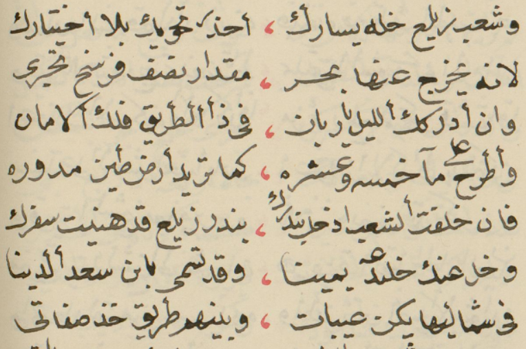
Sheikh Abdurahman Sh. Nur ( so, Sheekh Cabdiraxmaan Sheekh Nuur, ar, شيخ عبد الرحمن شيخ نور) was a Somali Sheikh (religious leader), qādi (judge) of the government at that time and the inventor of the Borama script for the Somali language. Biography Sheikh Abdurahman Sh. Nur was born in Gabiley and grew up in Borama and was of the royal lineage, the Reer Ugaas subclan of the Makayl-Dheere branch of the Gadabuursi Dir clan.David D. Laitin, ''Politics, Language, and Thought: The Somali Experience'', (University Of Chicago Press: 1977), pp.86-87. Growing up he was a Qur'anic teacher in the British Somaliland protectorate. His father Sheikh Nur was a well-known and notable figure and was a qādi for many years. He was a learned or knowledgeable man, in particular when it came to the history of his own clan, the Gadabuursi. Sheikh 'Abdurahman would later follow in his father's footsteps by also becoming a qādi, albeit of the entire northern British Somalila ... [...More Info...] [...Related Items...] OR: [Wikipedia] [Google] [Baidu] |
Districts Of Somaliland
The Districts of Somaliland (also known as local government districts) are second-level administrative subdivisions of Somaliland, below the level of region. There are a total of 22 district, each district is rated A, B, C, or D according to population, budget, and economic scale with the highest being A grade. The district where the state capital is located is always Class A (by Article 9 of the Local Government Law). The region with the most districts is Sanaag region (5), while the region with the fewest is Sahil region (2). The notation follows the Somali version of the 2019 Local Government Act. History From 1884 to 26 June 1960, Somaliland was divided into 6 administrative districts and the council (capital) was located in the city of the same name.https://www.faoswalim.org/resources/Land/General_Survey_Somaliland_Protectorate_1944-1950.pdf List of Districts Awdal Region Marodi Jeh Region Sanaag Region Sahil Region Sool Region Togdheer Region ... [...More Info...] [...Related Items...] OR: [Wikipedia] [Google] [Baidu] |
Somali Language
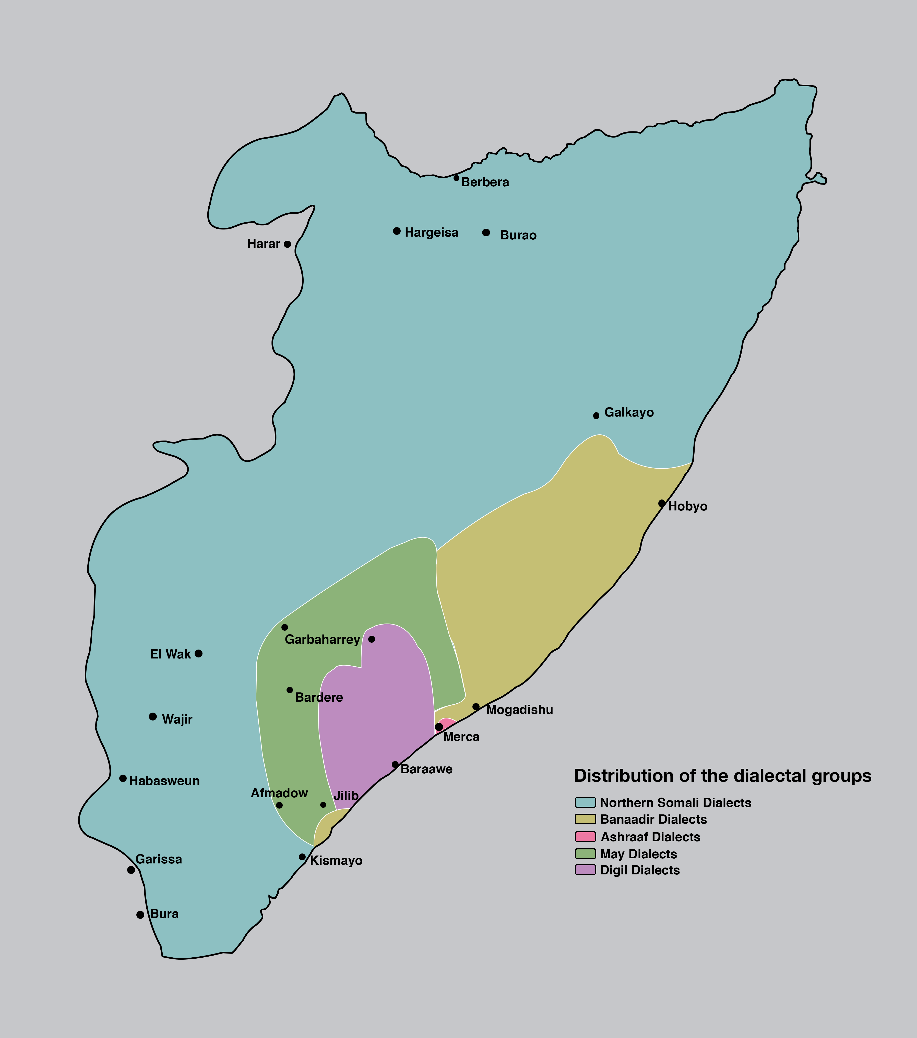
Somali (Latin script: ; Wadaad: ; Osmanya: 𐒖𐒍 𐒈𐒝𐒑𐒛𐒐𐒘 ) is an Afroasiatic language belonging to the Cushitic branch. It is spoken as a mother tongue by Somalis in Greater Somalia and the Somali diaspora. Somali is an official language in Somalia and Ethiopia, and a national language in Djibouti as well as in northeastern Kenya. The Somali language is written officially with the Latin alphabet although the Arabic alphabet and several Somali scripts like Osmanya, Kaddare and the Borama script are informally used.Lewis, I.M. (1958)The Gadabuursi Somali Script ''Bulletin of the School of Oriental and African Studies'', University of London, Vol. 21, pp. 134–156. Classification Somali is classified within the Cushitic branch of the Afroasiatic family, specifically, Lowland East Cushitic in addition to Afar and Saho. Somali is the best-documented of the Cushitic languages, with academic studies of the language dating back to the late 19th century. ... [...More Info...] [...Related Items...] OR: [Wikipedia] [Google] [Baidu] |
Amud
Amud or Amoud ( so, Camuud, ar, عمود) is an ancient, ruined town in the Awdal region of Somaliland.Damtew Teferra, ''African higher education: an international reference handbook'', (Indiana University Press: 2003) Named after its patron Saint ''Amud'' it was a center of activity during the Golden Age of the Adal Kingdom. The archaeological site is situated above sea level, around 10 km southeast of the regional capital Borama.Huntingford, "The town of Amud, Somalia", ''Azania'', 13 (1978), p. 184 Overview The historian G.W.B. Huntingford (1930) gives a detailed description of the ancient town in ''The town of Amud, Somaliland'': "The house are scattered around without any apparent plan; there are no streets and no trace of a surrounding wall. There is a mosque in the southern half of the dwelling area... ith arather oddly built mihrab facing the entrance... and immediately to the south... is the cemetery. There are upwards of two hundred houses, all well-built of ... [...More Info...] [...Related Items...] OR: [Wikipedia] [Google] [Baidu] |
Qaitbay
Sultan Abu Al-Nasr Sayf ad-Din Al-Ashraf Qaitbay ( ar, السلطان أبو النصر سيف الدين الأشرف قايتباي) (c. 1416/14187 August 1496) was the eighteenth Burji Mamluk Sultan of Egypt from 872 to 901 A.H. (1468–1496 C.E.). (Other transliterations of his name include Qaytbay, Kait Bey, and Qayt Bay.) He was Circassian by birth, and was purchased by the ninth sultan Barsbay (1422 to 1438 C.E.) before being freed by the eleventh Sultan Jaqmaq (1438 to 1453 C.E.). During his reign, he stabilized the Mamluk state and economy, consolidated the northern boundaries of the Sultanate with the Ottoman Empire, engaged in trade with other contemporaneous polities, and emerged as a great patron of art and architecture. In fact, although Qaitbay fought sixteen military campaigns, he is best remembered for the spectacular building projects that he sponsored, leaving his mark as an architectural patron on Mecca, Medina, Jerusalem, Damascus, Aleppo, Alexandria, ... [...More Info...] [...Related Items...] OR: [Wikipedia] [Google] [Baidu] |
Adal Sultanate
The Adal Sultanate, or the Adal Empire or the ʿAdal or the Bar Saʿad dīn (alt. spelling ''Adel Sultanate, ''Adal ''Sultanate'') () was a medieval Sunni Muslim Empire which was located in the Horn of Africa. It was founded by Sabr ad-Din II after the fall of the Sultanate of Ifat. The kingdom flourished circa 1415 to 1577.. The sultanate and state were established by the local inhabitants of Zeila. or the Harar plateau. At its height, the polity under Sultan Badlay controlled the territory stretching from Somaliland to the port city of Suakin in Sudan. The Adal Empire maintained a robust commercial and political relationship with the Ottoman Empire. Etymology Adal is believed to be an abbreviation of Havilah. Eidal or Aw Abdal, was the Emir of Harar in the eleventh century. In the thirteenth century, the Arab writer al-Dimashqi refers to the Adal Sultanate's capital, Zeila, by its Somali name "Awdal" ( so, "Awdal"). The modern Awdal region of Somaliland, which ... [...More Info...] [...Related Items...] OR: [Wikipedia] [Google] [Baidu] |
Mamluk
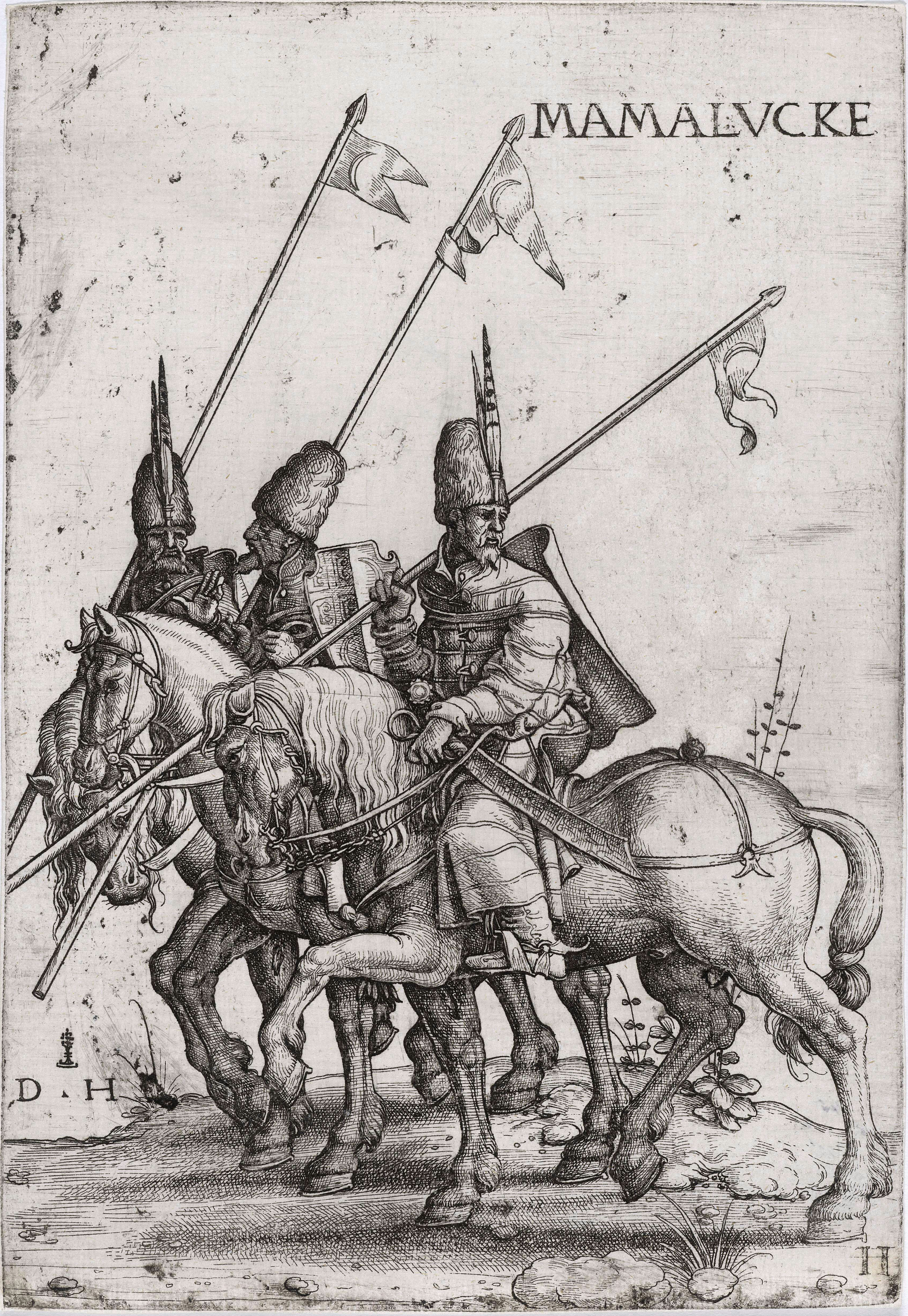
Mamluk ( ar, مملوك, mamlūk (singular), , ''mamālīk'' (plural), translated as "one who is owned", meaning "slave", also transliterated as ''Mameluke'', ''mamluq'', ''mamluke'', ''mameluk'', ''mameluke'', ''mamaluke'', or ''marmeluke'') is a term most commonly referring to non-Arab, ethnically diverse (mostly Southern Russian, Turkic, Caucasian, Eastern and Southeastern European) slave-soldiers and freed slaves who were assigned military and administrative duties, serving the ruling Arab dynasties in the Muslim world. The most enduring Mamluk realm was the knightly military class in Egypt in the Middle Ages, which developed from the ranks of slave-soldiers. Originally the Mamluks were slaves of Turkic origin from the Eurasian Steppe, but the institution of military slavery spread to include Circassians, Abkhazians, Georgians,"Relations of the Georgian Mamluks of Egypt with Their Homeland in the Last Decades of the Eighteenth Century". Daniel Crecelius and Gotch ... [...More Info...] [...Related Items...] OR: [Wikipedia] [Google] [Baidu] |


