|
Awdal
Awdal ( so, Awdal, ar, أودَل) is an administrative region (''Administrative divisions of Somaliland, gobol'') in western Somaliland. It was separated from Woqooyi Galbeed and became a province in 1984 and is the most northwesterly province of Somaliland. To the east it borders Woqooyi Galbeed, Maroodi Jeex and Sahil, Somaliland, Sahil; to its north-west it borders Djibouti; to its south and south-west lies Ethiopia; and the Gulf of Aden to its north. The province has an estimated population of 673,263. The region comprises the four districts of Borama, the regional capital, Baki District, Baki, Lughaya District, Lughaya, and Zeila District, Zeila. Overview Awdal (أودل) takes its name from the medieval Adal Sultanate (عَدَل), which was originally centered on Zeila. The area along the Ethiopian border is abundant with ruined cities, which were described by the British explorer Richard F. Burton. Topographical Arabian plate Awdal region is three distinct topo ... [...More Info...] [...Related Items...] OR: [Wikipedia] [Google] [Baidu] |
Borama
Borama ( so, Boorama, ar, بورما) is the Second capital city of Somaliland and the largest city of the northwestern Awdal region of Somaliland The commercial seat of the province, it is situated near the border with Ethiopia. During the Middle Ages, Borama was ruled by the Adal Sultanate. It later formed a part of the British Somaliland protectorate in the first half of the 20th century. According to the UNDP in 2014, the city had a population of around 398,609 making it one of the largest cities inside Somaliland. It has been a leading example in community organizing, having been the first area in Somaliland to adopt a self-help scheme in the wake of the civil war. History As with several nearby towns such as Amud, numerous archaeological finds have been discovered in the Borama area that point to an eventful past. The latter include ancient remains of tombs, houses and mosques, in addition to sherds of Oriental wares, particularly China, Chinese porcelain. The artefact ... [...More Info...] [...Related Items...] OR: [Wikipedia] [Google] [Baidu] |
Zeila
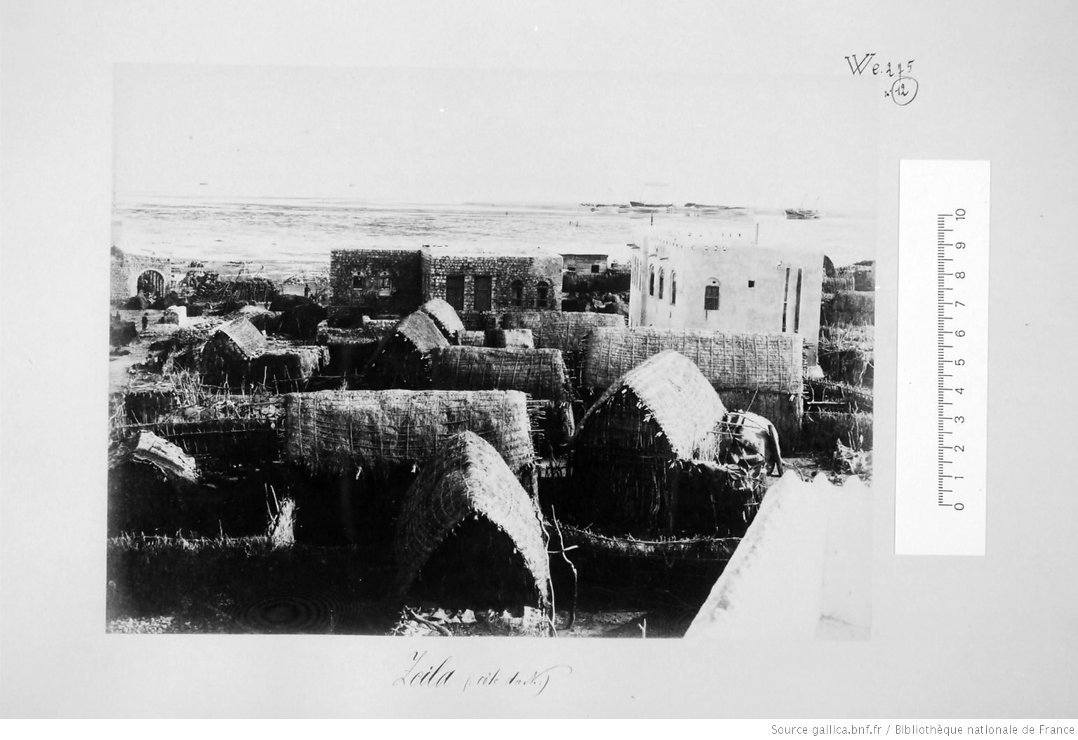
Zeila ( so, Saylac, ar, زيلع, Zayla), also known as Zaila or Zayla, is a historical port town in the western Awdal region of Somaliland. In the Middle Ages, the Jewish traveller Benjamin of Tudela identified Zeila (or Hawilah) with the Biblical location of Havilah. Most modern scholars identify it with the site of Avalites mentioned in the 1st-century Greco-Roman travelogue the ''Periplus of the Erythraean Sea'' and in Ptolemy, although this is disputed. The town evolved into an early Islamic center with the arrival of Muslims shortly after the Hijrah. By the 9th century, Zeila was the capital of the early Adal Kingdom and Ifat Sultanate in the 13th century; and also a capital for its successor state the Adal Sultanate, it would attain its height of prosperity a few centuries later in the 16th century. The city subsequently came under Ottoman and British protection in the 18th century. Up until recently Zeila was surrounded by a large wall with five gates: Bab al Sahil and B ... [...More Info...] [...Related Items...] OR: [Wikipedia] [Google] [Baidu] |
Zayla
Zeila ( so, Saylac, ar, زيلع, Zayla), also known as Zaila or Zayla, is a historical port town in the western Awdal region of Somaliland. In the Middle Ages, the Jewish traveller Benjamin of Tudela identified Zeila (or Hawilah) with the Biblical location of Havilah. Most modern scholars identify it with the site of Avalites mentioned in the 1st-century Greco-Roman travelogue the ''Periplus of the Erythraean Sea'' and in Ptolemy, although this is disputed. The town evolved into an early Islamic center with the arrival of Muslims shortly after the Hijrah. By the 9th century, Zeila was the capital of the early Adal Kingdom and Ifat Sultanate in the 13th century; and also a capital for its successor state the Adal Sultanate, it would attain its height of prosperity a few centuries later in the 16th century. The city subsequently came under Ottoman and British protection in the 18th century. Up until recently Zeila was surrounded by a large wall with five gates: Bab al Sahil and B ... [...More Info...] [...Related Items...] OR: [Wikipedia] [Google] [Baidu] |
Baki District
Baki District ( so, Degmada Baki) is a Administrative divisions of Somaliland, district in the Awdal region of western Somaliland. Demographics Baki is inhabited by the Reer Nuur branch of the Makahiil and Reer Mohamed branch of the Mahad 'Ase subclans of the Gadabuursi Dir (clan), Dir clan. Mayor *Idiris Faarax Rooble 2002 *Saleebaan Maxamuud Aadan 2016 Mining The Simodi Mountains, located 48 km east of Baki village, have long been used as a mine. In the past, coltan and other materials were mined, and nowadays beryllium is mined and is called the Simodi Beryllium Mining Site. Mining rights are complex. The Somaliland government has granted mining rights to China's African Resources Corporation (ARC.) However, local clans have complained that profits are not being returned to the local community. Somaliland government effectively controls Baki district, so the Federal Republic of Somalia has no real authority over it at all. However, there had been discussions between the Min ... [...More Info...] [...Related Items...] OR: [Wikipedia] [Google] [Baidu] |
Adal Sultanate
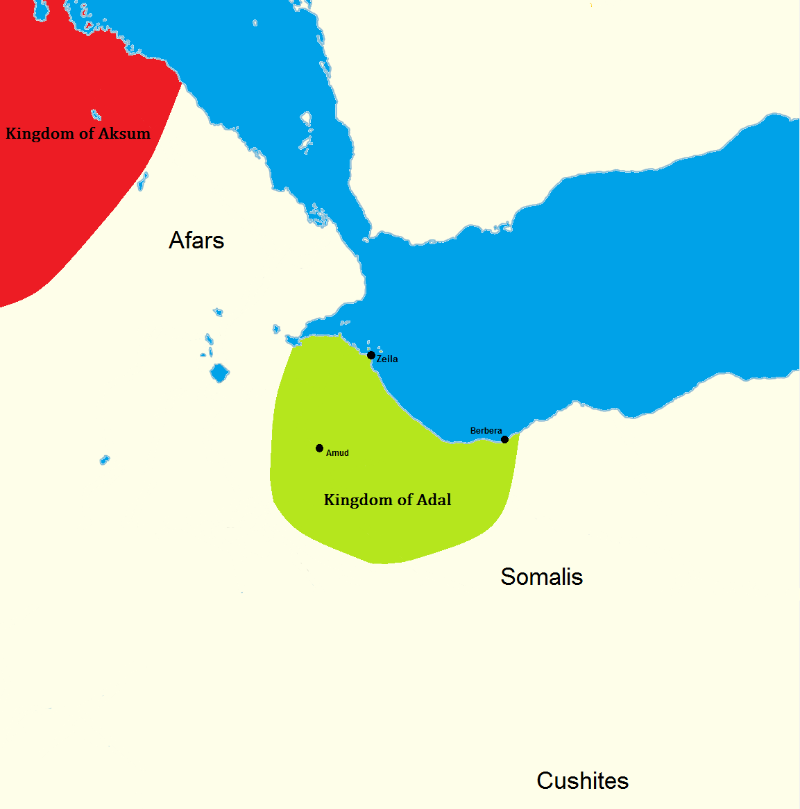
The Adal Sultanate, or the Adal Empire or the ʿAdal or the Bar Saʿad dīn (alt. spelling ''Adel Sultanate, ''Adal ''Sultanate'') () was a medieval Sunni Muslim Empire which was located in the Horn of Africa. It was founded by Sabr ad-Din II after the fall of the Sultanate of Ifat. The kingdom flourished circa 1415 to 1577.. The sultanate and state were established by the local inhabitants of Zeila. or the Harar plateau. At its height, the polity under Sultan Badlay controlled the territory stretching from Somaliland to the port city of Suakin in Sudan. The Adal Empire maintained a robust commercial and political relationship with the Ottoman Empire. Etymology Adal is believed to be an abbreviation of Havilah. Eidal or Aw Abdal, was the Emir of Harar in the eleventh century. In the thirteenth century, the Arab writer al-Dimashqi refers to the Adal Sultanate's capital, Zeila, by its Somali name "Awdal" ( so, "Awdal"). The modern Awdal region of Somaliland, which was p ... [...More Info...] [...Related Items...] OR: [Wikipedia] [Google] [Baidu] |
Governor Of Awdal
The Governor of Awdal is the chief executive of the Somaliland region of Awdal, leading the region's executive branch. Governors of the regions is appointed to the office by the Somaliland president. The current governor of Awdal is Mohammed Ahmed Alin. List of Governers See also *Awdal *Politics of Somaliland The politics of Somaliland take place within a hybrid system of governance, which, under the Somaliland constitution, combines traditional and western institutions. The constitution separates government into an executive branch, a legislative br ... References External links Governors of Awdal {{Somaliland-gov-off-stub ... [...More Info...] [...Related Items...] OR: [Wikipedia] [Google] [Baidu] |
Mohammed Ahmed Alin
Mohammed Ahmed Alin Yusuf ( so, Maxamed Axmed Caalin Yuusuf) also known as Tiimbaro is a Somaliland politician, who is currently serving as the Governor of Awdal region since June 2020. He also served as the Governor of Sanaag region of Somaliland from January 2018 to June 2020. Tiimbaro is currently serving as the Governor of Awdal region of Somaliland since June 2020. See also * Governor of Sanaag The Governor of Sanaag () is the chief executive of the Sanaag, leading the region's executive branch. Sanaag's territorial claims are disputed between Somaliland and Puntland, with some areas not clearly belonging to either of them. Therefore, n ... * Sanaag Region References Living people Governors of Awdal Governors of Sanaag Somaliland politicians Year of birth missing (living people) {{somaliland-politician-stub ... [...More Info...] [...Related Items...] OR: [Wikipedia] [Google] [Baidu] |
Somaliland
Somaliland,; ar, صوماليلاند ', ' officially the Republic of Somaliland,, ar, جمهورية صوماليلاند, link=no ''Jumhūrīyat Ṣūmālīlānd'' is a ''de facto'' sovereign state in the Horn of Africa, still considered internationally to be part of Somalia. Somaliland lies in the Horn of Africa, on the southern coast of the Gulf of Aden. It is bordered by Djibouti to the northwest, Ethiopia to the south and west, and Somalia to the east.Encyclopædia Britannica, ''The New Encyclopædia Britannica'', (Encyclopædia Britannica: 2002), p.835 Its claimed territory has an area of , with approximately 5.7 million residents as of 2021. The capital and largest city is Hargeisa. The government of Somaliland regards itself as the successor state to British Somaliland, which, as the briefly independent State of Somaliland, united in 1960 with the Trust Territory of Somaliland (the former Italian Somaliland) to form the Somali Republic.''The New Encyclopædia Br ... [...More Info...] [...Related Items...] OR: [Wikipedia] [Google] [Baidu] |
Lughaya District
Lughaya District ( so, Degmada Lughaya) is a district of the Awdal region in Somaliland. Lughaya District has a total population of 101,104 residents. Demographics The broader Lughaya District has a total population of 101,104 residents. The district is mainly inhabited by the Mahad 'Ase subclan of the Gadabuursi Dir clan who make up the predominant clan in the district. Malte Sommerlatte (2000) states: "In the centre of the study area are the Gadabursi, who extend from the coastal plains around Lughaye, through the Baki and Borama districts into the Ethiopian highlands west of Jijiga." In the Ruin and Renewal: The story of Somaliland (2004), the author states: "So too is the boundary of Lughaya district whose predominant (if not exclusive) inhabitants are today Gadabursi." The FSAU Monthly Food Security Report March (2003) states that the Gadabuursi clan are the main local inhabitants of the Lughaya District whilst Issa pastoralists migrate to the region seasonally from Ethi ... [...More Info...] [...Related Items...] OR: [Wikipedia] [Google] [Baidu] |
Regions Of Somaliland
The regions of Somaliland ( so, Gobolada Somaliland; ar, محافظات صوماليلاند) is divided into six administrative regions, Awdal, Sahil, Maroodi-Jeeh, Togdheer, Sanaag and Sool. These are in turn subdivided into twenty-two districts. Regions of Somaliland are the primary geographical divisions through which Somaliland is administered. A distinction is made between districts of grades A, B, C and D, with the classification being based on population, area, economy and production. Regions History British territory and independence era The local administration of British Somaliland (1884-June 26, 1960) was stipulated primarily by the Local Government Ordinance of 1953. The ordinance established councils in six districts that had divided Somaliland since 1944. The ordinance continued to be used after independence as the State of Somaliland (June 26-July 1, 1960). At the time of the integration with Italian Somaliland on July 1, 1960, there were the follow ... [...More Info...] [...Related Items...] OR: [Wikipedia] [Google] [Baidu] |
Zeila District
Zeila District ( so, Degmada Saylac) is a district in western Somaliland. Its capital is at Zeila. Demographics The town of Zeila is primarily inhabited by people from the Somali ethnic group, with the Gadabuursi subclan of the Dir especially well represented.Samatar, Abdi I. (2001) "Somali Reconstruction and Local Initiative: Amoud University," , p. 132. The Issa subclan of the Dir are especially well represented in the wider Zeila District. Tim Glawion (2020) describes the clan demographics of both the town of Zeila and the wider Zeila District: "Three distinct circles can be distinguished based on the way the security arena is composed in and around Zeila: first, Zeila town, the administrative centre, which is home to many government institutions and where the mostly ethnic Gadabuursi/Samaron inhabitants engage in trading or government service activities; second, Tokhoshi, an artisanal salt mining area eight kilometres west of Zeila, where a mixture of clan and state ins ... [...More Info...] [...Related Items...] OR: [Wikipedia] [Google] [Baidu] |
Administrative Divisions Of Somaliland
The administrative division of Somaliland are organized into three hierarchical levels. consists of 6 regions and 22 districts. Districts in turn contain villages. In addition, the capital Hargeisa has its own law (capital law) that is different from the law that defines administrative divisions. The administrative-territorial division of the country is established by the Law of Somaliland No. 23/2002 ( so, Xeerka Ismaamulka Gobolada iyo Degmooyinka), which was finally approved in 2007. Somaliland is a self-declared unrecognized sovereign state in the Horn of Africa, internationally considered to be part of Somalia. History Before March 21, 2008, the Somaliland government continued to use the six administrative regions covered by Somalia at the time of unification: Awdal, Waqooyi Gelbeed, Sanaag, Sool, Togdheer, Sahil. On March 22 of the same year, President Dahir Riyale Kahin issued the "Presidential Press Statement", announcing the establishment of 6 new administrative ... [...More Info...] [...Related Items...] OR: [Wikipedia] [Google] [Baidu] |


