|
Bernina Express
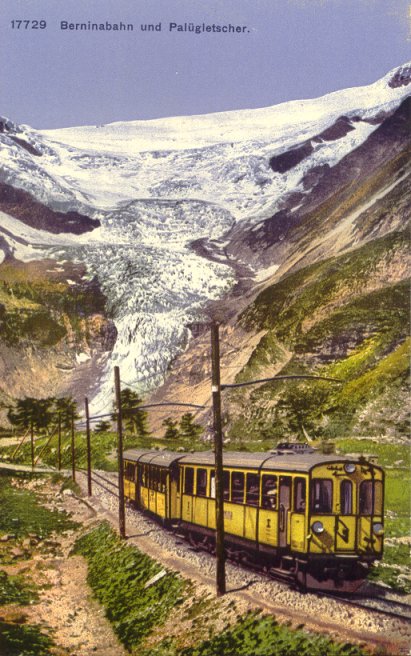
The Bernina Express is a train connecting Chur (or Davos) in Switzerland to Poschiavo in Switzerland and Tirano in Italy by crossing the Swiss Engadin Alps. For most of its journey, the train also runs along the World Heritage Site known as the Rhaetian Railway in the Albula / Bernina Landscapes. The train is operated by the Rhaetian Railway company for the purpose of sightseeing. It takes the form of an enhanced regional service between Tirano and Chur or Davos: panoramic coaches with enlarged windows and multi-lingual (English, Italian and German) audio guide on board. It is not an "express" in the sense of being a high-speed train; passengers must make a seat reservation either directly when they purchase Bernina Express tickets, or pay a small supplement on top of their regional train tickets. The Bernina Express is popular with tourists and connects in Tirano with the Post Bus service via Lake Como in Italy to Lugano in Switzerland. The Albula line and the Bernina line on ... [...More Info...] [...Related Items...] OR: [Wikipedia] [Google] [Baidu] |
Bernina Railway
The Bernina Railway (german: Berninalinie; it, Linea del Bernina; rm, Lingia dal Bernina) is a single-track railway line forming part of the Rhaetian Railway (RhB). It links the spa resort of St. Moritz, in the canton of Graubünden, Switzerland, with the town of Tirano, in the Province of Sondrio, Italy, via the Bernina Pass. Reaching a height of above sea level, it is the highest railway crossing in Europe and the third-highest railway in Switzerland. It also ranks as the highest adhesion railway of the continent, andwith inclines of up to 7%as one of the steepest adhesion railways in the world. The elevation difference on the section between the Bernina Pass and Tirano is , allowing passengers to view glaciers along the line. On 7 July 2008, the Bernina Railway and the Albula Railway, which also forms part of the RhB, were recorded in the list of UNESCO World Heritage Sites, under the name ''Rhaetian Railway in the Albula / Bernina Landscapes''. The whole site is a ... [...More Info...] [...Related Items...] OR: [Wikipedia] [Google] [Baidu] |
Lugano
Lugano (, , ; lmo, label=Ticinese dialect, Ticinese, Lugan ) is a city and municipality in Switzerland, part of the Lugano District in the canton of Ticino. It is the largest city of both Ticino and the Italian-speaking southern Switzerland. Lugano has a population () of , and an urban agglomeration of over 150,000. It is the List of cities in Switzerland, ninth largest Swiss city. The city lies on Lake Lugano, at its largest width, and, together with the adjacent town of Paradiso, Switzerland, Paradiso, occupies the entire bay of Lugano. The territory of the municipality encompasses a much larger region on both sides of the lake, with numerous isolated villages. The region of Lugano is surrounded by the Lugano Prealps, the latter extending on most of the Sottoceneri region, the southernmost part of Ticino and Switzerland. Both western and eastern parts of the municipality share an international border with Italy. Described as a market town since 984, Lugano was the object of con ... [...More Info...] [...Related Items...] OR: [Wikipedia] [Google] [Baidu] |
Thusis
Thusis ( it, Tosana, '' Romansh: Tusàn'') is a municipality in the Viamala Region in the Swiss canton of Graubünden. On 1 January 2018 the former municipality of Mutten merged into the municipality of Thusis. History Thusis is first mentioned in 1156 as ''Tosana''. The town was devastated by more than 10 fires and after the one of 1845, it had to be rebuilt. Geography Thusis has an area, , of . Of this area, 18% is used for agricultural purposes, while 58.2% is forested. Of the rest of the land, 15.2% is settled (buildings or roads) and the remainder (8.6%) is non-productive (rivers, glaciers or mountains). The municipality is the capital of the Thusis sub-district, of the Hinterrhein district, after 2017 it was part of the Viamala Region. [...More Info...] [...Related Items...] OR: [Wikipedia] [Google] [Baidu] |
Rhäzüns
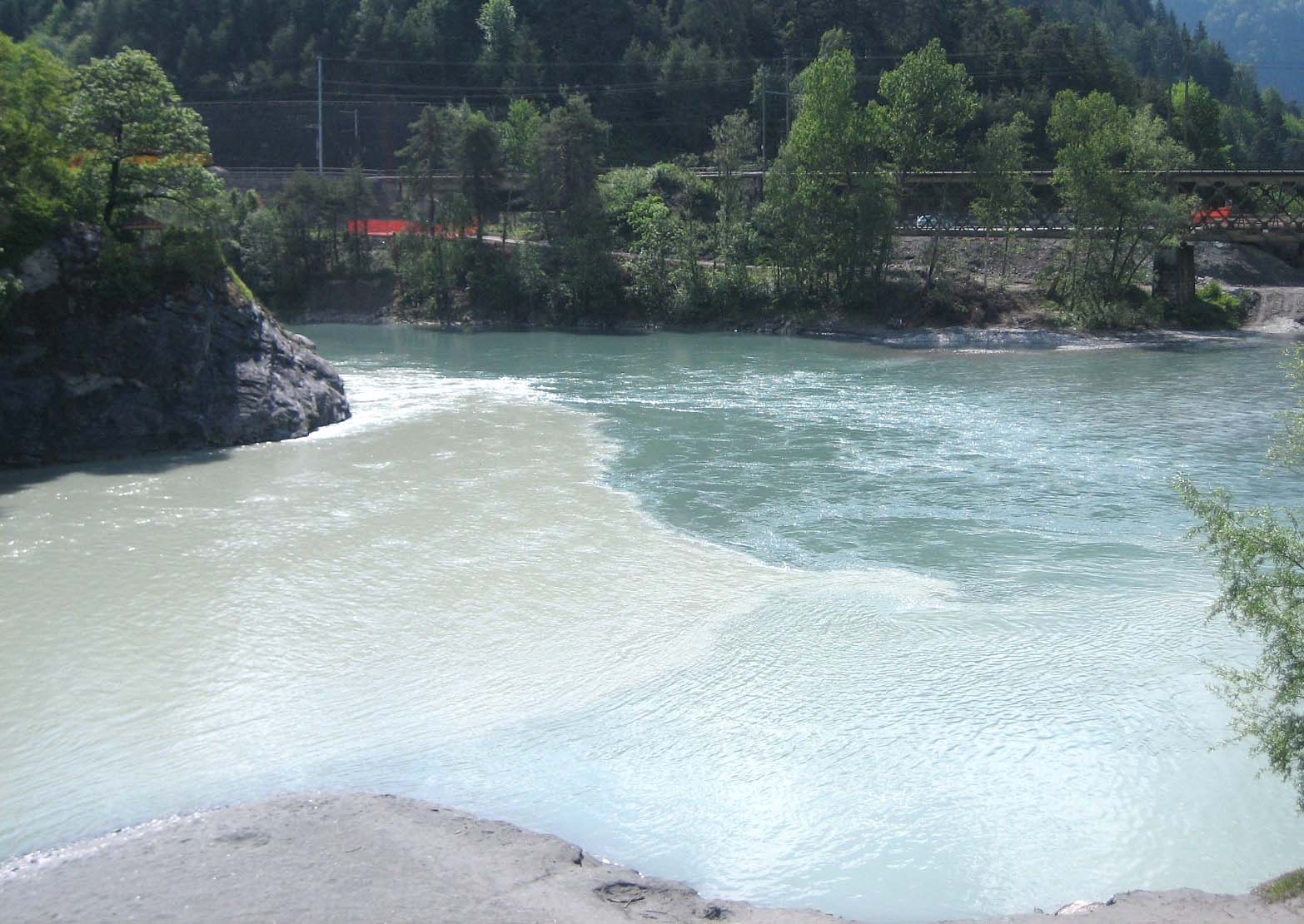
Rhäzüns is a municipality in the Imboden Region in the Swiss canton of Grisons. History Rhäzüns is first mentioned about 840 as ''Raezunne''. It formed a single parish with Bonaduz until the Reformation. It was part of the Grey League from 1424. It was acquired by the House of Habsburg in 1497 but remained part of the Three Leagues for the purposes of jurisdiction. In the Treaty of Schönbrunn (1809), the Habsburg Monarchy ceded the lordship of Rhäzüns to France. It reverted to Habsburg after the defeat of Napoleon in 1814, but was assigned to Grisons in the Vienna Congress of 1815 (article 78). The transition of administrative power to Grisons, as a canton of the restored Swiss Confederacy, became effective only on 19 January 1819. Geography Rhäzüns lies on the Hinterrhein, shortly before its confluence with the Vorderrhein. Rhäzüns has an area, , of . Of this area, 23.3% is used for agricultural purposes, while 69.1% is forested. Of the rest of the land, 4.2% i ... [...More Info...] [...Related Items...] OR: [Wikipedia] [Google] [Baidu] |
Hinterrhein (river)
The Hinterrhein (German; Italian: ''Reno Posteriore''; Sutsilvan: ''Ragn Posteriur''; Sursilvan: ''Rein Posteriur''; Rumantsch Grischun, Vallader, and Puter: ''Rain Posteriur''; Surmiran: ''Ragn posteriour''; en, Posterior Rhine) is one of the two initial tributaries of the Rhine (shorter in length but bigger by volume) rising in the canton of Graubünden in Switzerland. Course Flowing from the village Hinterrhein near the San Bernardino Pass through the Rheinwald valley, the river flows into a gorge called Roflaschlucht. In this gorge an equally sized tributary, the Avers Rhine, adds waters from the deep Val Ferrera and the very remote alp Avers and its side valley Valle di Lei on Italian territory. After the Rofla Gorge, the valley widens into a section called Schams. The Hinterrhein then reaches Andeer, before passing through another gorge, Viamala just before Thusis. Now another tributary of slightly bigger volume reaches the Hinterrhein as the Landwasser, draining a ... [...More Info...] [...Related Items...] OR: [Wikipedia] [Google] [Baidu] |
Bonaduz
Bonaduz ( rm, Panaduz) is a municipality in the Imboden Region in the Swiss canton of Graubünden. History Bonaduz is first mentioned in 960 as ''Beneduces''. Until 1854, the German-speaking hamlet of Sculms belonged to Bonaduz. Following a vote in that year, Sculms joined Versam. Geography Bonaduz has an area, , of . Of this area, 25.2% is used for agricultural purposes, while 61.3% is forested. Of the rest of the land, 7.3% is settled (buildings or roads) and the remainder (6.2%) is non-productive (rivers, glaciers or mountains). Until 2017 the municipality was located in the Rhäzüns sub-district, of the Imboden district, after 2017 it became part of the Imboden Region. [...More Info...] [...Related Items...] OR: [Wikipedia] [Google] [Baidu] |
Rhine
), Surselva, Graubünden, Switzerland , source1_coordinates= , source1_elevation = , source2 = Rein Posteriur/Hinterrhein , source2_location = Paradies Glacier, Graubünden, Switzerland , source2_coordinates= , source2_elevation = , source_confluence = Reichenau , source_confluence_location = Tamins, Graubünden, Switzerland , source_confluence_coordinates= , source_confluence_elevation = , mouth = North Sea , mouth_location = Netherlands , mouth_coordinates = , mouth_elevation = , progression = , river_system = , basin_size = , tributaries_left = , tributaries_right = , custom_label = , custom_data = , extra = The Rhine ; french: Rhin ; nl, Rijn ; wa, Rén ; li, Rien; rm, label= Sursilvan, Rein, rm, label= Sutsilvan and Surmiran, Ragn, rm, label=Rumantsch Grischun, Vallader and Puter, Rain; it, Reno ; gsw, Rhi(n), inclu ... [...More Info...] [...Related Items...] OR: [Wikipedia] [Google] [Baidu] |
Berninabahn Lej Pitschen Im Winter
The Bernina Railway (german: Berninalinie; it, Linea del Bernina; rm, Lingia dal Bernina) is a single-track railway line forming part of the Rhaetian Railway (RhB). It links the spa resort of St. Moritz, in the canton of Graubünden, Switzerland, with the town of Tirano, in the Province of Sondrio, Italy, via the Bernina Pass. Reaching a height of above sea level, it is the highest railway crossing in Europe and the third-highest railway in Switzerland. It also ranks as the highest adhesion railway of the continent, andwith inclines of up to 7%as one of the steepest adhesion railways in the world. The elevation difference on the section between the Bernina Pass and Tirano is , allowing passengers to view glaciers along the line. On 7 July 2008, the Bernina Railway and the Albula Railway, which also forms part of the RhB, were recorded in the list of UNESCO World Heritage Sites, under the name ''Rhaetian Railway in the Albula / Bernina Landscapes''. The whole site is a c ... [...More Info...] [...Related Items...] OR: [Wikipedia] [Google] [Baidu] |
Percent Sign
The percent sign (sometimes per cent sign in British English) is the symbol used to indicate a percentage, a number or ratio as a fraction of 100. Related signs include the permille (per thousand) sign and the permyriad (per ten thousand) sign (also known as a basis point), which indicate that a number is divided by one thousand or ten thousand, respectively. Higher proportions use parts-per notation. Correct style Form and spacing English style guides prescribe writing the percent sign following the number without any space between (e.g. 50%). However, the International System of Units and ISO 31-0 standard prescribe a space between the number and percent sign, in line with the general practice of using a non-breaking space between a numerical value and its corresponding unit of measurement. Other languages have other rules for spacing in front of the percent sign: * In Czech and in Slovak, the percent sign is spaced with a non-breaking space if the number is ... [...More Info...] [...Related Items...] OR: [Wikipedia] [Google] [Baidu] |


