|
Baurchuk Art Tekin
Baurchuk Art Tekin (; known also as ''Idikut Baurchuk'', ''Idikut Barchuq'') was a ruler, with a title of Idiqut ("Lord of happiness"), of the Qocho in Beshbalik (near present-day Ürümqi, China), Kara-Khoja (near present-day Turpan, China, known also as ''Idikut''-''Shahri''), Kumul, Kucha and Karasahr between 1208 and 1235. As a result of his policies, Uyghuria joined the Mongol Empire as its fifth Ulus (district) in 1211. In 1209, Baurchuk sparked a rebellion against the Western Liao dynasty, who had forced the Uyghurs into paying tribute. He killed the Gurkhan's envoy Shaukam and sent an embassy to Genghis Khan, asking for his help. The Mongol ruler accepted Baurchuk's deputation and pledged his support. During the following year or two, Baurchuk mounted military expeditions against ''Naimans'' and killed four sons of their ruler Dayan Khan. After this show of loyalty to Genghis Khan, he was received by the latter in modern-day Mongolia (1211), married his daughter Altun ... [...More Info...] [...Related Items...] OR: [Wikipedia] [Google] [Baidu] |
Qocho
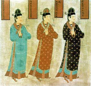
Qocho (), also known as Idiqut, ("holy wealth"; "glory"; "lord of fortune") was a Uyghur kingdom created in 843, with strong Chinese Buddhist and Tocharian influences. It was founded by Uyghur refugees fleeing the destruction of the Uyghur Khaganate after being driven out by the Yenisei Kirghiz. They made their summer capital in Qocho (also called ''Gaochang'' or ''Qara-Khoja'', near modern Turpan) and winter capital in Beshbalik (modern Jimsar County, also known as Tingzhou). Its population is referred to as the "Xizhou Uyghurs" after the old Tang Chinese name for Gaochang, the Qocho Uyghurs after their capital, the Kucha Uyghurs after another city they controlled, or the Arslan (lion) Uyghurs after their king's title. Timeline In 843 a group of Uyghurs migrated southward under the leadership of Pangtele and occupied Karasahr and Kucha, taking them from the Tibetan Empire. In 856, this group of Uyghurs received royal recognition from the Tang dynasty. At this time their c ... [...More Info...] [...Related Items...] OR: [Wikipedia] [Google] [Baidu] |
Chagatai Khan
Chagatai Khan ( Mongolian: ''; Čaɣatay''; mn, Цагадай, translit=Tsagadai; chg, , ''Čaġatāy''; ug, چاغاتاي خان, ''Chaghatay-Xan''; zh, 察合台, ''Chágětái''; fa, , ''Joghatây''; 22 December 1183 – 1 July 1242) was the second son of Genghis Khan and Börte. He inherited most of what are now five Central Asian states after the death of his father. He was also appointed by Genghis Khan to oversee the execution of the Yassa, the written code of law created by Genghis Khan. Under Genghis Khan Very little is known about Chagatai's earlier life. He was the second son of Genghis Khan and Börte. Chagatai was considered hot-headed and somewhat temperamental by his relatives, because of his attitude of non-acceptance of Jochi as a full-brother. He was the most vocal about this issue among his relations. He was assigned 4 mingghans (led by Qarachar of Barlas, Kököchü of Baarin, Müge of Jalairs and Idiqudai Noyan) and an appanage around Altai Mount ... [...More Info...] [...Related Items...] OR: [Wikipedia] [Google] [Baidu] |
China
China, officially the People's Republic of China (PRC), is a country in East Asia. It is the world's most populous country, with a population exceeding 1.4 billion, slightly ahead of India. China spans the equivalent of five time zones and borders fourteen countries by land, the most of any country in the world, tied with Russia. Covering an area of approximately , it is the world's third largest country by total land area. The country consists of 22 provinces, five autonomous regions, four municipalities, and two Special Administrative Regions (Hong Kong and Macau). The national capital is Beijing, and the most populous city and financial center is Shanghai. Modern Chinese trace their origins to a cradle of civilization in the fertile basin of the Yellow River in the North China Plain. The semi-legendary Xia dynasty in the 21st century BCE and the well-attested Shang and Zhou dynasties developed a bureaucratic political system to serve hereditary monarchies, or dyna ... [...More Info...] [...Related Items...] OR: [Wikipedia] [Google] [Baidu] |
Hui People
The Hui people ( zh, c=, p=Huízú, w=Hui2-tsu2, Xiao'erjing: , dng, Хуэйзў, ) are an East Asian ethnoreligious group predominantly composed of Chinese-speaking adherents of Islam. They are distributed throughout China, mainly in the northwestern provinces and in the Zhongyuan region. According to the 2011 census, China is home to approximately 10.5 million Hui people. The 110,000 Dungan people of Kazakhstan and Kyrgyzstan are also considered part of the Hui ethnicity. The Hui have a distinct connection with Islamic culture. For example, they follow Islamic dietary laws and reject the consumption of pork, the most commonly consumed meat in China, and have developed their own variation of Chinese cuisine. They also dress differently than the Han Chinese, some men wear white caps (taqiyah) and some women wear headscarves, as is the case in many Islamic cultures. The Hui people are one of 56 ethnic groups recognized by China. The government defines the Hui pe ... [...More Info...] [...Related Items...] OR: [Wikipedia] [Google] [Baidu] |
Ningxia
Ningxia (,; , ; alternately romanized as Ninghsia), officially the Ningxia Hui Autonomous Region (NHAR), is an autonomous region in the northwest of the People's Republic of China. Formerly a province, Ningxia was incorporated into Gansu in 1954 but was later separated from Gansu in 1958 and reconstituted as an autonomous region for the Hui people, one of the 56 officially recognised nationalities of China. Twenty percent of China's Hui population lives in Ningxia. Ningxia is bounded by Shaanxi to the east, Gansu to the south and west and Inner Mongolia Autonomous Region to the north and has an area of around . This sparsely settled, mostly desert region lies partially on the Loess Plateau and in the vast plain of the Yellow River and features the Great Wall of China along its northeastern boundary. Over about 2000 years an extensive system of canals (The total length about 1397 kilometers) has been built from Qin dynasty. Extensive land reclamation and irrigation projec ... [...More Info...] [...Related Items...] OR: [Wikipedia] [Google] [Baidu] |
Yinchuan
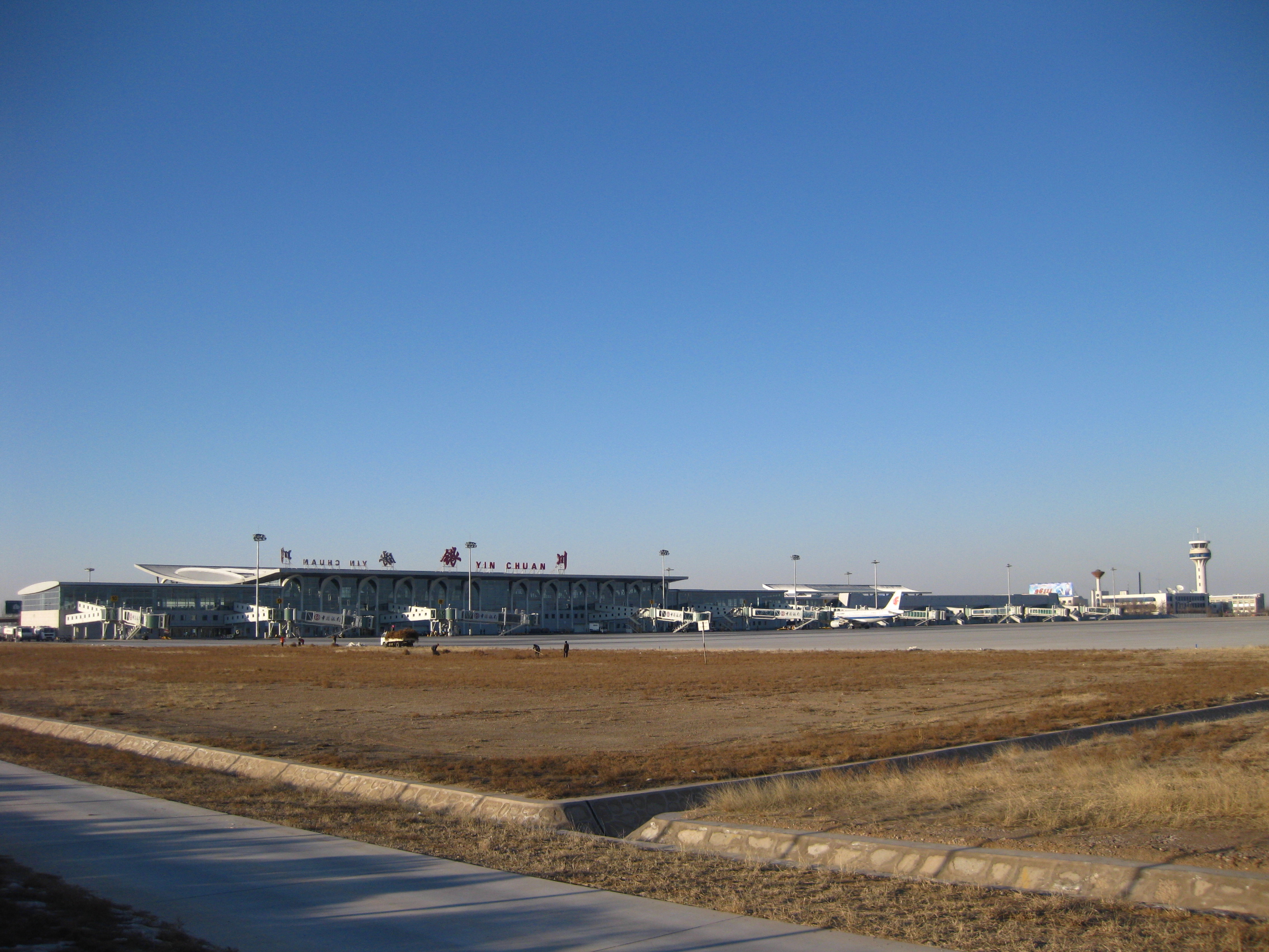
Yinchuan (, ; ) is the capital of the Ningxia Hui Autonomous Region, China, and was the capital of the Tangut-led Western Xia dynasty. It has an area of and a total population of 2,859,074 according to the 2020 Chinese census, and its built-up area was home to 1,901,793 inhabitants spread between three urban districts. The city's name literally means "silver river". Yinchuan is now the permanent site for the China-Arab Expo, a platform for cultural and economic exchanges between China and Arab countries. The city is also home to Ningxia University, the largest regional comprehensive university under the Project 211 in Ningxia Hui Autonomous Region. History Yinchuan was originally a county under the name of ''Fuping'' in the 1st century BCE; its name was changed to ''Huaiyuan'' in the 6th century CE. Western Xia After the fall of the Tang dynasty in 907, it came under the control of the Tangut-led Western Xia dynasty and was made the capital of the empire, provoking muc ... [...More Info...] [...Related Items...] OR: [Wikipedia] [Google] [Baidu] |
Tangut People
The Tangut people ( Tangut: , ''mjɨ nja̱'' or , ''mji dzjwo''; ; ; mn, Тангуд) were a Tibeto-Burman tribal union that founded and inhabited the Western Xia dynasty. The group initially lived under Tuyuhun authority, but later submitted to the Tang dynasty, prior to their establishment of the Western Xia. They spoke the Tangut language, which was previously believed to be one of the Qiangic languages or Yi languages that belong to the Tibeto-Burman family. Phylogenetic and historical linguistic accounts, however, reveal that Tangut belonged to the Gyalrongic languages. Language The Tangut language, otherwise known as ''Fan'', belongs to the Tibeto-Burman branch of the Sino-Tibetan language family. Like many other Sino-Tibetan languages, it is a tonal language with predominantly mono-syllabic roots, but it shares certain grammatical traits central to the Tibeto-Burman branch. It is still debated as to whether Tangut belongs to the Yi or Qiangic subdivision of Tibeto-Burm ... [...More Info...] [...Related Items...] OR: [Wikipedia] [Google] [Baidu] |
Western Xia
The Western Xia or the Xi Xia (), officially the Great Xia (), also known as the Tangut Empire, and known as ''Mi-nyak''Stein (1972), pp. 70–71. to the Tanguts and Tibetans, was a Tangut-led Buddhist imperial dynasty of China that existed from 1038 to 1227. At its peak, the dynasty ruled over the modern-day northwestern Chinese provinces of Ningxia, Gansu, eastern Qinghai, northern Shaanxi, northeastern Xinjiang, and southwest Inner Mongolia, and southernmost Outer Mongolia, measuring about . Its capital was Xingqing (modern Yinchuan), until its destruction by the Mongols in 1227. Most of its written records and architecture were destroyed, so the founders and history of the empire remained obscure until 20th-century research in China and the West. The Western Xia occupied the area around the Hexi Corridor, a stretch of the Silk Road, the most important trade route between northern China and Central Asia. They made significant achievements in literature, art, ... [...More Info...] [...Related Items...] OR: [Wikipedia] [Google] [Baidu] |
Nishapur
Nishapur or officially Romanized as Neyshabur ( fa, ;Or also "نیشاپور" which is closer to its original and historic meaning though it is less commonly used by modern native Persian speakers. In Persian poetry, the name of this city is written and pronounced as "نِشابور" (without the usage of "پ" or "ب"). In modern times and among the general public and the Persian mass media, "نیشابور" is the most commonly used style of pronunciation and spelling of this city though "نیشاپور" is also correct. Nišâpur, Nişapur, Nīshābūr, or Neyshapur are also the other Romanizations of this city. from Middle Persian ''"New-Shapuhr"'', meaning: "The New City of Shapur", "The Fair Shapur", or "The Perfect built of Shapur") is the second-largest city of Razavi Khorasan Province in the Northeast of Iran. Nishapur is situated in a fertile plain at the foot of Binalud Mountain Range and has been the historic capital of the Western Quarter of Greater Khorasan, the ... [...More Info...] [...Related Items...] OR: [Wikipedia] [Google] [Baidu] |
Otrar
Otrar or Utrar ( kk, Отырар, ''Otyrar'', Help:IPA/Kazakh, [wotəˈɾɑɾ]; otk, 𐰚𐰭𐱃𐰺𐰢𐰣, Keŋü Tarman), also called Farab, is a Central Asian ghost town that was a city located along the Silk Road in Kazakhstan. Otrar was an important town in the history of Central Asia, situated on the borders of settled and agricultural civilizations. It was the center of a great oasis and political district, commanding a key point connecting Kazakhstan with China, Europe, Near East, Near and Middle East, Siberia and Ural (region), Ural. Names The first known state in the region was known to Chinese scholars as ''Kangju'', which was centered on the Syr Darya (also known as the Kang River). Kangju existed from the 1st century BC until the 5th century AD. Its capital was reportedly at or near Bityan. After being subject to several different waves of invaders, Kangju collapsed into several independent states situated mainly in the Syr Darya valley and its tributaries of Ke ... [...More Info...] [...Related Items...] OR: [Wikipedia] [Google] [Baidu] |
Khwarezmian Empire
The Khwarazmian or Khwarezmian Empire) or the Khwarazmshahs ( fa, خوارزمشاهیان, Khwārazmshāhiyān) () was a Turko-Persian Sunni Muslim empire that ruled large parts of present-day Central Asia, Afghanistan, and Iran in the approximate period of 1077 to 1231, first as vassals of the Seljuk Empire and the Qara Khitai (Western Liao dynasty), and later as independent rulers, up until the Mongol conquest in the 13th century. It is estimated that the empire spanned an area of 2.3 million square kilometers to 3.6 million square kilometers effectively making it one of the largest land empires in history. In the beginning of the 13th century, the empire was the greatest power in the Muslim world. The empire, which was modelled on the preceding Seljuk Empire, was defended by a huge cavalry army composed largely of Kipchak Turks. However, in 1219, the Mongols under their ruler Genghis Khan invaded the Khwarazmian Empire, successfully conquering the whole of it in just t ... [...More Info...] [...Related Items...] OR: [Wikipedia] [Google] [Baidu] |
Ming Dynasty
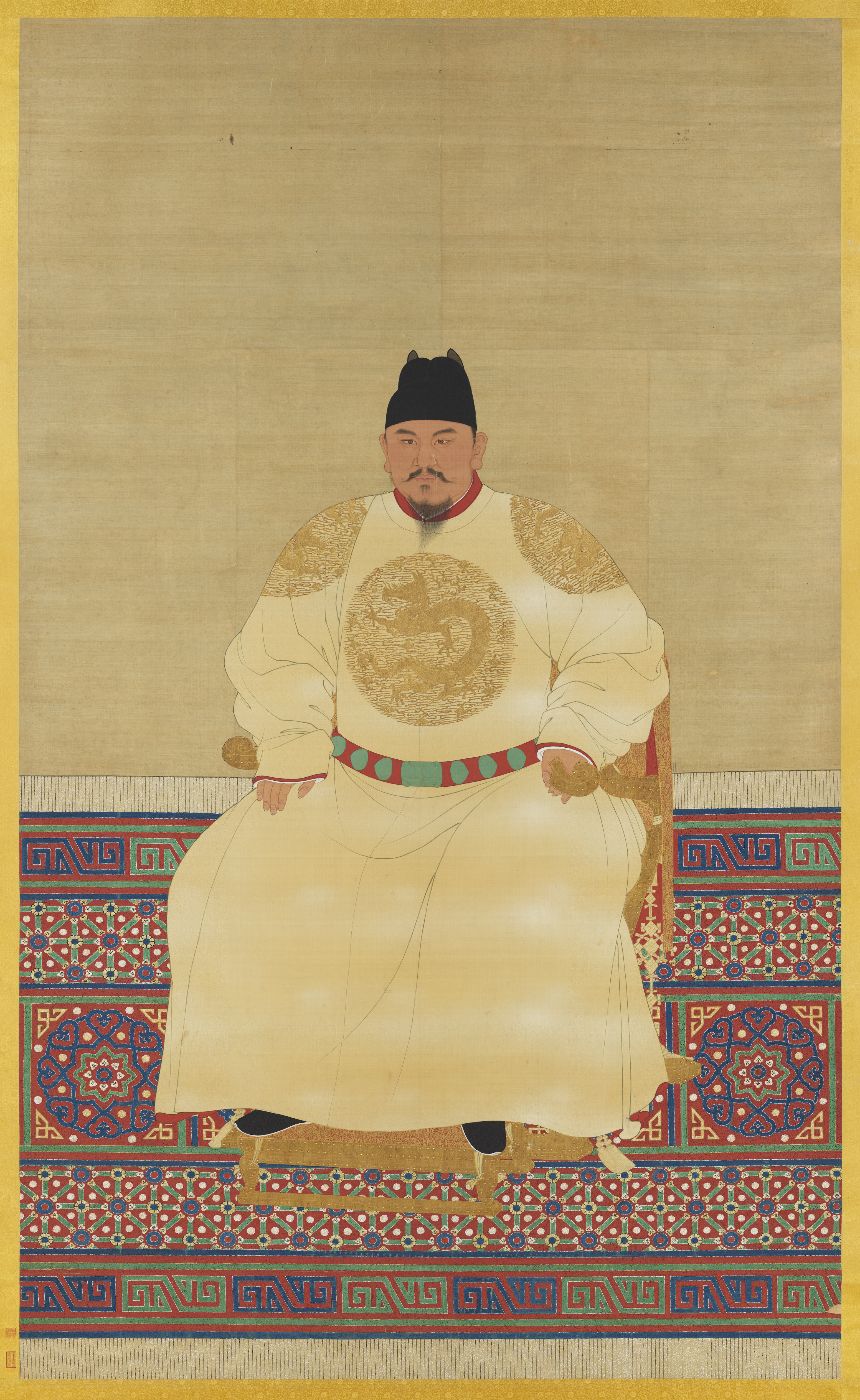
The Ming dynasty (), officially the Great Ming, was an Dynasties in Chinese history, imperial dynasty of China, ruling from 1368 to 1644 following the collapse of the Mongol Empire, Mongol-led Yuan dynasty. The Ming dynasty was the last orthodox dynasty of China ruled by the Han Chinese, Han people, the majority ethnic group in China. Although the primary capital of Beijing fell in 1644 to a rebellion led by Li Zicheng (who established the short-lived Shun dynasty), numerous rump state, rump regimes ruled by remnants of the House of Zhu, Ming imperial family—collectively called the Southern Ming—survived until 1662. The Ming dynasty's founder, the Hongwu Emperor (r. 1368–1398), attempted to create a society of self-sufficient rural communities ordered in a rigid, immobile system that would guarantee and support a permanent class of soldiers for his dynasty: the empire's standing army exceeded one million troops and the naval history of China, navy's dockyards in Nanjin ... [...More Info...] [...Related Items...] OR: [Wikipedia] [Google] [Baidu] |
_in_番客入朝圖_(937-976_CE).jpg)


