|
Ballochmyle Cup And Ring Marks
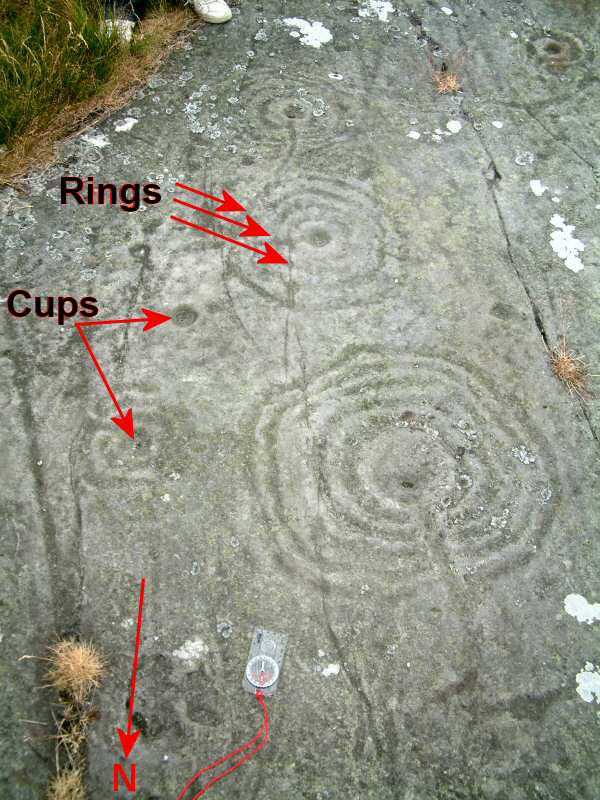
The Ballochmyle cup and ring marks were first recorded at Ballochmyle (NS 5107 2552), Mauchline, East Ayrshire, Scotland in 1986, very unusually carved on a vertical red sandstone cliff face, forming one of the most extensive areas of such carvings as yet found in Britain. They have been designated a scheduled monument. Discovery These carvings or petroglyphs were first recorded in 1986 (although a '1751' carved date suggests an earlier discovery) when the Kingencleugh Estate decided to clear an area of vegetation along the north side of the Liddell Burn that is a minor tributary stream of the River Ayr in an area famous for its quarrying of red sandstone. The removal of vegetation exposed the carvings that are distributed across two faces of a vertical outcrop of rock and they were reported to the Dick Institute in Kilmarnock. The presence of possible medieval carvings, the extensive quarrying with numerous workmen employed in the area, especially during the construction of the ... [...More Info...] [...Related Items...] OR: [Wikipedia] [Google] [Baidu] |
Neolithic
The Neolithic period, or New Stone Age, is an Old World archaeological period and the final division of the Stone Age. It saw the Neolithic Revolution, a wide-ranging set of developments that appear to have arisen independently in several parts of the world. This "Neolithic package" included the introduction of farming, domestication of animals, and change from a hunter-gatherer lifestyle to one of settlement. It began about 12,000 years ago when farming appeared in the Epipalaeolithic Near East, and later in other parts of the world. The Neolithic lasted in the Near East until the transitional period of the Chalcolithic (Copper Age) from about 6,500 years ago (4500 BC), marked by the development of metallurgy, leading up to the Bronze Age and Iron Age. In other places the Neolithic followed the Mesolithic (Middle Stone Age) and then lasted until later. In Ancient Egypt, the Neolithic lasted until the Protodynastic period, 3150 BC.Karin Sowada and Peter Grave. Egypt in th ... [...More Info...] [...Related Items...] OR: [Wikipedia] [Google] [Baidu] |
Ley Line
Ley lines () are straight alignments drawn between various historic structures and prominent landmarks. The idea was developed in early 20th-century Europe, with ley line believers arguing that these alignments were recognised by ancient societies that deliberately erected structures along them. Since the 1960s, members of the Earth Mysteries movement and other esoteric traditions have commonly believed that such ley lines demarcate " earth energies" and serve as guides for alien spacecraft. Archaeologists and scientists regard ley lines as an example of pseudoarchaeology and pseudoscience. The idea of "leys" as straight tracks across the landscape was put forward by the English antiquarian Alfred Watkins in the 1920s, particularly in his book ''The Old Straight Track''. He argued that straight lines could be drawn between various historic structures and that these represented trade routes created by ancient British societies. Although he gained a small following, Watkins' idea ... [...More Info...] [...Related Items...] OR: [Wikipedia] [Google] [Baidu] |
Cup And Ring Mark
Cup and ring marks or cup marks are a form of prehistoric art found in the Atlantic seaboard of Europe (Ireland, Wales, Northern England, Scotland, France (Brittany), Portugal, and Spain ( Galicia) – and in Mediterranean Europe – Italy (in Alpine valleys and Sardinia), Azerbaijan and Greece (Thessaly and Irakleia (Cyclades)), as well as in Scandinavia (Denmark, Sweden, Norway and Finland) and in Switzerland (at Caschenna in Grisons). Similar forms are also found throughout the world including Australia, Gabon, Greece, Hawaii, India ( Daraki-Chattan), Israel, Mexico, Mozambique and the Americas. The oldest known forms are found from the Fertile Crescent to India. They consist of a concave depression, no more than a few centimetres across, pecked into a rock surface and often surrounded by concentric circles also etched into the stone. Sometimes a linear channel called a gutter leads out from the middle. The decoration occurs as a petroglyph on natural boulders and outcrop ... [...More Info...] [...Related Items...] OR: [Wikipedia] [Google] [Baidu] |
Sardinia Mamoiada Perda Pinta
Sardinia ( ; it, Sardegna, label=Italian, Corsican and Tabarchino ; sc, Sardigna , sdc, Sardhigna; french: Sardaigne; sdn, Saldigna; ca, Sardenya, label=Algherese and Catalan) is the second-largest island in the Mediterranean Sea, after Sicily, and one of the 20 regions of Italy. It is located west of the Italian Peninsula, north of Tunisia and immediately south of the French island of Corsica. It is one of the five Italian regions with some degree of domestic autonomy being granted by a special statute. Its official name, Autonomous Region of Sardinia, is bilingual in Italian and Sardinian: / . It is divided into four provinces and a metropolitan city. The capital of the region of Sardinia — and its largest city — is Cagliari. Sardinia's indigenous language and Algherese Catalan are referred to by both the regional and national law as two of Italy's twelve officially recognized linguistic minorities, albeit gravely endangered, while the regional law provid ... [...More Info...] [...Related Items...] OR: [Wikipedia] [Google] [Baidu] |
Celts
The Celts (, see pronunciation for different usages) or Celtic peoples () are. "CELTS location: Greater Europe time period: Second millennium B.C.E. to present ancestry: Celtic a collection of Indo-European peoples. "The Celts, an ancient Indo-European people, reached the apogee of their influence and territorial expansion during the 4th century bc, extending across the length of Europe from Britain to Asia Minor."; . " e Celts, were Indo-Europeans, a fact that explains a certain compatibility between Celtic, Roman, and Germanic mythology."; . "The Celts and Germans were two Indo-European groups whose civilizations had some common characteristics."; . "Celts and Germans were of course derived from the same Indo-European stock."; . "Celt, also spelled Kelt, Latin Celta, plural Celtae, a member of an early Indo-European people who from the 2nd millennium bce to the 1st century bce spread over much of Europe."; in Europe and Anatolia, identified by their use of Celtic langua ... [...More Info...] [...Related Items...] OR: [Wikipedia] [Google] [Baidu] |
Anima Locus
The anima loci or animus loci is the "soul" of a place, its essential personality. A concept linked to the supernatural spirits of nature as residing in stones, springs, mountains, islands, trees, etc.Pennick, Nigel (1996). ''Celtic Sacred Landscapes''. Thames & Hudson. . P. 13 - 15. This practice is found in religions that have gods that may be more animal than man, like the Japanese Shinto. These beliefs are held throughout some modern religions too. Some of the Catholic Church has some beliefs like these. A country that follows these beliefs is Ireland, "there are several sites sacred to St. Patrick, but investigation has revealed that these were sites devoted to the worship of various Celtic gods and spirits long before the Catholic Church co-opted the location." Witchcraft In witchcraft, the anima loci is often referred to a spirit of the place, sprite, fairy, guardian. Sites with strong anima loci Image:Duskwatergorge2.JPG, Image:Duskwatergorge1.JPG, Image:Carlinstonea ... [...More Info...] [...Related Items...] OR: [Wikipedia] [Google] [Baidu] |
Argyll
Argyll (; archaically Argyle, in modern Gaelic, ), sometimes called Argyllshire, is a historic county and registration county of western Scotland. Argyll is of ancient origin, and corresponds to most of the part of the ancient kingdom of on Great Britain. Argyll was also a medieval bishopric with its cathedral at Lismore, as well as an early modern earldom and dukedom, the Dukedom of Argyll. It borders Inverness-shire to the north, Perthshire and Dunbartonshire to the east, and—separated by the Firth of Clyde—neighbours Renfrewshire and Ayrshire to the south-east, and Buteshire to the south. Between 1890 and 1975, Argyll was an administrative county with a county council. Its area corresponds with most of the modern council area of Argyll and Bute, excluding the Isle of Bute and the Helensburgh area, but including the Morvern and Ardnamurchan areas of the Highland council area. There was an Argyllshire constituency of the Parliament of Great Britain then Parli ... [...More Info...] [...Related Items...] OR: [Wikipedia] [Google] [Baidu] |
Dunadd
Dunadd (Scottish Gaelic ''Dún Ad'', "fort on the iverAdd") is a hillfort in Argyll and Bute, Scotland, dating from the Iron Age and early medieval period and is believed to be the capital of the ancient kingdom of Dál Riata. Dal Riata was a kingdom, that appeared in Argyll in the early centuries AD, possibly after the Romans had abandoned Southern Britain and at the time when the Anglo Saxons were crossing the North Sea to counter incursions over Hadrian's Wall by the Picts and Dalriadan Scots. Description Dunadd is a rocky crag that may have been one time an island and now lies inland near the River Add, from which it takes its name, a little north of Lochgilphead (NR 836 936). The surrounding land, now largely reclaimed, was formerly boggy and known as the ''Mòine Mhòr'' ("Great Moor") in Gaelic. This no doubt increased the defensive potential of the site.Alan Lane and Ewan Campbell, ''Dunadd: An early Dalriadic capital'' (Oxbow Books, Oxford, 2000). Detailed analysis of ... [...More Info...] [...Related Items...] OR: [Wikipedia] [Google] [Baidu] |
Petrosomatoglyph
A petrosomatoglyph is a supposed image of parts of a human or animal body in rock. They occur all over the world, often functioning as an important form of symbolism, used in religious and secular ceremonies, such as the crowning of kings. Some are regarded as artefacts linked to saints or culture heroes. The word comes from the Greek (, "stone"), ( "body"), and (, "to carve"). Feet are the most common; however, other features including knees, elbows, hands, heads and fingers are also found. Stylised representations of parts of the body are often open to dispute and are therefore on the fringes of acceptability as identifiable petrosomatoglyphs. Natural objects, such as rock crystals and rock formations which look like petrosomatoglyphs, whole animals, plants, etc., are collectively called "mimetoliths". Natural versus man-made petrosomatoglyphs Many examples of petrosomatoglyphs are likely to be natural in origin, such as rock-cut basins in rivers; however, they still have ... [...More Info...] [...Related Items...] OR: [Wikipedia] [Google] [Baidu] |
Liminal Deity
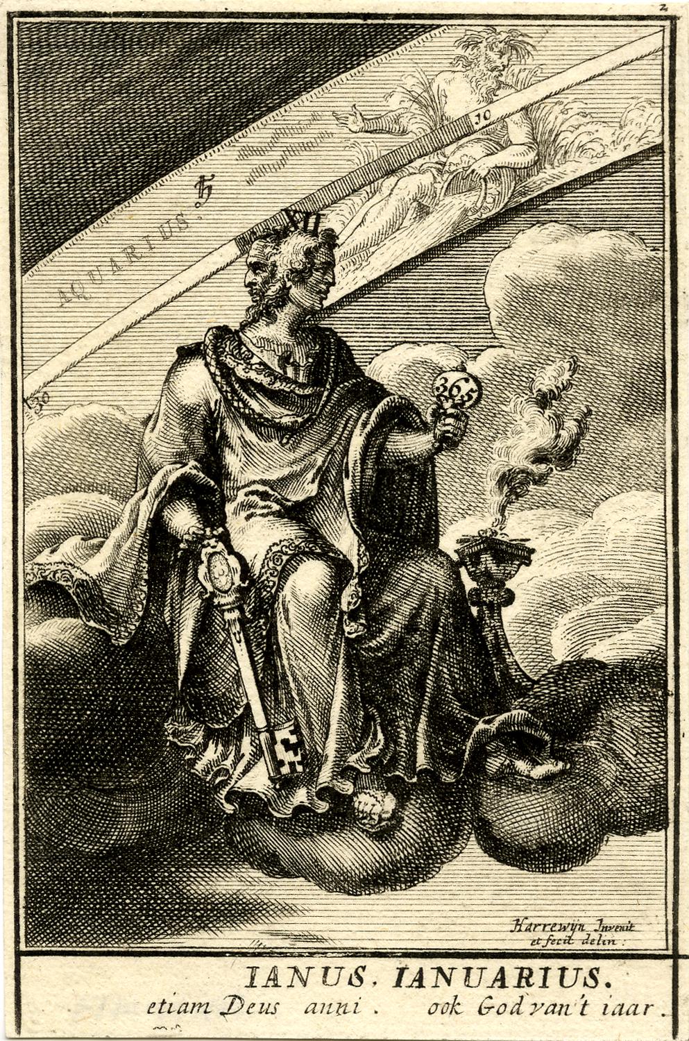
A liminal deity is a god or goddess in mythology who presides over thresholds, gates, or doorways; "a crosser of boundaries". Types of liminal deities include dying-and-rising deities, various agricultural deities, psychopomps and those who descend into the underworld: crossing the threshold between life and death. Vegetation deities mimic the annual dying and returning of plant life, making them seasonally cyclical liminal deities. In contrast, the one-time journey typical of the dying-and-rising myth, or legends of those who return from a descent to the underworld, represent a more narrow scope of liminal deities. Etymology The word "liminal", first attested to in English in 1884, comes from the Latin word "limen", meaning "threshold". "Liminality" is a term given currency in twentieth century British cultural anthropologist by Victor Turner. European Greek mythology * Adonis * Dionysus, who in one myth is torn apart by Titans, but brought back to life * Enodia, godd ... [...More Info...] [...Related Items...] OR: [Wikipedia] [Google] [Baidu] |


