|
Bruchmühlbach-Miesau
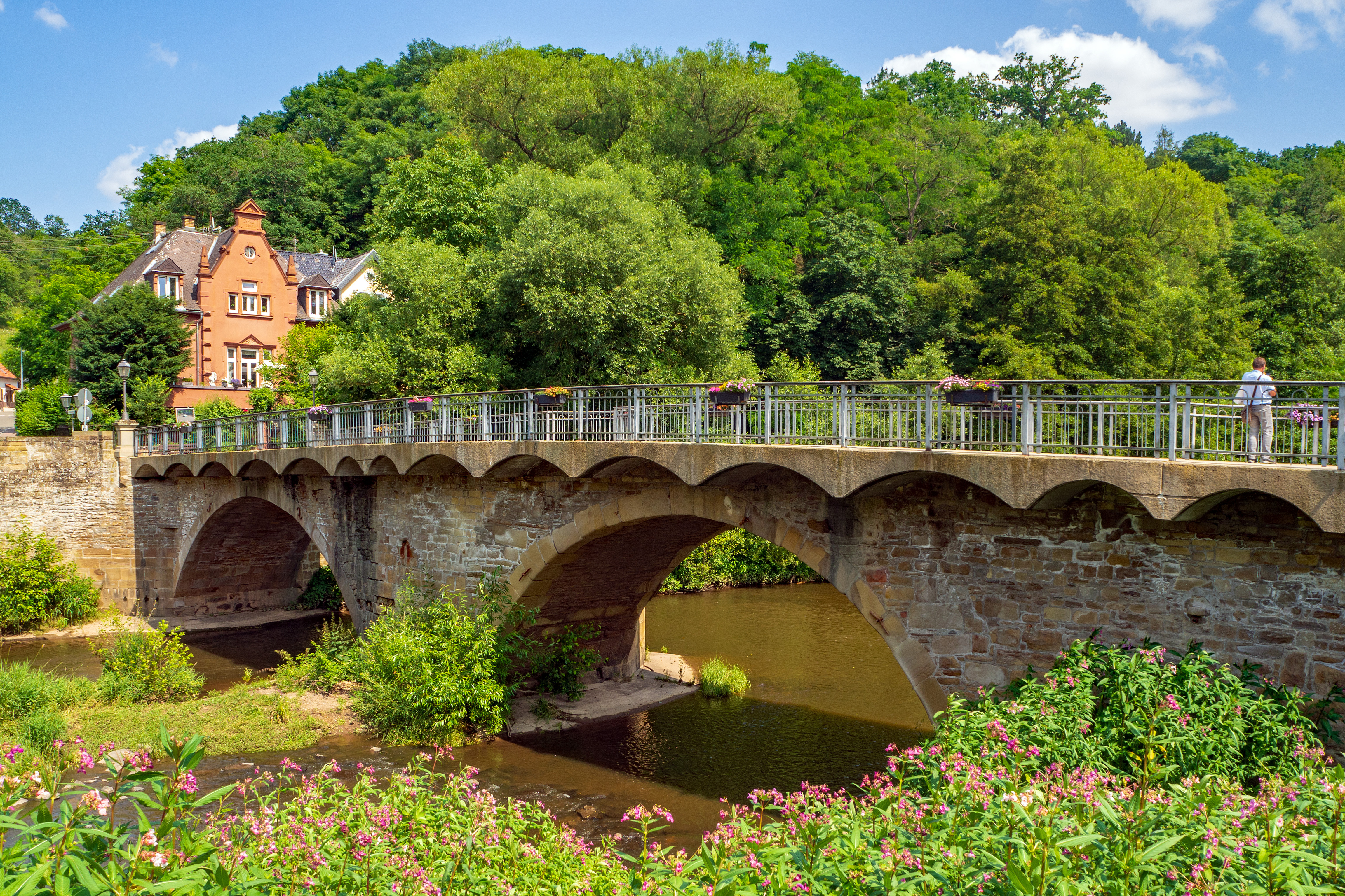
Bruchmühlbach-Miesau is a municipality in the district of Kaiserslautern in Rhineland-Palatinate, Germany. It is situated on the small river Glan, approx. 10 km north-east of Homburg, and 25 km west of Kaiserslautern. It has many festivals and is the home of two storks which are the pride of the village. Nearby is the Miesau Army Depot, a United States Army installation. Also nearby is Ohmbachsee, a small lake that is a popular location for concerts, festivals and the weekend. Bruchmühlbach-Miesau is the seat of the ''Verbandsgemeinde A Verbandsgemeinde (; plural Verbandsgemeinden) is a low-level administrative unit in the German federal states of Rhineland-Palatinate and Saxony-Anhalt. A Verbandsgemeinde is typically composed of a small group of villages or towns. Rhineland- ...'' ("collective municipality") Bruchmühlbach-Miesau. History The towns of Bruchmühlbach and Miesau, now joined, have a long history. Bruchmühlbach was first mentioned in the year ... [...More Info...] [...Related Items...] OR: [Wikipedia] [Google] [Baidu] |
Bruchmühlbach-Miesau (Verbandsgemeinde)
Bruchmühlbach-Miesau is a ''Verbandsgemeinde'' ("collective municipality") in the district of Kaiserslautern, Rhineland-Palatinate, Germany. The seat of the ''Verbandsgemeinde'' is in Bruchmühlbach-Miesau. The ''Verbandsgemeinde'' Bruchmühlbach-Miesau consists of the following ''Ortsgemeinden'' ("local municipalities"): # Bruchmühlbach-Miesau # Gerhardsbrunn # Lambsborn # Langwieden # Martinshöhe Martinshöhe is a municipality in the district of Kaiserslautern, in Rhineland-Palatinate, western Germany Germany,, officially the Federal Republic of Germany, is a country in Central Europe. It is the second most populous country ... Verbandsgemeinde in Rhineland-Palatinate Kaiserslautern (district) {{Kaiserslautern-geo-stub ... [...More Info...] [...Related Items...] OR: [Wikipedia] [Google] [Baidu] |
Kaiserslautern (district)
Kaiserslautern is a district (''Kreis'') in the south of Rhineland-Palatinate, Germany. Neighboring districts are (from west clockwise) Kusel, Saarpfalz-Kreis, Donnersbergkreis, Bad Dürkheim and Südwestpfalz. The city of Kaiserslautern is almost fully enclosed by, but not belonging to the district. History The district of Kaiserslautern was established in 1939. Minor changes of the borders occurred in 1969 and 1972. Geography The district includes parts of the Palatinate Forest (''Pfälzer Wald'') in the east and the North Palatine Hills (''Nordpfälzer Bergland'') in the west, as well as the lowlands between them. Partnerships Since 1962 the district has had a partnership with Lancaster County, Pennsylvania. As part of the partnership of Rhineland-Palatinate with Rwanda, the district has had a partnership with the municipality of Musasa since 1983. In 2002, a partnership with the Polish district of Olesno was started. Coat of arms The eagle on the top of the coat of arms repr ... [...More Info...] [...Related Items...] OR: [Wikipedia] [Google] [Baidu] |
Kaiserslautern
Kaiserslautern (; Palatinate German: ''Lautre'') is a city in southwest Germany, located in the state of Rhineland-Palatinate at the edge of the Palatinate Forest. The historic centre dates to the 9th century. It is from Paris, from Frankfurt am Main, 666 kilometers (414 miles) from Berlin, and from Luxembourg. Kaiserslautern is home to about 100,000 people. Additionally, approximately 45,000 NATO military personnel are based in the city and its surrounding district ('' Landkreis Kaiserslautern''), contributing approximately US$1 billion annually to the local economy. History and demographics Prehistoric settlement in the area of what is now Kaiserslautern has been traced to at least 800 BC. Some 2,500-year-old Celtic tombs were uncovered at Miesau, a town about west of Kaiserslautern. The recovered relics are now in the Museum for Palatinate History at Speyer. Medieval period Kaiserslautern received its name from the favourite hunting retreat of Holy Roman Emperor F ... [...More Info...] [...Related Items...] OR: [Wikipedia] [Google] [Baidu] |
Ortsteil
A village is a clustered human settlement or Residential community, community, larger than a hamlet (place), hamlet but smaller than a town (although the word is often used to describe both hamlets and smaller towns), with a population typically ranging from a few hundred to a few thousand. Though villages are often located in rural areas, the term urban village is also applied to certain urban neighborhoods. Villages are normally permanent, with fixed dwellings; however, transient villages can occur. Further, the dwellings of a village are fairly close to one another, not scattered broadly over the landscape, as a dispersed settlement. In the past, villages were a usual form of community for societies that practice subsistence agriculture, and also for some non-agricultural societies. In Great Britain, a hamlet earned the right to be called a village when it built a Church (building), church. [...More Info...] [...Related Items...] OR: [Wikipedia] [Google] [Baidu] |
Municipality
A municipality is usually a single administrative division having corporate status and powers of self-government or jurisdiction as granted by national and regional laws to which it is subordinate. The term ''municipality'' may also mean the governing body of a given municipality. A municipality is a general-purpose administrative subdivision, as opposed to a special-purpose district. The term is derived from French and Latin . The English word ''municipality'' derives from the Latin social contract (derived from a word meaning "duty holders"), referring to the Latin communities that supplied Rome with troops in exchange for their own incorporation into the Roman state (granting Roman citizenship to the inhabitants) while permitting the communities to retain their own local governments (a limited autonomy). A municipality can be any political jurisdiction, from a sovereign state such as the Principality of Monaco, to a small village such as West Hampton Dunes, New York. Th ... [...More Info...] [...Related Items...] OR: [Wikipedia] [Google] [Baidu] |
Rhineland-Palatinate
Rhineland-Palatinate ( , ; german: link=no, Rheinland-Pfalz ; lb, Rheinland-Pfalz ; pfl, Rhoilond-Palz) is a western state of Germany. It covers and has about 4.05 million residents. It is the ninth largest and sixth most populous of the sixteen states. Mainz is the capital and largest city. Other cities are Ludwigshafen am Rhein, Koblenz, Trier, Kaiserslautern, Worms and Neuwied. It is bordered by North Rhine-Westphalia, Saarland, Baden-Württemberg and Hesse and by the countries France, Luxembourg and Belgium. Rhineland-Palatinate was established in 1946 after World War II, from parts of the former states of Prussia (part of its Rhineland and Nassau provinces), Hesse (Rhenish Hesse) and Bavaria (its former outlying Palatinate kreis or district), by the French military administration in Allied-occupied Germany. Rhineland-Palatinate became part of the Federal Republic of Germany in 1949 and shared the country's only border with the Saar Protectorate until the latter wa ... [...More Info...] [...Related Items...] OR: [Wikipedia] [Google] [Baidu] |
Germany
Germany,, officially the Federal Republic of Germany, is a country in Central Europe. It is the second most populous country in Europe after Russia, and the most populous member state of the European Union. Germany is situated between the Baltic and North seas to the north, and the Alps to the south; it covers an area of , with a population of almost 84 million within its 16 constituent states. Germany borders Denmark to the north, Poland and the Czech Republic to the east, Austria and Switzerland to the south, and France, Luxembourg, Belgium, and the Netherlands to the west. The nation's capital and most populous city is Berlin and its financial centre is Frankfurt; the largest urban area is the Ruhr. Various Germanic tribes have inhabited the northern parts of modern Germany since classical antiquity. A region named Germania was documented before AD 100. In 962, the Kingdom of Germany formed the bulk of the Holy Roman Empire. During the 16th ce ... [...More Info...] [...Related Items...] OR: [Wikipedia] [Google] [Baidu] |
Glan (Nahe)
The Glan () is a river in southwestern Germany, right tributary of the Nahe. It is approximately long. It rises in the Saarland, northwest of Homburg. It flows generally north, through Rhineland-Palatinate, and empties into the Nahe near Odernheim am Glan, at Staudernheim, across the Nahe from Bad Sobernheim. Other towns along the Glan are Altenglan, Glan-Münchweiler, Lauterecken and Meisenheim. Etymology The Celtic root of the name comes either from ''glann'' (shining) or from '' glen'' (U-shaped valley). See also *List of rivers of Saarland *List of rivers of Rhineland-Palatinate A list of rivers of Rhineland-Palatinate, Germany: A * Aar * Adenauer Bach * Ahr * Alf * Alfbach *Appelbach *Asdorf * Aubach B * Birzenbach *Blattbach * Breitenbach * Brexbach * Brohlbach, tributary of the Moselle * Brohlbach, tributary of the ... References Rivers and lakes of Western Palatinate Rivers of Saarland North Palatinate Rivers of Germany {{RhinelandPalatinate- ... [...More Info...] [...Related Items...] OR: [Wikipedia] [Google] [Baidu] |
Homburg, Saarland
Homburg (; french: Hombourg, pfl, Humborch) is a town in Saarland, Germany and the administrative seat of the Saarpfalz district. With a population of 43,029 inhabitants (2022), it is the third largest town in the state. The city offers over 30,000 workplaces. The medical department of the University of Saarland is situated here. The city is also home to the Karlsberg beer brewery. Major employers include Robert Bosch GmbH, Schaeffler Group and Michelin. Geography Homburg is located in the northern part of the Saarpfalz district, bordering Rhineland-Palatinate. It is 16 km from Neunkirchen and 36 km from Saarbrücken. The city districts are situated in the Blies valley or on its tributaries Erbach, Lambsbach and Schwarzbach. Homburg is composed of Homburg center and nine city districts: Beeden, Bruchhof-Sanddorf, Einöd, Erbach, Jägersburg, Kirrberg, Reiskirchen, Schwarzenbach and Wörschweiler. Einöd includes: Einöd, Ingweiler and Schwarzenacker; ... [...More Info...] [...Related Items...] OR: [Wikipedia] [Google] [Baidu] |
United States Army
The United States Army (USA) is the land service branch of the United States Armed Forces. It is one of the eight U.S. uniformed services, and is designated as the Army of the United States in the U.S. Constitution.Article II, section 2, clause 1 of the United States Constitution (1789). See alsTitle 10, Subtitle B, Chapter 301, Section 3001 The oldest and most senior branch of the U.S. military in order of precedence, the modern U.S. Army has its roots in the Continental Army, which was formed 14 June 1775 to fight the American Revolutionary War (1775–1783)—before the United States was established as a country. After the Revolutionary War, the Congress of the Confederation created the United States Army on 3 June 1784 to replace the disbanded Continental Army.Library of CongressJournals of the Continental Congress, Volume 27/ref> The United States Army considers itself to be a continuation of the Continental Army, and thus considers its institutional inception to be th ... [...More Info...] [...Related Items...] OR: [Wikipedia] [Google] [Baidu] |
Verbandsgemeinde
A Verbandsgemeinde (; plural Verbandsgemeinden) is a low-level administrative unit in the German federal states of Rhineland-Palatinate and Saxony-Anhalt. A Verbandsgemeinde is typically composed of a small group of villages or towns. Rhineland-Palatinate The state of Rhineland-Palatinate is divided into 163 Verbandsgemeinden, which are municipal associations grouped within the 24 districts of the state and subdivided into 2,257 Ortsgemeinden (singular Ortsgemeinde) which comprise single settlements. Most of the Verbandsgemeinden were established in 1969. Formerly the name for an administrative unit was ''Amt''. Most of the functions of municipal government for several municipalities are consolidated and administered centrally from a larger or more central town or municipality among the group, while the individual municipalities (Ortsgemeinden) still maintain a limited degree of local autonomy. Saxony-Anhalt The 11 districts of Saxony-Anhalt are divided into ''Verwaltungsgemein ... [...More Info...] [...Related Items...] OR: [Wikipedia] [Google] [Baidu] |
.jpg)


