|
Bregana
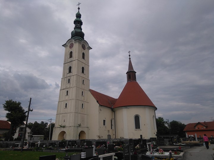
Bregana (; german: Bergana)''Leksikon občin kraljestev in dežel zastopanih v državnem zboru,'' vol. 6: ''Kranjsko''. 1906. Vienna: C. Kr. Dvorna in Državna Tiskarna, p. 68. is a settlement () that is part of the town of , , |
A3 (Croatia)
The A3 motorway ( hr, Autocesta A3) is a major motorway in Croatia spanning . The motorway connects Zagreb, the nation's capital, to the Slavonia region and a number of cities along the Sava River. It represents a major east–west transportation corridor in Croatia and a significant part of the Pan-European Corridor X, serving as a transit route between the European Union states and the Balkans. Apart from Zagreb, where the A3 motorway comprises a considerable part of the Zagreb bypass, the motorway runs near a number of significant Croatian cities. The motorway consists of two traffic lanes and an emergency lane in each driving direction, separated by a central reservation. All intersections of the A3 motorway are grade separated, and the motorway comprises several large stack and cloverleaf interchanges at junctions with four other motorways in Croatia: A1, A2, A4 and A5. There is a cloverleaf interchange is on the A3 route, where the A11 motorway is scheduled to br ... [...More Info...] [...Related Items...] OR: [Wikipedia] [Google] [Baidu] |
Samobor
Samobor () is a city in Zagreb County, Croatia. It is part of the Zagreb metropolitan area. Administratively it is a part of Zagreb County. Geography Samobor is located west of Zagreb, between the eastern slopes of the Samobor hills ( hr, Samoborsko gorje), the eastern part of Žumberak Mountains, in the Sava River valley. It is part of the historical region of Croatia proper. Administration The city government, court, police, health service, and a post office are part of the Samobor infrastructure. History Samobor has existed as a free royal town since 1242, according to a document of endowment by King Béla IV. Since the Treaty of Karlowitz in 1699, ''Szamobor'' was part of the Habsburg monarchy, (Transleithania after the compromise of 1867), and soon after in the Kingdom of Croatia-Slavonia, created when the Kingdom of Slavonia and the Kingdom of Croatia were merged in 1868. In the late 19th and early 20th century, Samobor was a district capital in the Zagreb Count ... [...More Info...] [...Related Items...] OR: [Wikipedia] [Google] [Baidu] |
Zagreb
Zagreb ( , , , ) is the capital (political), capital and List of cities and towns in Croatia#List of cities and towns, largest city of Croatia. It is in the Northern Croatia, northwest of the country, along the Sava river, at the southern slopes of the Medvednica mountain. Zagreb stands near the international border between Croatia and Slovenia at an elevation of approximately above mean sea level, above sea level. At the 2021 census, the city had a population of 767,131. The population of the Zagreb urban agglomeration is 1,071,150, approximately a quarter of the total population of Croatia. Zagreb is a city with a rich history dating from Roman Empire, Roman times. The oldest settlement in the vicinity of the city was the Roman Andautonia, in today's Ščitarjevo. The historical record of the name "Zagreb" dates from 1134, in reference to the foundation of the settlement at Kaptol, Zagreb, Kaptol in 1094. Zagreb became a free royal city in 1242. In 1851 Janko Kamauf became Z ... [...More Info...] [...Related Items...] OR: [Wikipedia] [Google] [Baidu] |
A2 (Slovenia)
The A2 motorway ( sl, avtocesta A2, Ilirika) is a motorway in Slovenia, around 180 km long, connecting the Karawanks Tunnel (at the Austrian border) via the capital city Ljubljana to Obrežje (at the Croatian border, near Zagreb). It connects several major Slovene cities, including Kranj, Ljubljana, and Novo Mesto, and is part of Pan-European Corridor X. The route of the motorway largely follows the path of the Brotherhood and Unity Highway, which was a two-lane non-divided road constructed as the main traffic artery within Yugoslavia. With the construction of the divided motorway, most of the previous road was demolished. A notable exception can be seen on the southern A2 segment between Grosuplje and Višnja Gora, where the previous road was grandfathered into the motorway system; it lacks a hard shoulder and has sharp turns and an exit ramp with a 10% grade. The northern segment between Višnja Gora and Grosuplje follows a completely different path, with three traffic l ... [...More Info...] [...Related Items...] OR: [Wikipedia] [Google] [Baidu] |
Naselje
The territory of Croatia is divided by the Croatian Bureau of Statistics into small settlements, in Croatian ''naselje'' (singular, pl. ''naselja''). They indicate existing or former human settlement (similar to the United States census designated places or the UK census output areas - OA) and are not necessarily incorporated places. Rather, the administrative units (local authorities) are cities (''grad'', pl. ''gradovi'') and municipalities (''općina'', pl. ''općine''), which are composed of one or more settlements. , there are 6,749 settlements in Croatia. Rural individual settlements are usually referred to as '' selo'' (village; pl. ''sela''). Municipalities (or communes) in Croatia comprise one or more, usually, rural settlements. A city usually includes an eponymous large settlement which in turn consists of several urban and suburban settlements. The Constitution of Croatia allows a ''naselje'' or a part thereof to form some form of local government. This form of local ... [...More Info...] [...Related Items...] OR: [Wikipedia] [Google] [Baidu] |
Rupa, Croatia
Rupa ( it, Ruppa) is a village in northwest Croatia near its border with Slovenia. It is located in Matulji ( it, Mattuglie) municipality in Primorje-Gorski Kotar County, 17 km from the town of Matulji. It has a population of 310 (census 2001). Rupa is a major border crossing between the two countries where Croatia's Autocesta A7 motorway connects with Slovenia's Highway 7. The Slovenian town opposite Rupa is Jelšane in Ilirska Bistrica municipality. With Slovenia joining the Schengen area The Schengen Area ( , ) is an area comprising 27 European countries that have officially abolished all passport and all other types of border control at their mutual borders. Being an element within the wider area of freedom, security and j ... on December 21, 2007, Rupa-Jelšane became a Schengen external border crossing. References {{coord, 45.478, N, 14.286, E, source:hrwiki_region:HR, format=dms, display=title Croatia–Slovenia border crossings Populated places in Primorje-Go ... [...More Info...] [...Related Items...] OR: [Wikipedia] [Google] [Baidu] |
Brdovec
Brdovec is a municipality in the Zagreb County, Croatia. The closest town to Brdovec is neighboring Zaprešić on the east. Demographics According to the 2001 census, there are 10,287 inhabitants, 92% which are Croats. They live in 13 settlements: * Brdovec - 2,310 * Donji Laduč - 745 * Drenje Brdovečko - 694 * Gornji Laduč - 864 * Harmica - 232 * Javorje - 634 * Ključ Brdovečki - 663 * Prigorje Brdovečko - 1,258 * Prudnice - 641 * Savski Marof - 35 * Šenkovec - 733 * Vukovo Selo - 381 * Zdenci Brdovečki - 1,097 Austro-Hungarian 1910 census According to the 1910 census in Croatia , image_flag = Flag of Croatia.svg , image_coat = Coat of arms of Croatia.svg , anthem = "Lijepa naša domovino"("Our Beautiful Homeland") , image_map = , map_caption = , capit ..., municipality of Brdovec had 4,021 inhabitants,Book: "Ethnic and religious composition of population of Croatia, 1880-1991: by sett ... [...More Info...] [...Related Items...] OR: [Wikipedia] [Google] [Baidu] |
Savski Marof
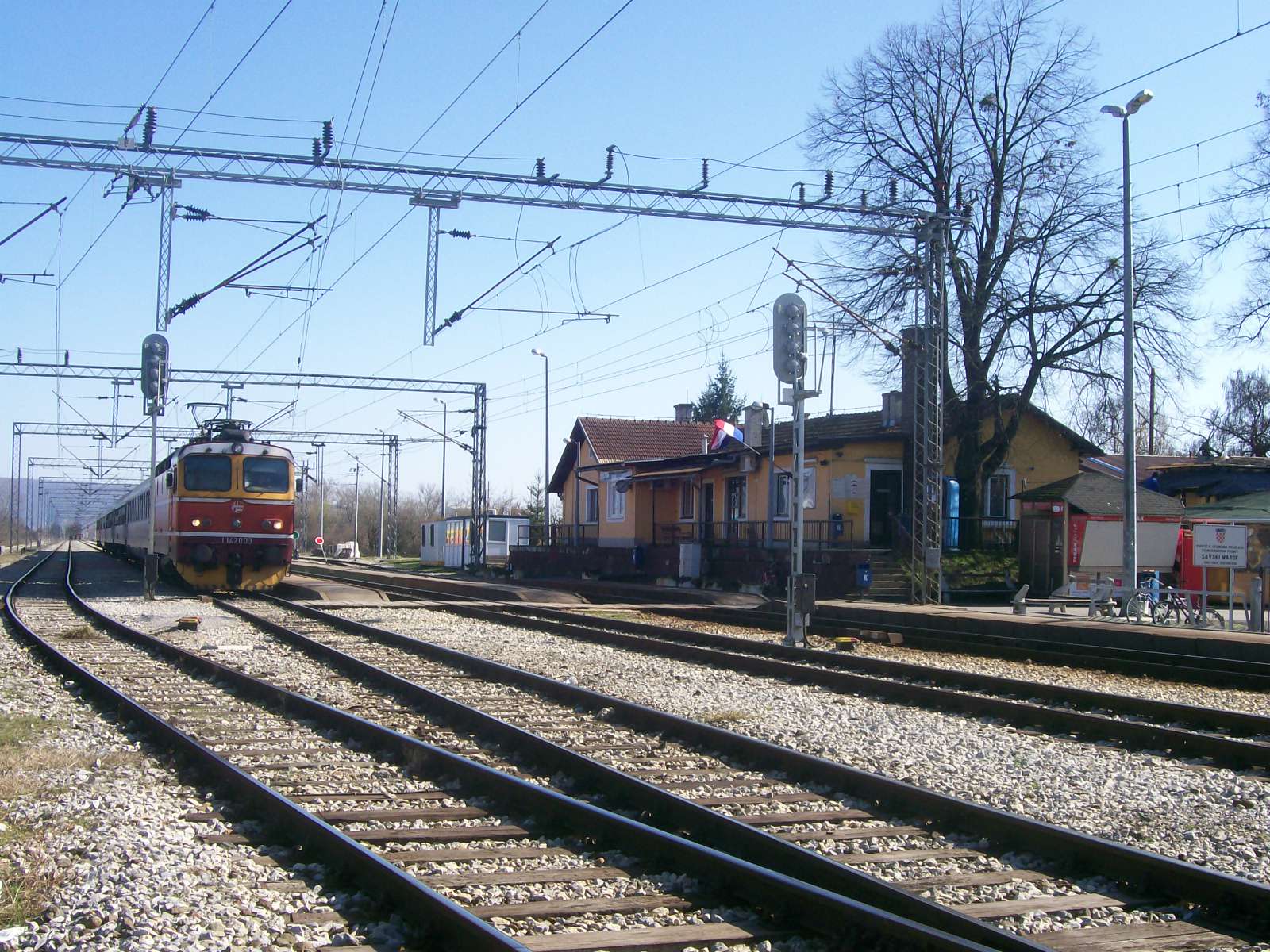
Savski Marof is a naselje (settlement) in the municipality of Brdovec, Zagreb County, Croatia. According to the 2001 census, it has 35 inhabitants living in an area of . This makes it the least dense settlement and the smallest by population in Brdovec. It is second-smallest by area (after Harmica Harmica () is a settlement in Croatia, located on the border with Slovenia. It is connected by the D225 highway. The eponymous border crossing is also located in Harmica, connecting Croatia's D225 with Slovenia's R2-420. Notable people * Ivan P ...). References {{commonscat, Savski Marof Populated places in Zagreb County ... [...More Info...] [...Related Items...] OR: [Wikipedia] [Google] [Baidu] |
Harmica
Harmica () is a settlement in Croatia, located on the border with Slovenia. It is connected by the D225 highway. The eponymous border crossing is also located in Harmica, connecting Croatia's D225 with Slovenia's R2-420. Notable people * Ivan Perkovac (1826–1871), journalist, editor of ''Pozor'' and ''Vijenac'', member of parliament, secretary of Matica hrvatska Matica hrvatska ( la, Matrix Croatica) is the oldest independent, non-profit and non-governmental Croatian national institution. It was founded on February 2, 1842 by the Croatian Count Janko Drašković and other prominent members of the Illyri ... References Populated places in Zagreb County {{ZagrebCounty-geo-stub ... [...More Info...] [...Related Items...] OR: [Wikipedia] [Google] [Baidu] |
Slovenska Vas, Brežice
Slovenska Vas (; sl, Slovenska vas) is a settlement in the Municipality of Brežice in eastern Slovenia, next to the border with Croatia. The area is part of the traditional region of Lower Carniola. During the Second World War, when it was known as ''Bregansko selo'', it was one of five Slovene settlements annexed by the Independent State of Croatia. It is now included with the rest of the municipality in the Lower Sava Statistical Region The Lower Sava Statistical Region ( sl, Posavska statistična regija; until December 31, 2014 ) is a statistical region in Slovenia. It has good traffic accessibility and is located in the Sava and Krka Valleys, with hilly areas with vineyards and .... Name The name of the settlement was changed from ''Bregansko selo'' to ''Slovenska vas'' in 1993. References External linksSlovenska Vas on Geopedia Populated places in the Municipality of Brežice {{Brežice-geo-stub ... [...More Info...] [...Related Items...] OR: [Wikipedia] [Google] [Baidu] |
Ljubljana
Ljubljana (also known by other historical names) is the capital and largest city of Slovenia. It is the country's cultural, educational, economic, political and administrative center. During antiquity, a Roman city called Emona stood in the area. Ljubljana itself was first mentioned in the first half of the 12th century. Situated at the middle of a trade route between the northern Adriatic Sea and the Danube region, it was the historical capital of Carniola, one of the Slovene-inhabited parts of the Habsburg monarchy. It was under Habsburg rule from the Middle Ages until the dissolution of the Austro-Hungarian Empire in 1918. After World War II, Ljubljana became the capital of the Socialist Republic of Slovenia, part of the Socialist Federal Republic of Yugoslavia. The city retained this status until Slovenia became independent in 1991 and Ljubljana became the capital of the newly formed state. Name The origin of the name ''Ljubljana'' is unclear. In the Middle Ages, both ... [...More Info...] [...Related Items...] OR: [Wikipedia] [Google] [Baidu] |
Serbia
Serbia (, ; Serbian language, Serbian: , , ), officially the Republic of Serbia (Serbian language, Serbian: , , ), is a landlocked country in Southeast Europe, Southeastern and Central Europe, situated at the crossroads of the Pannonian Basin and the Balkans. It shares land borders with Hungary to the north, Romania to the northeast, Bulgaria to the southeast, North Macedonia to the south, Croatia and Bosnia and Herzegovina to the west, and Montenegro to the southwest, and claims a border with Albania through the Political status of Kosovo, disputed territory of Kosovo. Serbia without Kosovo has about 6.7 million inhabitants, about 8.4 million if Kosvo is included. Its capital Belgrade is also the List of cities in Serbia, largest city. Continuously inhabited since the Paleolithic Age, the territory of modern-day Serbia faced Slavs#Migrations, Slavic migrations in the 6th century, establishing several regional Principality of Serbia (early medieval), states in the early Mid ... [...More Info...] [...Related Items...] OR: [Wikipedia] [Google] [Baidu] |


