|
Bonner Platz (Munich)
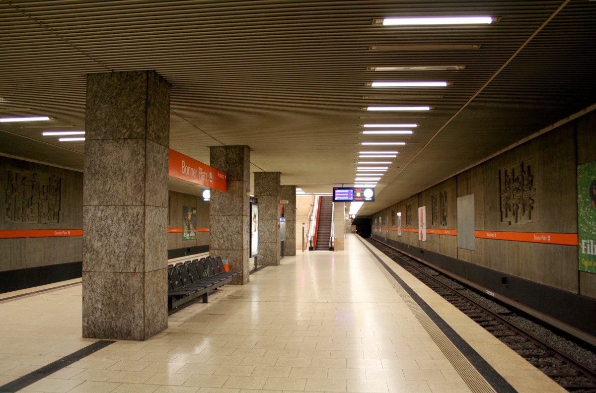
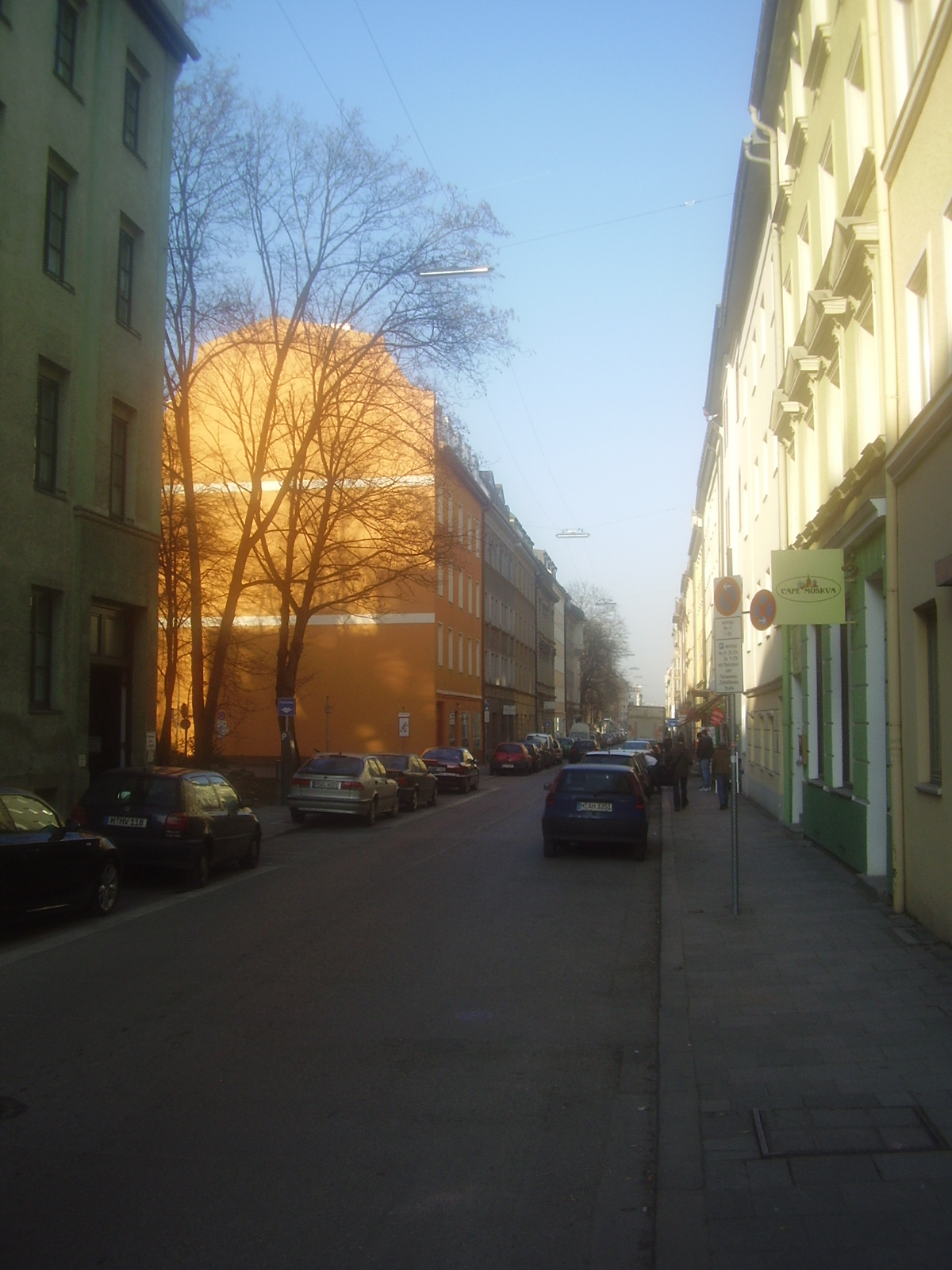
Bonner Platz, 1906 named after the city of Bonn, is a square in the Schwabing district of Munich, in the Schwabing-West quarter. The underground station of the same name Bonner Platz of the line U3 is located here. The following streets flows into the square (clockwise): from the west the Karl-Theodor-Straße, from the north the Bonner Straße, from the North East corner of the square to the east the Rheinstraße, from the South East Corner of the square to the east Karl-Theodor-Straße and to the south Viktoriastraße. The square is crossed diagonally by the western Karl-Theodor-Straße and the Rheinstraße, which merge into each other here and belong to the busy city tangent Dietlindenstraße - Potsdamer Straße - Rheinstraße - Karl-Theodor-Straße - Ackermannstraße. In contrast, the eastern Karl-Theodor-Straße is of secondary importance; it crosses the aforementioned through road and becomes Bonner Straße. In addition, there are narrow car park access roads on the northern, ... [...More Info...] [...Related Items...] OR: [Wikipedia] [Google] [Baidu] |
Bonn
The federal city of Bonn ( lat, Bonna) is a city on the banks of the Rhine in the German state of North Rhine-Westphalia, with a population of over 300,000. About south-southeast of Cologne, Bonn is in the southernmost part of the Rhine-Ruhr region, Germany's largest metropolitan area, with over 11 million inhabitants. It is a university city and the birthplace of Ludwig van Beethoven. Founded in the 1st century BC as a Roman settlement in the province Germania Inferior, Bonn is one of Germany's oldest cities. It was the capital city of the Electorate of Cologne from 1597 to 1794, and residence of the Archbishops and Prince-electors of Cologne. From 1949 to 1990, Bonn was the capital of West Germany, and Germany's present constitution, the Basic Law, was declared in the city in 1949. The era when Bonn served as the capital of West Germany is referred to by historians as the Bonn Republic. From 1990 to 1999, Bonn served as the seat of government – but no longer capital – ... [...More Info...] [...Related Items...] OR: [Wikipedia] [Google] [Baidu] |
Schwabing
Schwabing is a borough in the northern part of Munich, the capital of the German state of Bavaria. It is part of the city borough 4 (Schwabing-West) and the city borough 12 (Schwabing-Freimann). The population of Schwabing is estimated about 100.000, making it one of the largest districts of Munich. The main boulevard is Leopoldstraße. Overview Schwabing was a village, with a church documented in the 14th century. Schwabing used to be famous as Munich's bohemian quarter, but has lost much of this reputation due to strong gentrification in the last decades. A popular location is the ''Englischer Garten'', or English Garden, one of the world's largest public parks. Other not so commonly known parks in Schwabing are Leopoldpark, Petuelpark and Biotop am Ackermannbogen. The main buildings of Munich's largest universities, Ludwigs-Maximilians-Universität and the Technical University of Munich and Academy of Fine Arts are situated in the nearby Maxvorstadt. A student housing ... [...More Info...] [...Related Items...] OR: [Wikipedia] [Google] [Baidu] |
Munich
Munich ( ; german: München ; bar, Minga ) is the capital and most populous city of the States of Germany, German state of Bavaria. With a population of 1,558,395 inhabitants as of 31 July 2020, it is the List of cities in Germany by population, third-largest city in Germany, after Berlin and Hamburg, and thus the largest which does not constitute its own state, as well as the List of cities in the European Union by population within city limits, 11th-largest city in the European Union. The Munich Metropolitan Region, city's metropolitan region is home to 6 million people. Straddling the banks of the River Isar (a tributary of the Danube) north of the Northern Limestone Alps, Bavarian Alps, Munich is the seat of the Bavarian Regierungsbezirk, administrative region of Upper Bavaria, while being the population density, most densely populated municipality in Germany (4,500 people per km2). Munich is the second-largest city in the Bavarian dialects, Bavarian dialect area, ... [...More Info...] [...Related Items...] OR: [Wikipedia] [Google] [Baidu] |
Bonner Platz (Munich U-Bahn)
Bonner Platz is an U-Bahn station in Munich Munich ( ; german: München ; bar, Minga ) is the capital and most populous city of the States of Germany, German state of Bavaria. With a population of 1,558,395 inhabitants as of 31 July 2020, it is the List of cities in Germany by popu ... on the U3. References Munich U-Bahn stations Railway stations in Germany opened in 1972 1972 establishments in West Germany {{Munich-U-Bahn-stub ... [...More Info...] [...Related Items...] OR: [Wikipedia] [Google] [Baidu] |
Stammstrecke 1 (Munich U-Bahn)
The Stammstrecke 1 of the Munich U-Bahn is the first, of a total of three realized main routes, in the subway network of the Bavarian capital Munich. It runs mainly in north-south direction and is currently used by the two subway lines, the U3 and U6. Also, since 15 December 2013, the additional amplifier line, the U8, runs on Saturdays on the section Olympiazentrum- Scheidplatz. Between the subway stations Münchner Freiheit and Implerstraße, the lines U3 and U6 run on the same route, before, or after which they branch off and the two lines are then run each on a separate route. The mainline 1 has a total length of 41 kilometers and passes 42 subway stations. It does not run exclusively in Munich urban areas, but for a distance of about eight kilometers in the northern area of Garching. A large part of the northern section of the U6 runs above ground, the remaining part completely in tunnels. On 19 October 1971, the operation was recorded on the first main line with the U6 l ... [...More Info...] [...Related Items...] OR: [Wikipedia] [Google] [Baidu] |
Schleißheimer Straße (Munich)
Schleißheimer Straße is the second longest street in Munich after Dachauer Straße (11.2 km) with a length of 8.14 km. It starts in the city centre at Stiglmaierplatz, leads through five districts and ends at Goldschmiedplatz. It takes its name from the northern suburb of Oberschleißheim, where it originally ended. Course The Schleißheimer Straße starts as a one-lane one-way street in the center of Maxvorstadt district as a branch of the Dachauer Straße a little north of the Stiglmaierplatz, leads past the Maßmannpark and runs almost straight from south to north through Schwabing, Am Riesenfeld, Milbertshofen-Am Hart, Milbertshofen, Lerchenau and Harthof to the district Feldmoching-Hasenbergl, Hasenbergl. From the city centre to the height of Moosacher Straße / Frankfurter Ring, the road is mostly one-lane, with the exception of a section in front of Petuelring. Afterwards it leads continuously as two lanes up to its end at the Goldschmiedplatz / corner Aschenbrennerstra� ... [...More Info...] [...Related Items...] OR: [Wikipedia] [Google] [Baidu] |
Ungererstraße
The Ungererstraße is a street about 2.5 km long in the Schwabing district of Munich. It leads (parallel to the English Garden) from Leopoldstraße at the Münchner Freiheit in the north-east direction past the Ungererbad and the Nordfriedhof to Freimann past the Studentenstadt to Freisinger Landstraße at the corner of the Frankfurter Ring. In the northern part, west of the road, lies Neuer Israelitische Friedhof. The street's subway stations are: Dietlindenstraße, Nordfriedhof, Alte Heide and Studentenstadt. The Ungererstraße was formerly called ''Landshuter Straße'' and ''Freisinger Landstraße'', before it was renamed after August Ungerer (1860–1921), the engineer and owner of the ''Ungererbad''. In 1886, August Ungerer opened the Ungerer Tramway in the Freisinger Landstraße, which was the first electric tram in Munich to link Schwabing's ''Würmbad'' (today Ungererbad) to the horse-drawn railway network at the Schwabinger Großwirt. In 1895, the Ungererbahn was repla ... [...More Info...] [...Related Items...] OR: [Wikipedia] [Google] [Baidu] |
Oberwiesenfeld Army Airfield
Oberwiesenfeld Army Airfield is a former military airfield, located in Munich, Bavaria, Germany. History Military use of Oberwiesenfeld can be traced to about 1784 Electoral Bavarian artillery units which used the field as a training ground. It was used as an artillery training site and as a training area by the Bavarian Army throughout the 19th Century. As early as the late 19th century the Oberwiesenfeld was used as a landing area for Hot air balloon and Airships, both military and civilian. From 1909 onwards the field was also used as an airfield. On 1 January 1912 the field served as the founding place for the Royal Bavarian Flying Corps (German: Königlich Bayerische Fliegertruppe). The unit moved out to Oberschleißheim 3 months later, however. Because the field was also used as an exercise field for the Bavarian Cavalry, military exercises and aircraft movements could not occur at the same time. This was not resolved until 1925, when a permanent runway was constructed. ... [...More Info...] [...Related Items...] OR: [Wikipedia] [Google] [Baidu] |
Englischer Garten
The ''Englischer Garten'' (, ''English Garden'') is a large public park in the centre of Munich, Bavaria, stretching from the city centre to the northeastern city limits. It was created in 1789 by Sir Benjamin Thompson (1753–1814), later Count Rumford (''Reichsgraf von Rumford''), for Prince Charles Theodore, Elector of Bavaria. Thompson's successors, Reinhard von Werneck (1757–1842) and Friedrich Ludwig von Sckell (1750–1823), advisers on the project from its beginning, both extended and improved the park. With an area of (370 ha or 910 acres), the ''Englischer Garten'' is one of the world's largest urban public parks. The name refers to its English garden form of informal landscape, a style popular in England from the mid-18th century to the early 19th century and particularly associated with Capability Brown. History Creation When the Elector of Bavaria Maximilian III Joseph, the last ruler from the Bavarian branch of the Wittelsbach dynasty, died childless in 17 ... [...More Info...] [...Related Items...] OR: [Wikipedia] [Google] [Baidu] |
Bundesstraße 2 R
The Bundesstraße 2R is a German federal highway (''German:'' Bundesstraße) in Bavaria. It runs as a ring road within the city of Munich in Bavaria, is long, and is the most traffic-prone road in Germany. It is called the "Middle Ring" (''German:'' Mittlerer Ring) because of its concentric position between the Altstadtring and the incomplete Outer Ring, as well as being within the Autobahnring. Traffic importance The Middle Ring is the backbone of all traffic in Munich, since the ring is the fastest connection to all major traffic axes in the city. It replaced all the Bundesstraßen that ran through the center of the city, even the Bundesstraße 2, for which it is named (the R stands for Ring). Within the Middle Ring, there are only municipal streets. From the eight Autobahns that go to Munich, six of them have access to the Middle Ring. The A 8 (towards Salzburg), A 9 (towards Nuremberg-Berlin) and A 96 (towards Lindau) all have direct access to the Middle Ring. The A 94 ... [...More Info...] [...Related Items...] OR: [Wikipedia] [Google] [Baidu] |
Squares In Munich
In Euclidean geometry, a square is a regular quadrilateral, which means that it has four equal sides and four equal angles (90-degree angles, π/2 radian angles, or right angles). It can also be defined as a rectangle with two equal-length adjacent sides. It is the only regular polygon whose internal angle, central angle, and external angle are all equal (90°), and whose diagonals are all equal in length. A square with vertices ''ABCD'' would be denoted . Characterizations A convex quadrilateral is a square if and only if it is any one of the following: * A rectangle with two adjacent equal sides * A rhombus with a right vertex angle * A rhombus with all angles equal * A parallelogram with one right vertex angle and two adjacent equal sides * A quadrilateral with four equal sides and four right angles * A quadrilateral where the diagonals are equal, and are the perpendicular bisectors of each other (i.e., a rhombus with equal diagonals) * A convex quadrilateral with successiv ... [...More Info...] [...Related Items...] OR: [Wikipedia] [Google] [Baidu] |


