|
Bolor-Tagh
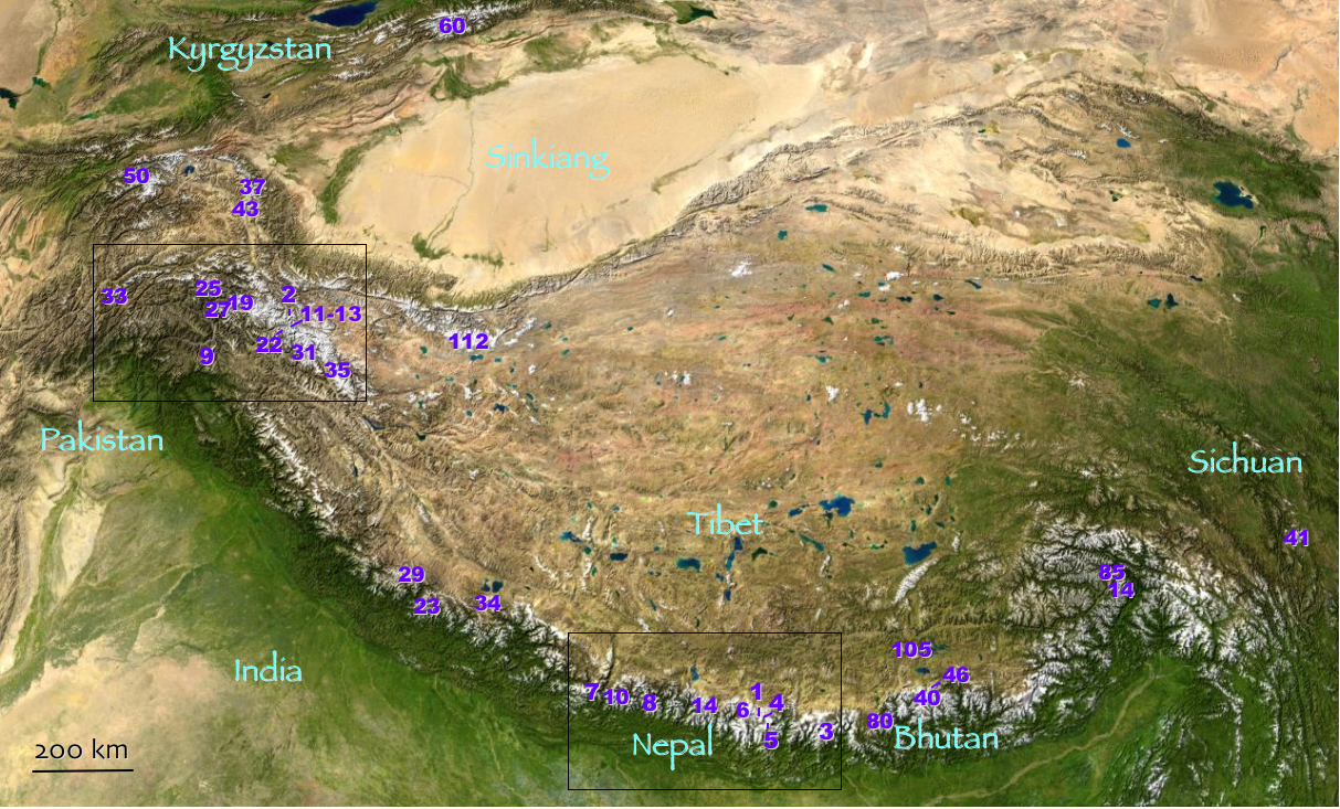
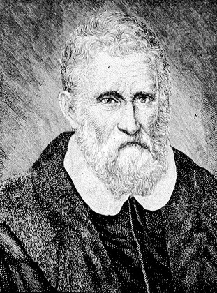
Bolor-Tagh is an old name for the longitudinal range in eastern Pamir Mountains (ancient Mount Imeon) extending from Kunlun Mountains in the south to the east extremity of the Trans-Alay Range in the north. Highest peaks Kongur Tagh (7649 m) and Muztagh Ata. Bolor-Tagh lies entirely in the Xinjiang province of western China. Marco Polo visited the area in 1271 during his travel to China China, officially the People's Republic of China (PRC), is a country in East Asia. It is the world's most populous country, with a population exceeding 1.4 billion, slightly ahead of India. China spans the equivalent of five time zones and ..., describing it under the name of ‘Bolor’. References * * Meyers Konversationslexikon. Verlag des Bibliographischen Instituts, Leipzig und Wien, Vierte Auflage, 1885–1892. * Brockhaus' Konversationslexikon. F. A. Brockhaus in Leipzig, Berlin und Wien, 14. Auflage, 1894–1896. * Polo, Marco and Rustichello of Pisa.''The Travels of Marco ... [...More Info...] [...Related Items...] OR: [Wikipedia] [Google] [Baidu] |
Pamir Mountains
The Pamir Mountains are a mountain range between Central Asia and Pakistan. It is located at a junction with other notable mountains, namely the Tian Shan, Karakoram, Kunlun, Hindu Kush and the Himalaya mountain ranges. They are among the world's highest mountains. Much of the Pamir Mountains lie in the Gorno-Badakhshan Province of Tajikistan. To the south, they border the Hindu Kush mountains along Afghanistan's Wakhan Corridor in Badakhshan Province, Chitral District, Chitral and Gilgit-Baltistan regions of Pakistan. To the north, they join the Tian Shan mountains along the Alay Valley of Kyrgyzstan. To the east, they extend to the range that includes China's Kongur Tagh, in the "Eastern Pamirs", separated by the Yarkand River, Yarkand valley from the Kunlun Mountains. Name and etymology Since Victorian times, they have been known as the "Roof of the World", presumably a translation from Persian language, Persian. Names In other languages they are called: ps, , ; k ... [...More Info...] [...Related Items...] OR: [Wikipedia] [Google] [Baidu] |
Mount Imeon
Mount Imeon () is an ancient name for the Central Asian complex of mountain ranges comprising the present Hindu Kush, Pamir and Tian Shan, extending from the Zagros Mountains in the southwest to the Altay Mountains in the northeast, and linked to the Kunlun, Karakoram and Himalayas to the southeast. The term was used by Hellenistic-era scholars as "Imaus Mount", even though non-Greek in etymology, and predating Alexander the Great. Geography A detailed description of the mountainous territory and its people was given in the Armenian geography index '' Ashharatsuyts'' written by Anania Shirakatsi in the 7th century AD.Eremian, SurenReconstructed map of Central Asia from ‘Ashharatsuyts’./ref>Shirakatsi, Anania, ''The Geography of Ananias of Sirak (Asxarhacoyc): The Long and the Short Recensions''. Introduction, Translation and Commentary by Robert H. Hewsen. Wiesbaden: Reichert Verlag, 1992. 467 pp. According to the original ''Ashharatsuyts'' mapping reconstructed by Acad. ... [...More Info...] [...Related Items...] OR: [Wikipedia] [Google] [Baidu] |
Kunlun Mountains
The Kunlun Mountains ( zh, s=昆仑山, t=崑崙山, p=Kūnlún Shān, ; ug, كۇئېنلۇن تاغ تىزمىسى / قۇرۇم تاغ تىزمىسى ) constitute one of the longest mountain chains in Asia, extending for more than . In the broadest sense, the chain forms the northern edge of the Tibetan Plateau south of the Tarim Basin. The exact definition of Kunlun Mountains varies over time. Older sources used Kunlun to mean the mountain belt that runs across the center of China, that is, Altyn Tagh along with the Qilian and Qin Mountains. Recent sources have the Kunlun range forming most of the south side of the Tarim Basin and then continuing east, south of the Altyn Tagh. Sima Qian (''Records of the Grand Historian'', scroll 123) says that Emperor Wu of Han sent men to find the source of the Yellow River and gave the name Kunlun to the mountains at its source. The name seems to have originated as a semi-mythical location in the classical Chinese text ''Classic of Mounta ... [...More Info...] [...Related Items...] OR: [Wikipedia] [Google] [Baidu] |
Trans-Alai
russian: Заалайский хребет , etymology = , photo = Alai Valley 1.jpg , photo_caption = Trans-Alay Range and Alay Valley , photo_size = 250 , country = Kyrgyzstan, Tajikistan , state = , region = Osh Province, Gorno-Badakshan , district = , border = , highest = Lenin Peak , elevation_m = 7134 , range_coordinates = , length_km = 250 , length_orientation = E-W , width_km = 40 , width_orientation = N-S , area_km2 = , geology = Limestone and schist , orogeny = , period = Paleozoic and Mesozoic , coordinates = , map = Tajikistan , map_caption = Location in Tajikistan , label_position = none , language = ky The Trans-Alay Range ( ky, Чоң Алай кырка тоосу, Chong Alay kyrka toosu; russian: Заалайский хребет, translit=Zaalaisky Khrebet; also 'Trans Alai') is the northernmost range of the Pamir Mountain System. Geography The Trans-Alay is located in the area where the Pamirs and the Tian Shan come together. T ... [...More Info...] [...Related Items...] OR: [Wikipedia] [Google] [Baidu] |
Kongur Tagh
Kongur Tagh or Kongkoerh ( Kyrgyz: Коңур Тоо; Uyghur: , Коңур Тағ, meaning "Brown Mountain"; mn, Хонгор Таг, (Хонгор/Kongur/Kongur is Mongolian word for the color Mongolians use for Buckskin colored horse) ''Hongor Tag''; zh, s=公格尔峰, t=公格爾峰, p=Gōnggé'ěr Fēng; also referred to as Kongur), is the highest peak in the Pamir Mountains, and also the highest mountain wholly within the Xinjiang Uyghur Autonomous Region, China. With an elevation of , it is also the highest mountain outside of the Hindu Kush/ Karakoram and Himalaya ranges. Geography Kongur Tagh is within a range called the Kongur Shan (.) Kongur Tagh is located just north of Muztagh Ata and visible from Karakul Lake. Some sources use "Kongur Shan" mistakenly to refer to the peak itself. The Kongur Shan range, including Muztagh Ata, is separated by the major Yarkand River valley from the Kunlun Mountains and thus is included in the "Eastern Pamirs". Kongur Tagh is ... [...More Info...] [...Related Items...] OR: [Wikipedia] [Google] [Baidu] |
Muztagh Ata
Muztagh Ata or Muztagata (, Музтағ Ата, literally "ice-mountain-father"; ; formerly known as Mount Tagharma or Taghalma and Wi-tagh) is the second highest (7546 metres) of the mountains which form the northern edge of the Tibetan Plateau in China (not the second highest of the mountains of the Tibetan Plateau). It is sometimes regarded as being part of the Kunlun Mountains, although physically it is more closely connected to the Pamirs. It is also one of the relatively easier 7,000 m peaks in the world to climb, due to its gentle western slope and the comparatively drier weather of Xinjiang, though a thorough acclimatization period and a very strong physical condition are crucial for success. Location Muztagh Ata lies just south of Kongur Tagh, the highest peak of this somewhat isolated range that is separated from the main chain of the Kunlun by the large Yarkand River valley, and thus generally included in the "Eastern Pamirs". Not far to the north and east of th ... [...More Info...] [...Related Items...] OR: [Wikipedia] [Google] [Baidu] |
Xinjiang
Xinjiang, SASM/GNC: ''Xinjang''; zh, c=, p=Xīnjiāng; formerly romanized as Sinkiang (, ), officially the Xinjiang Uygur Autonomous Region (XUAR), is an autonomous region of the People's Republic of China (PRC), located in the northwest of the country at the crossroads of Central Asia and East Asia. Being the largest province-level division of China by area and the 8th-largest country subdivision in the world, Xinjiang spans over and has about 25 million inhabitants. Xinjiang borders the countries of Mongolia, Russia, Kazakhstan, Kyrgyzstan, Tajikistan, Afghanistan, Pakistan and India. The rugged Karakoram, Kunlun and Tian Shan mountain ranges occupy much of Xinjiang's borders, as well as its western and southern regions. The Aksai Chin and Trans-Karakoram Tract regions, both administered by China, are claimed by India. Xinjiang also borders the Tibet Autonomous Region and the provinces of Gansu and Qinghai. The most well-known route of the historic Silk Ro ... [...More Info...] [...Related Items...] OR: [Wikipedia] [Google] [Baidu] |
China
China, officially the People's Republic of China (PRC), is a country in East Asia. It is the world's most populous country, with a population exceeding 1.4 billion, slightly ahead of India. China spans the equivalent of five time zones and borders fourteen countries by land, the most of any country in the world, tied with Russia. Covering an area of approximately , it is the world's third largest country by total land area. The country consists of 22 provinces, five autonomous regions, four municipalities, and two Special Administrative Regions (Hong Kong and Macau). The national capital is Beijing, and the most populous city and financial center is Shanghai. Modern Chinese trace their origins to a cradle of civilization in the fertile basin of the Yellow River in the North China Plain. The semi-legendary Xia dynasty in the 21st century BCE and the well-attested Shang and Zhou dynasties developed a bureaucratic political system to serve hereditary monarchies, or dyna ... [...More Info...] [...Related Items...] OR: [Wikipedia] [Google] [Baidu] |
Marco Polo
Marco Polo (, , ; 8 January 1324) was a Venetian merchant, explorer and writer who travelled through Asia along the Silk Road between 1271 and 1295. His travels are recorded in ''The Travels of Marco Polo'' (also known as ''Book of the Marvels of the World '' and ''Il Milione'', ), a book that described to Europeans the then mysterious culture and inner workings of the Eastern world, including the wealth and great size of the Mongol Empire and China in the Yuan Dynasty, giving their first comprehensive look into China, Persia, India, Japan and other Asian cities and countries. Born in Venice, Marco learned the mercantile trade from his father and his uncle, Niccolò and Maffeo, who travelled through Asia and met Kublai Khan. In 1269, they returned to Venice to meet Marco for the first time. The three of them embarked on an epic journey to Asia, exploring many places along the Silk Road until they reached Cathay (China). They were received by the royal court of Kublai Khan, ... [...More Info...] [...Related Items...] OR: [Wikipedia] [Google] [Baidu] |

.jpg)


