|
Bitihorn
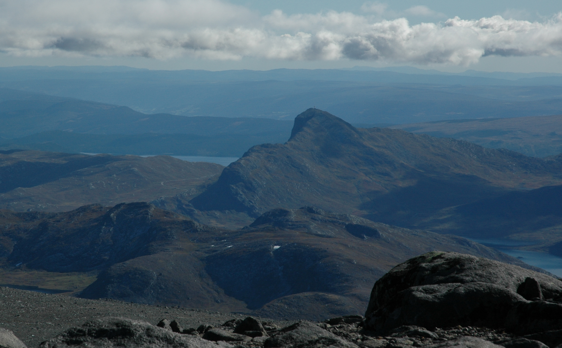
Bitihorn (local pronunciation: ) is a mountain on the border of Vang Municipality and Øystre Slidre Municipality in Innlandet county, Norway. The tall mountain is located in the Jotunheimen mountains about northwest of the village of Beitostølen. The mountain is surrounded by several other notable mountains including Rasletind and Raslet to the north, Gråhøi and Kvernhøi to the northeast, and Skaget to the east. It is situated on the west side of Norwegian County Road 51, and because of its location, it is a landmark for tourists following that popular driving route. Geology The mountain is steep towards south and east, and there is a subtle change in the rock layers between the sparagmite foundation and the summit which consists of the much harder gabbro rock. The summit is one of the southernmost outcrops of gabbro in the vicinity, and Bitihorn is therefore significantly higher than its neighbors to the south and east. Underneath the sparagmite layer, lies a layer ... [...More Info...] [...Related Items...] OR: [Wikipedia] [Google] [Baidu] |
Bygdin
Bygdin is a lake in Vang Municipality in Innlandet county, Norway. The is located in the southern part of the Jotunheimen mountain range. The long, narrow mountain lake is located between the large lakes Tyin (to the west) and Vinstre to the east. The depth of Bygdin is regulated for hydroelectric power generation at nearby power plants. The normal level of the water lies between above sea level. The maximum depth of the lake is . The Vinsteråni river runs out Bygdin, passes through the Vinstre and Vinstervatna lakes and into the river Vinstra. That river later flows into the Gudbrandsdalslågen river. Bygdin lies to the southeast part of the Jotunheimen and north of the lake lies a mountainous area that often reaches elevations over . Some of the notable mountains located along the shores of the lake include Galdeberget, Torfinnstindene, and Nørdre Kalvehølotinden. Along the lake there are many tourist huts. On the west end lies Eidsbugarden, on the north side lies the ... [...More Info...] [...Related Items...] OR: [Wikipedia] [Google] [Baidu] |
Norwegian County Road 51
County Road 51 ( no, Fylkesvei 51) is a highway which runs north–south between Vågå and Gol, Norway. Part of the road runs concurrently with E16, between Leira and Fagernes. The section across Valdresflye is designated a National Tourist Route. This section is closed in the winter. Prior to 2010, the road was known as National Road 51 ( no, Riksvei 51). File:Valdresflya (Jotunheimen).jpg, Country road 51 running across Valdresflye File:Valdres - Bitihorn.JPG, The road with Bitihorn Bitihorn (local pronunciation: ) is a mountain on the border of Vang Municipality and Øystre Slidre Municipality in Innlandet county, Norway. The tall mountain is located in the Jotunheimen mountains about northwest of the village of Beitost ... in the background References 051 County roads in Buskerud County roads in Oppland National Tourist Routes in Norway {{Norway-road-stub ... [...More Info...] [...Related Items...] OR: [Wikipedia] [Google] [Baidu] |
Rasletind
Rasletind or Rasletinden is a mountain on the border of Vang Municipality and Vågå Municipality in Innlandet county, Norway. The tall mountain is located in the Jotunheimen mountains within Jotunheimen National Park. The mountain sits about southwest of the village of Vågåmo and about northwest of the village of Beitostølen. The mountain is surrounded by several other notable mountains including Gråhøi to the east; Bukkehåmåren, Høgdebrotet, and Eggi to the north; Tjønnholstinden and Tjønnholsoksle to the northwest; and Kalvehøgde and Leirungskampen to the west. The mountain has two main summits, named Øystre Rasletind and Rasletind. The higher summit reaches an elevation of above sea level. It is located on the border between the municipalities of Vang and Vågå. The secondary peak reaches an elevation of above sea level a little further to the east. That peak forms a tripoint for the municipal borders of Vang, Vågå, and Øystre Slidre municipal ... [...More Info...] [...Related Items...] OR: [Wikipedia] [Google] [Baidu] |
Raslet
Raslet is a mountain on the border of Øystre Slidre Municipality and Vang Municipality in Innlandet county, Norway. The tall mountain is located in the Jotunheimen mountains, on the western edge of the Valdresflye plateau. It sits about northwest of the village of Beitostølen. The mountain is surrounded by several other notable mountains including Rasletinden to the northwest, Nørdre Kalvehølotinden to the west, Bitihorn to the south, Gråhøi and Kvernhøi to the east, and Heimdalshøe to the northeast. See also *List of mountains of Norway by height There are 291 peaks in Norway with elevations of over above sea level and that have a topographic prominence of more than 10 meters. The following list includes those 186 that have a topographic prominence of 50 meters or more. The topographic i ... References Øystre Slidre Vang, Innlandet Mountains of Innlandet {{Innlandet-mountain-stub ... [...More Info...] [...Related Items...] OR: [Wikipedia] [Google] [Baidu] |
Christen Smith (botanist)
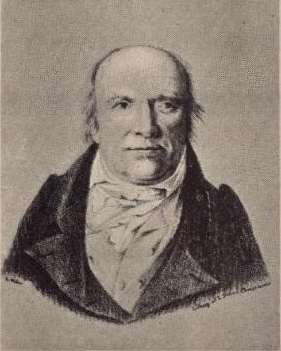
Christen Smith (17 October 1785 – 22 September 1816) was an early 19th-century Norwegian physician, economist and natural history, naturalist, particularly botany, botanist. He died, only 30 years old during a dramatic expedition to the Congo River in 1816, leaving a wealth of botanical material. Early years Smith was born at Skoger in Drammen, Norway. He studied medicine and botany at the University of Copenhagen under Professor Martin Vahl. Together with Jens Wilken Hornemann, he traveled through large parts of Norway and carried out botanical investigations, collecting plants to be included in the plate work ''Flora Danica''. Joakim Frederik Schouw and Morten Wormskjold were in the company for part of the trip. The party climbed several mountain tops in Jotunheimen, for some of which it was the first recorded ascent, e.g. Bitihorn 1811 and Hårteigen 1812.Munthe, Preben (2004): ''Christen Smith - botaniker og økonom'' (in Norwegian). Aschehoug, Oslo The Canary and Madeira e ... [...More Info...] [...Related Items...] OR: [Wikipedia] [Google] [Baidu] |
Jens Esmark
Jens Esmark (31 January 1763 – 26 January 1839) was a Danish-Norwegian professor of mineralogy who contributed to many of the initial discoveries and conceptual analyses of glaciers, specifically the concept that glaciers had covered larger areas in the past. Biography Jens Esmark was born in Houlbjerg in Århus, Denmark. Esmark moved to Norway to the silver mining community of Kongsberg. He studied at the local mining academy. He completed his subsequent studies in Copenhagen and was accepted as a surveyor. Starting in 1797, Esmark was employed as a lecturer in mineralogy at the Kongsberg Mining Academy. In 1814, Esmark became Norway's first professor of geology as a professor of geology at the University of Oslo, and was described as "a pioneer in glacial geology", by professor of Quaternary geology and Glaciology Bjørn G. Andersen. In 1798, Esmark was the first person to ascend Snøhetta, highest in the mountain range Dovrefjell in southern Norway. The same year he l ... [...More Info...] [...Related Items...] OR: [Wikipedia] [Google] [Baidu] |
Kvernhøi
Kvernhøi is a mountain in Øystre Slidre Municipality in Innlandet county, Norway. The tall mountain is located about northeast of the village of Beitostølen. The mountain is surrounded by several other notable mountains including Heimdalshøe to the north, Gråhøi to the northeast, Bitihorn to the southwest, and Raslet to the west. The lake Vinstre lies to the south. The mountain sits on the eastern edge of the Valdresflye plateau. See also *List of mountains of Norway by height There are 291 peaks in Norway with elevations of over above sea level and that have a topographic prominence of more than 10 meters. The following list includes those 186 that have a topographic prominence of 50 meters or more. The topographic i ... References Øystre Slidre Mountains of Innlandet {{Innlandet-mountain-stub ... [...More Info...] [...Related Items...] OR: [Wikipedia] [Google] [Baidu] |
Botany
Botany, also called , plant biology or phytology, is the science of plant life and a branch of biology. A botanist, plant scientist or phytologist is a scientist who specialises in this field. The term "botany" comes from the Ancient Greek word (''botanē'') meaning " pasture", " herbs" "grass", or " fodder"; is in turn derived from (), "to feed" or "to graze". Traditionally, botany has also included the study of fungi and algae by mycologists and phycologists respectively, with the study of these three groups of organisms remaining within the sphere of interest of the International Botanical Congress. Nowadays, botanists (in the strict sense) study approximately 410,000 species of land plants of which some 391,000 species are vascular plants (including approximately 369,000 species of flowering plants), and approximately 20,000 are bryophytes. Botany originated in prehistory as herbalism with the efforts of early humans to identify – and later cultivate – ed ... [...More Info...] [...Related Items...] OR: [Wikipedia] [Google] [Baidu] |
Besshø
Besshø or Besshøe is a mountain in Vågå Municipality in Innlandet county, Norway. The tall mountain is located in the Jotunheimen mountains within Jotunheimen National Park. The mountain sits about southwest of the village of Vågåmo and about northwest of the village of Beitostølen. The mountain is surrounded by several other notable mountains including Kollhøin to the north, Veslfjellet and Besseggen to the southeast, Bukkehåmåren and Eggi to the south, and Gloptinden to the west. The mountain lies right above the lake Bessvatnet, along the Besseggen hiking trail. On the mountain's north-eastern side a small cirque glacier, and is surrounded by a large ice-cored moraine, a relatively rare feature in Norway. From Besseggen there is a nice view over the lakes Gjende and Bessvatnet. Gjende is about 400 m lower than Bessvatnet. While Bessvatnet has a blue colour common to lakes, Gjende has a green colour due to glacier runoff depositing clay into the lake (rock flou ... [...More Info...] [...Related Items...] OR: [Wikipedia] [Google] [Baidu] |
Innlandet
Innlandet is a county in Norway. It was created on 1 January 2020 with the merger of the old counties of Oppland and Hedmark (the municipalities of Jevnaker and Lunner were transferred to the neighboring county of Viken on the same date). The new county has an area of , making it the second largest county in Norway after Troms og Finnmark county. The county name translates to "The Inland" which reflects that the county is the only landlocked county in Norway. The county covers approximately 17% of the total area of the mainland area of Norway. It stretches from the Viken county and the Oslo region in the south to Trøndelag county in the north. In the northwest, the county borders Møre og Romsdal and the Vestland county in the west. To the east the county borders the Swedish counties of Värmland and Dalarna. The northern and western areas of the county are dominated by the mountainous areas Rondane, Dovrefjell and Jotunheimen. The Galdhøpiggen mountain is located within t ... [...More Info...] [...Related Items...] OR: [Wikipedia] [Google] [Baidu] |


