|
Baybridge, Northumberland
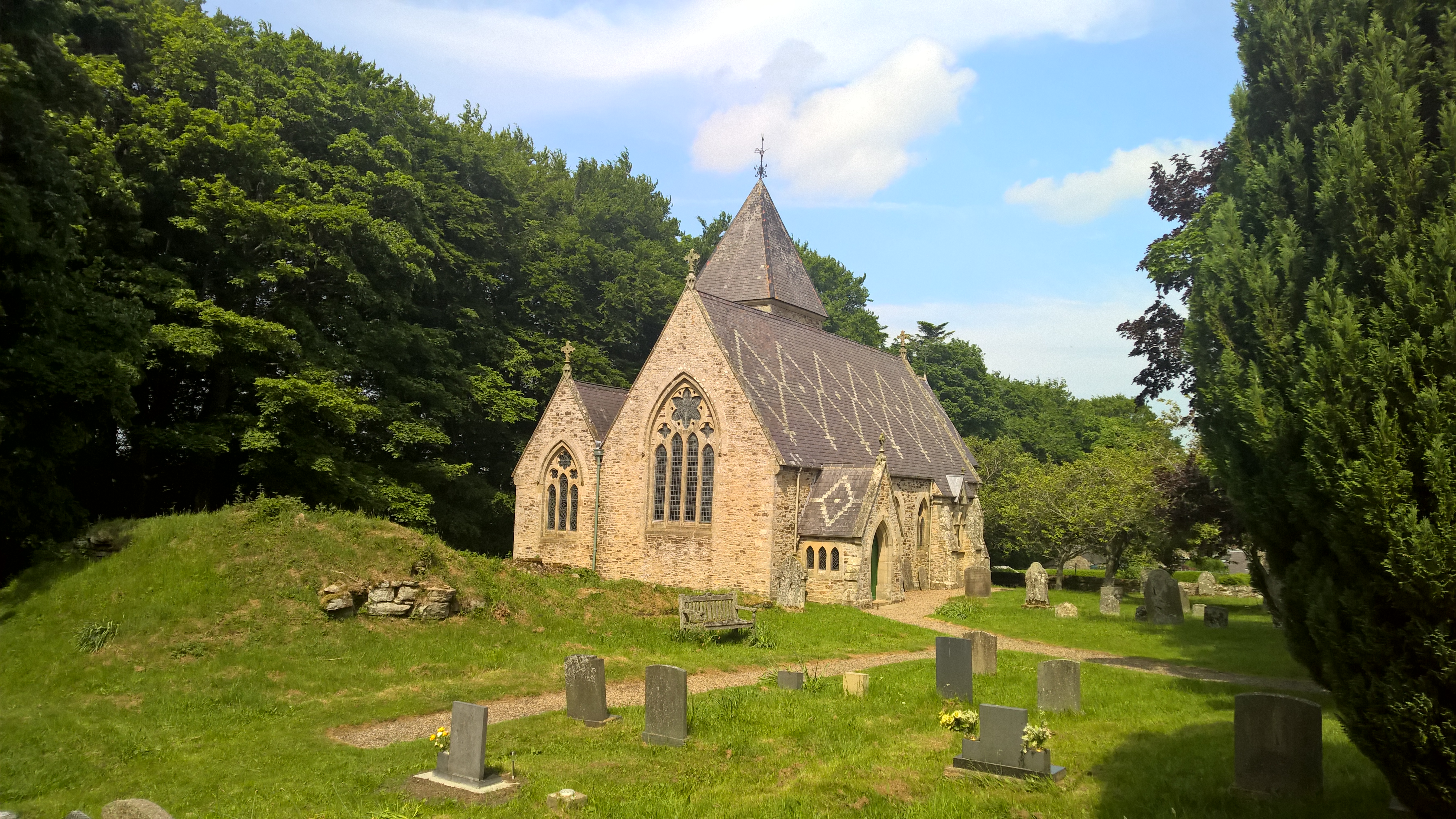
Baybridge is a small village in Northumberland, England, just to the west of Blanchland and on the border with County Durham. It is situated to the west of Consett and the Derwent Reservoir, between Newbiggin and Blanchland. Baybridge is approximately 100 miles from Edinburgh, Scotland, and historically home to Northumbrian border pipers. The Methodist chapel, dated 1867, was possibly designed by S.S. Teulon (he designed a number of buildings in nearby Hunstanworth). An inn, the Miners’ Arms, (now a private house) was built in the late 18th century and reflects the role of lead mining in the area. In 1866 this was the scene of a riot between local miners and Cornish miners over favouritism shown to the local miners. Governance Baybridge is in the parliamentary constituency of Hexham Hexham ( ) is a market town and civil parishes in England, civil parish in Northumberland, England, on the south bank of the River Tyne, formed by the confluence of the North Ty ... [...More Info...] [...Related Items...] OR: [Wikipedia] [Google] [Baidu] |
Northumberland County Council
Northumberland County Council is a unitary authority in North East England. The population of the non-metropolitan unitary authority at the 2011 census was 316,028. History It was formed in 1889 as the council for the administrative county of Northumberland. The city of Newcastle upon Tyne was a county borough independent from the county council, although the county council had its meeting place at Moot Hall, Newcastle upon Tyne, Moot Hall in the city. Tynemouth subsequently also became a county borough in 1904, removing it from the administrative county. The county was further reformed in 1974, becoming a non-metropolitan county and ceding further territory around the Newcastle conurbation to the new metropolitan county of Tyne and Wear. As part of the 2009 structural changes to local government in England it became a unitary authority with the same boundaries, this disregarded the referendum held in 2005 in which the population voted against the forming of a unitary authority. ... [...More Info...] [...Related Items...] OR: [Wikipedia] [Google] [Baidu] |
Northumberland
Northumberland () is a county in Northern England, one of two counties in England which border with Scotland. Notable landmarks in the county include Alnwick Castle, Bamburgh Castle, Hadrian's Wall and Hexham Abbey. It is bordered by land on three sides; by the Scottish Borders region to the north, County Durham and Tyne and Wear to the south, and Cumbria to the west. The fourth side is the North Sea, with a stretch of coastline to the east. A predominantly rural county with a landscape of moorland and farmland, a large area is part of Northumberland National Park. The area has been the site of a number of historic battles with Scotland. Name The name of Northumberland is recorded as ''norð hẏmbra land'' in the Anglo-Saxon Chronicle, meaning "the land north of the Humber". The name of the kingdom of ''Northumbria'' derives from the Old English meaning "the people or province north of the Humber", as opposed to the people south of the Humber Estuary. History ... [...More Info...] [...Related Items...] OR: [Wikipedia] [Google] [Baidu] |
Hexham (UK Parliament Constituency)
Hexham is a constituency in Northumberland represented in the House of Commons of the UK Parliament since 2010 by Guy Opperman, a Conservative. As with all constituencies, the constituency elects one Member of Parliament (MP) by the first past the post system of election at least every five years. The seat was created as one of four single member divisions of the county of Northumberland under the Redistribution of Seats Act 1885. Constituency profile The second-largest constituency by land area in England (covering 250,992 hectares), Hexham reaches to the Pennines and is traversed by Hadrian's Wall, which runs almost due east–west through England. It includes substantial agricultural holdings, forestry, wood processing, food, minerals, and manufactured hardware industries. In the midst of the northwest of the constituency is Kielder Water; running between this area and the middle of the seat is the southern portion of Kielder Forest, and in the west, the attractions of the ... [...More Info...] [...Related Items...] OR: [Wikipedia] [Google] [Baidu] |
Blanchland
Blanchland is a village in Northumberland, England, on the County Durham boundary. The population of the civil parish at the 2011 census was 135. Set beside the river in a wooded section of the Derwent valley, Blanchland is an attractive small village in the North Pennines Area of Outstanding Natural Beauty. Blanchland was formed out of the medieval Blanchland Abbey property by Nathaniel Crew, 3rd Baron Crew, the Bishop of Durham, 1674–1722. It is a conservation village, largely built of stone from the remains of the 12th-century Abbey. It features picturesque houses, set against a backdrop of deep woods and open moors. Located near the Derwent Reservoir, it provides facilities for sailing and fishing. The Lord Crewe Arms Hotel has a vast fireplace where 'General' Tom Forster hid during the Jacobite rising of 1715. W. H. Auden stayed at the Lord Crewe Arms with fellow student Gabriel Carritt at Easter 1930, and later remarked that no place held sweeter memories. Writer ... [...More Info...] [...Related Items...] OR: [Wikipedia] [Google] [Baidu] |
County Durham
County Durham ( ), officially simply Durham,UK General Acts 1997 c. 23Lieutenancies Act 1997 Schedule 1(3). From legislation.gov.uk, retrieved 6 April 2022. is a ceremonial county in North East England.North East Assembly �About North East England. Retrieved 30 November 2007. The ceremonial county spawned from the historic County Palatine of Durham in 1853. In 1996, the county gained part of the abolished ceremonial county of Cleveland.Lieutenancies Act 1997 . Retrieved 27 October 2014. The county town is the of |
Consett
Consett is a town in County Durham, England, about south-west of Newcastle upon Tyne. It had a population of 27,394 in 2001 and an estimate of 25,812 in 2019. History Consett sits high on the edge of the Pennines. Its' name originates in the Old English ''Cunecsheafod'' ("Cunec's headland"), first recorded in the 13th century. In 1841, it was a village community of only 145, but it was about to become a boom town: below the ground were coking coal and blackband iron ore, and nearby was limestone. These three ingredients were needed for blast furnaces to produce iron and steel. The town is perched on the steep eastern bank of the River Derwent and owes its origins to industrial development arising from lead mining in the area, together with the development of the steel industry in the Derwent Valley, which is said to have been initiated by immigrant German cutlers and sword-makers from Solingen, who settled in the village of Shotley Bridge during the 17th century. During the ... [...More Info...] [...Related Items...] OR: [Wikipedia] [Google] [Baidu] |
Derwent Reservoir, North East England
The Derwent Reservoir is a reservoir on the River Derwent, on the border between County Durham and Northumberland, in England. It is west of Consett. It is 3.5 miles (5.6 km) long) and covers an area of 4 km2 and has a maximum depth of 100 ft (30m) and when full, holds 11,000 million gallons (50,000,000m³). The reservoir is a key part of the water supply network in north east England (which is owned and managed by Northumbrian Water) as it is the principal water source for the Tyne and Wear metropolitan area supplying per day. The reservoir was first proposed in 1957 when the Sunderland and South Shields Water Company promoted the Derwent Water Order. Building work began on the reservoir in 1960, and it was opened in July 1967 by Princess Alexandra. Unlike other reservoirs in Northern England that are flooded valleys with a dam head, Derwent was dug out of the ground and the earth removed was used in its dam head. The flow of the River Derwent can be supplem ... [...More Info...] [...Related Items...] OR: [Wikipedia] [Google] [Baidu] |
Samuel Sanders Teulon
Samuel Sanders Teulon (2 March 1812 – 2 May 1873) was an English Gothic Revival architect, noted for his use of polychrome brickwork and the complex planning of his buildings. Family Teulon was born in 1812 in Greenwich, Kent, the son of a cabinet-maker from a French Huguenot family. His younger brother William Milford Teulon (1823–1900) also became an architect. Career He was articled to George Legg, and later worked as an assistant to the Bermondsey-based architect George Porter. He also studied in the drawing schools of the Royal Academy. He set up his own independent practice in 1838, and in 1840 won the competition to design some almshouses for the Dyers' Company at Ball's Pond, Islington. After this his practice expanded rapidly. During the next few years his works mainly consisted of parish schools, parsonages and similar buildings, mostly in the Home Counties. He was a friend of George Gilbert Scott and became a member of the Council of the Royal Institute of Brit ... [...More Info...] [...Related Items...] OR: [Wikipedia] [Google] [Baidu] |
Hunstanworth
Hunstanworth is a small village in County Durham, England. It is situated approximately 10 miles to the west of Consett, south-west of the village of Blanchland. The population of the village as taken at the 2011 Census was 116. Listed in the Boldon Book (1183), “Robert Corbet held Hunstanworth by forest service, as is expressed in his charter of inheritance”. Other nearby lands where held by the Hospital of St Giles at Kepier to which Corbet settled his whole estate. The Hospital held the lands until the dissolution when they were passed to William Paget. The church, dedicated to St James the Less, was built in 1781 on a medieval site. The village was designed and built around the original parish church. The Reverend Daniel Capper commissioned architect Samuel Sanders Teulon to create the village in 1862-3; as well as rebuilding the church, Teulon delivered a vicarage and stable block, school and school-house and a mix of terraced, semi-detached and detached houses, all cons ... [...More Info...] [...Related Items...] OR: [Wikipedia] [Google] [Baidu] |
House Of Commons Of The United Kingdom
The House of Commons is the lower house of the Parliament of the United Kingdom. Like the upper house, the House of Lords, it meets in the Palace of Westminster in London, England. The House of Commons is an elected body consisting of 650 members known as members of Parliament (MPs). MPs are elected to represent constituencies by the first-past-the-post system and hold their seats until Parliament is dissolved. The House of Commons of England started to evolve in the 13th and 14th centuries. In 1707 it became the House of Commons of Great Britain after the political union with Scotland, and from 1800 it also became the House of Commons for Ireland after the political union of Great Britain and Ireland. In 1922, the body became the House of Commons of the United Kingdom of Great Britain and Northern Ireland after the independence of the Irish Free State. Under the Parliament Acts 1911 and 1949, the Lords' power to reject legislation was reduced to a delaying power. The g ... [...More Info...] [...Related Items...] OR: [Wikipedia] [Google] [Baidu] |


