|
Bawdsey Ferry
The ferries in Suffolk are a series of local ferry services in the county of Suffolk in Eastern England. Most cross rivers within the county, and one connects Suffolk with Essex to the south. Bawdsey Ferry Bawdsey Ferry carries foot passengers and bicycles across the mouth of the River Deben between Felixstowe Ferry and Bawdsey and provides continuity for the Suffolk Coast Path and Regional Cycle Route 41. It operates from Easter weekend until the end of October on a varying timetable, and can also be used as a water taxi to moored yachts. Prior to 1894 the small passenger boats ran ferry trips. In 1894 Sir William Quilter, owner of Bawdsey Manor, established a steam-drawn chain ferry which the family owned until 1931. From 1931 until the start of WW2 Charlie Brinkley then operated a launch for passengers with his son Robert (senior). Bawdsey Manor was purchased by the RAF in 1936 to become RAF Bawdsey and the ferry was closed to the public during WW2. After the end of ... [...More Info...] [...Related Items...] OR: [Wikipedia] [Google] [Baidu] |
Ferry
A ferry is a ship, watercraft or amphibious vehicle used to carry passengers, and sometimes vehicles and cargo, across a body of water. A passenger ferry with many stops, such as in Venice, Italy, is sometimes called a water bus or water taxi. Ferries form a part of the public transport systems of many waterside cities and islands, allowing direct transit between points at a capital cost much lower than bridges or tunnels. Ship connections of much larger distances (such as over long distances in water bodies like the Mediterranean Sea) may also be called ferry services, and many carry vehicles. History In ancient times The profession of the ferryman is embodied in Greek mythology in Charon, the boatman who transported souls across the River Styx to the Underworld. Speculation that a pair of oxen propelled a ship having a water wheel can be found in 4th century Roman literature "''Anonymus De Rebus Bellicis''". Though impractical, there is no reason why it could not work ... [...More Info...] [...Related Items...] OR: [Wikipedia] [Google] [Baidu] |
Butley Ferry
The ferries in Suffolk are a series of local ferry services in the county of Suffolk in Eastern England. Most cross rivers within the county, and one connects Suffolk with Essex to the south. Bawdsey Ferry Bawdsey Ferry carries foot passengers and bicycles across the mouth of the River Deben between Felixstowe Ferry and Bawdsey and provides continuity for the Suffolk Coast Path and Regional Cycle Route 41. It operates from Easter weekend until the end of October on a varying timetable, and can also be used as a water taxi to moored yachts. Prior to 1894 the small passenger boats ran ferry trips. In 1894 Sir William Quilter, owner of Bawdsey Manor, established a steam-drawn chain ferry which the family owned until 1931. From 1931 until the start of WW2 Charlie Brinkley then operated a launch for passengers with his son Robert (senior). Bawdsey Manor was purchased by the RAF in 1936 to become RAF Bawdsey and the ferry was closed to the public during WW2. After the end of ... [...More Info...] [...Related Items...] OR: [Wikipedia] [Google] [Baidu] |
NCR 51
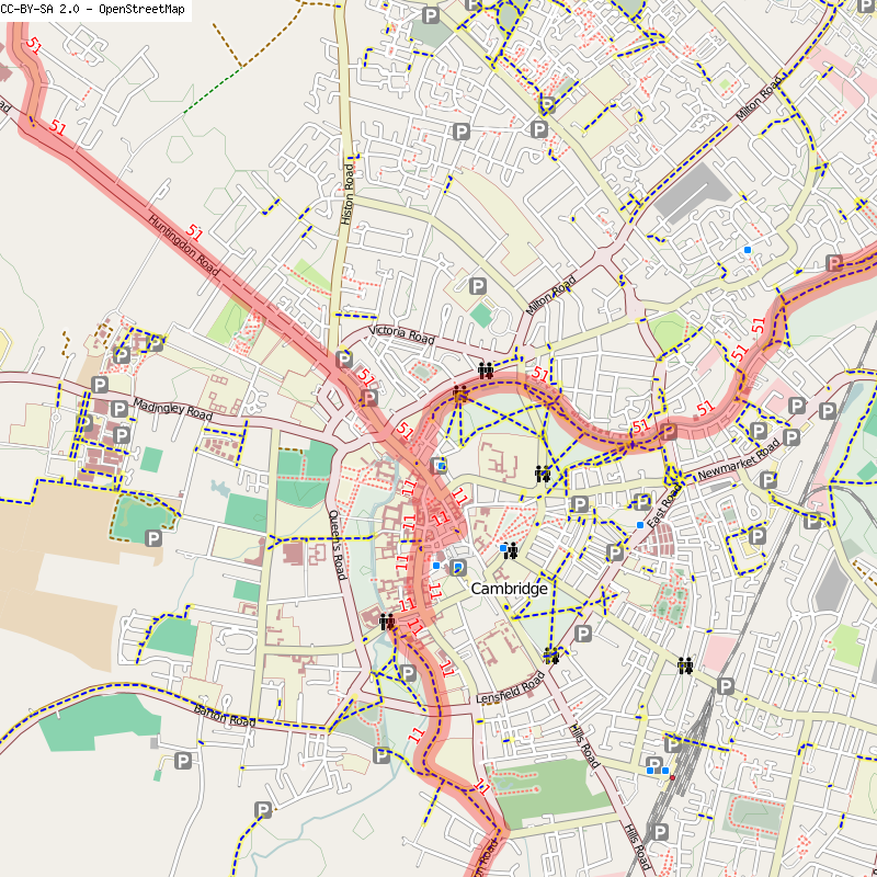
National Cycle Route 51 is an English long distance cycle route running broadly east-west connecting Colchester and the port of Harwich to Oxford via Ipswich, Bury St Edmunds, Cambridge, Bedford, Milton Keynes, Bicester, and Kidlington. Links to: * National Cycle Route 1 at Colchester and Ipswich *National Cycle Route 6 at Milton Keynes * RCR 41 at Felixstowe * NCR 11 at Cambridge * NCR 12 at Huntingdon * National Cycle Route 50 near Verney Junction Forms part of the North Sea Cycle Route. Route Colchester to Harwich Colchester , Wivenhoe , Great Oakley , Harwich This section runs from Colchester and National Cycle Route 1 to Harwich, where a seasonal foot ferry can be caught to Suffolk where the line continues. For much of its length it is also the route of the North Sea Cycle Route, although this branches off at a park in Dovercourt to head to the Harwich International Port at Parkeston where there is access via ferry to the Continent. At Harwich the signs ind ... [...More Info...] [...Related Items...] OR: [Wikipedia] [Google] [Baidu] |
Harwich Harbour Ferry
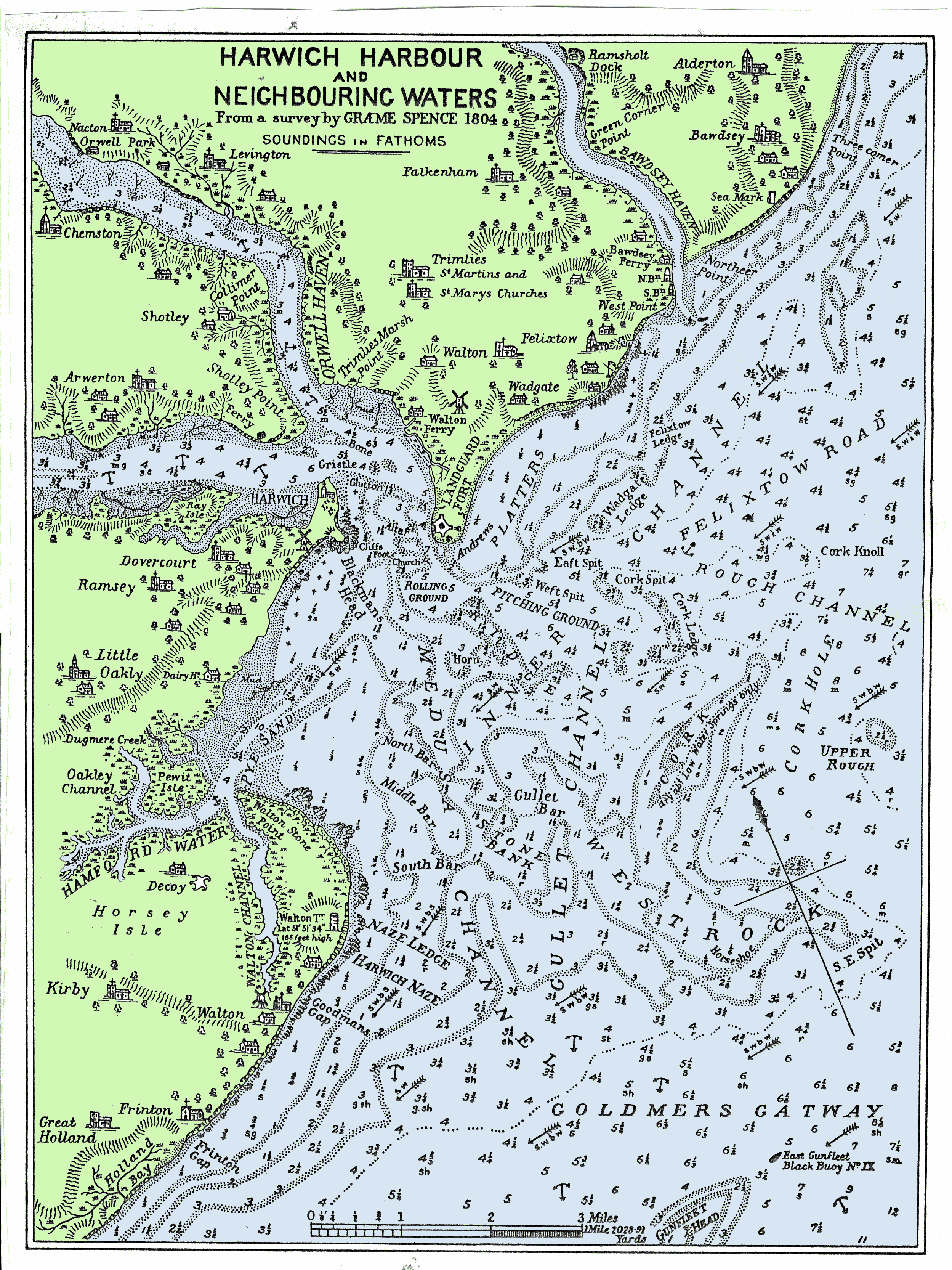
The Harwich Harbour Ferry is a foot and bicycle ferry for 58 passengers that runs from April until end of October between Ha'penny Pier near Harwich to Landguard Fort near Felixstowe and Shotley marina. As well as for local traffic, this ferry can be used as a short cut on the Suffolk Coast Path; it takes bicycles, prams, e-bikes and is used by National Cycle Route NCR 51 and the North Sea Cycle Route. The ferry service started in 1912 and was operated from 1925 until 1992 by the . The service was later started with the MV ''Explorer 12'', a Sea Truck, which is owned by Austrian Christian Zemann and his English wife Lucy Zemann and licensed to carry 12 passengers. As of 2016 the service is provided by the simply-named ''Harbour Ferry''. The boat was once a lifeboat from the liner SS ''Canberra'' and is now licensed and equipped for 58 passengers. See also * Felixstowe * Harwich International Port * Landguard Fort * Local Ferries in Suffolk * National Cycle Route 51 ... [...More Info...] [...Related Items...] OR: [Wikipedia] [Google] [Baidu] |
River Blyth, Suffolk
The River Blyth is a river in east Suffolk, England. Its source is near Laxfield and it reaches a tidal estuary between Southwold and Walberswick on the North Sea coast. Course The course of the river passes through agricultural land between Laxfield and Halesworth, flowing through the estate of Heveningham Hall and the village of Walpole before being crossed by the A144 road and the East Suffolk Line to the south of Halesworth. East of Halesworth the river is canalised in places and has a clear flood plain with land being used as grazing marsh. At Blythburgh it is crossed by the A12 trunk road before entering the estuarine section of the river. The estuary mouth forms the main harbour area of Southwold and is still an active fishing harbour. The estuary is central to the plot of Peter Greenaway's film ''Drowning by Numbers'', being the scene of the final drowning. The river can be crossed by pedestrians by a public footbridge called the Bailey Bridge about a mile upstream f ... [...More Info...] [...Related Items...] OR: [Wikipedia] [Google] [Baidu] |
Walberswick
Walberswick is a village and civil parish on the Suffolk coast in England. It is at the mouth of the River Blyth on the south side of the river. The town of Southwold lies to the north of the river and is the nearest town to Walberswick, around away. Walberswick is around south of Lowestoft on the North Sea coast. It is east of Halesworth and northeast of the county town of Ipswich. Coastal erosion and the shifting of the mouth of the River Blyth caused the neighbouring town of Dunwich, to the south, to be lost as a port in the last years of the 13th century. Following a brief period of rivalry and dispute with Dunwich, Walberswick became a major trading port from the 13th century until World War I. Almost half of the village's properties are holiday homes. History The name Walberswick is believed to derive from the Saxon Waldbert [...More Info...] [...Related Items...] OR: [Wikipedia] [Google] [Baidu] |
Southwold
Southwold is a seaside town and civil parish on the English North Sea coast in the East Suffolk district of Suffolk. It lies at the mouth of the River Blyth within the Suffolk Coast and Heaths Area of Outstanding Natural Beauty. The town is about south of Lowestoft, north-east of Ipswich and north-east of London, within the parliamentary constituency of Suffolk Coastal. The "All Usual Residents" 2011 Census figure gives a total of 1,098 persons for the town. The 2012 Housing Report by the Southwold and Reydon Society concluded that 49 per cent of the dwellings are used as second homes or let to holiday-makers. History Southwold was mentioned in ''Domesday Book'' (1086) as a fishing port, and after the "capricious River Blyth withdrew from Dunwich in 1328, bringing trade to Southwold in the 15th century", it received its town charter from Henry VII in 1489. The grant of the charter is marked by the annual Trinity Fair, when it is read out by the Town Clerk. Over following ... [...More Info...] [...Related Items...] OR: [Wikipedia] [Google] [Baidu] |
Shotley Gate
Shotley Gate is a settlement in the civil parish of Shotley, in the Babergh district, in the county of Suffolk, England. It is located at the tip of Shotley Peninsula and is the larges settlement in the parish of Shotley, in 2020 it had an estimated population of 1461. Shotley Gate has a pub called the Bristol Arms (formerly the Shotley Gate Inn) the settlement of Shotley Gate developed either side of Bristol Hill. By about 800 AD, the Vikings or Danes started to make an appearance in this area. Under the Peace of Wedmore in 878, all land north of the old Roman Watling Street, which ran from London to Chester, was given to the Viking leader, Guthrum. Shotley therefore became part of Danelaw. The peace was short-lived however, and following an unsuccessful Viking attack on Kent, Alfred King of Wessex attacked the enemy in East Anglia. The Anglo-Saxon Chronicle for the year 885 reads as follows: ''The same year sent King Alfred a fleet from Kent into East Anglia. As soon as th ... [...More Info...] [...Related Items...] OR: [Wikipedia] [Google] [Baidu] |
Felixstowe
Felixstowe ( ) is a port town in Suffolk, England. The estimated population in 2017 was 24,521. The Port of Felixstowe is the largest container port in the United Kingdom. Felixstowe is approximately 116km (72 miles) northeast of London. History The town is named after Felix of Burgundy, a saint and the first bishop of the East Angles in the seventh century. The old Felixstowe hamlet was centred on a pub and church, having stood on the site since long before the Norman conquest of England. The early history of Felixstowe, including its Roman, Anglo-Saxon, Norman and medieval defences, is told under the name of Walton, because the name Felixstowe was given retrospectively, during the 13th century, to a place which had expanded to a form beyond the boundaries of Walton alone. In the Doomsday book, for instance, only Walton is shown, and not Felixstowe, which at the time held little more than a few houses scattered over the cliff tops. Walton was a settlement on the River Orwell ... [...More Info...] [...Related Items...] OR: [Wikipedia] [Google] [Baidu] |
Landguard Fort
Landguard Fort is a fort at the mouth of the River Orwell outside Felixstowe, Suffolk, designed to guard the mouth of the river. It is now managed by the charity English Heritage and is open to the public. History Originally known as Langer Fort, the first fortifications from 1540 were a few earthworks and blockhouse, but it was king James I who ordered, from 1621, the construction of a square fort with bulwarks at each corner. In 1667 the Dutch, under Michiel de Ruyter, landed a force of 2,000 men on Felixstowe beach in front of (what is now called) Undercliff Road East and advanced on to the fort, but were repulsed by Nathaniel Darrel and his garrison of 400 musketeers of the Duke of York & Albany's Maritime Regiment (the first Royal Marines) and 100 artillerymen with 54 cannon.Rickard, J The fort was considered part of Essex in the 18th and 19th centuries; births and deaths within the garrison were recorded as 'Landguard Fort, Essex'. A new Fort battery was built in ... [...More Info...] [...Related Items...] OR: [Wikipedia] [Google] [Baidu] |
Harwich Quay
Harwich is a town in Essex, England, and one of the Haven ports on the North Sea coast. It is in the Tendring district. Nearby places include Felixstowe to the north-east, Ipswich to the north-west, Colchester to the south-west and Clacton-on-Sea to the south. It is the northernmost coastal town in Essex. Its position on the estuaries of the Stour and Orwell rivers, with its usefulness to mariners as the only safe anchorage between the Thames and the Humber, led to a long period of civil and military maritime significance. The town became a naval base in 1657 and was heavily fortified, with Harwich Redoubt, Beacon Hill Battery, and Bath Side Battery. Harwich is the likely launch point of the ''Mayflower'', which carried English Puritans to North America, and is the presumed birthplace of ''Mayflower'' captain Christopher Jones. Harwich today is contiguous with Dovercourt and the two, along with Parkeston, are often referred to collectively as ''Harwich''. History The t ... [...More Info...] [...Related Items...] OR: [Wikipedia] [Google] [Baidu] |
.jpg)


.jpg)

