|
Bamut
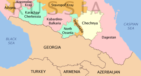
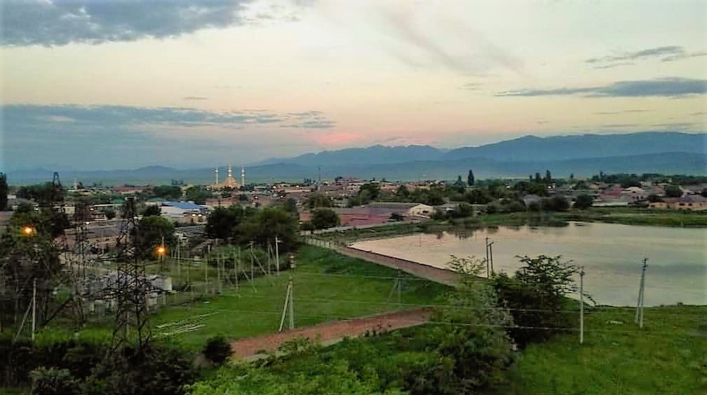
Bamut (russian: Бамут, ce, Буммат, ''Bummat'') is a types of inhabited localities in Russia, rural locality (a ''village#Russia, selo'') in Sernovodsky District, Chechnya. Administrative and municipal status Municipally, Bamut is incorporated as Bamutskoye rural settlement. It is the administrative center of the municipality and is the only settlement included in it. Geography Bamut is located on both banks of the Fortanga River. It is located west of the town of Achkhoy-Martan and west of the city of Grozny. The nearest settlements to Bamut are Katyr-Yurt in the east, Shalazhi, Stary Achkhoy and Yandi, Achkhoy-Martanovsky District, Yandi in the south-east, Arshty in the south-west, Nesterovskaya, Republic of Ingushetia, Nesterovskaya in the north-west, and Assinovskaya and Novy Sharoy in the north. History From 1922 to 1934, Bamut was a part of the Ingush Autonomous Oblast. In 1944, after the genocide and deportation of the Chechen and Ingush people and t ... [...More Info...] [...Related Items...] OR: [Wikipedia] [Google] [Baidu] |
Battle Of Bamut
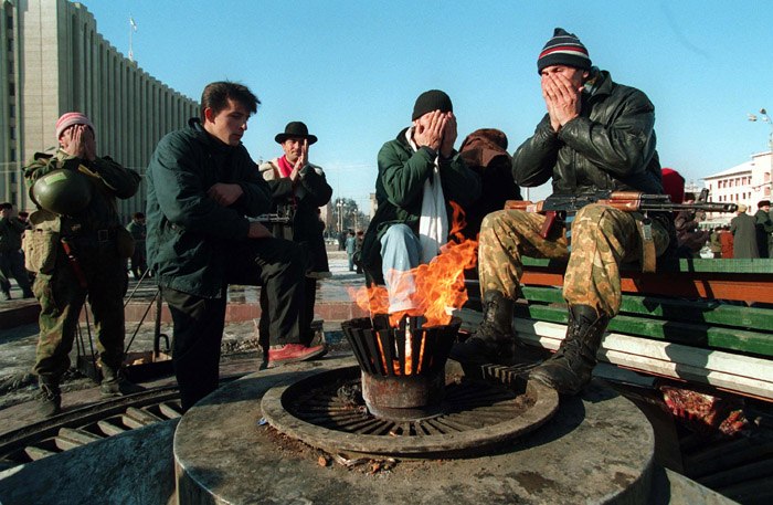
The Battle of Bamut was the long-lasting attempt of the Russian army to capture the village of Bamut in Western Chechnya. The fighting that took place subsequently lead to the complete destruction of the village. Battle In Spring 1995 during the First Chechen War, much of the significant cities and areas had been captured by the Russian army, leaving Bamut as one of the last Chechen controlled area in the lowlands. On the 10th of March 1995, fierce battles began for the village of Bamut. Several attacks on the village by the Russian army had already failed, leaving the tanks and armored vehicles to litter in the streets. The core defense of the village was made up of fighters primarily from the village and surrounding areas most notably under the command of Khizir Khachukaev. “The approaches to the village and its main streets were mined with anti-tank and anti-personnel mines. Some of the firing points were covered with reinforced concrete.” On April 18th, in the vicinity o ... [...More Info...] [...Related Items...] OR: [Wikipedia] [Google] [Baidu] |
Second Chechen War
The Second Chechen War (russian: Втора́я чече́нская война́, ) took place in Chechnya and the border regions of the North Caucasus between the Russia, Russian Federation and the Chechen Republic of Ichkeria, from August 1999 to April 2009. In August 1999, Islamist fighters from Chechnya War of Dagestan, infiltrated Russia's Dagestan region, violating Russia's borders. During the initial campaign, Russians, Russian military and pro-Russian Chechens, Chechen paramilitary forces faced Chechen separatists in open combat and seized the Chechen capital Grozny after a winter Battle of Grozny (1999–2000), siege that lasted from December 1999 until February 2000. Russia established direct rule over Chechnya in May 2000 although Chechen militant Resistance movement, resistance throughout the North Caucasus region continued to inflict heavy Russian casualties and challenge Russian political control over Chechnya for several years. Both sides carried out attacks a ... [...More Info...] [...Related Items...] OR: [Wikipedia] [Google] [Baidu] |
Achkhoy-Martan
Achkhoy-Martan (russian: Ачхой-Мартан, ce, Iашхой-Марта, ''Jaşxoy-Marta'' or Тӏехьа-Марта, ''Theẋa-Marta'') is a types of inhabited localities in Russia, rural locality (a ''village#Russia, selo'') in, and the administrative center of Achkhoy-Martanovsky District, Chechnya. Administrative and municipal status Municipally, Achkhoy-Martan is incorporated as Achkhoy-Martanovskoye rural settlement. It is the administrative center of the municipality and is the only settlement included in it. Achkhoy-Martan, which is the largest rural settlement in Chechnya, is also the administrative center of Achkhoy-Martanovsky District. Geography The Fortanga River ( ce, Марта) flows through the center of the village. To the east of the village is the Achkhu River. The name of the village comes from these two rivers. Achkhoy-Martan is located south-west of the city of Grozny. The nearest settlements to Achkhoy-Martan are Novy Sharoy in the north, Shaa ... [...More Info...] [...Related Items...] OR: [Wikipedia] [Google] [Baidu] |
Katyr-Yurt
Katyr-Yurt (russian: Катыр-Юрт or Катар-Юрт, ce, Котар-Йурт, ''Kotar-Yurt'') is a rural locality (a '' selo'') in Achkhoy-Martanovsky District, Chechnya. Administrative and municipal status Municipally, Katyr-Yurt is incorporated as Katyr-Yurtovskoye rural settlement. It is the administrative center of the municipality and is the only settlement included in it. Geography Katyr-Yurt is located between the Netkhoy and Shalazha rivers. It is located south-east of the town of Achkhoy-Martan and south-west of the city of Grozny. The nearest settlements to Katyr-Yurt are Shaami-Yurt and Valerik in the north-east, Gekhi in the east, Gekhi-Chu in the south-east, Shalazhi in the south, Yandi in the south-west, Bamut in the west, and Achkhoy-Martan in the north-west. History In 1944, after the genocide and deportation of the Chechen and Ingush people and the Chechen-Ingush ASSR was abolished, the village of Katyr-Yurt was renamed to Tutovo, and se ... [...More Info...] [...Related Items...] OR: [Wikipedia] [Google] [Baidu] |
Stary Achkhoy
Stary Achkhoy (russian: Старый Ачхой, ce, Ӏашхой-КӀотар, ''Jaşxoy-Khotar'') is a rural locality (a '' selo'') in Achkhoy-Martanovsky District, Chechnya. Administrative and municipal status Municipally, Stary Achkhoy is incorporated as Staro-Achkhoyskoye rural settlement. It is the administrative center of the municipality and is the only settlement included in it. Geography Stary Achkhoy is located on both banks of the Achkhu River. It is located south-east of the town of Achkhoy-Martan and south-west of the city of Grozny. The nearest settlements to Stary Achkhoy are Bamut in the west, Achkhoy-Martan in the north-west, Katyr-Yurt in the north-east, and Yandi in the east. History In 1944, after the genocide and deportation of the Chechen and Ingush people and the Chechen-Ingush ASSR was abolished, the village of Stary Achkhoy was renamed to Kizilovo, and settled by people from other ethnic groups. From 1944 to 1957, it was a part of the Novose ... [...More Info...] [...Related Items...] OR: [Wikipedia] [Google] [Baidu] |
Assinovskaya
Assinovskaya (russian: Ассиновская, ce, Эха-Борзе, ''Exa-Borze'') is a rural locality (a ''stanitsa'') in Sunzhensky District, Chechnya. Administrative and municipal status Municipally, Assinovskaya is incorporated as Assinovskoye rural settlement. It is the administrative center of the municipality and is the only settlement included in it. Geography The village of Assinovskaya is located on the left bank of the Assa River (hence the name). It is located south of the village of Sernovodskoye and west of the city of Grozny. The nearest settlements to Assinovskaya are Sernovodskoye in the north, Novy Sharoy in the east, Achkhoy-Martan in the south-east, Bamut in the south, and Berd-Yurt and Nesterovskaya in the west. History The village of Assinovskaya was founded in 1847 on the land of the Karabulak aul of Akh-Borzoy. According to official maps at the time, the aul and the village existed simultaneously, so on the map of the for 1871, there are ... [...More Info...] [...Related Items...] OR: [Wikipedia] [Google] [Baidu] |
Types Of Inhabited Localities In Russia
The classification system of inhabited localities in Russia and some other post-Soviet states has certain peculiarities compared with those in other countries. Classes During the Soviet time, each of the republics of the Soviet Union, including the Russian SFSR, had its own legislative documents dealing with classification of inhabited localities. After the dissolution of the Soviet Union, the task of developing and maintaining such classification in Russia was delegated to the federal subjects.Articles 71 and 72 of the Constitution of Russia do not name issues of the administrative and territorial structure among the tasks handled on the federal level or jointly with the governments of the federal subjects. As such, all federal subjects pass their own laws establishing the system of the administrative-territorial divisions on their territories. While currently there are certain peculiarities to classifications used in many federal subjects, they are all still largely ba ... [...More Info...] [...Related Items...] OR: [Wikipedia] [Google] [Baidu] |
Nesterovskaya, Republic Of Ingushetia
Nesterovskaya ( inh, ГIажара-Юрт, ''Ghažara-Jurt''; russian: Нестеровская) is a stanitsa in Sunzhensky District of Ingushetia, Russia. It is located on the Assa River The Assa (Tsirtslovn-Tskhali, russian: Асса, Цирцловн-Цхали, ka, ასა, ce, Iaьса-хи, inh, Эса-хий) is a right tributary of the Sunzha in Georgia and Russia. It is located in Dusheti Municipality of Mtskheta-Mtia .... Population: . References Rural localities in Ingushetia {{Ingushetia-geo-stub ... [...More Info...] [...Related Items...] OR: [Wikipedia] [Google] [Baidu] |
First Chechen War
The First Chechen War, also known as the First Chechen Campaign,, [Armed conflict in the Chechen Republic and on bordering territories of the Russian Federation] Федеральный закон № 5-ФЗ от 12 января 1995 (в редакции от 27 ноября 2002) "О ветеранах" or the First Russian-Chechen war, was a war of independence which the Chechen Republic of Ichkeria waged against the Russia, Russian Federation from December 1994 to August 1996. The first war was preceded by the Russian Intervention in Ichkeria, in which Russia tried to covertly overthrow the Ichkerian government. After the initial campaign of 1994–1995, culminating in the devastating Battle of Grozny (1994–1995), Battle of Grozny, Russian federal forces attempted to seize control of the mountainous area of Chechnya, but they faced heavy resistance from Chechen guerrilla warfare, guerrillas and raids on the flatlands. Despite Russia's overwhelming advantages in firepower, manp ... [...More Info...] [...Related Items...] OR: [Wikipedia] [Google] [Baidu] |
Dagestan Autonomous Soviet Socialist Republic
The Dagestan Autonomous Soviet Socialist Republic av, Дагъистаналъул Автономияб Советияб Социалистияб Жумгьурият az, Дағыстан Мухтар Совет Сосиалист Республикасы kum, Дагъыстан Автономиялы Советни Социалистни Республика (1921–1991), abbreviated as Dagestan ASSR; av, Дагъистаналъул АССР; kum, Дагъыстан АССР; lez, Дагъустандин АССР; lbe, Дагъусттаннал АССР; az, Дағыстан МССР, italics=no;Aghul language, Aghul: Дагъустан АССР; ce, ДегӀастанан АССР; nog, Дагыстан АССР or DASSR and also unofficially known as Soviet Dagestan or just simply Dagestan, was an autonomous republics of the Soviet Union, autonomous republic of the Russian SFSR within the Soviet Union. This "Land of Mountains" was known also for having a "mountain of peopl ... [...More Info...] [...Related Items...] OR: [Wikipedia] [Google] [Baidu] |
Dagestan
Dagestan ( ; rus, Дагеста́н, , dəɡʲɪˈstan, links=yes), officially the Republic of Dagestan (russian: Респу́блика Дагеста́н, Respúblika Dagestán, links=no), is a republic of Russia situated in the North Caucasus of Eastern Europe, along the Caspian Sea. It is located north of the Greater Caucasus, and is a part of the North Caucasian Federal District. The republic is the southernmost tip of Russia, sharing land borders with the countries of Azerbaijan and Georgia to the south and southwest, the Russian republics of Chechnya and Kalmykia to the west and north, and with Stavropol Krai to the northwest. Makhachkala is the republic's capital and largest city; other major cities are Derbent, Kizlyar, Izberbash, Kaspiysk and Buynaksk. Dagestan covers an area of , with a population of over 3.1 million, consisting of over 30 ethnic groups and 81 nationalities. With 14 official languages, and 12 ethnic groups each constituting more than 1% ... [...More Info...] [...Related Items...] OR: [Wikipedia] [Google] [Baidu] |
Chechen-Ingush Autonomous Soviet Socialist Republic
The Checheno-Ingush Autonomous Soviet Socialist Republic; inh, Нохч-ГӀалгӀай Автономе Советий Социализма Республика, Noxç-Ġalġay Avtonome Sovetiy Socializma Respublika; russian: Чече́но-Ингу́шская Автономная Советская Социалистическая Республика, Checheno-Ingushskaya Avtonomnaya Sovetskaya Sotsialisticheskaya Respublika (Checheno-Ingush ASSR) was an autonomous republic within the Russian Soviet Federative Socialist Republic, in existence from 1936 to 1944 and again from 1957 to 1992. Its capital was Grozny. As of the 1979 census, the territory had an area of and a population of 611,405 being Chechens, 134,744 Ingush, and the rest being Russians and other ethnic groups. History Russian Empire In 1810, the historical Ingushetia voluntarily joined Imperial Russia, and in 1859 the historical Chechnya was annexed to Russia as well, during the long Caucasian war o ... [...More Info...] [...Related Items...] OR: [Wikipedia] [Google] [Baidu] |
_to_8_Sep_2019.png)


