|
Katyr-Yurt
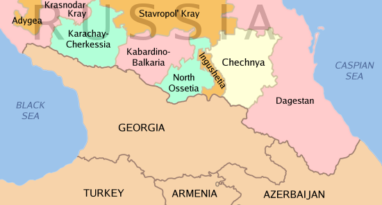
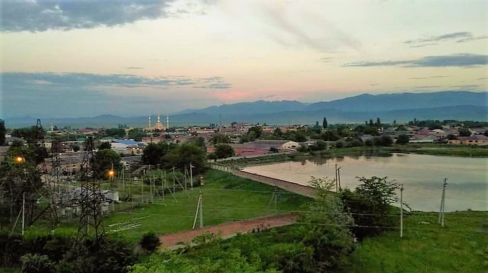
Katyr-Yurt (russian: Катыр-Юрт or Катар-Юрт, ce, Котар-Йурт, ''Kotar-Yurt'') is a rural locality (a '' selo'') in Achkhoy-Martanovsky District, Chechnya. Administrative and municipal status Municipally, Katyr-Yurt is incorporated as Katyr-Yurtovskoye rural settlement. It is the administrative center of the municipality and is the only settlement included in it. Geography Katyr-Yurt is located between the Netkhoy and Shalazha rivers. It is located south-east of the town of Achkhoy-Martan and south-west of the city of Grozny. The nearest settlements to Katyr-Yurt are Shaami-Yurt and Valerik in the north-east, Gekhi in the east, Gekhi-Chu in the south-east, Shalazhi in the south, Yandi in the south-west, Bamut in the west, and Achkhoy-Martan in the north-west. History In 1944, after the genocide and deportation of the Chechen and Ingush people and the Chechen-Ingush ASSR was abolished, the village of Katyr-Yurt was renamed to Tutovo, and se ... [...More Info...] [...Related Items...] OR: [Wikipedia] [Google] [Baidu] |
Bombing Of Katyr-Yurt
The reported bombing of Katyr-Yurt (Chechnya) occurred on February 4, 2000, when Russian forces bombed the village of Katyr-Yurt and afterwards a refugee convoy under white flags. The village was also previously bombed by the Russians in 1995 and in 1996. Events Journalists who managed to report on the area confirmed the use, by the Russians, of the vacuum bomb on the town. Vacuum bombs are dropped by parachute, and, when a couple of meters from the ground, release a cloud of petrol gas. The gas then reacts with the air, causing an explosion and then a vacuum, sucking away oxygen from living people, thus killing them. The residents, including many civilian refugees who had fled the fighting Grozny, were not warned in advance or told of safe exit routes by the Russian side. The sudden heavy bombardment of the village began in the early hours of the morning and subsided at approximately 3 p.m. At that time, many of the villagers attempted to leave, believing that the military had ... [...More Info...] [...Related Items...] OR: [Wikipedia] [Google] [Baidu] |
Shaami-Yurt
Shaami-Yurt (russian: Шаами-Юрт, ce, ШаӀми-Йурт, ''Şajmi-Yurt'') is a rural locality (a '' selo'') in Achkhoy-Martanovsky District, Chechnya. Administrative and municipal status Municipally, Shaami-Yurt is incorporated as Shaami-Yurtovskoye rural settlement. It is the administrative center of the municipality and is the only settlement included in it. Geography Shaami-Yurt is located between the Fortanga and Shalazha rivers, near to the confluence with the Assa River. It is located north-east of the town of Achkhoy-Martan and south-west of the city of Grozny. The Caucasus highway runs to the north of the village. The nearest settlements to Shaami-Yurt are Davydenko and Samashki in the north-west, Zakan-Yurt in the north-east, Khambi-Irze and Kulary in the east, Gekhi and Valerik in the south-east, and Katyr-Yurt in the south-west. History In 1944, after the genocide and deportation of the Chechen and Ingush people and the Chechen-Ingush ASSR wa ... [...More Info...] [...Related Items...] OR: [Wikipedia] [Google] [Baidu] |
Second Chechen War
The Second Chechen War (russian: Втора́я чече́нская война́, ) took place in Chechnya and the border regions of the North Caucasus between the Russia, Russian Federation and the Chechen Republic of Ichkeria, from August 1999 to April 2009. In August 1999, Islamist fighters from Chechnya War of Dagestan, infiltrated Russia's Dagestan region, violating Russia's borders. During the initial campaign, Russians, Russian military and pro-Russian Chechens, Chechen paramilitary forces faced Chechen separatists in open combat and seized the Chechen capital Grozny after a winter Battle of Grozny (1999–2000), siege that lasted from December 1999 until February 2000. Russia established direct rule over Chechnya in May 2000 although Chechen militant Resistance movement, resistance throughout the North Caucasus region continued to inflict heavy Russian casualties and challenge Russian political control over Chechnya for several years. Both sides carried out attacks a ... [...More Info...] [...Related Items...] OR: [Wikipedia] [Google] [Baidu] |
Valerik, Achkhoy-Martanovsky District
Valerik (russian: Валерик, ce, ВаларгтӀе, ''Valergthe'') is a rural locality (a '' selo'') in Achkhoy-Martanovsky District, Chechnya. Administrative and municipal status Municipally, Valerik is incorporated as Valerikskoye rural settlement. It is the administrative center of the municipality and the only settlement included in it. Geography Valerik is located on both banks of the Valerik River. It is located east of the village of Achkhoy-Martan and south-west of the city of Grozny. The nearest settlements to Valerik are Zakan-Yurt in the north, Khambi-Irze and Kulary in the north-east, Gekhi in the east, Gekhi-Chu and Shalazhi in the south, Katyr-Yurt in the west, and Shaami-Yurt in the north-west. History In 1944, after the genocide and deportation of the Chechen and Ingush people and the Chechen-Ingush ASSR was abolished, the village of Valerik was renamed and settled by other ethnic groups. From 1944 to 1957, it was a part of the Novoselsky Di ... [...More Info...] [...Related Items...] OR: [Wikipedia] [Google] [Baidu] |
Bamut
Bamut (russian: Бамут, ce, Буммат, ''Bummat'') is a types of inhabited localities in Russia, rural locality (a ''village#Russia, selo'') in Sernovodsky District, Chechnya. Administrative and municipal status Municipally, Bamut is incorporated as Bamutskoye rural settlement. It is the administrative center of the municipality and is the only settlement included in it. Geography Bamut is located on both banks of the Fortanga River. It is located west of the town of Achkhoy-Martan and west of the city of Grozny. The nearest settlements to Bamut are Katyr-Yurt in the east, Shalazhi, Stary Achkhoy and Yandi, Achkhoy-Martanovsky District, Yandi in the south-east, Arshty in the south-west, Nesterovskaya, Republic of Ingushetia, Nesterovskaya in the north-west, and Assinovskaya and Novy Sharoy in the north. History From 1922 to 1934, Bamut was a part of the Ingush Autonomous Oblast. In 1944, after the genocide and deportation of the Chechen and Ingush people and t ... [...More Info...] [...Related Items...] OR: [Wikipedia] [Google] [Baidu] |
Achkhoy-Martan
Achkhoy-Martan (russian: Ачхой-Мартан, ce, Iашхой-Марта, ''Jaşxoy-Marta'' or Тӏехьа-Марта, ''Theẋa-Marta'') is a types of inhabited localities in Russia, rural locality (a ''village#Russia, selo'') in, and the administrative center of Achkhoy-Martanovsky District, Chechnya. Administrative and municipal status Municipally, Achkhoy-Martan is incorporated as Achkhoy-Martanovskoye rural settlement. It is the administrative center of the municipality and is the only settlement included in it. Achkhoy-Martan, which is the largest rural settlement in Chechnya, is also the administrative center of Achkhoy-Martanovsky District. Geography The Fortanga River ( ce, Марта) flows through the center of the village. To the east of the village is the Achkhu River. The name of the village comes from these two rivers. Achkhoy-Martan is located south-west of the city of Grozny. The nearest settlements to Achkhoy-Martan are Novy Sharoy in the north, Shaa ... [...More Info...] [...Related Items...] OR: [Wikipedia] [Google] [Baidu] |
Yandi, Achkhoy-Martanovsky District
Yandi (russian: Янди, ce, Янди-КӀотар, ''Yandi-Khotar'') is a rural locality (a '' selo'') in Achkhoy-Martanovsky District, Chechnya. Administrative and municipal status Municipally, Yandi is incorporated as Yandinskoye rural settlement. It is the administrative center of the municipality and is the only settlement included in it. Geography Yandi is located on the right bank of the Netkhoy River. It is located south-east of the town of Achkhoy-Martan and south-west of the city of Grozny. The nearest settlements to Yandi are Katyr-Yurt and Valerik in the north-east, Gekhi in the east, Shalazhi in the south-east, and Stary Achkhoy in the west. History In 1944, after the genocide and deportation of the Chechen and Ingush people and the Chechen-Ingush ASSR was abolished, the village of Yandi was renamed to Orekhovo, and settled by people from other ethnic groups. From 1944 to 1957, it was a part of the Novoselsky District of Grozny Oblast Grozny Oblast ... [...More Info...] [...Related Items...] OR: [Wikipedia] [Google] [Baidu] |
Shalazhi
Shalazhi (russian: link=no, Шалажи; ce, Шалажа, ''Şalaƶa'') is a rural locality (a '' selo'') in the Urus-Martanovsky District, the Chechen Republic, Russia. Geography Shalazhi is located west of the republic on the foothills of the Greater Caucasus mountains and is located on the banks of the Shalezha River. It is west of Urus-Martan and south-west of the City of Grozny. The nearest settlements to Shalazhi are Katyr-Yurt and Valerik in the north, Gekhi-Chu in the east and Yandi in the north-west. History 1944–1958 In 1944, after the genocide and deportation of the Chechen and Ingush people and the Chechen-Ingush ASSR was abolished, the village of Shalazhi (Şalaƶa) was renamed to Podgornoye. In 1958, after the Vaynakh people returned and the Chechen-Ingush ASSR was restored, the village regained its old names, Shalazhi in Russian, and Şalaƶa in Chechen. Present time In 2020, the village made headlines as the place where Abdullah Anzorov was buried ... [...More Info...] [...Related Items...] OR: [Wikipedia] [Google] [Baidu] |
Grozny Oblast
Grozny Oblast (russian: Гро́зненская о́бласть) was an administrative entity (an ''oblast'') of the Russian SFSR that was established as Grozny Okrug () on 7 March 1944 and abolished on 9 January 1957. Formation After the 1940–1944 insurgency in Chechnya, the Soviet government deported the entire Chechen and Ingush population. The vacated Checheno-Ingush ASSR was abolished, and its territory partitioned, with the southern mountainous region being joined to the Georgian SSR, the western Ingush populated area to the North Ossetian ASSR, and the eastern strip of like size to the Dagestan ASSR. The resulting territory was joined with vast Kizlyarsky District and with Naursky District of Stavropol Krai. Most of the territory in the north was mixed Nogay and ethnic Russian (Terek Cossack), although southern areas did include excessive ethnic Chechen land, that was now vacated. This was settled mostly by refugees from the western regions of the USSR who fled th ... [...More Info...] [...Related Items...] OR: [Wikipedia] [Google] [Baidu] |
Chechen-Ingush Autonomous Soviet Socialist Republic
The Checheno-Ingush Autonomous Soviet Socialist Republic; inh, Нохч-ГӀалгӀай Автономе Советий Социализма Республика, Noxç-Ġalġay Avtonome Sovetiy Socializma Respublika; russian: Чече́но-Ингу́шская Автономная Советская Социалистическая Республика, Checheno-Ingushskaya Avtonomnaya Sovetskaya Sotsialisticheskaya Respublika (Checheno-Ingush ASSR) was an autonomous republic within the Russian Soviet Federative Socialist Republic, in existence from 1936 to 1944 and again from 1957 to 1992. Its capital was Grozny. As of the 1979 census, the territory had an area of and a population of 611,405 being Chechens, 134,744 Ingush, and the rest being Russians and other ethnic groups. History Russian Empire In 1810, the historical Ingushetia voluntarily joined Imperial Russia, and in 1859 the historical Chechnya was annexed to Russia as well, during the long Caucasian war o ... [...More Info...] [...Related Items...] OR: [Wikipedia] [Google] [Baidu] |
Achkhoy-Martanovsky District
Achkhoy-Martanovsky District (russian: Ачхо́й-Марта́новский райо́н; ce, Тӏеьха-Мартан кӏошт, ''Theẋa-Martan khoşt'') is an administrativeDecree #500 and municipalLaw #40-RZ district (raion), one of fifteen in the Chechen Republic, Russia. It is located in the west of the republic. The area of the district is . Its administrative center is the rural locality (a '' selo'') of Achkhoy-Martan. Health care State health facilities in the district are represented by one central district hospital in Achkhoy-Martan and one district hospital in Samashki Samashki (russian: Самашки; ce, СемаӀашка, '' Semajaşka'') is a rural locality (a '' selo'') in Achkhoy-Martanovsky District, Chechnya. Samashki is the administrative center and only settlement of the Samashkinskoye rural settle .... Demographics Population: 64,839 ( 2002 Census); The population of Achkhoy-Martan accounts for 25.7% of the district's total population. Ref ... [...More Info...] [...Related Items...] OR: [Wikipedia] [Google] [Baidu] |

_to_8_Sep_2019.png)

