|
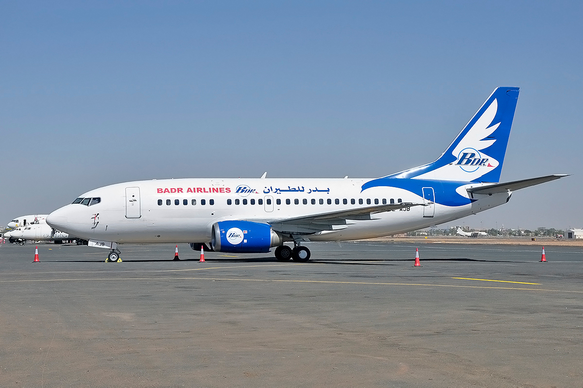
Badr Airlines
Badr Airlines, formerly Sarit Airlines (from 1997 to 2004), is an airline based in Khartoum, Sudan, operating cargo and passenger air services for humanitarian aid missions, and chartered VIP flights. Its main base is Khartoum International Airport Khartoum International Airport (Arabic:مطار الخرطوم الدولي) is the principal airport in Khartoum, the capital of Sudan. The current airport will be replaced by the New Khartoum International Airport in Omdourman 40 kilom .... Destinations As of December 2021, Badr Airlines operates to the following destinations: Fleet Badr Airlines fleet includes: References External links *ALS {{Airlines of Sudan Airlines of Sudan Airlines established in 1997 Cargo airlines of Sudan Companies based in Khartoum ... [...More Info...] [...Related Items...] OR: [Wikipedia] [Google] [Baidu] |
Khartoum
Khartoum or Khartum ( ; ar, الخرطوم, Al-Khurṭūm, din, Kaartuɔ̈m) is the capital of Sudan. With a population of 5,274,321, its metropolitan area is the largest in Sudan. It is located at the confluence of the White Nile, flowing north from Lake Victoria, and the Blue Nile, flowing west from Lake Tana in Ethiopia. The place where the two Niles meet is known as ''al-Mogran'' or ''al-Muqran'' (; English: "The Confluence"). From there, the Nile continues north towards Egypt and the Mediterranean Sea. Divided by these two parts of the Nile, Khartoum is a tripartite metropolis with an estimated population of over five million people, consisting of Khartoum proper, and linked by bridges to Khartoum North ( ) and Omdurman ( ) to the west. Khartoum was founded in 1821 as part of Egypt, north of the ancient city of Soba. While the United Kingdom exerted power over Egypt, it left administration of the Sudan to it until Mahdist forces took over Khartoum. The British atte ... [...More Info...] [...Related Items...] OR: [Wikipedia] [Google] [Baidu] |
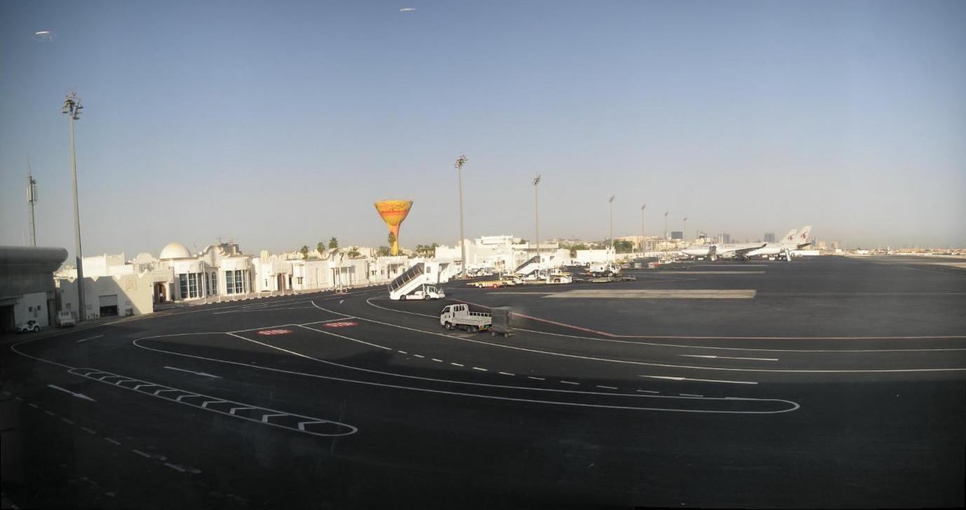
Doha International Airport
Doha International Airport ( ar, مطار الدوحة الدولي) is an airport in Doha, Qatar. It was Qatar's commercial international airport until Hamad International Airport opened on 27 May 2014. While all scheduled commercial traffic ceased, the airport site and existing runway is still used by Qatar Emiri Air Force, Qatar Amiri Flight, Rizon Jet, Gulf Helicopters and Qatar Aeronautical College. It also acts as a state/diplomatic airport catering to both Qatar Amiri Flight (which is based at the airport) and state visit flights. The airport welcomed commercial flights again on 15 September 2022 for selected airlines to handle increased traffic for the 2022 FIFA World Cup taking place in the country in November. History Doha International Airport opened in 1959 replacing Dukhan Airport, which was built in the 1930s and located west of Doha. The airport suffered from overutilization, even though it had been expanded numerous times. Before the opening of the new airp ... [...More Info...] [...Related Items...] OR: [Wikipedia] [Google] [Baidu] |
Kassala Airport
Kassala Airport is an airport serving Kassala, the capital city of the state of Kassala in Sudan. Facilities The airport resides at an elevation of above mean sea level. It has one runway designated 02/20 with an asphalt Asphalt, also known as bitumen (, ), is a sticky, black, highly viscous liquid or semi-solid form of petroleum. It may be found in natural deposits or may be a refined product, and is classed as a pitch. Before the 20th century, the term a ... surface measuring . Airlines and destinations References External links * {{authority control Airports in Sudan Kassala (state) ... [...More Info...] [...Related Items...] OR: [Wikipedia] [Google] [Baidu] |
Kassala
Kassala ( ar, كسلا) is the capital of the state of Kassala in eastern Sudan. Its 2008 population was recorded to be 419,030. Built on the banks of the Gash River, it is a market town and is famous for its fruit gardens. Many of its inhabitants are from the Hadendawa people. The town was formerly a railroad hub, however, as of 2006 there was no operational railway station in Kassala and much of the track leading to and from the town has been salvaged or fallen into disrepair. Kassala's location along the main Khartoum-Port Sudan highway makes it an important trade center. History Neolithic The ancient settlement of Mahal Teglinos flourished here during the Early Gash Group phase (ca. 2800–2500 BC). Egyptian jars dating from this period have been found here. At that time, the inhabitants at Mahal Teglinos were already trading with Egypt, Nubia, and the southern Arabian Peninsula. Mahal Teglinos settlement continued after that, and also flourished during the late Gash ... [...More Info...] [...Related Items...] OR: [Wikipedia] [Google] [Baidu] |
Geneina Airport
Geneina Airport is an airport serving Geneina, in the Darfur region of Sudan. Airlines and destinations Geneina Air Base Geneina hosts Sudanese Air Force Helicopter Squadron (Mil Mi-8 The Mil Mi-8 (russian: Ми-8, NATO reporting name: Hip) is a medium twin-turbine helicopter, originally designed by the Soviet Union in the 1960s and introduced into the Soviet Air Force in 1968. It is now produced by Russia. In addition t ...) References External links Airports in Sudan World War II airfields in Sudan Airfields of the United States Army Air Forces Air Transport Command in Central and South Africa Airfields of the United States Army Air Forces {{Sudan-airport-stub ... [...More Info...] [...Related Items...] OR: [Wikipedia] [Google] [Baidu] |
Geneina
Geneina (sometimes Al-Junaynah) ( ar, الجنينة, lit. ''the little garden'') is a city in West Darfur, part of dar Masalit region, that joined British Sudan at the end of 1919 through the Gilani agreement signed between the Masalit Sultanate and the Kingdom of Britain, according to which it became a territory. It is now the capital of the Sudanese state of West Darfur. As of 2008, it had a population of 252,744. Climate Geneina has a hot semi-arid climate (Köppen ''BSh'') with two distinct seasons: a short, warm and humid wet season from mid-June to late September and a long, hot, desiccating dry season covering the remaining nine months of the year. Transportation The locality is served by the Geneina Airport Geneina Airport is an airport serving Geneina, in the Darfur region of Sudan. Airlines and destinations Geneina Air Base Geneina hosts Sudanese Air Force Helicopter Squadron (Mil Mi-8 The Mil Mi-8 (russian: Ми-8, NATO reporting name ... . Referenc ... [...More Info...] [...Related Items...] OR: [Wikipedia] [Google] [Baidu] |
El Obeid Airport
El Obeid Airport is an airport serving El-Obeid, the capital city of the North Kurdufan state in Sudan. Facilities The airport resides at an elevation of above mean sea level. It has one runway designated 01/19 with an asphalt surface measuring . Airlines and destinations El Obeid Air Base The airport hosts Sudanese Air Force Helicopter Squadron operating Mil Mi-24 and Mil Mi-35 The Soviet and later Russian Mil Mi-24 helicopter has been produced in many variants, as described below. History In 1966, Soviet aircraft designer Mikhail Mil created a mock-up design of a new helicopter (derived from the Mil Mi-8) which was m ... attack helicopters. References External links * {{authority control Airports in Sudan North Kurdufan El-Obeid ... [...More Info...] [...Related Items...] OR: [Wikipedia] [Google] [Baidu] |
El Obeid
El-Obeid ( ar, الأبيض, ''al-ʾAbyaḍ'', lit."the White"), also romanized as Al-Ubayyid, is the capital of the state of North Kurdufan, in Sudan. History and overview El-Obeid was founded by the pashas of Ottoman Egypt in 1821. It was attacked by the Mahdists in September 1882, and, after capitulation, was subsequently destroyed in 1883. It was then rebuilt on a modern plan in 1898, following the fall of the Mahdist empire. In 2008, its population was 340,940. It is an important transportation hub: the terminus of a rail line, the junction of various national roads and camel caravan routes, and the end of a pilgrim route from Nigeria. As regional commercial centre, it is known for products such as gum arabic, millet, oilseeds, and livestock. The population of El-Obeid today is majority Muslim, with a small Christian presence. The town is the site of an airport and an oil refinery. El-Obeid is home to the University of Kordofan, one of the largest universities in Suda ... [...More Info...] [...Related Items...] OR: [Wikipedia] [Google] [Baidu] |
El Fasher Airport
El Fasher Airport , also known as Al Fashir Airport, is an airport serving El Fasher (Al Fashir), the capital city of the North Darfur state in Sudan. United Nations peacekeeping force UNAMID uses a special terminal at El Fasher Airport for transportation. Facilities The airport resides at an elevation of above mean sea level. It has 2 runways: 05/23 with an asphalt surface measuring and 18/36 with a gravel surface measuring . Airlines and destinations El Fasher Air Base The airport hosts a number of Sudanese Air Force units: * Fighter (Close Air Support) Squadron (Sukhoi Su-25) * Helicopter Squadron (Mil Mi-8, Mil Mi-24, Mil Mi-35) * Transport Squadron (Antonov An-26) References External links * {{authority control Airports in Sudan North Darfur Airfields of the United States Army Air Forces Airfields of the United States Army Air Forces Air Transport Command in Central and South Africa World War II airfields in Sudan ... [...More Info...] [...Related Items...] OR: [Wikipedia] [Google] [Baidu] |
El Fasher
Al Fashir, Al-Fashir or El Fasher ( ar, الفاشر) is the capital city of North Darfur, Sudan. It is a large town in the Darfur region of northwestern Sudan, northeast of Nyala, Sudan. "Al-Fashir" (description) ''Encyclopædia Britannica'', 2007, webpage: A historical Caravan (travellers), caravan post, Al-Fashir is located at an elevation of about . The town serves as an agricultural marketing point for the cereals and fruits grown in the surrounding region. Al-Fashir is linked by road with both Geneina and Umm Keddada. Al-Fashir had 264,734 residents , an increase from 2001, when the population was estimated to be 178,500. Al Fashir University was created in 1990 by decree of President Omar Hassan Ahmed Bashir, and was officially opened in February 1991 in premises west of El Fasher Airport and south of the El Fashir School. History Late in the 18th century, Sultan 'Abd al-Rahman al-Rashed of the Fur Sultanate, Darfur Sultanate moved his itinerant court (''fash ... [...More Info...] [...Related Items...] OR: [Wikipedia] [Google] [Baidu] |
Damazin Airport
Damazin Airport is an airport serving Damazin, located in the Blue Nile state in Sudan. Facilities The airport resides at an elevation of above mean sea level. It has one runway designated 17/35 with an asphalt surface measuring . Airlines and destinations Damazin Air Base The airport hosts Sudanese Air Force Helicopter Squadron operating transport helicopters and attack helicopters: * Mil Mi-8 * Mil Mi-24 * Mil Mi-35 The Soviet and later Russian Mil Mi-24 helicopter has been produced in many variants, as described below. History In 1966, Soviet aircraft designer Mikhail Mil created a mock-up design of a new helicopter (derived from the Mil Mi-8) which was ... References Google Maps - Damazin External links * Airports in Sudan Blue Nile (state) {{Sudan-airport-stub ... [...More Info...] [...Related Items...] OR: [Wikipedia] [Google] [Baidu] |
Damazin
Ad-Damazin ( ar, الدمازين, Ad-Damāzīn) is the capital city of Blue Nile, Sudan. It is the location of the Roseires Dam and power generation plant. Ad-Damazin is served by a terminal station of a branch line of the national railway network. However, the train service to Ad-Damazin has been discontinued many years ago. Instead the town can be reached from Khartoum via a decent tarmac road and by plane. However, Damazin Airport is mainly served by UNMIS or government flights. Ad-Damazin is a city filled with many dialects, but the majority of the population speaks Sudanese Arabic, which is an accent of the original Arabic language. The city lies west of the Nile river and northwest of the Roseires reservoir. Blue Nile University (Jameat Al Neel Alazraq) is a public university located in Ad-Damazin, established in 1995. Climate Like other parts of the Sahel, Ad-Damazin has a hot semi-arid climate (Köppen climate classification ''BSh''), with a wet season and a dry season ... [...More Info...] [...Related Items...] OR: [Wikipedia] [Google] [Baidu] |


