|
Atyrau Region
Atyrau Region ( kk, Атырау облысы / ; russian: Атырауская область) formerly known as Guryev Region (russian: Гурьевская область) until 1991, is one of the regions of Kazakhstan, in the west of the country around the northeast of the Caspian Sea. Its capital is the city of Atyrau, with a population of 355,117; the region itself has a population of 659,074, of which Kazakhs make up more than 90%. History The Turan lowlands of Atyrau Region were the central homeland for the Malkar "Hun" dynasties of late antiquity. Geography With an area of 118,600 square kilometers, it is the second-smallest region in Kazakhstan (Turkistan Region is the smallest). It borders Russia (Astrakhan Oblast) to the west, as well as the fellow Kazakh regions Aktobe Region, Aktobe to the east, Mangystau Region, Mangystau to the south, and the West Kazakhstan Region to the north. The Ural River is the border between Asia and Europe and flows from Russia to the Cas ... [...More Info...] [...Related Items...] OR: [Wikipedia] [Google] [Baidu] |
Atyrau
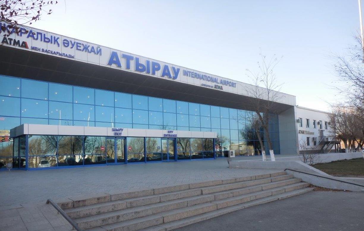
Atyrau ( kk, Атырау, ', ; russian: Атырау, ), known until 1991 as Guryev (russian: Гурьев, ), is a city in Kazakhstan and the capital of Atyrau Region. Atyrau is a transcontinental city, at the mouth of the Ural River on the Caspian Sea, between Europe and Asia, west of Almaty and east of the Russian city of Astrakhan. Atyrau is famous for its oil and gas industries. It has a population of 355,117 as of 2020. It is predominantly made up of Kazakhs, the minorities being Russians, Koreans, Tatars and Uzbeks. History The wooden fort at the mouth of the Yaik River was founded in 1645 as ''Nizhny Yaitzky gorodok'' (literally, ''Lower Yaik Fort'') by the Russian trader Gury Nazarov, a native of Yaroslavl, who specialized in trade with Khiva and Bukhara. The fort was plundered by the Yaik Cossacks, leading the Guriev family to rebuild it in stone (1647–62). Tsar Alexis sent a garrison of Streltsy to protect the fort from Cossack incursions. Despite these efforts ... [...More Info...] [...Related Items...] OR: [Wikipedia] [Google] [Baidu] |
Mangystau Region
Mangystau ( kk, Маңғыстау облысы, Mañğystau oblysy; russian: Мангистауская область, Mangistauskaya oblast) is a Regions of Kazakhstan, region of Kazakhstan. Its capital is Aktau (a seaport), which has a population of 183,350 (2017); the entire Mangystau Province has a population of 736,795 (2021). Geography The region is located in the southwest of the country, and includes Mangyshlak Peninsula. It has much of Kazakhstan's Caspian Sea, Caspian Shore. It also borders neighboring countries Turkmenistan and Uzbekistan. Mangystau also borders two other Kazakh regions (counter-clockwise), Aktobe Region and Atyrau Region. The area of the region is 165,600 square kilometers. Engineers discovered petroleum in the area in the days of the Soviet Union, drilling commenced, and much of the area was built up around the industry. The territory of Mangystau includes varied landscapes and desert lands: Caspian lowland, plateaus (Usturt, Mangyshlak, Kendirli-K ... [...More Info...] [...Related Items...] OR: [Wikipedia] [Google] [Baidu] |
Russians In Kazakhstan
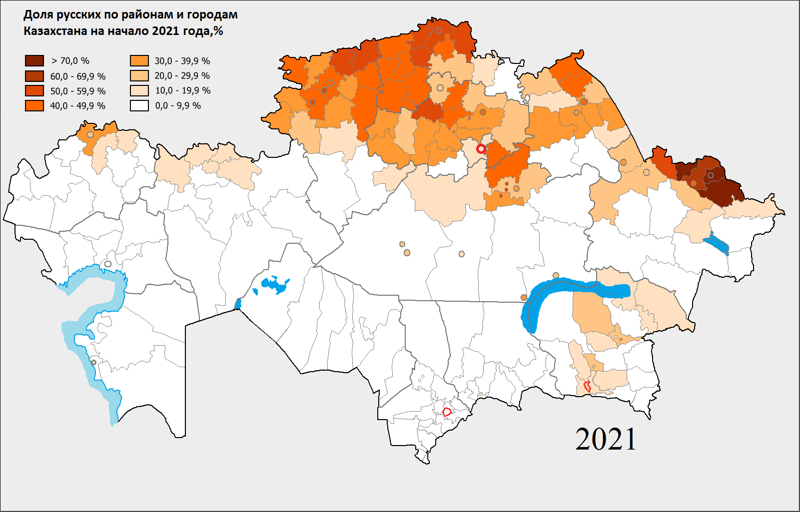
There has been a substantial population of Russians in Kazakhstan since the 19th century. Although their numbers have been reduced since the breakup of the Soviet Union, they remain prominent in Kazakh society today. Russians formed a plurality of the Kazakh SSR's population for several decades. Early colonisation The first Rus' traders and soldiers began to appear on the northwestern edge of modern Kazakhstan territory in the early 16th century, when Cossacks established the forts that later became the cities of Oral (Ural'sk, est. 1520) and Atyrau (Gur'yev). Ural, Siberian and later Orenburg Cossack Hosts gradually established themselves in parts of northern Kazakhstan. In 1710s and 1720s Siberian Cossacks founded Oskemen (Ust-Kamennaya), Semey (Semipalatinsk) and Pavlodar (Fort Koryakovskiy) as border forts and trading posts. Russian imperial authorities followed and were able to seize Kazakh territory because the local khanates were preoccupied by a war with Kalmyks (Oirats ... [...More Info...] [...Related Items...] OR: [Wikipedia] [Google] [Baidu] |
Novorossiisk
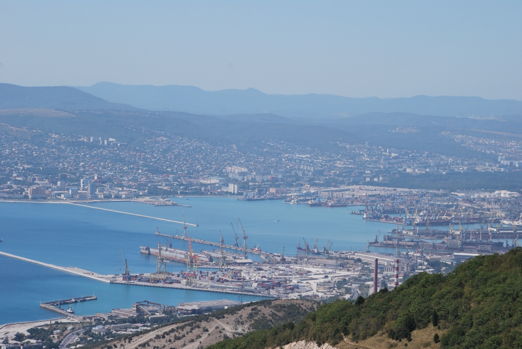
Novorossiysk ( rus, Новоросси́йск, p=nəvərɐˈsʲijsk; ady, ЦIэмэз, translit=Chəməz, p=t͡sʼɜmɜz) is a city in Krasnodar Krai, Russia. It is one of the largest ports on the Black Sea. It is one of the few cities honored with the title of the Hero City. Population: History In antiquity, the shores of the Tsemes Bay were the site of Bata ( el, Μπάτα), an ancient Greek colony that specialized in the grain trade. It is mentioned in the works of Strabo and Ptolemy, among others. Following brief periods of Roman and Khazar control, from the 9th century onwards, the area was part of the Byzantine θέμα Χερσῶνος ''Thema Khersonos'' (Province of Cherson). During the 11th century, the area was overrun and controlled by nomads from the Eurasian steppe, led by the Cumans. Later that century, the Byzantine emperor Ἀλέξιος Κομνηνός Alexios I Komnenos ( r. 1081–1118) was approached by Anglo-Saxon refugees, who had left E ... [...More Info...] [...Related Items...] OR: [Wikipedia] [Google] [Baidu] |
Tengiz Field
Tengiz field ( kk, Теңіз мұнай кен орны, ''Teñız mūnai ken orny''; Tengiz is Turkic for "sea") is an oil field located in northwestern Kazakhstan's low-lying wetlands along the northeast shores of the Caspian Sea. It covers a project license area which also includes a smaller Korolev field as well as several exploratory prospects. Sizewise, Tengiz reservoir is wide and long. Discovered in 1979, Tengiz oil field is one of the largest discoveries in recent history. The city of Atyrau, north of Tengiz, is the main transport hub of Tengiz oil. Many nations are involved in a large geopolitical competition to secure access to this source of oil. The Tengiz oil fields entered a new phase of production with the construction of its Second Generation Project (SGP) and the introduction of sour gas injection (SGI). This onshore development, which has been in the planning and approval stage since 2002, began in 2004 and required a total investment of $7.4bn. The i ... [...More Info...] [...Related Items...] OR: [Wikipedia] [Google] [Baidu] |
Samara, Russia
Samara ( rus, Сама́ра, p=sɐˈmarə), known from 1935 to 1991 as Kuybyshev (; ), is the largest city and administrative centre of Samara Oblast. The city is located at the confluence of the Volga and the Samara rivers, with a population of over 1.14 million residents, up to 1.22 million residents in the urban agglomeration, not including Novokuybyshevsk, which is not conurbated. The city covers an area of , and is the eighth-largest city in Russia and tenth agglomeration, the third-most populous city on the Volga, as well as the Volga Federal District. Formerly a closed city, Samara is now a large and important social, political, economic, industrial, and cultural centre in Russia and hosted the European Union—Russia Summit in May 2007. It has a continental climate characterised by hot summers and cold winters. The life of Samara's citizens has always been intrinsically linked to the Volga River, which has not only served as the main commercial thoroughfare of Russia th ... [...More Info...] [...Related Items...] OR: [Wikipedia] [Google] [Baidu] |
Oil Pipeline
Pipeline transport is the long-distance transportation of a liquid or gas through a system of pipes—a pipeline—typically to a market area for consumption. The latest data from 2014 gives a total of slightly less than of pipeline in 120 countries of the world. The United States had 65%, Russia had 8%, and Canada had 3%, thus 76% of all pipeline were in these three countries. ''Pipeline and Gas Journals worldwide survey figures indicate that of pipelines are planned and under construction. Of these, represent projects in the planning and design phase; reflect pipelines in various stages of construction. Liquids and gases are transported in pipelines, and any chemically stable substance can be sent through a pipeline. Pipelines exist for the transport of crude and refined petroleum, fuels – such as oil, natural gas and biofuels – and other fluids including sewage, slurry, water, beer, hot water or steam for shorter distances. Pipelines are useful for transporting water ... [...More Info...] [...Related Items...] OR: [Wikipedia] [Google] [Baidu] |
Kashagan Field
Kashagan Field ( kk, Қашаған кен орны, ''Qashaǵan ken orny'') is an offshore oil field in Kazakhstan's zone of the Caspian Sea. The field, discovered in 2000, is located in the northern part of the Caspian Sea close to Atyrau and is considered the world's largest discovery in the last 30 years, combined with the Tengiz Field. When discovered, it was the second largest oil field in the world. It is estimated that the Kashagan Field has recoverable reserves of about of crude oil. Harsh conditions, including sea ice during the winter, temperature variation from , extremely shallow water and high levels of hydrogen sulfide, together with mismanagement and disputes, make it one of the most challenging oil megaprojects. Commercial production began in September 2013. It has been designated as the main source of supply for the Kazakhstan-China oil pipeline. CNN Money estimates that development of the field had cost US$116 billion as of 2012, which mad ... [...More Info...] [...Related Items...] OR: [Wikipedia] [Google] [Baidu] |
Tengiz Field
Tengiz field ( kk, Теңіз мұнай кен орны, ''Teñız mūnai ken orny''; Tengiz is Turkic for "sea") is an oil field located in northwestern Kazakhstan's low-lying wetlands along the northeast shores of the Caspian Sea. It covers a project license area which also includes a smaller Korolev field as well as several exploratory prospects. Sizewise, Tengiz reservoir is wide and long. Discovered in 1979, Tengiz oil field is one of the largest discoveries in recent history. The city of Atyrau, north of Tengiz, is the main transport hub of Tengiz oil. Many nations are involved in a large geopolitical competition to secure access to this source of oil. The Tengiz oil fields entered a new phase of production with the construction of its Second Generation Project (SGP) and the introduction of sour gas injection (SGI). This onshore development, which has been in the planning and approval stage since 2002, began in 2004 and required a total investment of $7.4bn. The i ... [...More Info...] [...Related Items...] OR: [Wikipedia] [Google] [Baidu] |
Caspian Depression
The Caspian Depression ( kk, Каспий маңы ойпаты, ''Kaspıı mańy oıpaty''; rus, Прикаспи́йская ни́зменность, p=prʲɪkɐˈspʲijskəjə ˈnʲizmʲɪnnəsʲtʲ, Caspian Lowland) or Pricaspian/Peri-Caspian Depression/Lowland is a low-lying flatland region encompassing the northern part of the Caspian Sea, the largest enclosed body of water on Earth. It is the larger northern part of the wider Aral-Caspian Depression around the Aral and Caspian Seas. The level of the Caspian sea is below sea level, however several areas in the depression are even lower, and among them Karagiye near Aktau is the lowest at . Geography The depression lies at the southern end of the Ryn Desert, and is in both Kazakhstan and Russia. Most of the Russian Republic of Kalmykia lies in the Caspian Depression. The Volga River and the Ural River flow into the Caspian Sea through this region. The deltas of the Ural and Volga Rivers are extensive wetlands. Th ... [...More Info...] [...Related Items...] OR: [Wikipedia] [Google] [Baidu] |
Petroleum
Petroleum, also known as crude oil, or simply oil, is a naturally occurring yellowish-black liquid mixture of mainly hydrocarbons, and is found in geological formations. The name ''petroleum'' covers both naturally occurring unprocessed crude oil and petroleum products that consist of refined crude oil. A fossil fuel, petroleum is formed when large quantities of dead organisms, mostly zooplankton and algae, are buried underneath sedimentary rock and subjected to both prolonged heat and pressure. Petroleum is primarily recovered by oil drilling. Drilling is carried out after studies of structural geology, sedimentary basin analysis, and reservoir characterisation. Recent developments in technologies have also led to exploitation of other unconventional reserves such as oil sands and oil shale. Once extracted, oil is refined and separated, most easily by distillation, into innumerable products for direct use or use in manufacturing. Products include fuels such as gasol ... [...More Info...] [...Related Items...] OR: [Wikipedia] [Google] [Baidu] |
Europe
Europe is a large peninsula conventionally considered a continent in its own right because of its great physical size and the weight of its history and traditions. Europe is also considered a Continent#Subcontinents, subcontinent of Eurasia and it is located entirely in the Northern Hemisphere and mostly in the Eastern Hemisphere. Comprising the westernmost peninsulas of Eurasia, it shares the continental landmass of Afro-Eurasia with both Africa and Asia. It is bordered by the Arctic Ocean to the north, the Atlantic Ocean to the west, the Mediterranean Sea to the south and Asia to the east. Europe is commonly considered to be Boundaries between the continents of Earth#Asia and Europe, separated from Asia by the drainage divide, watershed of the Ural Mountains, the Ural (river), Ural River, the Caspian Sea, the Greater Caucasus, the Black Sea and the waterways of the Turkish Straits. "Europe" (pp. 68–69); "Asia" (pp. 90–91): "A commonly accepted division between Asia and E ... [...More Info...] [...Related Items...] OR: [Wikipedia] [Google] [Baidu] |


