|
Atyrau
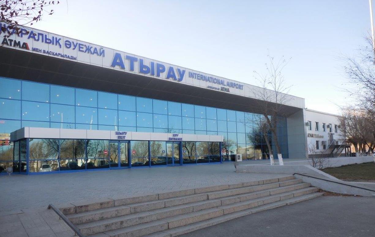
Atyrau ( kk, Атырау, ', ; russian: Атырау, ), known until 1991 as Guryev (russian: Гурьев, ), is a city in Kazakhstan and the capital of Atyrau Region. Atyrau is a transcontinental city, at the mouth of the Ural River on the Caspian Sea, between Europe and Asia, west of Almaty and east of the Russian city of Astrakhan. Atyrau is famous for its oil and gas industries. It has a population of 355,117 as of 2020. It is predominantly made up of Kazakhs, the minorities being Russians, Koreans, Tatars and Uzbeks. History The wooden fort at the mouth of the Yaik River was founded in 1645 as ''Nizhny Yaitzky gorodok'' (literally, ''Lower Yaik Fort'') by the Russian trader Gury Nazarov, a native of Yaroslavl, who specialized in trade with Khiva and Bukhara. The fort was plundered by the Yaik Cossacks, leading the Guriev family to rebuild it in stone (1647–62). Tsar Alexis sent a garrison of Streltsy to protect the fort from Cossack incursions. Despite these effor ... [...More Info...] [...Related Items...] OR: [Wikipedia] [Google] [Baidu] |
Atyrau Region
Atyrau Region ( kk, Атырау облысы / ; russian: Атырауская область) formerly known as Guryev Region (russian: Гурьевская область) until 1991, is one of the regions of Kazakhstan, in the west of the country around the northeast of the Caspian Sea. Its capital is the city of Atyrau, with a population of 355,117; the region itself has a population of 659,074, of which Kazakhs make up more than 90%. History The Turan lowlands of Atyrau Region were the central homeland for the Malkar "Hun" dynasties of late antiquity. Geography With an area of 118,600 square kilometers, it is the second-smallest region in Kazakhstan (Turkistan Region is the smallest). It borders Russia (Astrakhan Oblast) to the west, as well as the fellow Kazakh regions Aktobe to the east, Mangystau to the south, and the West Kazakhstan Region to the north. The Ural River is the border between Asia and Europe and flows from Russia to the Caspian Sea through the region, mea ... [...More Info...] [...Related Items...] OR: [Wikipedia] [Google] [Baidu] |
Regions Of Kazakhstan
Kazakhstan is divided into 17 regions ( kk, облыстар/''oblystar''; singular: облыс/''oblys''; russian: области/''oblasti''; singular: область/''oblast). The regions are further subdivided into districts ( kk, аудандар/''audandar''; singular: аудан/''audan''; russian: районы/; singular: russian: район/). Three cities, Shymkent, the largest city Almaty, and the capital Astana) are not part of the regions they are surrounded by. On 16 March 2022, Kazakh President Kassym-Jomart Tokayev announced that three new regions would be created. Abai Region was created from East Kazakhstan Region with its capital in Semey. Ulytau Region was created from Karaganda Region with its capital in Jezkazgan. Jetisu Region was created from Almaty Region with its capital in Taldykorgan; Almaty Region's capital was moved from Taldykorgan to Qonaev. __TOC__ Regions Demographic statistics In 2022, three new regions were created - Abai ... [...More Info...] [...Related Items...] OR: [Wikipedia] [Google] [Baidu] |
Ural River
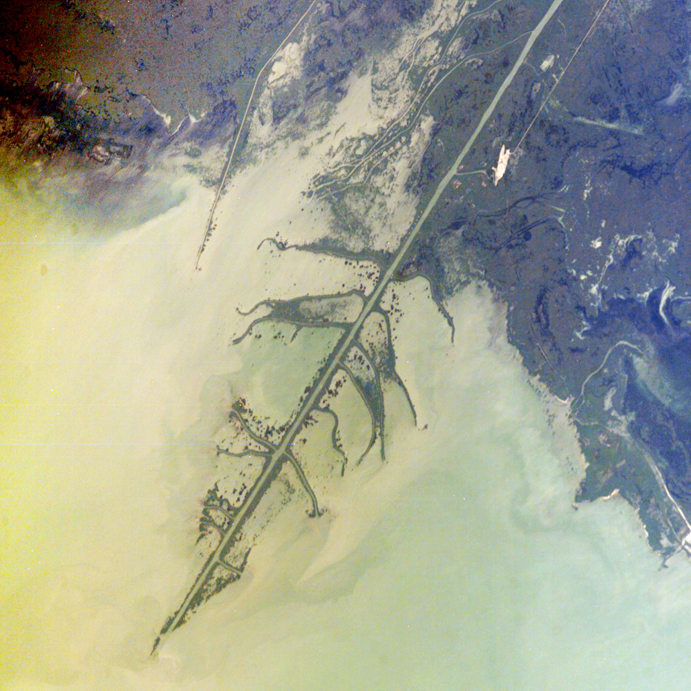
The Ural (russian: Урал, ), known before 1775 as Yaik (russian: Яик, ba, Яйыҡ, translit=Yayıq, ; kk, Жайық, translit=Jaiyq, ), is a river flowing through Russia and Kazakhstan in the continental border between Europe and Asia. It originates in the southern Ural Mountains and discharges into the Caspian Sea. At , it is the third-longest river in Europe after the Volga and the Danube, and the 18th-longest river in Asia. The Ural is conventionally considered part of the boundary between the continents of Europe and Asia. The Ural arises near Mount Kruglaya in the Ural Mountains, flows south parallel and west of the north-flowing Tobol, through Magnitogorsk, and around the southern end of the Urals, through Orsk where it turns west for about , to Orenburg, where the river Sakmara joins. From Orenburg it continues west, passing into Kazakhstan, then turning south again at Oral, and meandering through a broad flat plain until it reaches the Caspian a few miles ... [...More Info...] [...Related Items...] OR: [Wikipedia] [Google] [Baidu] |
Kazakhstan
Kazakhstan, officially the Republic of Kazakhstan, is a transcontinental country located mainly in Central Asia and partly in Eastern Europe. It borders Russia Russia (, , ), or the Russian Federation, is a transcontinental country spanning Eastern Europe and Northern Asia. It is the largest country in the world, with its internationally recognised territory covering , and encompassing one-eigh ... to Kazakhstan–Russia border, the north and west, China to China–Kazakhstan border, the east, Kyrgyzstan to Kazakhstan–Kyrgyzstan border, the southeast, Uzbekistan to Kazakhstan–Uzbekistan border, the south, and Turkmenistan to Kazakhstan–Turkmenistan border, the southwest, with a coastline along the Caspian Sea. Its capital is Astana, known as Nur-Sultan from 2019 to 2022. Almaty, Kazakhstan's largest city, was the country's capital until 1997. Kazakhstan is the world's largest landlocked country, the largest and northernmost Muslim world, Muslim-majority cou ... [...More Info...] [...Related Items...] OR: [Wikipedia] [Google] [Baidu] |
Yaik River
The Ural (russian: Урал, ), known before 1775 as Yaik (russian: Яик, ba, Яйыҡ, translit=Yayıq, ; kk, Жайық, translit=Jaiyq, ), is a river flowing through Russia and Kazakhstan in the continental border between Europe and Asia. It originates in the southern Ural Mountains and discharges into the Caspian Sea. At , it is the third-longest river in Europe after the Volga and the Danube, and the 18th-longest river in Asia. The Ural is conventionally considered part of the boundary between the continents of Europe and Asia. The Ural arises near Mount Kruglaya in the Ural Mountains, flows south parallel and west of the north-flowing Tobol, through Magnitogorsk, and around the southern end of the Urals, through Orsk where it turns west for about , to Orenburg, where the river Sakmara joins. From Orenburg it continues west, passing into Kazakhstan, then turning south again at Oral, and meandering through a broad flat plain until it reaches the Caspian a few miles be ... [...More Info...] [...Related Items...] OR: [Wikipedia] [Google] [Baidu] |
Manjali Mosque
The Manjali Mosque ( kk, Imanǵalı meshiti/Иманғали мешіті; russian: Мечеть Имангали) is located on Satpayev Avenue in the center of Atyrau, Kazakhstan Kazakhstan, officially the Republic of Kazakhstan, is a transcontinental country located mainly in Central Asia and partly in Eastern Europe. It borders Russia Russia (, , ), or the Russian Federation, is a transcontinental coun .... Construction began in 1999 and was completed in 2001. The mosque opened for public use on 5 May 2001 and can accommodate 600 worshipers. The mosque has a large dome with a height of 23 meters. Its outer diameter measures at 7 metres and inner diameter at 5 metres. The total area of the mosque, including the grounds surrounding it, is 1328.3 square metres, with the mosque itself occupying 1093.1 sq.m. It consists of 2 floors, two large halls, five prayer rooms, men's and women's prayer rooms, a reading room, a madrassa, a library and additional rooms for ... [...More Info...] [...Related Items...] OR: [Wikipedia] [Google] [Baidu] |
UTC+5
UTC+05:00 is an identifier for a time offset from UTC of +05:00. This time is used in: As standard time (Northern Hemisphere winter) ''Principal cities: Islamabad, Karachi'' South Asia *Pakistan - Time in Pakistan As standard time (year-round) ''Principal cities: Tashkent, Ashgabat, Dushanbe, Malé, Yekaterinburg, Martin-de-Viviès, Port-aux-Français, Aktobe, Atyrau, Kyzylorda, Aktau'' South Asia *Maldives – Time in the Maldives Central Asia *Kazakhstan - Time in Kazakhstan **The provinces of Aktobe, Atyrau, Kyzylorda, Mangystau and West Kazakhstan **Except all the regions of East Kazakhstan *Tajikistan – Time in Tajikistan *Turkmenistan – Time in Turkmenistan *Uzbekistan – Time in Uzbekistan Eastern Europe *Russia – Yekaterinburg Time *Volga Federal District **Bashkortostan, Orenburg Oblast and Perm Krai *Ural Federal District **Chelyabinsk Oblast, Khanty-Mansi Autonomous Okrug, Kurgan Oblast, Sverdlovsk Oblast, Tyumen Oblast and Yamalo-Nenets Autonomous ... [...More Info...] [...Related Items...] OR: [Wikipedia] [Google] [Baidu] |
Astrakhan
Astrakhan ( rus, Астрахань, p=ˈastrəxənʲ) is the largest city and administrative centre of Astrakhan Oblast in Southern Russia. The city lies on two banks of the Volga, in the upper part of the Volga Delta, on eleven islands of the Caspian Depression, 60 miles (100 km) from the Caspian Sea, with a population of 475,629 residents at the 2021 Census. At an elevation of below sea level, it is the lowest city in Russia. Astrakhan was formerly the capital of the Khanate of Astrakhan (a remnant of the Golden Horde), and was located on the higher right bank of the Volga, 7 miles (11 km) from the present-day city. Situated on caravan and water routes, it developed from a village into a large trading centre, before being conquered by Timur in 1395 and captured by Ivan the Terrible in 1556. In 1558 it was moved to its present site. The oldest economic and cultural center of the Lower Volga, [...More Info...] [...Related Items...] OR: [Wikipedia] [Google] [Baidu] |
Caspian Sea
The Caspian Sea is the world's largest inland body of water, often described as the List of lakes by area, world's largest lake or a full-fledged sea. An endorheic basin, it lies between Europe and Asia; east of the Caucasus, west of the broad steppe of Central Asia, south of the fertile plains of Southern Russia in Eastern Europe, and north of the mountainous Iranian Plateau of Western Asia. It covers a surface area of (excluding the highly saline lagoon of Garabogazköl to its east) and a volume of . It has a salinity of approximately 1.2% (12 g/L), about a third of the salinity of average seawater. It is bounded by Kazakhstan to the northeast, Russia to the northwest, Azerbaijan to the southwest, Iran to the south, and Turkmenistan to the southeast. The sea stretches nearly from north to south, with an average width of . Its gross coverage is and the surface is about below sea level. Its main freshwater Inflow (hydrology), inflow, Europe's longest river, the Volga, enters ... [...More Info...] [...Related Items...] OR: [Wikipedia] [Google] [Baidu] |
River Delta
A river delta is a landform shaped like a triangle, created by deposition of sediment that is carried by a river and enters slower-moving or stagnant water. This occurs where a river enters an ocean, sea, estuary, lake, reservoir, or (more rarely) another river that cannot carry away the supplied sediment. It is so named because its triangle shape resembles the Greek letter Delta. The size and shape of a delta is controlled by the balance between watershed processes that supply sediment, and receiving basin processes that redistribute, sequester, and export that sediment. The size, geometry, and location of the receiving basin also plays an important role in delta evolution. River deltas are important in human civilization, as they are major agricultural production centers and population centers. They can provide coastline defense and can impact drinking water supply. They are also ecologically important, with different species' assemblages depending on their landscape posi ... [...More Info...] [...Related Items...] OR: [Wikipedia] [Google] [Baidu] |
Stepan Razin
Stepan Timofeyevich Razin (russian: Степа́н Тимофе́евич Ра́зин, ; 1630 – ), known as Stenka Razin ( ), was a Cossack leader who led a major uprising against the nobility and tsarist bureaucracy in southern Russia in 1670–1671. Early life Razin's father, Timofey Razya, supposedly came from a suburb of Voronezh, a city near Russia's steppe frontier, called the Wild Fields. Razin's uncle and grandmother still lived in the village of ''New Usman or ''Usman' Sobakina'', outside of Voronezh, until 1667. The identity of Razin's mother is debated. In one document, Razin was referred to as a ''tuma Cossack'' which means "half-blood", leading to a hypothesis that his mother was a captured "Turkish" (''turchanka'') or Crimean Tatar woman. However, this term was also used by "upper Cossacks" as a derogatory nickname towards all "lower Cossacks" regardless of origin Another hypothesis draws on information about Razin's godmother Matrena Govorukha. According to ... [...More Info...] [...Related Items...] OR: [Wikipedia] [Google] [Baidu] |
Streltsy
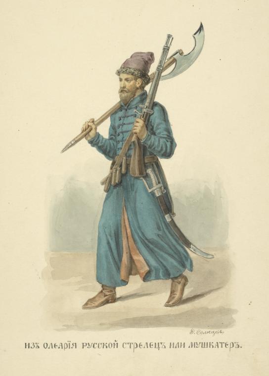
, image = 01 106 Book illustrations of Historical description of the clothes and weapons of Russian troops.jpg , image_size = , alt = , caption = , dates = 1550–1720 , disbanded = , country = Tsardom of Russia , allegiance = Streltsy Department , branch = , type = Infantry , role = , size = , command_structure = Russian Army , garrison = Moscow , garrison_label = , nickname = , patron = Saint George , motto = , colors = , colors_label = , march = , mascot = , anniversaries = , equipment = , equipment_label = , battles = Siege of Kazan Livonian War Battle of Molodi Polish–Muscovite War (1605–1618) Smolensk WarRusso-Polish War (1654–1667)Great Northern War , battles_label = , decorations = , battle_honours = , battle_honours_label = , flying_hours = , website = , current_commander = , commander1 = , commander1_label = , commander2 = , commander2_label = , commander3 = , commander3_label = , commander4 = , commander4_label = , ... [...More Info...] [...Related Items...] OR: [Wikipedia] [Google] [Baidu] |


