|
AstĂşn
AstĂşn is a ski resort situated near the town of Canfranc in the High Aragon of the western Pyrenees (province of Huesca, Spain). The source of the Aragon River is in the resort. IbĂłn de Truchas attracts anglers. It is connected to the city by 33 km of the N -330. At his feet is the urbanization of the tracks, which had 6 inhabitants in 2012. The resort It has 39 km of marked pistes, it is one of the most modern resorts of the Pyrenees. The highest point is ''La Raca'' peak, 2300 m AMSL, with a vertical drop of 600 m. The base of the resort is a purpose-built town which includes several hotels and apartments and is situated at 1700 m AMSL. From there the main chair lifts provide access for the resort. The resort itself occupies two different high mountain valleys, defining two sectors: ''La Raca - Sarrios'', and ''Truchas''. Each sector is accessed from the base of the resort using a chair lift. AstĂşn offers a joint ski pass with the neighbouring resort of CandanchĂ ... [...More Info...] [...Related Items...] OR: [Wikipedia] [Google] [Baidu] |
CandanchĂş
CandanchĂş is a ski resort situated near the town of Canfranc in the High Aragon of the western Pyrenees (province of Huesca, Spain). The name of the area is an adaptation of French "Camp d'Anjou" as this was originally the site of a military camp of the French Angevin dynasty. This is also located near the road on the historical Camino de Santiago. The ski resort of CandanchĂş is located in the Aragonese Pyrenees. It is 1 km from Puerto del Somport the border with France. Neighbor AstĂşn ski resort, is located 27 km north of the city of Jaca. On the right bank of the river Arago, near the bridge of Santa Cristina, are the ruins of the Hospital of Santa Cristina of Somport, a hospice for pilgrims on the Camino de Santiago. The resort It has 59 km of marked pistes, it's one of the earliest developed resorts of the Pyrenees. It's known for its very difficult steep pistes such as ''Tubo Zapatilla''. The highest point is ''La Tuca'' peak, 2400 m AMSL, with a ver ... [...More Info...] [...Related Items...] OR: [Wikipedia] [Google] [Baidu] |
Pyrenees
The Pyrenees (; es, Pirineos ; french: Pyrénées ; ca, Pirineu ; eu, Pirinioak ; oc, Pirenèus ; an, Pirineus) is a mountain range straddling the border of France and Spain. It extends nearly from its union with the Cantabrian Mountains to Cap de Creus on the Mediterranean Sea, Mediterranean coast. It reaches a maximum altitude of at the peak of Aneto. For the most part, the main crest forms a divide between Spain and France, with the microstate of Andorra sandwiched in between. Historically, the Crown of Aragon and the Kingdom of Navarre extended on both sides of the mountain range. Etymology In Greek mythology, Pyrene (mythology), Pyrene is a princess who eponym, gave her name to the Pyrenees. The Greek historiography, Greek historian Herodotus says Pyrene is the name of a town in Celts, Celtic Europe. According to Silius Italicus, she was the virgin daughter of Bebryx, a king in Narbonensis, Mediterranean Gaul by whom the hero Hercules was given hospitality during his ... [...More Info...] [...Related Items...] OR: [Wikipedia] [Google] [Baidu] |
IbĂłn De Truchas
IbĂłn de Truchas is a lake at the winter resort of AstĂşn in the Province of Huesca Huesca ( an, Uesca, ca, Osca), officially Huesca/Uesca, is a province of northeastern Spain, in northern Aragon. The capital is Huesca. Positioned just south of the central Pyrenees, Huesca borders France and the French Departments of Haute-Ga ..., northeastern Spain. It lies at an elevation of and has a maximum depth of . It is a popular place for fishing and hiking. References Truchas Geography of the Province of Huesca {{huesca-geo-stub ... [...More Info...] [...Related Items...] OR: [Wikipedia] [Google] [Baidu] |
Huesca (province)
Huesca ( an, Uesca, ca, Osca), officially Huesca/Uesca, is a province of northeastern Spain, in northern Aragon. The capital is Huesca. Positioned just south of the central Pyrenees, Huesca borders France and the French Departments of Haute-Garonne, Pyrénées-Atlantiques and Hautes-Pyrénées. Within Spain, Huesca's neighboring provinces are Navarre, Zaragoza and Lleida. Geography Covering a primarily mountainous area of km², the province of Huesca has a total population of in 2018, with almost a quarter of its people living in the capital city of Huesca. The low population density, 14.62/km², has meant that Huesca's lush valleys, rivers, and lofty mountain ranges have remained relatively pristine and unspoiled by progress. Home to majestic scenery, the tallest mountain in the Pyrenees, the Aneto; eternal glaciers, such as at Monte Perdido; and the National Park of Ordesa and Monte Perdido, rich in flora and protected fauna. Popular with mountaineers, spelunkers, para ... [...More Info...] [...Related Items...] OR: [Wikipedia] [Google] [Baidu] |
Jaca
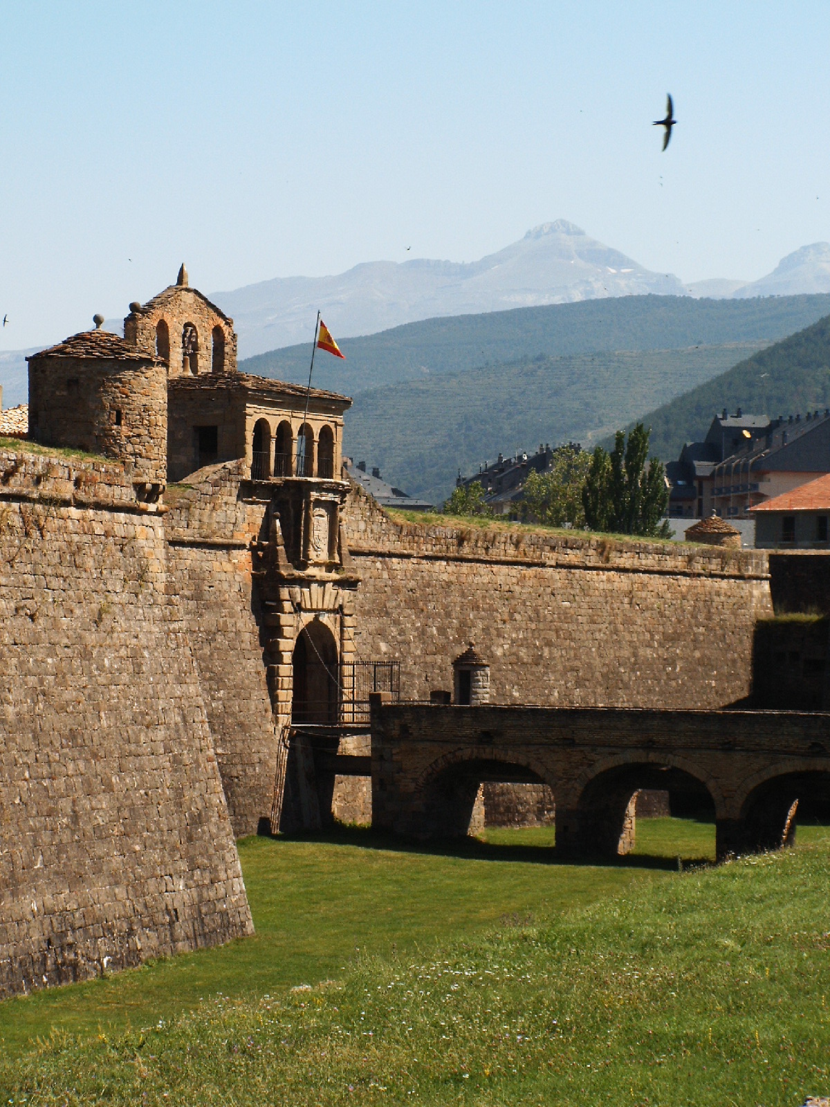
Jaca (; in Aragonese: ''Chaca'' or ''Xaca'') is a city of northeastern Spain in the province of Huesca, located near the Pyrenees and the border with France. Jaca is an ancient fort on the AragĂłn River, situated at the crossing of two great early medieval routes, one from Toulousse to Santiago de Compostela and Pau to Zaragoza. Jaca was the city out of which the County and Kingdom of Aragon developed. It was the capital of Aragon until 1097 and also the capital of Jacetania. Villages Besides Jaca town, there are a number of outlying villages in Jaca's municipality, including the ski resort of AstĂşn. History The origins of the city are obscure, but its name is apparently of Iacetani origin, mentioned by Strabo as one of the most celebrated of the numerous small tribes inhabiting the Ebro basin. Strabo adds that their territory lay on the site of the wars in the 1st century BC between Sertorius and Pompey. According to the atlas of the ancient Greek and Roman worlds Jaca was ... [...More Info...] [...Related Items...] OR: [Wikipedia] [Google] [Baidu] |
Piste
A ''piste'' () is a marked ski run or path down a mountain for snow skiing, snowboarding, or other mountain sports. This European term is FrenchEnglish language ''Fédération Internationale de Ski'' (FIS) website ("trail", "track") and synonymous with 'trail', 'slope', or 'run' in North America. The word is pronounced using a long "e" sound so that it rhymes with "beast". North Americans employ its common European antonym, 'off piste', to describe , especially when referring to skiing outside officially approved areas of a |
Kindergarten
Kindergarten is a preschool educational approach based on playing, singing, practical activities such as drawing, and social interaction as part of the transition from home to school. Such institutions were originally made in the late 18th century in Germany, Bavaria and Alsace to serve children whose parents both worked outside home. The term was coined by German pedagogue Friedrich Fröbel, whose approach globally influenced early-years education. Today, the term is used in many countries to describe a variety of educational institutions and learning spaces for children ranging from 2 to 6 years of age, based on a variety of teaching methods. History Early years and development In 1779, Johann Friedrich Oberlin and Louise Scheppler founded in Strasbourg an early establishment for caring for and educating preschool children whose parents were absent during the day. At about the same time, in 1780, similar infant establishments were created in Bavaria. In 1802, Princess P ... [...More Info...] [...Related Items...] OR: [Wikipedia] [Google] [Baidu] |
Restaurants
A restaurant is a business that prepares and serves food and drinks to customers. Meals are generally served and eaten on the premises, but many restaurants also offer take-out and food delivery services. Restaurants vary greatly in appearance and offerings, including a wide variety of cuisines and service models ranging from inexpensive fast-food restaurants and cafeterias to mid-priced family restaurants, to high-priced luxury establishments. Etymology The word derives from early 19th century from French word 'provide food for', literally 'restore to a former state' and, being the present participle of the verb, The term ''restaurant'' may have been used in 1507 as a "restorative beverage", and in correspondence in 1521 to mean 'that which restores the strength, a fortifying food or remedy'. History A public eating establishment similar to a restaurant is mentioned in a 512 BC record from Ancient Egypt. It served only one dish, a plate of cereal, wild fowl, and on ... [...More Info...] [...Related Items...] OR: [Wikipedia] [Google] [Baidu] |
Chair Lift
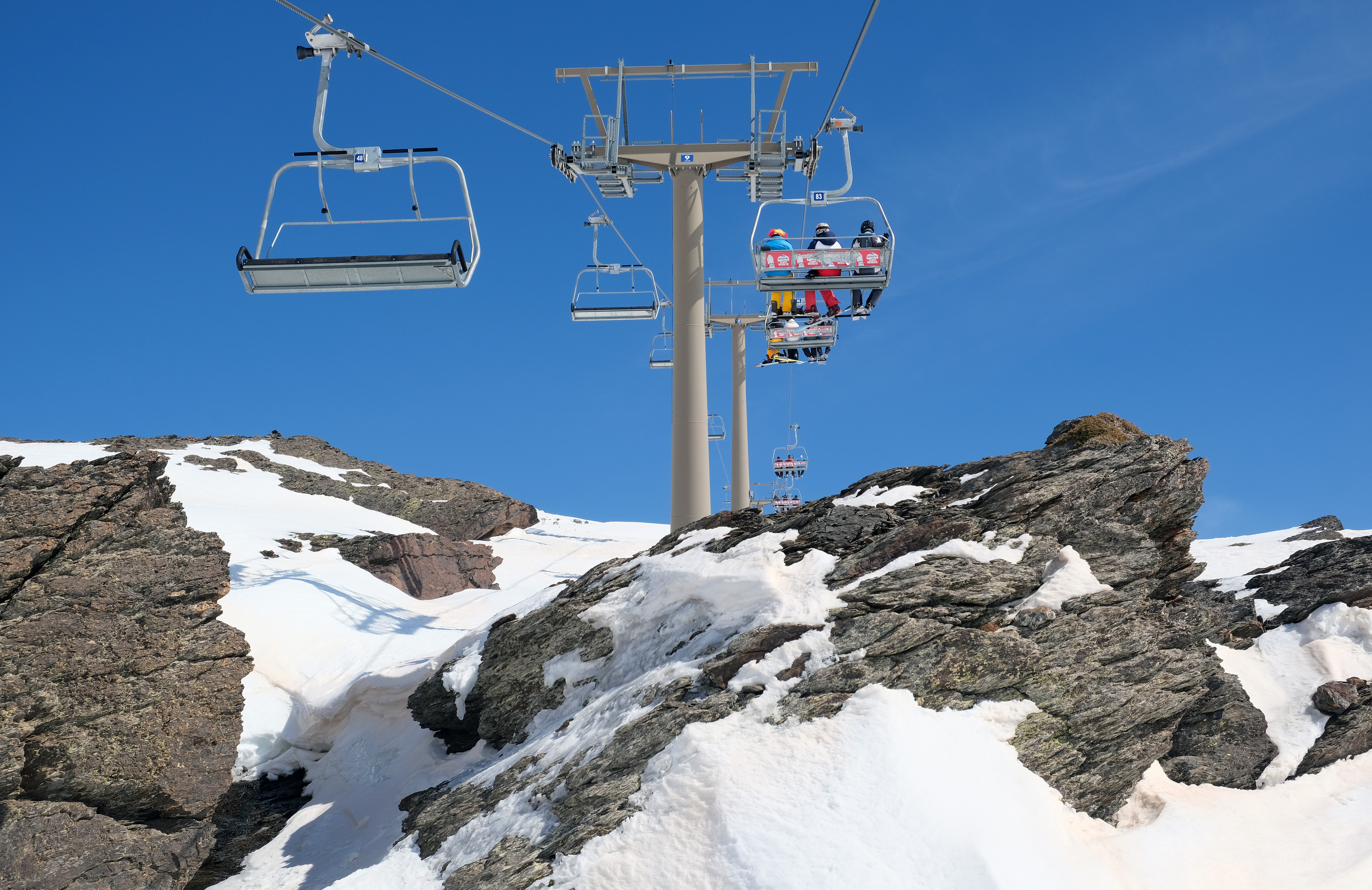
An elevated passenger ropeway, or chairlift, is a type of aerial lift, which consists of a continuously circulating steel wire rope loop strung between two end terminals and usually over intermediate towers, carrying a series of chairs. They are the primary onhill transport at most ski areas (in such cases referred to as 'ski lifts'), but are also found at amusement parks, various tourist attractions, and increasingly in urban transport. Depending on carrier size and loading efficiency, a passenger ropeway can move up to 4000 people per hour, and the fastest lifts achieve operating speeds of up to or . The two-person double chair, which for many years was the workhorse of the ski industry, can move roughly 1200 people per hour at rope speeds of up to . The four person detachable chairlift ("high-speed quad") can transport 2400 people per hour with an average rope speed of . Some bi and tri cable elevated ropeways and reversible tramways achieve much greater operating speeds ... [...More Info...] [...Related Items...] OR: [Wikipedia] [Google] [Baidu] |
AMSL
Height above mean sea level is a measure of the vertical distance (height, elevation or altitude) of a location in reference to a historic mean sea level taken as a vertical datum. In geodesy, it is formalized as ''orthometric heights''. The combination of unit of measurement and the physical quantity (height) is called "metres above mean sea level" in the metric system, while in United States customary and imperial units it would be called "feet above mean sea level". Mean sea levels are affected by climate change and other factors and change over time. For this and other reasons, recorded measurements of elevation above sea level at a reference time in history might differ from the actual elevation of a given location over sea level at a given moment. Uses Metres above sea level is the standard measurement of the elevation or altitude of: * Geographic locations such as towns, mountains and other landmarks. * The top of buildings and other structures. * Flying objects such ... [...More Info...] [...Related Items...] OR: [Wikipedia] [Google] [Baidu] |


.jpg)

